Typhoon Tip
-
Posts
44,539 -
Joined
-
Last visited
Content Type
Profiles
Blogs
Forums
American Weather
Media Demo
Store
Gallery
Everything posted by Typhoon Tip
-
Occasional Thoughts on Climate Change
Typhoon Tip replied to donsutherland1's topic in Climate Change
Ha, ... was just reading about that. Also ( imho ) likely an example of the 'synergistic heat wave,' a type of heat burst phenomenon that exceeds leading indicators - but I did not admittedly read that stated. If the so-called Weather Attribution Group's study contains that verbiage then credit - I've haven't read the entire report. Anyway, synergistic heat bursts are increasing in frequency, and they are a different animal than merely recognizing a ridge of warm air in the models out in time and assessing three days 90+. -
actually ... 3 or 4 days may be spinning that, too. The ensembles, all three sources, really don't lift that formulating cold pattern out of the eastern continent until after D10! We'll just have to hope the models are - as usual - shorting the solar/seasonal forcing, whereby they end up over amplified out in time. There is some possibility this corrects toward something less extreme.
-
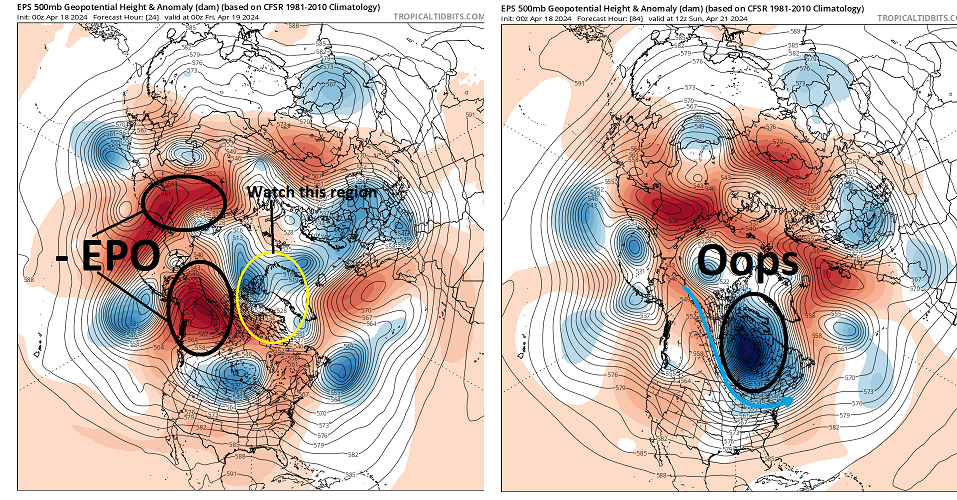
It's a race... Folks are unaware/don't care/... tired of looking and don't wanna consider, pick a negligence, but the -EPO taking place this week was a strong telecon signal dating back some 10 days. We aren't likely getting out of that without some sort of cold profiled synoptic torment - how much so/amplitude TBD. Could mean anything from a mere 3 or 4 days of glancing BL air with frosty mornings, to setting the table for a snow event event whether the dailies of the runs even show that at this time.
-
Spring won't be complete until we've significantly muted the orchard crop for a 3rd straight year ...
-
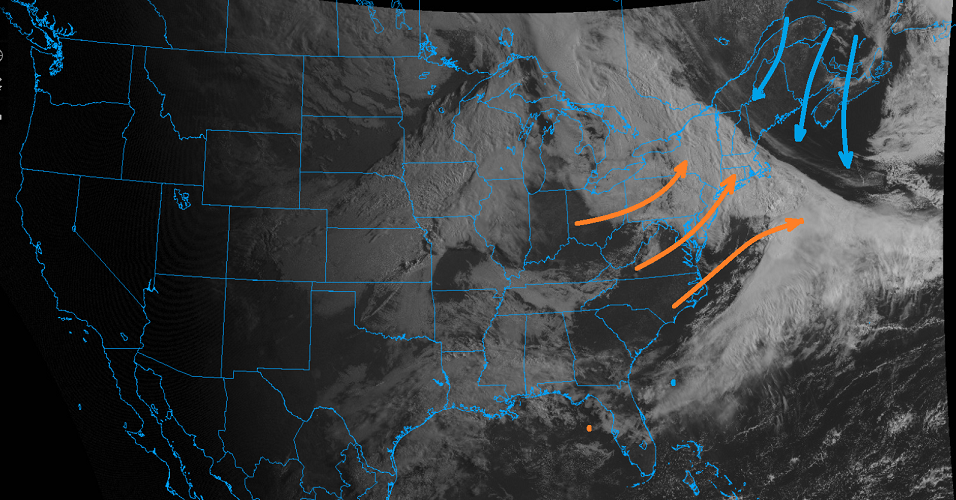
Knew this was going to happen when looking at those charts a couple of days ago. Three days of sun just has to mean three days of fecal skies and cold air. There's a convergence axis in the larger circulation medium, the axis of which is stalled right over New England. You gotta loop your hi res larger scale imagery to get a feel for how this ain't goin' nowhere quickly It's not well enough that we get to just have a fair time of it - there's apparently a butt -bang budget that afflicts this region. Any sunny day in April is not allowed to just be a sunny day ... there has to be this misery 100% tax in the other direction. Lol. Remarkable how accurately and precisely the models all were in depicting this circumstance above from week out in time - go wonder!
-
It'll go 7 games because of the two 0Ts the B's lost to make that happen ...after giving up the tying goal with 30 sec left in regulation, too -
-
This is very interesting https://phys.org/news/2024-04-scientists-paradox-extreme-cold-events.html I've mused a possible sci fi novel idea in the past where "Gaia," it turns out, has an an ethereal consciousness; it's just so vast it eludes what we think of as awareness - ... perhaps 'godlike'. And, it is well-aware of CC, more importantly, how to "cure" the disease. I like the analogy of the Clean setting on an oven - you know... raise the temperature to kiln degrees and converts the organics to ash. The impetus here is of course to clean the disease causing agent. But that's kind of hard to do if the pathogen is aware of the temperature rise. Uh... humans are the intended ash to complete this metaphor. By sending cold cloaks into the continents ... think of the frog in the pan experiment: plunk a frog into a pan of boiling water and it immediately jumps out ( or tries to...). But turn the heat up slowly and the frog, continuously adapting, will do so until it is cooked alive. That's all tongue-in-cheek, but it's an eerie negative feedback loop whence the primary inducing differential CC agent only responds immediately to that which is directly perceivable through the five senses ... which is precisely needed, and is being offset.
-
Nice ... much milder 12z GFS run. Much more in line with the ensemble mean's mass field distribution out in time so perhaps giving this type of solution some credence. It has a flat ridge in a -PNAP continental flow structure, with a wavy boundary from roughly IA to ME in the extended -
-
It's an annoying look for spring/warmth enthusiasts. We'll have to keep scraping by with 'fake' warm days at best, and may have some chilly ones mixed in ... until 7 to 10 days from now. I doubt any of those cold profiled events the GFS' native bias to disregard seasonal forcing and run back to February it always does at this time of year, have much of any hope of actually materializing. Rarely so, the April 1987 and May 1977's can happen. But given the stochastic nature of spring modeling season in general ...those are more typically last minute detected. In a cooler hemisphere in spring, the GFS will be the first in line to offer up 6:2 snow at 20" fantasies.
-
Wrong ... Kevin already proclaimed spring 2023 was warm and dewy everywhere - ...I think he should know. god
-
Look at this incredible warm up on the 12z Euro ..
-
All we have to do is reverse the last 3 decades of accelerated global warming ...thus, returning the total manifold of base circulation tendencies to the previous paradigm ... The "Japan marine heat wave" will go ahead and disperse should be easy to do
-
we'll be fretting around with nape -like days ... some mild, but a few cooler than normal through D7 but we really need to get on the other side of this, which is pretty well agreed upon by every modeling convention there is, telecon to operational version. After 6 or 7 days from now, this has rapidly moderated to a general nominal dispersion of neg and pos anomalies ... by then being late April/sun it's like the final escape out of this abysmal cold season at that time - that's probably be modestly AN. In fact, there's even to modest suggestion emerging that a mirror departure may formulate very late this month - but heh ...extended range in April is about as dependable as a lotto ticket so we'll see.
-
Temps approaching the mid 80s on the 29th no less... ha
-
34 ? heh Not likely that your garden's nut sack tickles 32, no ... but, big high, null wind, DPs of 24 or whatever will likely radiate the interior into problem territory, if the overnight guidance were correct, as is. Short version, there's a fair chance it won't actually be as cold as the overnight guidance. Longer, is the whole attenuation game ... Models tend to oversell just about everything they see out in time. It's gotten worse over the last 10 or years - roughly around the time all this exotic computing power/speed surged. interesting. But it seems almost perfunctory to assume all cold waves, hot waves, storm amplitude ... hell, the connections I make on my dating apps ... just go ahead and assume some 10 to 50% less inspiring actually happens. Seasonal forcing in spring has always tended to cause cool bias errors in extended range modeling. That's been there long before this recent model attenuation thing. So combining those two aspect... Kevin will now undoubtedly interpret this exchange as an install affirmation and temperatures approaching 90
-
Ha ha ha, Weatherwiz
-
The sun won't be denied though. Even if the ambient temperature is held into the upper 40s ... when the wind is light and the sky is open, the sun has a way of offsetting that significantly. Sometimes it helps to compare against the mirror season to put sol into perspective... This is the same sun as ~ August 24th today, and August 19 by this weekend.
-
Ummm
-
still was 36 here with just a subtle amount of frost on the top of the car though. None in the lawn and so forth, no, but exposed metallic surfaces at 36 ? heh Kinda feel that has to stop before the seasonal gravity well has truly been escaped. It's like the Voyager I ... even though it is beyond the terminal shock boundary ... until passes through the interstellar La Grange point it still technically in the sun's outer tentacles. haha ... oooo k Anyway, the reason I muse about it is because this f'n -EPO is for real. Hate it. The overnight runs leaned colder again, loading S-SE Canada with neg anomaly ... I think we're gonna have to risk some frosty mornings this weekend. We really/probably should be on the other side of that 2 to 3 day window and then we'll be at last seasonally released. somethin' like that
-
and the sun is hot! It always feels warm of course but this light/no wind scenario under 100% open sky, that sun is like sitting in front of an emitter of a microwave oven
-
somewhat rare phenomenon this morning ... the bona fide 0% cloud at pan-dimensional scale
-
That's a local yokel favorite "hang out" for suicide ..there, and testing gravity through the 70 foot of draft under the university ave bridge. The bladed rocks at the bottom make "absolution" a certainty.
-
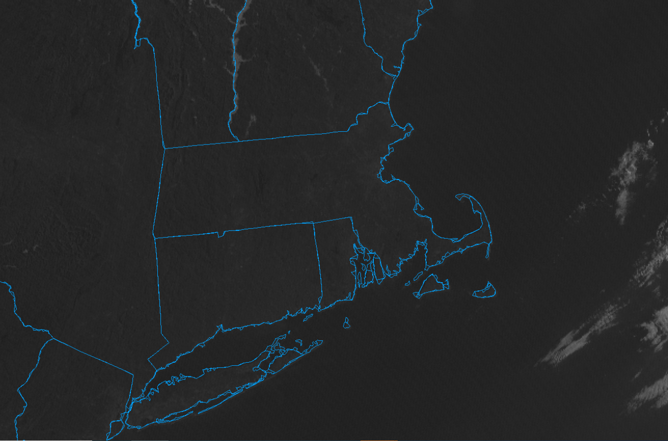
Floods are interesting to observe first hand. Objects et al sticking out of water like they have no business being where they are. It's not unusual as your driving by, you look over your shoulder to see a playground swing set and its attached slide jutting out mid way up. A repurposed oil-drum painted green being used as a garbage can nearby. What is it about playgrounds and ball parks - they always seem to be laid out right next to some innocuous slow moving stream on the other side of a brambled row of shrubbery, just beyond the outfield's chain-link fence. It's like the settlers might have surveyed the land back whence and realized a flood control issue and thought, 'Well, what the hell else are we gonna to do with the land?' Typical white man ... instead of just leaving it be, they create a rec center out of the natural setting - 'cept... said Nature didn't get that memo during wet springs. Scale that up and obviously we're talking about a whole different dimension of gawk affect. Like... the Merrimack River in May, 2006. Mother's Day weekend, in short order a stalled cut-off low pumped some 3 or 4 month's worth of rain into the head region up in the Whites after a respectably hefty snow year was still trying to unburden itself down the water shed. Wow... arresting. The overflow at the Tyngsborough dam just up the way from UML has about a 20 ft draft over the crest to the crag rock below, that latter more typically dried out and exposed on a typical August afternoon. It also demarcates the beginning of the aqueduct that runs immediately parallel to the original river basin from that point about a mile to a main gate that rejoins the river just east of the University Ave bridge - it's nearly 50 feet deep at that point. It was originally used to power the Mill industry during the latter gilded era and early industrialization's invasion of the Merrimack Valley known as Lowell's Boote Cotton Mills. There was flood in ( I think 1937 ) ... The 2005 event may have come close to 90th percentile of that. I'm not sure... but both overwhelmed that control system. The water in 2005 flowed over top the dam to such an astonishing altitude that it became nearly laminar over the top. 20 foot draft below that crest and the water above and below the dam became nearly not above nor below the dam. After having been on or around the campus for 4 or 5 years through the late 1990s ... to then go back and see that sight was ... you just stood there wide eyed.
-
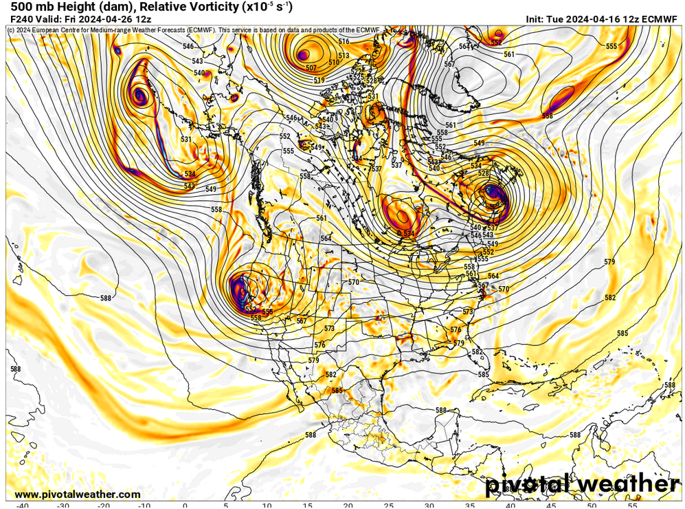
There could be early heat S of 45 N as far NE as Chicago later in the month after we get past/exhausted that -EPO cold load here in the foreground. interesting. The telecon spread is beginning to enter the less statistically significant warm season ... but, the AO(epo/nao) appear to rapidly neutralize to N/S standard deviation really by the end of this week 1. After that, the PNA is meandering meaninglessly above and/or below 0 SD itself which amounts to neutral. I see the zonal tendency to the field still hinted in the cinema out in time between the Date meridian and California over the Pacific... I wouldn't be shocked if we see a low amplitude (spatial ) warm SW release in over the last 7 to 10 days of the month. Zonal tendencies also tend to precede ridging and then sure enough, the long range does show a ridge between Hawaii and the WC ... concomitantly, heights fall over the Great Basin.
-
Are your lilacs leafing out? I've had the unfortunate reality of having lived at this address now 7 or 8 years longer than I had originally envisioned of my future life ... and over the course of the extended stay I have observed lilac bloom behavior as getting early and earlier every year. Right now, the leafs are young but unfurling, and there are adolescence bouquets emerging too. This may be the earliest yet What can I say ...I'm a nerd. For some reason I notice things like that and they stick to my memory like Rain Man