Harry Perry
-
Posts
1,143 -
Joined
-
Last visited
Content Type
Profiles
Blogs
Forums
American Weather
Media Demo
Store
Gallery
Everything posted by Harry Perry
-
We are still SO far out - no one should have any expectations yet. It is nice to finally have something to watch though, and to have weenie maps is pure lust.
-

Winter 2023/24 Medium/Long Range Discussion
Harry Perry replied to Chicago Storm's topic in Lakes/Ohio Valley
I could certainly see a redux of that storm being the outcome with this one if thermals are marginal.
-
Winter '23-'24 Piss and Moan/Banter Thread
Harry Perry replied to IWXwx's topic in Lakes/Ohio Valley
He emphasized on the potential being there for something big and that a lot is to change in the coming days, which I agree with. -
Winter '23-'24 Piss and Moan/Banter Thread
Harry Perry replied to IWXwx's topic in Lakes/Ohio Valley
I think you’ll be pleasantly surprised. -
Winter 2023/24 Medium/Long Range Discussion
Harry Perry replied to Chicago Storm's topic in Lakes/Ohio Valley
Spring started today if you ask him. -
Winter 2023/24 Medium/Long Range Discussion
Harry Perry replied to Chicago Storm's topic in Lakes/Ohio Valley

-
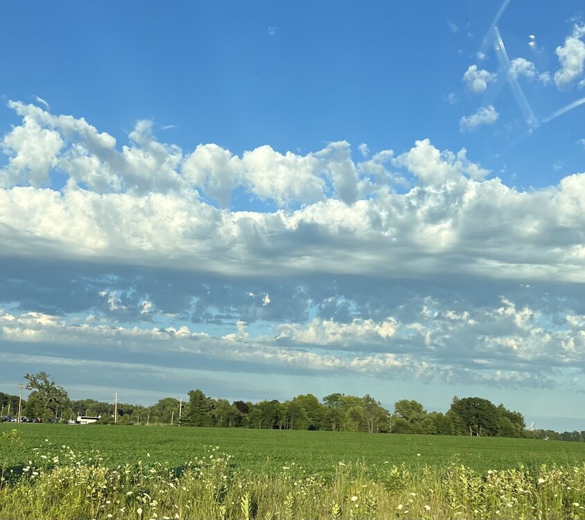
Beautiful day on this side of the lake, 76° and very low humidity. Some models showing dew points jumping 20°+ degrees here tomorrow in only 6-10 hours time. Will be interesting to feel.
-
Steady rain, constant rumbling, occasional lightning, 102° hot tub… love to see/feel/hear it. Weather station has a 27mph wind gust, felt like more but lasted less than 5 seconds. Thoughts and prayers for the people camping near Chicago.
-
Willing to bet we will have some good rumblers with anvil crawlers and stratiform rain around our areas tonight.
-
Looks like the HRRR sniffed out something, but looks like garbage over this way for tonight. Wonder what the next SPC outlook will look like. Almost looks as though storms are firing along the higher dew point gradient from N IL points southeast into Indiana. Dare I say… this mornings bullshit in Indiana forked SWMI once again by working over the atmosphere creating a rather large cold-pool, and only slowly advanced that cold-pool NE into the area while better untapped air pushed into northern Indiana? Time will tell. Already cooling off here @79° and clear skies.
-
I would believe that’s the cap breaking. Just the vents in my truck lol.
-
Still a good cap here… lake breeze just pushed east of here.
-
you should see what I do for work
-
I fully expect to head to FireKeepers Casino in my typical Friday night fashion, drink 2-3 Crown Peach doubles, lose a few $$$ then on my way home hopefully be watching anvil-crawlers/constant lighting moving in from the west all to be finished off while sitting in the hot tub while it starts to storm. Also looks like the cold front won’t be moving through now until tomorrow morning, so kinda thinking we may be in for a pretty quiet afternoon and evening. 100% cloudy here at the moment with just the slightest trace of sun poking through - definitely not going to make it into the 90’s today, but with the later timing of the front the severe threat is kinda meh around here anyway. Just hoping for some good rollers and lots of lightning. Edit* Peaked at the 14z HRRR and chuckled.. shows a nasty local bow pushing through at around 80mph with large hail at 3am - sweet Looks pretty wicked in northern Illinois around 9PM though…
-
2023 Short/Medium Range Severe Weather Discussion
Harry Perry replied to Chicago Storm's topic in Lakes/Ohio Valley
Heavy rain here, a little organization with the back side precip, would expect it to decay by late morning and hopefully get some filtered sun by noon. -
2023 Short/Medium Range Severe Weather Discussion
Harry Perry replied to Chicago Storm's topic in Lakes/Ohio Valley
I don’t know, not throwing the towel in yet, but I fully expect temps to be overdone at minimum today.. thus keeping instability tamed. This crapvection is naturally going to inhibit some of what could’ve been this afternoons potential. Also… that’s a ton of debris clouds - a good 6-8 hours worth moving ever so slowly east.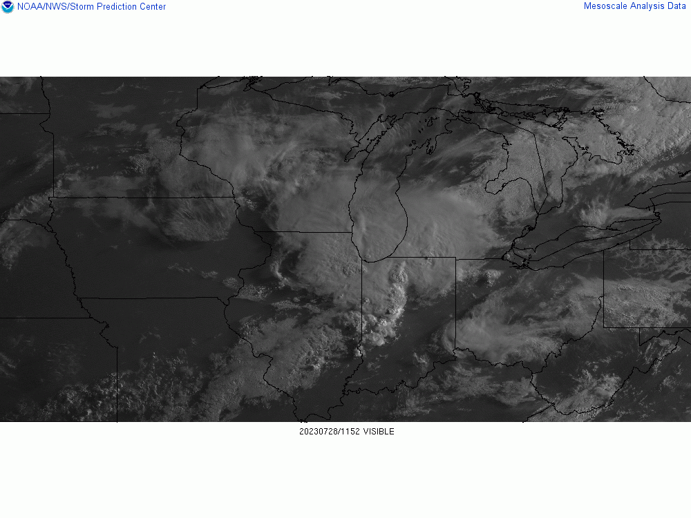
-
2023 Short/Medium Range Severe Weather Discussion
Harry Perry replied to Chicago Storm's topic in Lakes/Ohio Valley
ILX always seems to have higher SBCAPE, lot of corn nearby? Some of the highest readings I’ve ever witnessed came from ILX where the dew points always seem to be higher than surrounding areas. -
2023 Short/Medium Range Severe Weather Discussion
Harry Perry replied to Chicago Storm's topic in Lakes/Ohio Valley
Wow is right.. hell of a sounding. Never know, tomorrows storm mode could start off with some SUPs, likely nothing like the Andover event but the ingredients are definitely there. Would expect a bump to ENH for most of us overnight and tornado probs increased a bit. I was looking at my local sounding and have a ton of hail matches. Hard pass on all of that nonsense. -
2023 Short/Medium Range Severe Weather Discussion
Harry Perry replied to Chicago Storm's topic in Lakes/Ohio Valley
It’s our time to shine. -
2023 Short/Medium Range Severe Weather Discussion
Harry Perry replied to Chicago Storm's topic in Lakes/Ohio Valley
Wow, just checked 00z and yeah, would be a higher end event for most of the sub. Southeast Wisconsin just absolutely mutilated. Check out some of the UD Helicity Swaths maxing out the scale over Grafton and West Bend. Impressive. HRRR probably a pretty realistic outcome with the instability in place and the 50kt LLJ punching from the west around dark. Going to be a busy night. -
Yeah, I kinda had a feeling this is how today would unfold. I’d throw the towel in anywhere west of 127 and north of 96. Believe anything that develops to the west will be sub-severe and mainly follow the instability gradient to the south.
-
Had a 20mph gust-front here with some torrential rain. Minor flooding on side streets. Temps down to 66°. No lightning. The atmosphere has over-turneth.
-
I agree. GRR is optimistic on this first round not overturning the atmosphere and better instability (even mentioning sunshine) later this afternoon setting the stage for severe. I just don’t see that happening, and the 15z HRRR agrees. I could see more of an isolated threat but with that, most of the storms this afternoon would be independent sups capable of some tornados with the directional shear in place. Highly conditional, but would expect areas closer to Detroit, Toledo, Findley and areas into Canada - such as Chatham to really be under the gun later on today.
-
Thinking that the best shot for severe will be closer to Metro Detroit later on today. Lots of clouds and the decaying mcs is out running the better support over this way.
-
Every hour of the HRRR has been a significantly different outcome. Very fluid situation as CAMs are struggling with actual placement of storm development with every advancing hour. I don’t think we’ll have much of an idea of what truly transpires until at least 06-12z tomorrow when upstream convection develops. At that point it’ll be easier to differentiate CAMs and other short range guidance into a solution more likely to transpire; hence the blob vs. a more detailed outline for tomorrows SVR WX outlook. One thing for certain is the ingredients in place for tomorrow are better than average for this summer at least. Plenty of heat, higher surface dew points, potent shortwave approaching, deep layer around ~50kts, high lapse rates, etc… all depends on what develops overnight into tomorrow morning. Obviously a better chance if more instability is realized and less morning cloud cover materializes. Finally, something to watch.