jconsor
-
Posts
1,041 -
Joined
-
Last visited
Content Type
Profiles
Blogs
Forums
American Weather
Media Demo
Store
Gallery
Everything posted by jconsor
-
Historical context - Isaias is easily the strongest Oct-Nov GOM hurricane since the beginning of the 20th Century when considering the 15 strongest El Ninos. Note that 2002 (Lili) was excluded from this list as it was a Modoki Nino. https://x.com/yconsor/status/2108558918406328651
-
Impressive microwave pass confirming the last recon message which showed a closed eyewall. https://x.com/yconsor/status/2108197204842446876
-
Side comment - I think we will see 1-3 named storms after this one with about a 50% chance of of another hurricane (likely in the subtropics). But yeah, it's pretty comical that this one seems to be defying many of our expectations.
-
2026 Atlantic Hurricane Season
jconsor replied to Stormchaserchuck1's topic in Tropical Headquarters
Larry, I think that UKMET forecast showing Fay coming back this weekend is likely not a total outlier. Moreover, seems Fay may have been deactivated too fast; it's almost like she's taunting NHC - every time they try to deactivate her, convection increases and she refuses to die! https://x.com/yconsor/status/2105201133736415667 -
Strong Nor'Easter/Hybrid Storm Late September 2026
jconsor replied to Rjay's topic in New York City Metro
Looks like there were 3 distinct "hotspots": 1) Central coastal NJ 2) Western Suffolk, especially North Shore 3) Eastern MA -
Strong Nor'Easter/Hybrid Storm Late September 2026
jconsor replied to Rjay's topic in New York City Metro
Duration and persistence of high water levels for NJ shore was one key aspect that made this storm unique/unusual: https://x.com/JoeMartWx/status/2104638298111045740 -
Strong Nor'Easter/Hybrid Storm Late September 2026
jconsor replied to Rjay's topic in New York City Metro
This system was clearly a black swan given the time of year and not being a tropical cyclone: https://x.com/yconsor/status/2105195828478361705 -
@vortex95 @jbenedet Would be interested to hear how would you counter Ryan and Tomer Burg's claim that this is merely a warm seclusion with no subtropical characteristics? Personally I think this is well on its way to being subtropical. You don't get a burst of convection like that near the center over 25C waters with thicknesses near 580 from upper-level/synoptic forcing alone like Tomer claims. https://x.com/burgwx/status/2103912607010750893 https://x.com/RyanWeather/status/2103917149110653089
-
Strong Nor'Easter/Hybrid Storm Late September 2026
jconsor replied to Rjay's topic in New York City Metro
WPC analyzed the low as 995 mb at 15z: https://www.wpc.ncep.noaa.gov/#page=sfc -
Strong Nor'Easter/Hybrid Storm Late September 2026
jconsor replied to Rjay's topic in New York City Metro
All of the NJ coast up to Monmouth County (e.g. NWS Mount Holly's territory) is under a High Wind warning: https://forecast.weather.gov/wwamap/wwatxtget.php?cwa=PHI&wwa=high wind warning -
Strong Nor'Easter/Hybrid Storm Late September 2026
jconsor replied to Rjay's topic in New York City Metro
While GRAF is likely overdone, I do think we likely see 75+ mph wind gusts not too far offshore of NJ. https://x.com/WeatherProf/status/2103311148711854175 -
Strong Nor'Easter/Hybrid Storm Late September 2026
jconsor replied to Rjay's topic in New York City Metro
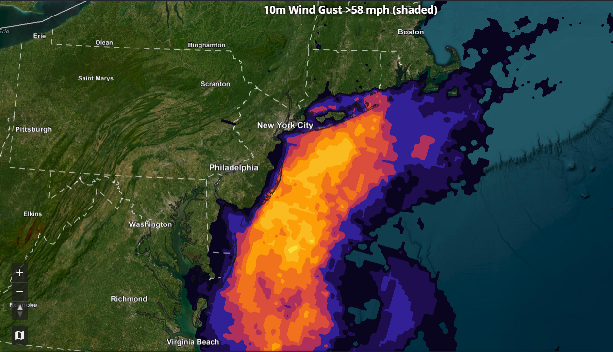
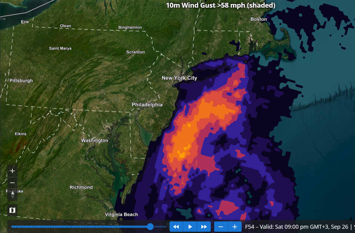
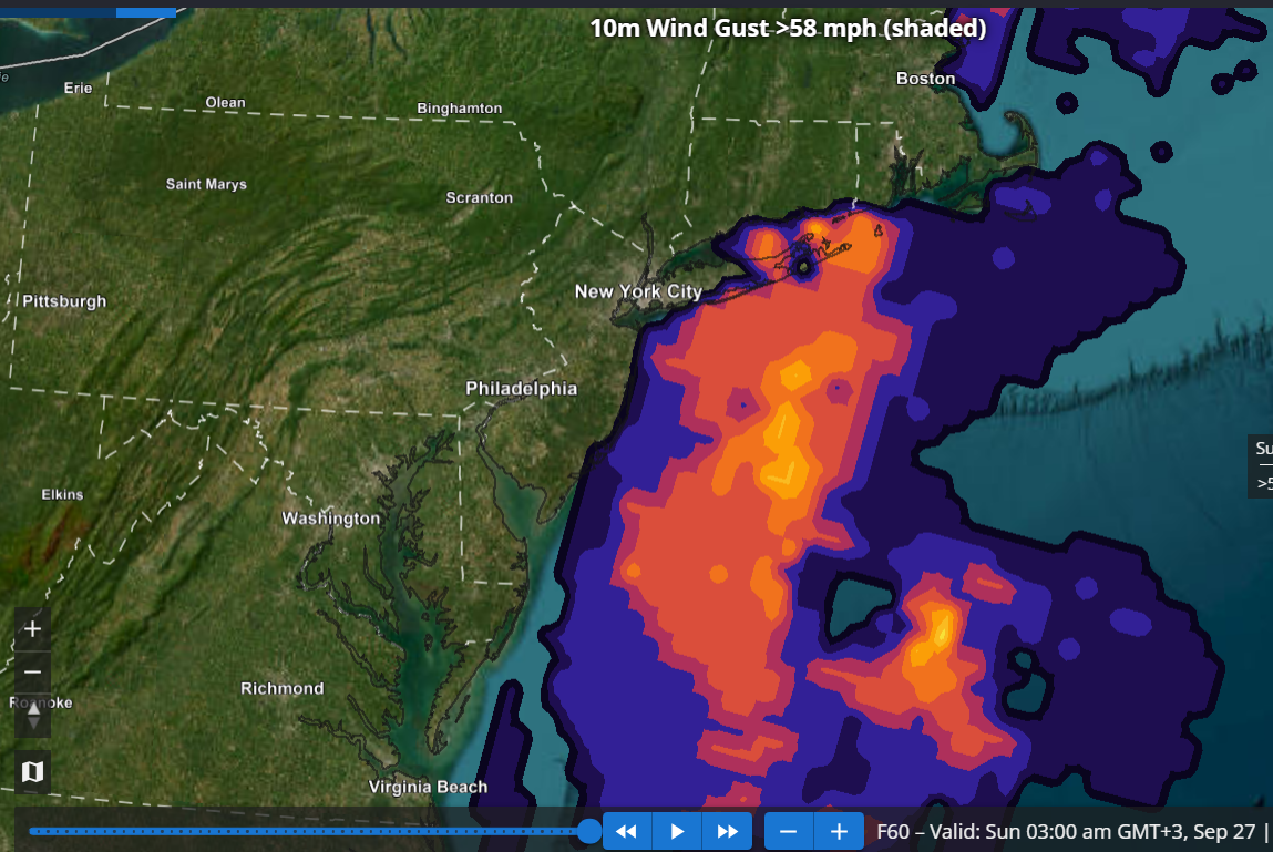
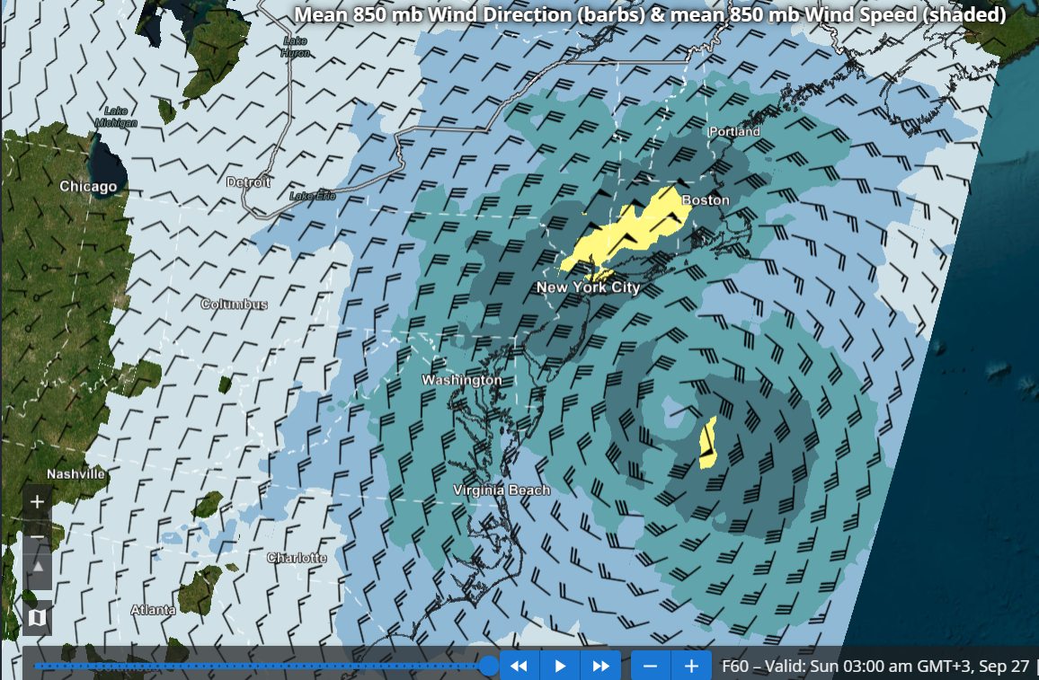
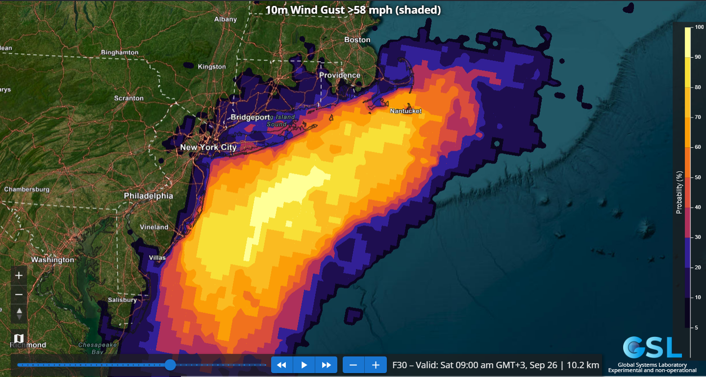
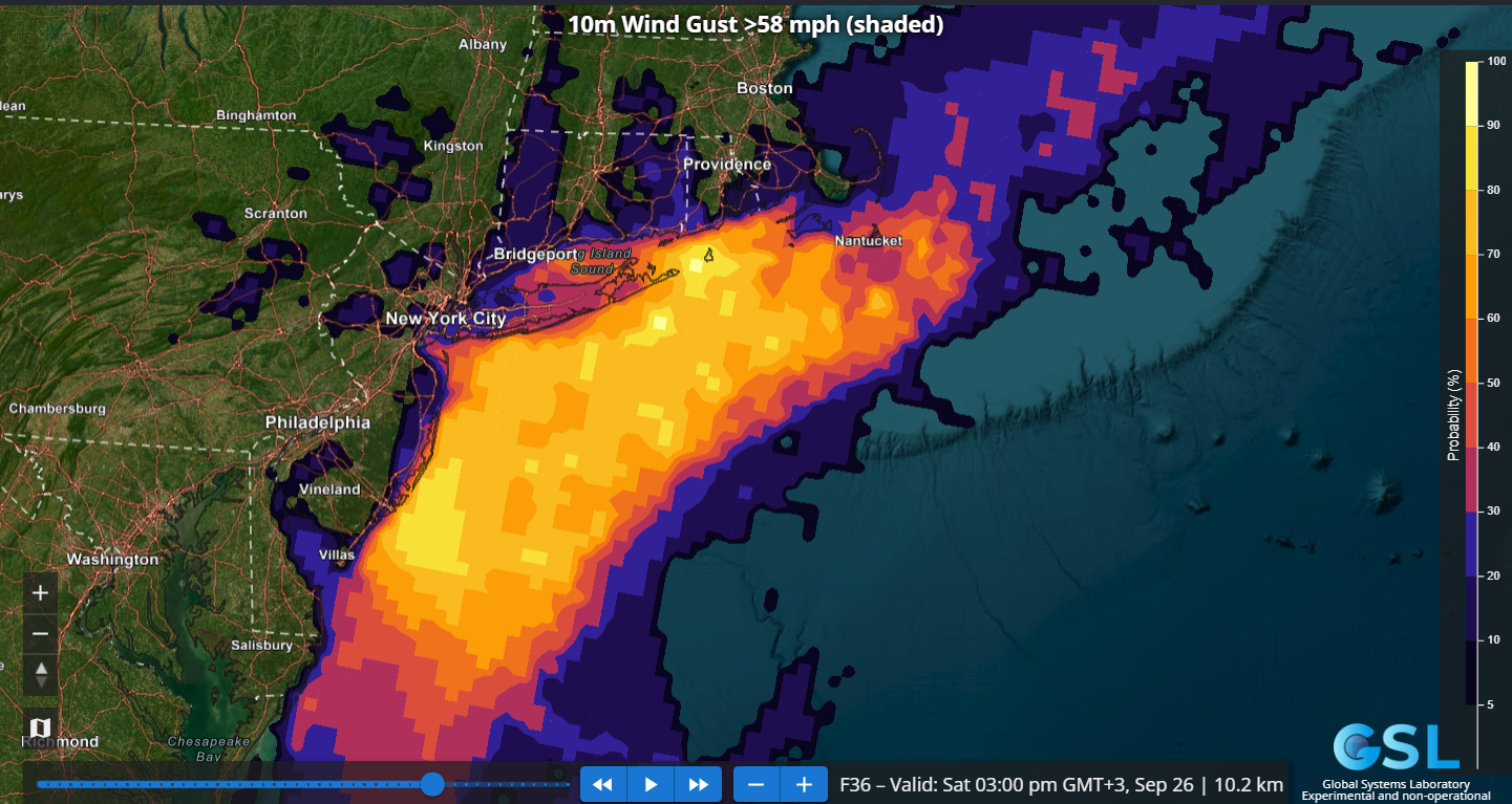
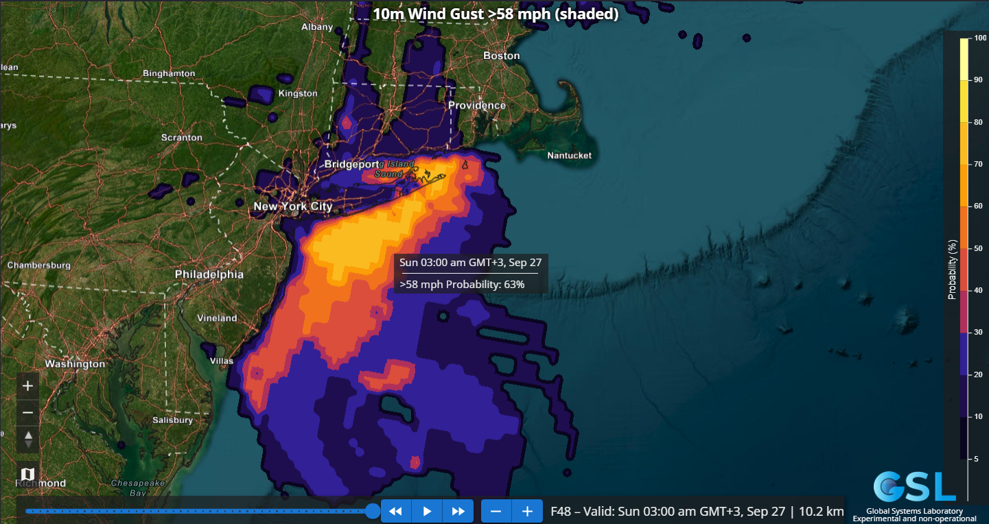
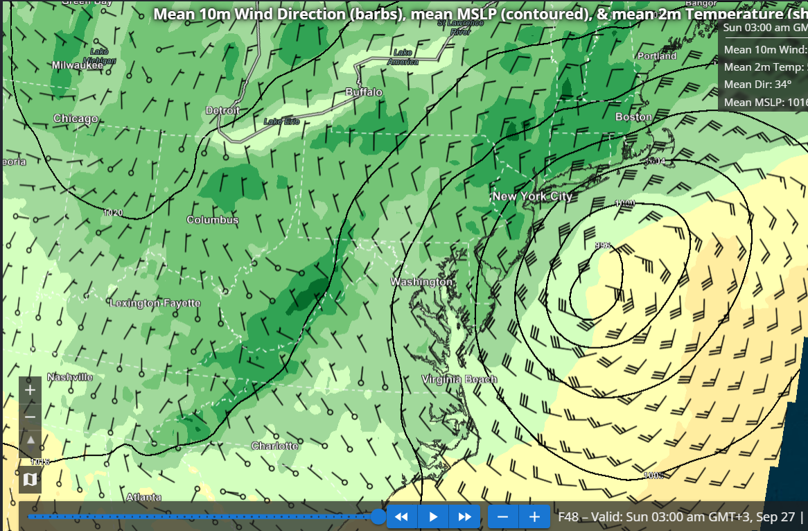
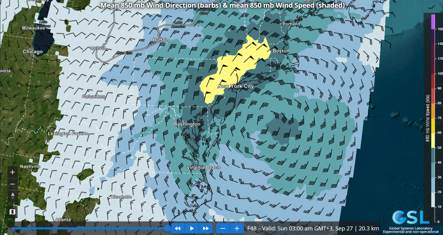
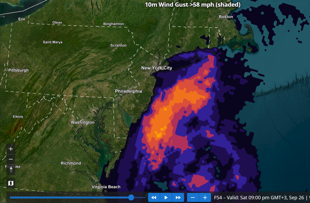
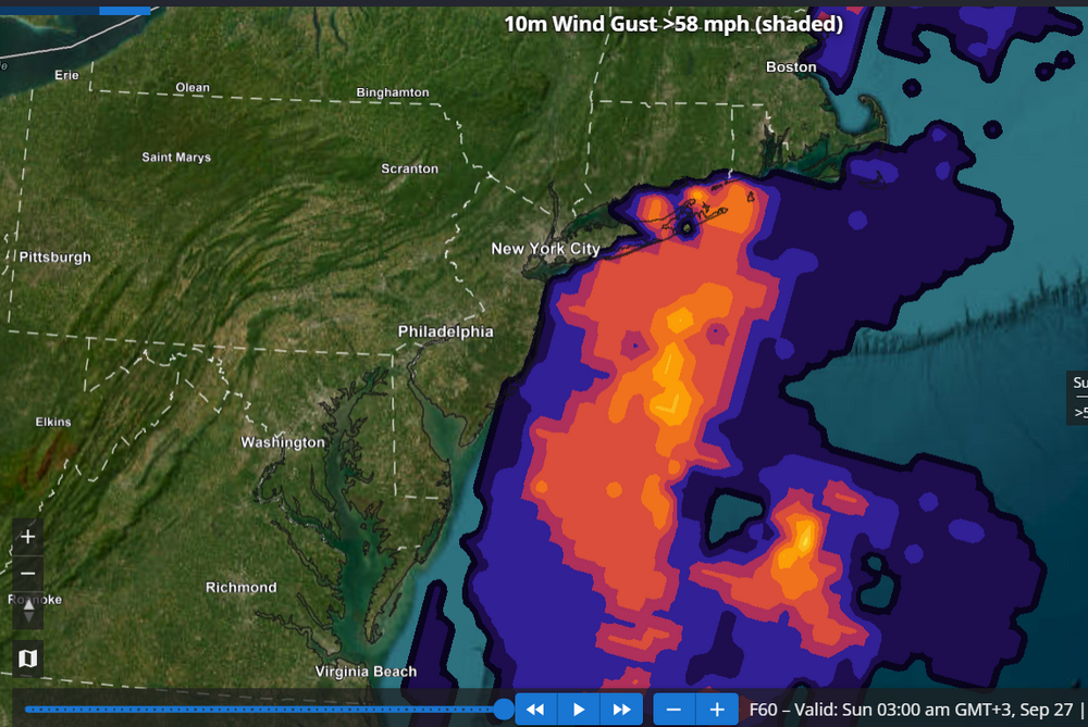
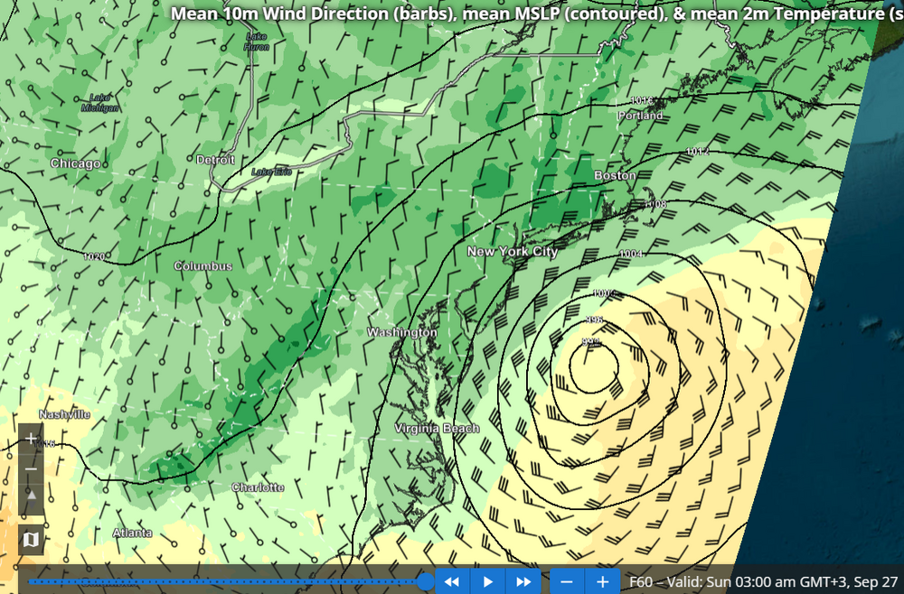
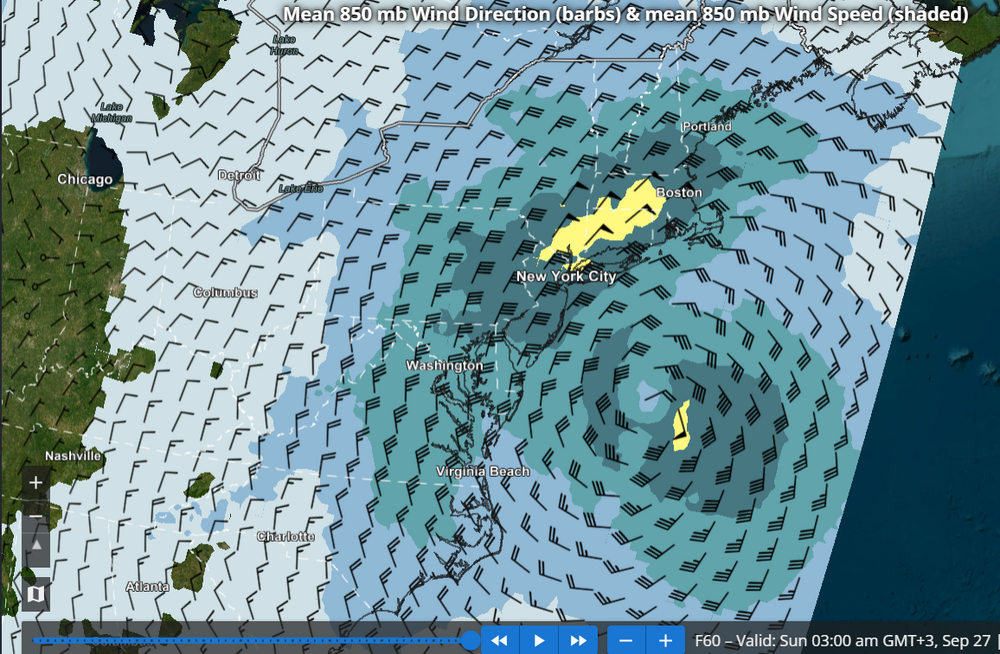
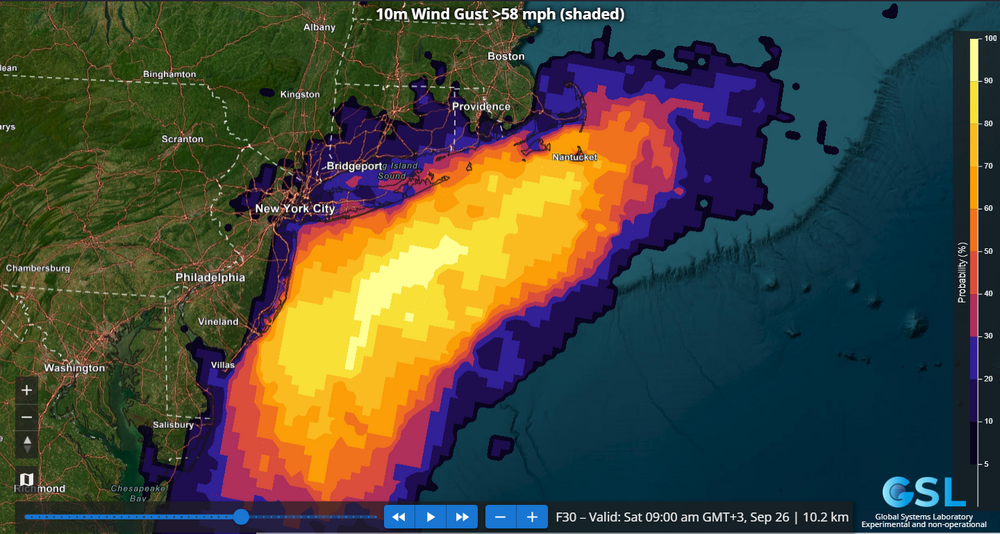
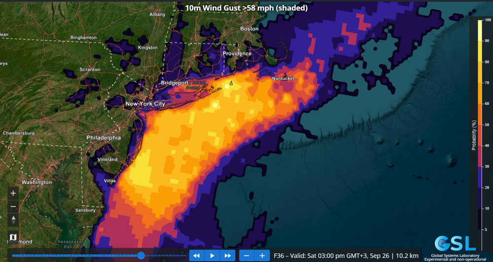
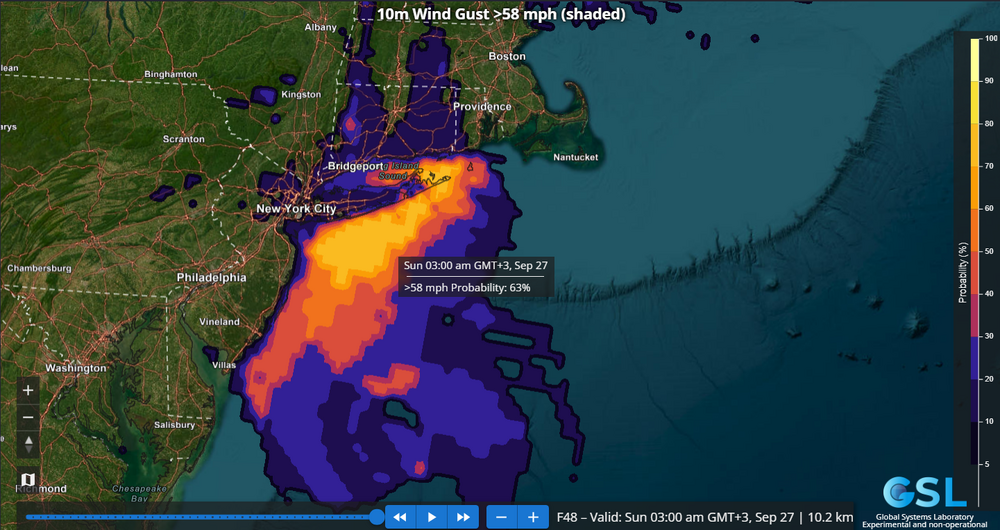
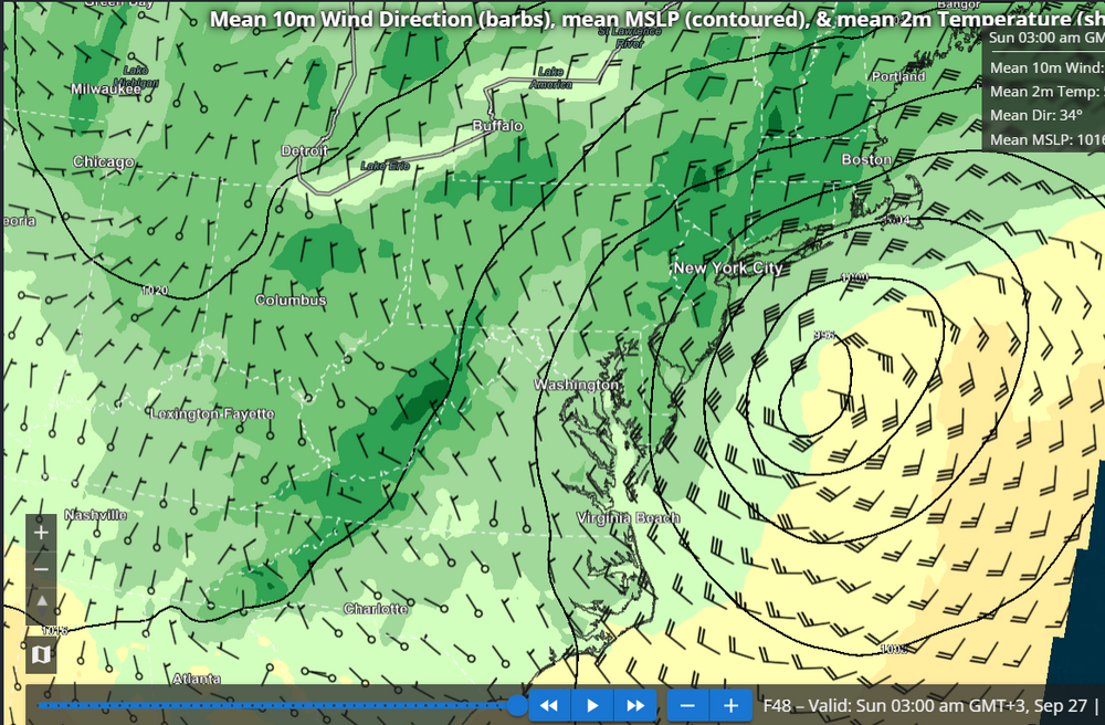
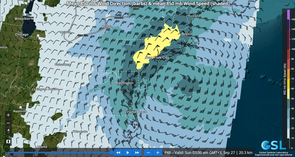
The REFS (RRFS ensemble) probability of wind gusts exceeding High Wind Warning criteria e.g. 58 mph for Sat into early Sun morning remains unnervingly high for the South Shore of LI as well as Eastern Suffolk. Additionally, on this run, the probabilities over 25% have edged into southern portions of NYC like southern SI and far southern Brooklyn and Queens. Still unclear to me why NWS Upton is holding back on a high wind warning for the above-mentioned areas, especially eastern Suffolk where the model consensus is strongest. Note the REFS has shifted NW with the position of the low pressure and the 850 mb low center at 48 hours, if you compare to the 60 hour forecast from the previous post.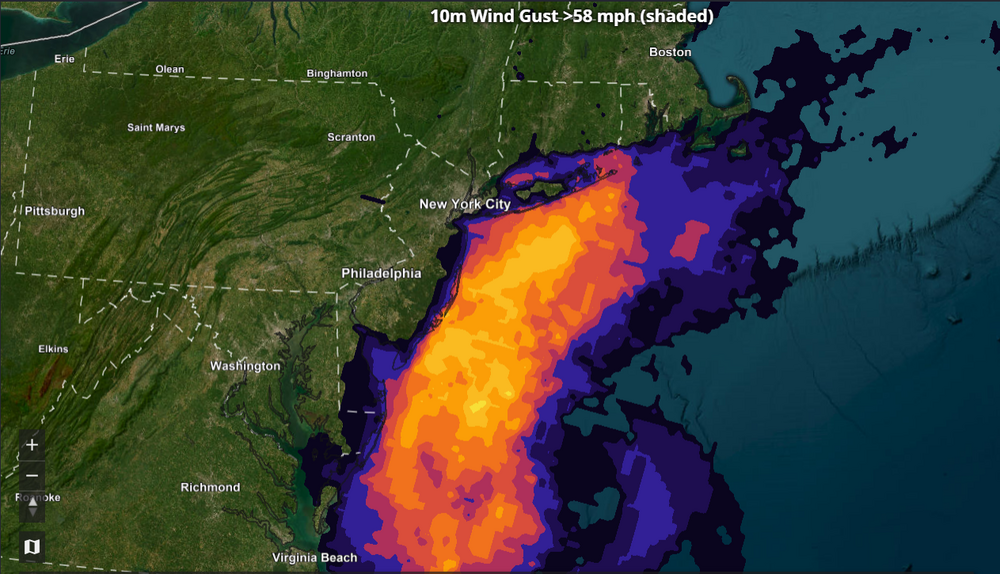
-
Strong Nor'Easter/Hybrid Storm Late September 2026
jconsor replied to Rjay's topic in New York City Metro
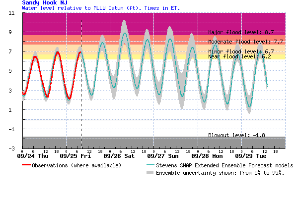
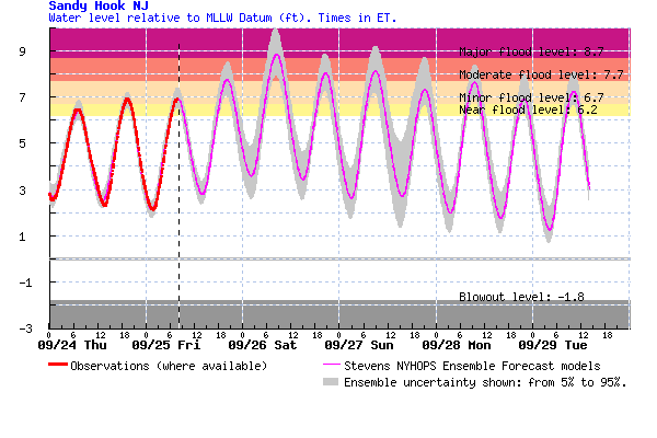
The NWS water level forecast for Sandy Hook may be conservative. Consensus of the 3 main forecast models (https://hudson.dl.stevens-tech.edu/sfas/) is for a water level peaking around 9 feet, with potential for 9.5-10 feet in the higher end scenarios. That could easily put this event as the fourthhighest in the past 60 years.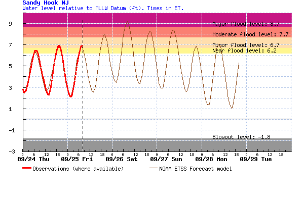
-
Strong Nor'Easter/Hybrid Storm Late September 2026
jconsor replied to Rjay's topic in New York City Metro
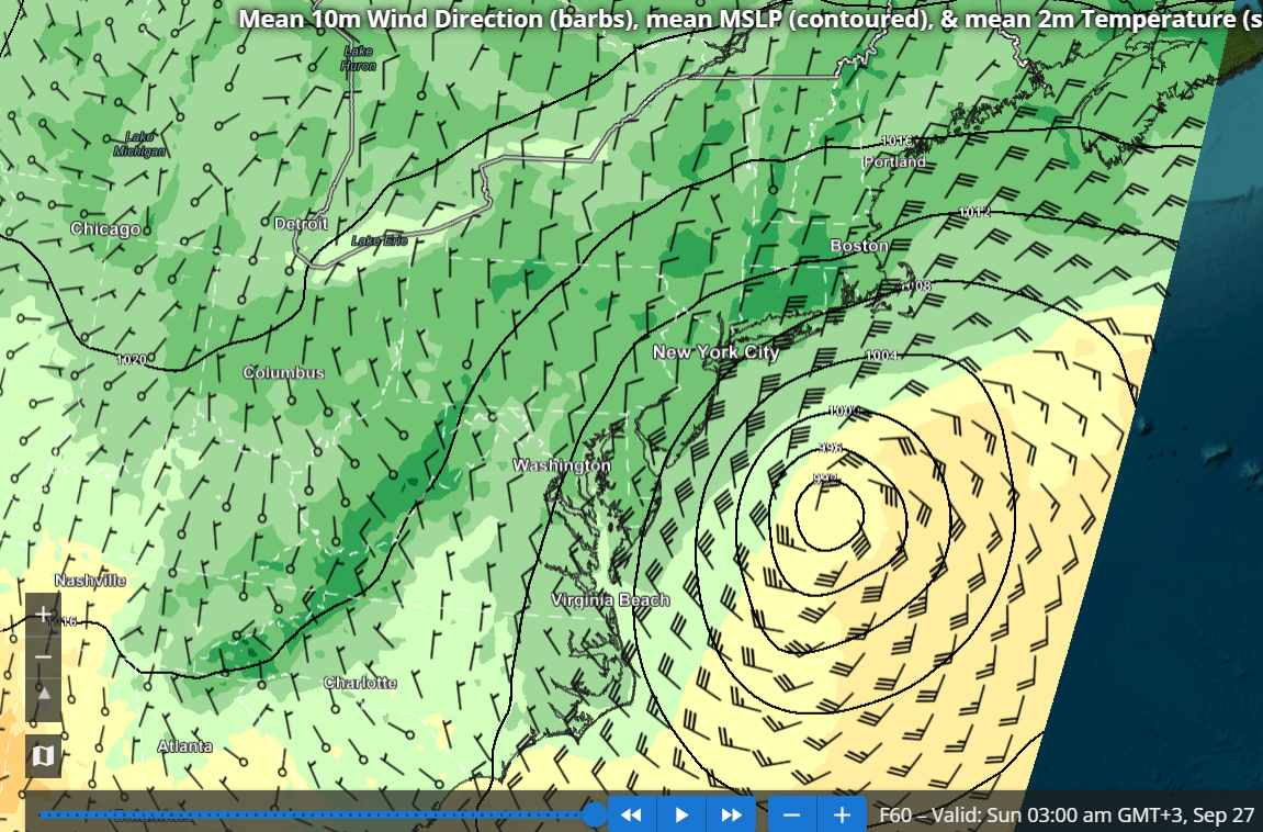
I agree the specific REFS scenario should be largely dismissed, though the idea of a westward turn occurring fairly far south near southern NJ and the Delmarva has merit IMHO. The REFS (RRFS ensemble) has a lot of value and so far I have barely seen anyone mentioning it. Probably because the site with REFS graphics seems to be a pretty well kept secret: https://sites.gsl.noaa.gov/desi/ The images I posted below show probability of 58 mph wind gusts (HWW criteria) at 42, 54 and 60 hours from the most recent REFS run (15z). Based on this I think a HWW would be well justified for the south shore of LI as well as eastern Suffolk, perhaps even into se CT. I also added the MSLP and 850 mb wind forecasts from the REFS at 60 hours, showing the mean places the storm well north of the RRFS operational.
-
Port Arthur is ~10 miles inland and still well outside the core of tiny Edouard - not surprising winds haven't been very strong so far, but that could change soon. Texas Point (at Sabine Pass) on the coast at the border of TX/LA has recently seen sustained NNW winds to 50 kt with gusts to 59 kt. This is on the "weaker" western side of the storm. https://www.ndbc.noaa.gov/station_page.php?station=txpt2 On the eastern side, but a little outside the eyewall, around 12 PM CT Calcasieu Pass, LA saw sustained winds to 38 kt and gusts 45 kt. https://www.ndbc.noaa.gov/station_page.php?station=capl1
-
While I do think Chris Martz is largely off his rocker and clearly biased, this new information (if verified) does change the background to the Nepal floods significantly IMHO: https://x.com/MatthewWielicki/status/2094549198473740371
-
As others have been discussing, Dolly has proven quite resilient vs. model expectations, with the recent 'explosion' of convection seemingly aided by the diffluent, highly sheared flow. Surface obs from the Leeward Islands in the NE Caribbean have been quite interesting. I agree with @vortex95 that it's pretty clear Dolly doesn't meet the criteria for a TC, but it is not far off IMHO. Thread here: https://x.com/yconsor/status/2094029423624310857
-
AI models are not infallible. Sometimes they can be "blind" until the last minute, as appears to be the case with 96L. https://x.com/yconsor/status/2092682443710923077
-
If it walks like a duck and quacks like a duck, it's probably a duck... https://x.com/yconsor/status/2092623985091494311
-
2026-2027 Record-breaking El Nino
jconsor replied to Stormchaserchuck1's topic in Weather Forecasting and Discussion
You can find VP anomaly from 1940s to present from JMA 3Q reanalysis here: https://ds.data.jma.go.jp/gmd/tcc/tcc/products/clisys/figures/db_hist_jun_tcc.html (10 day means) https://ds.data.jma.go.jp/gmd/tcc/tcc/products/clisys/figures/db_hist_mon_tcc.html (monthly means) In the menu on upper left under "Field", click on Tropics. Then under Element, click 200 hPa Velocity Potential. -
Recent guidance targeting northern NJ for heaviest rainfall: https://x.com/BhatiaKieran/status/2082103580756971568
-
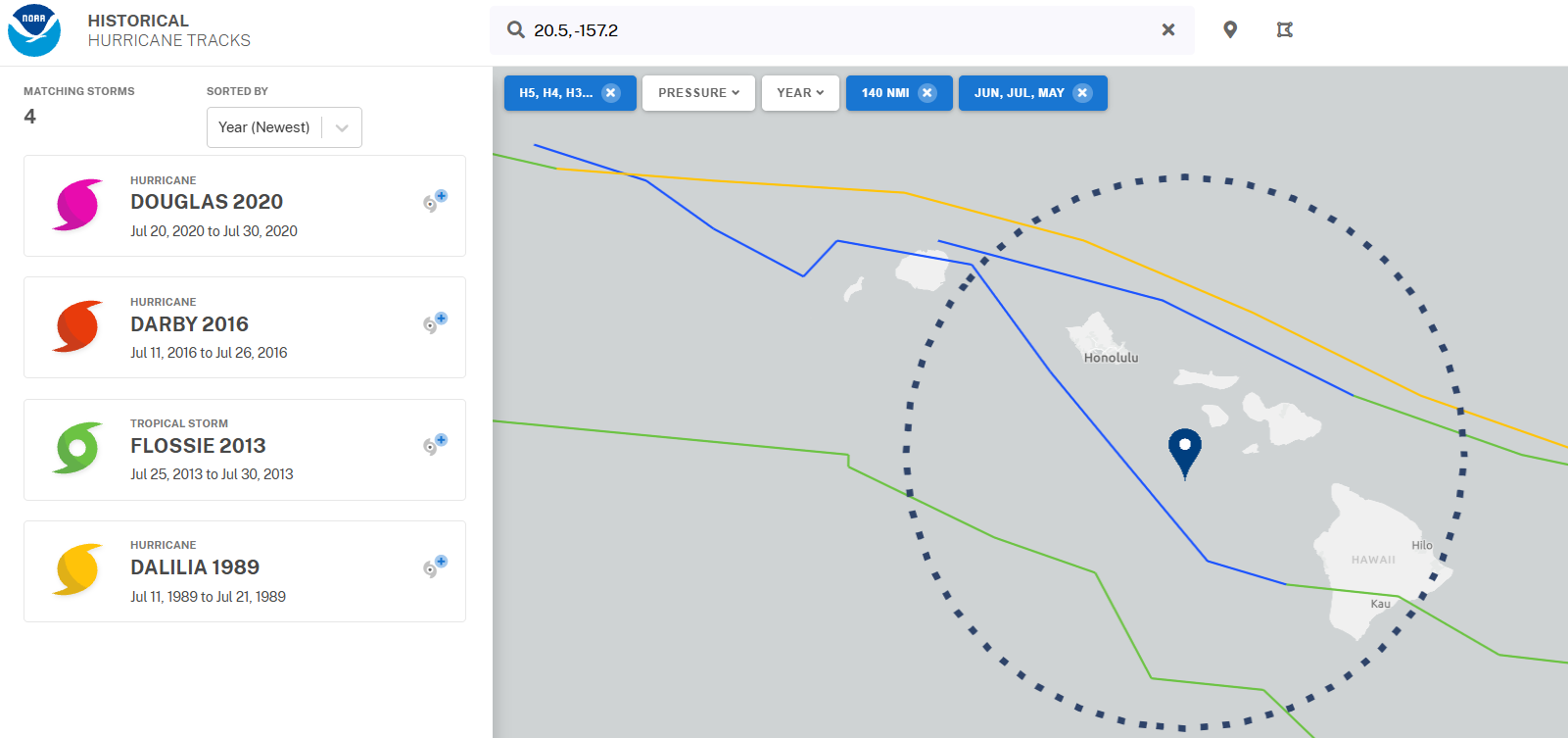
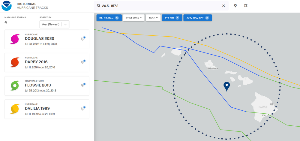
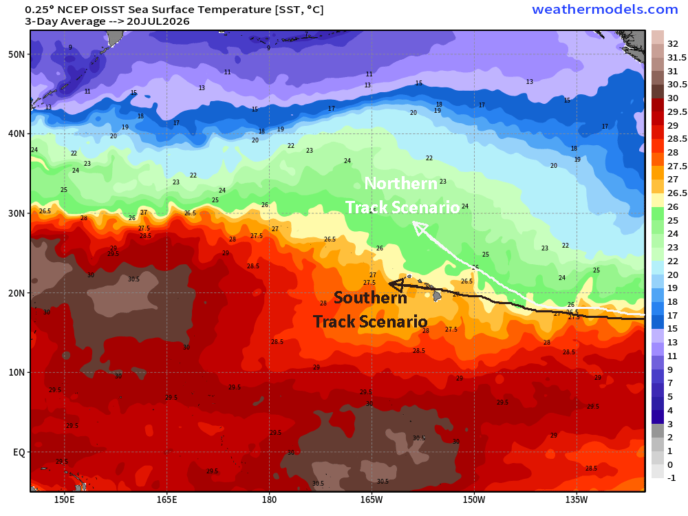
Our next US hurricane threat comes from an unlikely place so early in the season - the eastern/central Pacific! Fausto is expected to track west in general direction of Hawaii by mid next week, but big questions remain on whether it turns more NW and weakens (a la EPS) or continues westward and threatens Hawaii. Even a tropical storm strength system passing near Hawaii so early in the season would be in rare company. Check out my latest blog with more details: https://hurricanehacker.substack.com/p/eastern-pacific-stealing-tropical (Note - while my blog is mainly Atlantic focused, when there is a land threat in the eastern or central Pacific I will cover it. The subsequent posts on Fausto will be more in-depth than this one... please follow the blog on Substack for updates.)
-
Bertha has been a rather confounding/challenging TC to forecast. I'd be wary of being fooled by its current appearance (LLC decoupled from convection). Posted in-depth thoughts on Bertha's future here at my blog: https://hurricanehacker.substack.com/p/bertha-gaining-strength-heading-for
-
While there is typically relatively high uncertainty for nascent, not well defined systems, I agree with NHC and posters here that the uncertainty here is unusually high due to the forecast coast-parallel track and the strong dependence of the track later this week on how quickly future Bertha gets organized in the next day or two. I go into the potential scenarios and all of the details here: https://hurricanehacker.substack.com/p/tropical-storm-bertha-likely-to-form?r=etzas
-
2026 Atlantic Hurricane Season
jconsor replied to Stormchaserchuck1's topic in Tropical Headquarters
Will the tropical system off the west coast of Florida manage to organize despite moderate northerly wind shear over the next few days? It's expected to spend three to five days over the very warm waters of the Gulf of Mexico, which suggests we shouldn't count this system out. While a weaker system is the most likely scenario, there is the potential for a stronger system if it continues moving west under strong central/southeast US ridging and doesn't turn quickly northward toward Florida. https://hurricanehacker.substack.com/p/tricky-forecast-for-gulf-of-mexico