

Windspeed
-
Posts
4,737 -
Joined
-
Last visited
Content Type
Profiles
Blogs
Forums
American Weather
Media Demo
Store
Gallery
Everything posted by Windspeed
-
The MCV accociated with the old boundary draped off the ECONUS might be forming an LLC under the current MCS complex that went up this evening. Note the circular pattern of the lightning near the highest cloud tops. Possible curved banding forming might be the beginnings of an LLC and we may get a named system out of this sooner than later if it holds together.
-
Fairly healthy wave axis with an MCS mid-level vort max south of the Verdes. Who knows if it will persist long with the SAL locked in to its NW. But interesting nonetheless. 12Z ECMWF does have a solution or two that closes off a surface low but there's negligible model support beyond that.
-

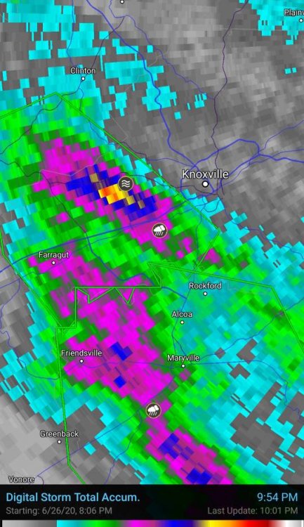
TN valley heavy rain/flooding week of whenever
Windspeed replied to janetjanet998's topic in Tennessee Valley
-
Classic La Niña taking shape. Questions remain on strength and coverage, especially in 3.4, but it is no doubt kicking in at this point. I suspect even a moderate La Niña would be a safe call, but still can't rule out a --ENSO either.
-
That particular model animation shows Azore's ridging below the 700 hPa layer of the atmosphere backing down over the eastern subtropical Atlantic. Surface-to-mid level pressures weaken slightly, retreating poleward. This eases low-level easterlies off Africa, which, in turn, limits SAL propagation westward off Africa. Additionally the ITCZ would become less suppressed south and gain some latitude within that pressure regime. This would help increase instability along the MDR, with better low-level convergence for convection, especially if the MJO is in a favorable phase aloft. Tropical wave tracks would also gain some latitude with the decrease in pressure heights, and be able to tap into moisture feed from the ITCZ. We generally see this pattern of strong Azores ridging back down in August, not early July. Typically a beefy late Spring to middle Summer eastern Atlantic Azores ridge is why we generally see SAL and too amped a low-level easterly jet to favor any MDR development. That, and upper level shear and vorticity is not yet favorable. At any rate, the pattern in the animation above may coincide with a favorable MJO [see below] and a relaxation of upper level wind shear across the Caribbean and lower MDR as well.
-
-
If SAL plumes continue to be lifted and break away into the easterly jet during the potential favorable MJO phase over the Atlantic, I am sure it would still have a negative effect on environmental conditions for cyclogenesis. But we have seen cyclogenesis occur with waves that were interacting with SAL in the past. It really just depends on location of a hypothetical wave axis versus the most hostile dry airmass and propagation of moisture flux out of the ITCZ. That's a remains to be seen kind of thing. Who knows...
-
Plumes of SAL dry airmass and aerosols riding the easterly jet should suppress activity for a few weeks at least. It will moderate with time as the ITCZ and individual waves begin to gain some latitude July-August.
-
Looks like AOML's OHC and TCHP maps are ingesting RS data correctly now. Still a vast spread of TCHP for mid-June, but way more realistic.
-
-
-
-
Notice in long-range modeling, the region of above median precipitation shifts from interior western Africa to off of the western coastal region of Africa, just south of the Cape Verdes, into the Atlantic MDR. The ITCZ and WAM becomes focused there. As such, this suggests that easterly intertropical waves that continue forming over deep interior and eastern Africa, if their energy holds together, will move off the African coast, and should reach a favorable environment for tropical development somewhere within the MDR:
-
That precip anomaly map only matters to show that the pattern from the Indian Ocean to West Africa has favored stronger intertropical frontal troughs to support wave formation in the interior of central Africa. This has coincided with an amped West African Monsoon, resulting in a much wetter pattern than normal the past few months. The pattern could, of course, change. At any rate, the N. African anticyclone / SAL typically breaks off aerosol-laden dry airmasses during this stretch of Summer when typical strong Azores ridging below the 700 hpa layer begins cranking the ENE and easterly jet off of NW Africa. But by mid-July to mid-August, the Azores SPHP generally shifts west into a SER/WAR regime, especially during a +AMO/+NAO/-ENSO setup, allowing WAM to expand west of the Cape Verdes and ITCZ to gain latitude. If that occurs, increased numbers of tropical waves and MCSs exiting Africa into the Atlantic MDR would seem to favor the MDR being active this year. I believe it will even be hyperactive based on earlier discussions in this thread, but we shall see.
-
The dust is coming from the Saharan and portions of the sub-Saharan that is not within the above normal precipitation regions discussed earlier. Yes, Morocco and Northern Algeria has seen above normal precipitation due to cutoffs and the previous -NAO pattern, which tracked extra tropical cyclones into the Mediterranean off of the Eastern Atlantic. This had little influence on the main desert regions though. In the image below, the two red Xs have remained normal (dry, low precip) over Saharan and sub-Saharan. The blue X has seen above normal, but that is still mostly an arid region. The point of the original post above was to show the extreme above normal precipitation amounts for already generally moist grasslands and forest regions of the interior and west-central African continent, south of the sub-Saharan region. This suggests increased numbers of multi-convective systems and tropical waves advancing through the West African Monsoon (WAM), which should increase activity out into the Atlantic ITCZ and MDR through the heart of the Cape Verde stretch of the season. As for the dust, the Azores ridge is cranking below the 700 hpa level of the atmosphere seen in purple below. This is inducing strong easterly trades off the Sub-Saharan region pulling desert dust along with it. The low-level easterly jet burst will push all the way across the Atlantic over the next 10 days.
-
-
ECMWF + UKMET long-range precipitation forecast courtes of Ben Noll Weather..
-
22/11/6 *** stares down [mention=9730]WxWatcher007[/mention] with The Good, the Bad and the Ugly theme playing ***
-
The previous TCHP maps may have been showing old data. This does seem to make sense based on the Gulf Stream data from last week being virtually non-existant for heat content on previous maps. There should be noticeable kinetic energy in the GS off of Florida by this time frame, yet last week's maps were showing zilch there.
-
Awesome for you to have gone back and checked previous days. Yes, something is amiss.
-
Strong +AMO/+NAO with robust Azores ridging may keep the wavetrain and ITCZ slightly displaced at a lower latitude this August-October. Though it should back down somewhat, the pattern could result cyclogenesis at slightly lower latitudes within the MDR and ESE of the Lesser Antilles.
-
Though I have been sharing posts from meteorological and climatological social media, and making comments of my own about the 2020 season, I've yet to make a formal post on any predictions. At this point, it's probably not going to surprise anyone that I am now calling for a "hyperactive" 2020 Atlantic hurricane season. There is no doubt that it will be active, but too many signals are suggesting we will see a big ACE producing year. Possibly even near to something like 2017. Though I do expect more action in the deep Caribbean vs the northern, I also expect MDR development in August-October to be above normal with plenty of cyclogenesis occurring at low latitudes. We may see an Ivan, Dean, Allen or Gilbert type powerful Cape Verde Hurricane reach Central America or the GOM. I expect significant Western Caribbean development as well. Perhaps more than one. The setup looks amped for big numbers and indicators make it difficult to not give into the hype. So really if we see anything not representative of a very active to hyperactive season by October, this would be a huge forecast bust. I am pretty confident in these numbers: An additional 19 tropical cyclones beyond Cristobal for a total of 22, 11 of those hurricanes, 6 being majors, with around 190 accumulated cyclone energy (ACE) for the season. Edit: Already revising total numbers up to 22 as I was thinking ahead and did not account for having had 3 TCs already.
-
^ RE: Long-range velocity potential mentioned above into July from GFS and EPS members:
-
Maps of TCHP and depth of 26°C isotherm. I never recall seeing such high-end anomalous kinetic energy stored up this early in the calendar year. These maps look more akin to mid-August. There will be an amplified easterly jet below 700 hpa this week that will hopefully bring down / cool off the MDR somewhat. But with hints in long-range modeling suggestive of a synoptic pattern that would support long-tracking deep Caribbean TCs, the anomalous OHC is a bit troubling, especially given the atmospheric pattern for velocity potential over the Caribbean may be among the most favorable for TCs development during the heart of the season.
-
Informative chain thread on long-range modeling SSTs and steering pattern for 2020 Atl Hurricane Season:


