

wxdude64
-
Posts
7,622 -
Joined
-
Last visited
About wxdude64

- Currently Viewing Topic: August Discobs 2026
Recent Profile Visitors
16,143 profile views


-
Yep, a completely different world up there. Glad you had a great trip, as someone else said, just gotta keep a watch out for the 'sliders' on the ground and whatnot.
-
About a tenth overnight, about that much since the 7 am report. MUGGY, MUGGY, MUGGY! 71.2/70.0 currently with light rain at 9:30 am.
-
My numbers for the month of July 2026. Averaged high temp was 83.7 degrees vs a normal of 83.9 degrees, -0.2 degrees below average. The warmest temp recorded was 93.3 degrees on the 4th. Averaged low temp was 64.2 degrees vs a normal of 62.8 degrees, a +1.4 degrees above average. The overall averaged temp was 74.0 degrees vs a normal of 73.4 degrees, a +0.6 degrees above average. The total rainfall for the month was 4.50 inches vs a normal of 4.01 inches a +0.49 inches above average. The greatest rainfall was on the 21st with 1.07 inches. There were 16 days with measurable, 2 days with a 'T' and 12 dry days. There were 3 days with winds above 25 mph, with the highest wind happening on the 21st and 22nd at 26 mph. Three new records were set, a new daily rainfall on the 21st, a new record high on the 4th and a new 'warm minimum' set on the 19th. A very hot start to the month, with average to slightly below average the rest of the month and finally a month with above average precip.
-
I'm in the same boat as you, wooded forest surrounding the house creating shade. The Flood brands DO just as good a job as the expensive stuff, IMO. I've used them for years, and about every third year I'm redoing the process, just at a cheaper price point.
-
DCA: -0.3 NYC: -0.7 BOS: -0.7 ORD: -0.5 ATL: +0.2 IAH: +1.1 DEN: +1.3 PHX: +1.3 SEA: +0.3
-
Another spectacular morning here. Currently 55.1/53.9 after a 54.2 low.
-
Well.... my sunny early morning has gone partly to mostly cloudy?? The forecast is 100% sun today. Glancing at satellite you can see the clouds filling in over the area from WV. I'll blame the NW flow.
-
And just checking, Canaan NWR got down to 38!
-
Absolutely wonderful morning here! Clear skies and 58.1/57.0 with a light W wind at 2 mph. Yesterday's high was 77.4 with NW winds and partly cloudy skies, a great day to be outside doing stuff. Today is looking like a repeat.
-
Sun just popped out for a few minutes here, and up to 77.6/71.1, muggy!! Just got split by the first line, and with two tornado warnings close by i am happy about that.
-
Yes. The 'remains' of something upstream passing thru this morning NW to SE. Something that hasn't happened in a good while. Decent rain and deep rumbles of thunder over the past two hours. About .2-.25" in the gauge currently. Temp 66.5/66.1.
-
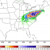
Closer, closer.... This went REALLY close to the Lewisburg WV airport about 3 to 5 minutes ago. Tornado Warning WVC025-220230- /O.NEW.KRNK.TO.W.0009.260722T0206Z-260722T0230Z/ BULLETIN - EAS ACTIVATION REQUESTED Tornado Warning National Weather Service BLACKSBURG VA 1006 PM EDT Tue Jul 21 2026 The National Weather Service in BLACKSBURG has issued a * Tornado Warning for... East central Greenbrier County in southeastern West Virginia... * Until 1030 PM EDT. * At 1006 PM EDT, a severe thunderstorm capable of producing a tornado was located near Frankford, or near Renick, moving east at 40 mph. HAZARD...Tornado. SOURCE...Radar indicated rotation. IMPACT...Flying debris will be dangerous to those caught without shelter. Mobile homes will be damaged or destroyed. Damage to roofs, windows, and vehicles will occur. Tree damage is likely. * Locations impacted include... Neola... and Alvon.
-
Getting closer to this area, doubt it gets here though... Tornado Warning WVC025-220145- /O.NEW.KRNK.TO.W.0007.260722T0117Z-260722T0145Z/ BULLETIN - EAS ACTIVATION REQUESTED Tornado Warning National Weather Service BLACKSBURG VA 917 PM EDT Tue Jul 21 2026 The National Weather Service in BLACKSBURG has issued a * Tornado Warning for... West central Greenbrier County in southeastern West Virginia... * Until 945 PM EDT. * At 917 PM EDT, a severe thunderstorm capable of producing a tornado was located over Rainelle, moving east at 30 mph. HAZARD...Tornado. SOURCE...Radar indicated rotation. IMPACT...Flying debris will be dangerous to those caught without shelter. Mobile homes will be damaged or destroyed. Damage to roofs, windows, and vehicles will occur. Tree damage is likely. * Locations impacted include... Rainelle... Rupert... Quinwood... Bingham... Anjean... Duo... and Meadow Bluff.
-
Had a storm roll thru earlier around 3 pm, little over 1/2 inch in the gauge.
-
Big thunderstorm rolled thru here around 4 am with lots of CTG lightning and booming thunder. Not much wind (26 mph gust) but picked up 1.07" of rain, which beat previous daily record of 0.99" from 1984.


