

LawdogGRNJ
-
Posts
68 -
Joined
-
Last visited
About LawdogGRNJ

Recent Profile Visitors
1,455 profile views


-
Late 90's - remember a largely unforecast event that dumped 20+ inches on the eastern edge of the Mass North shore. Literally 2 miles inland...absolutely nothing. (Salem to Peabody for ref)
-
Extreme Cold, Snow & Sleet: SECS 1/24 - 1/26
LawdogGRNJ replied to TriPol's topic in New York City Metro
Lots of discussion about amount total changes...Has the timing changed much? -
Extreme Cold, Snow & Sleet: SECS 1/24 - 1/26
LawdogGRNJ replied to TriPol's topic in New York City Metro
Exactly - having gone through one of the historic ice storms of the 1990's, there's nothing "nice" about them. -
Prediction you can bank on: Grocery store, shelf clearing, mania will be in full gear by Thursday.
-
2025 Atlantic Hurricane Season
LawdogGRNJ replied to BarryStantonGBP's topic in Tropical Headquarters
It gets worse...now there's evidence of Jerry meandering in the Atlantic. -
That's because there is no CNJ
-
Clear roads just west of EWR. 1/4 to 1/2 on the grass...not much falling.
-
Curious, why is the amount of wind shear that Milton has to go through to get to FL not forecast to weaken it dramatically?
-
Did Ernesto just split into 2 storms?
-
2024 Atlantic Hurricane Season
LawdogGRNJ replied to Stormchaserchuck1's topic in Tropical Headquarters
About 35N, 70W now. Off the NC coastline. -
2024 Atlantic Hurricane Season
LawdogGRNJ replied to Stormchaserchuck1's topic in Tropical Headquarters
Is there another system trying to form north east of Invest 92L? Low shear area. Shows on water vapor and clouds are just starting to pop. -
No big surprise this storm is not getting farther north. Take a look a the monster Tuesday's snow became. Impressive.
-
Given your username, I'd expect you to be his greatest champion...lol
-
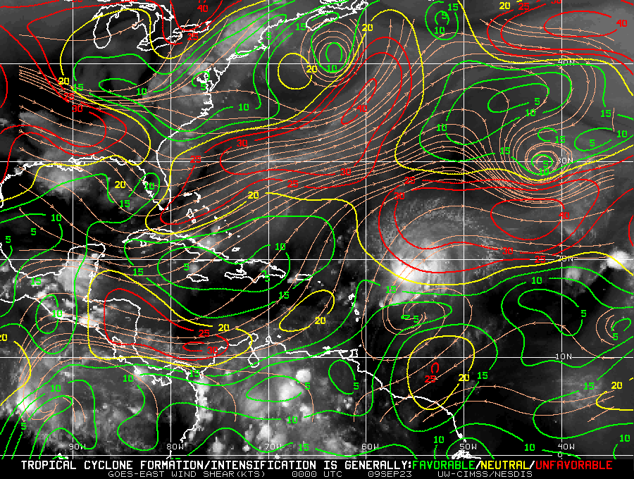
Good image of the shear map and it's affect on Lee. I'd expect reorganization and intensification after moves into more favorable conditions to the west.
-
On a (slim) positive note, Ian will wipe the FL drought map clean.... https://droughtmonitor.unl.edu/CurrentMap/StateDroughtMonitor.aspx?FL


