TWCCraig
-
Posts
2,659 -
Joined
-
Last visited
Content Type
Profiles
Blogs
Forums
American Weather
Media Demo
Store
Gallery
Everything posted by TWCCraig
-
Despite the wind, the past couple of days had near perfect weather. Feels like a fall morning but with the bonus of a longer day and higher sun angle. Someone the other day mentioned Gypsy moths, you can see where they're taking over. Lots of defoliation occurring in some areas
-
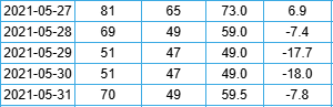
In 2021, NYC had back to back days with high temps of only 51 on May 29th and 30th, happens.
-
Here we had two separate downburst thunderstorms come through in 2019, one in late June and one in August. Both caused extensive damage in the area. Radar estimated 80mph winds. Two severe storms in one season and it's been quiet ever since. I remember we got a decent thunderstorm in December last year lol
-
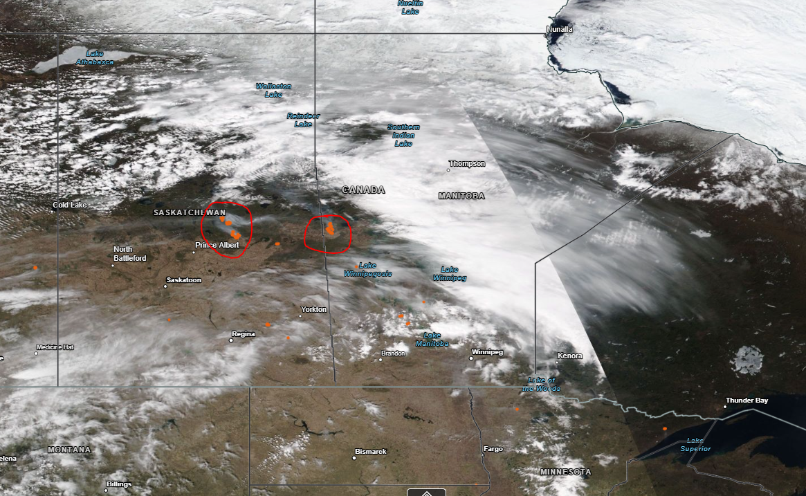
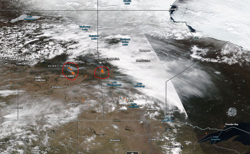
Couple ongoing right now in Saskatchewan and Manitoba, this satellite pic was taken yesterday, fires circled in red, orange dots
-
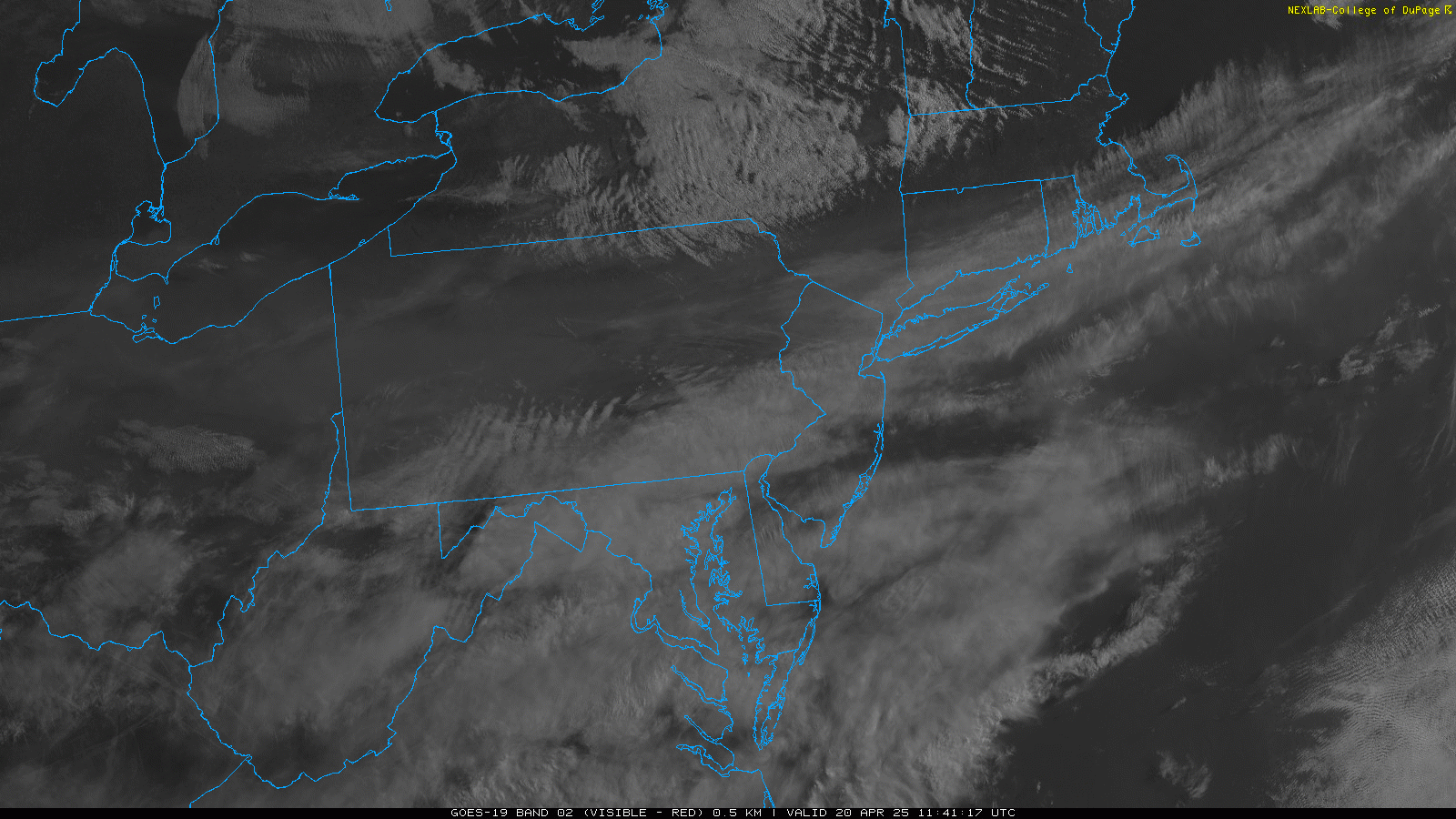
Little bit of elevated smoke from Canadian wildfires this morning. Thankfully not more
-
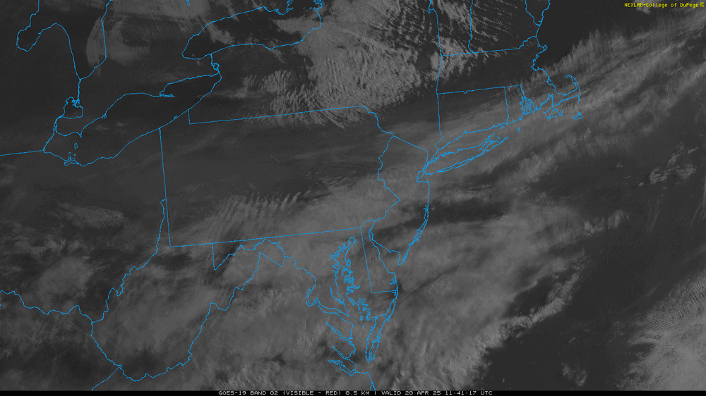
Always interesting when a "cold" front comes through in the spring on LI, temps went from the upper 50's last night to near 70 in the early morning once the front passed. There's a bit of elevated smoke in the sky on the visible satellite, noticeable over PA. It is moving south with clearer air to our north
-
Down to 70 already after a high of 79. Sea breeze cooling off the south shore fast
-
AI can only be so good as the data and observations that go into it. Less input data, more inaccuracy. Clouds are holding back temps a bit here. Need them to thin out to get into the 70's here and 80's inland.
-
I'm not saying that asking for average temps is a stretch but everyday isn't average, especially with how springs (particularly April) are around here it's tough to expect sustained nice weather. I'm just saying if it was a week of 75+, not many would complain.
-
I hope so. If it's 65 and sunny I'll gladly take that, but there's always the possibility of backdoor fronts, clouds, and wind
-
Don't know how much stock to put into it, but the weeklies are below average for most of May, and they were below average for most of April too
-
It's a problem when a 75+ degree day in March is talked about like it's "just a nice spring day", but 40 and rain in April is "well below average". I think some have an unrealistic expectation that the weather should be 60+ daily in the spring and that just isn't the case in the northeast. People do want warmer weather which is part of the reason why many move south. I always look at the record lows and see how much colder it could be, that should be put into perspective when people want to talk about how cold it is. It's been said before, people are getting used to the warmer weather. The general public wouldn't bat an eye if April was +3, but they would if it was -3, that's for sure.
-
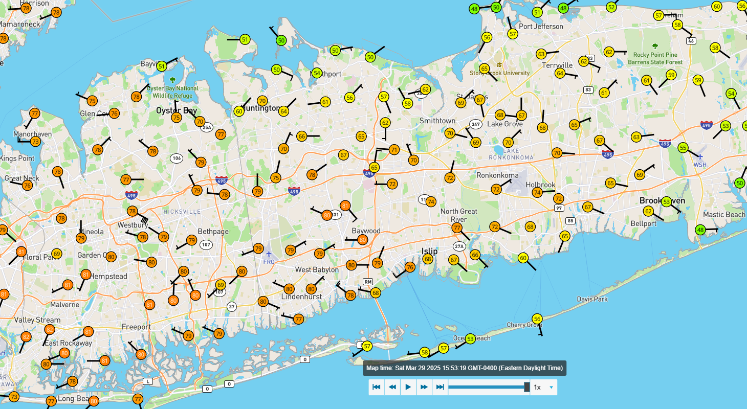
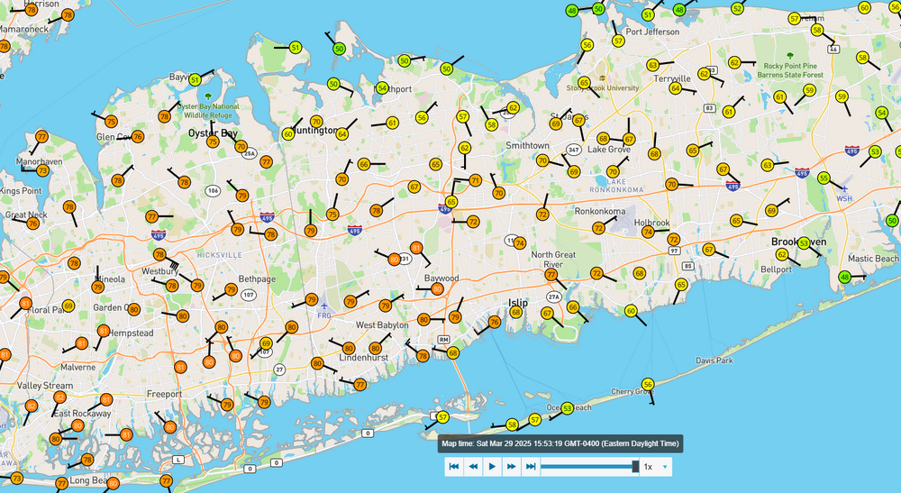
67 here, 53 two miles to my east, the real BDCF. First front that came through was more like a sea breeze, from the north shore...
-
30° difference between north and south shores
-
Up to 79 with west wind, front should be here very soon Absolutely wild how much warmer it is right now on the south shore than the north shore
-
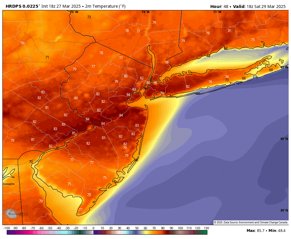
The HRRR had this well modeled as well, only difference was the NAM never showed 80+ degrees, classic lol Interesting enough, the sea breeze actually got pushed back, my winds are now due west
-
77 50 in Kings Park, meanwhile it still in the 70's out to Shirley
-
77 with SW winds. The front is coming through faster over the water than it is on land, as modeled. Should have another hour or so of warmth
-
Briefly peaked at 82, sea breeze just came through but we still have SW flow so temps aren't falling dramatically
-
78 and toasty
-
66 so far, clouds beginning to clear so temps should sky rocket. Westhampton already at 70. Winds are coming from the W to WSW so that's good for us on LI, should be warm until at least 5 or 6pm
-
Weatherbell has been using the same color scale for years on their maps in fahrenheit. The maps in Celsius are different and have red starting around 35C
-
People forget it snowed in May 2020, so getting cold late into spring isn't unheard of. Fwiw, most of the water near the coast is running slightly above normal from the Gulf of Maine down to the Delmarva. We had the same phantom "cold pool" last year to our northeast and it was gone by summer
-
I think those anomalies are indicative of a shifting Gulf stream and not long term shifts or trends. But I'm no expert or anything when it comes to this. This was March 2024, last year, similar cold blobs and warm blobs. By June the cold blobs were mostly gone as the Gulf stream shifted north and warmer weather came: