frostfern
-
Posts
2,265 -
Joined
-
Last visited
Content Type
Profiles
Blogs
Forums
American Weather
Media Demo
Store
Gallery
Everything posted by frostfern
-
Very dark shelf cloud. Could be some strong gusts.
-
It was a good one, though I was half asleep. Could have used a little more rain than what I got but the thunder was nice and loud.
-
If the system on Sunday is far enough east I might chase. The problem is storms often don't get into Indiana until after dark. East central Illinois is easier to get to than northwest Illinois because I can go south around Chicago.
-
I don’t know what the definition of “garden variety” is. I just want a non-severe storm in the mature stage with real downpours and frequent thunder cracks for once as opposed to decaying scraps and light stratiform. Michigan is being Michigan though.
-
I don’t know what the speed was here but it was strong for this time of year (outside of a thunderstorm). The cold front that came through during the morning sounded like a November gale, but with late spring warmth. Weird system.
-
Spring 2015 was awful. I remember there were flakes falling here around the middle of May when foliage was like 75% open.
-
Ponding issues are bigger here if it rains hard in March or April. I have had my lawn puddle seep into the basement before, but its always March or April. By May it seems like the grass just sucks it up and grows a foot. It might just be that the thin layer of muddy clay over the mostly sandy soil gets more porous as soon as it gets warmer.
-
The “homes wiped clean” doesn’t seem like a reliable indicator of wind speed to me. There are probably other details that determine where debris gets piled up vs scoured away. It probably was EF5, but damage is already so complete at the high end of EF4 it’s hard to differentiate. Beyond no walls left standing its kind of fuzzy what else to look for. Weird stuff like picking pavement off the ground might not be apparent everywhere.
-
It seems the whole system trended stronger and more north.
-
Don’t really want severe IMBY either, but a 50 dbz cell overhead with some CGs would sure be nice.
-
Miss NW .
-
That severe watch was such a bust. I think the dewpoints mixed out south of I-96. The line held together better north of the front. The steep mid-level lapse rates and higher deepoints are way west.
-
Too far west for me to reach in an afternoon.
-
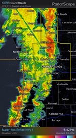
GRR Gap is real.
-
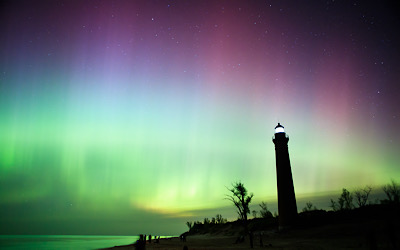
Amazing!
-

2024 Short/Medium Range Severe Weather Discussion
frostfern replied to Chicago Storm's topic in Lakes/Ohio Valley
Probably too far west for me. Getting though Chicago is such a pain. I’ll take the day off and leave early in the morning if its looking really good. -
It wasn’t ideal for chasing. The clouds were so thick and low it was hard to make things out. Add tons of trees in the area. Just too risky. I rather chase lower end stuff here, like just a good lightning show over the lake.
-
Yea. I wasn't able to chase the excitement that hit the southern part of the state last week and it's been zzzzz IMBY lately. Low 60s and clouds. Not much real rain or thunder. Thankfully not cold, but dreary nonetheless.
-
Rain underperforming up here. Nearby pond water level is still low.
-
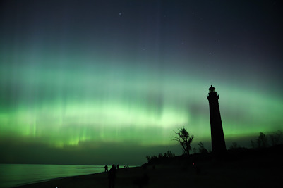
Last night the lights came out briefly shortly after midnight. I slept through the first show Friday night.
-
I've observed that outside of the deep south and plains, tornadoes sometimes favor the margins of the highest CAPE. There was a super sharp CAPE gradient over far SW Michigan. The later batch of convection was associated with the leading edge of even higher CAPE with dewpoints near 70 pushing into the OV later in the evening. This effect I've observed might just be a side effect of the wind being more backed in the lowest km near warm fronts or other types of horizontal temperature gradients. The Michigan storms also seemed lower topped due to being closer to the upper low. CAPE was possibly fatter despite being less overall. The storms were also more strongly forced under an area of vorticity advection aloft as opposed to being driven by afternoon heating.
-
Always a problem when it's far from the radar. There's a significant hail spike too.
-
I'm interested to see how long that tornado has been on the ground. It's been going for miles.
-
I just got a massive anvil bolt from the blue way up in GRR. Boy it shook the ground hard. It's barely even sprinkling.
-
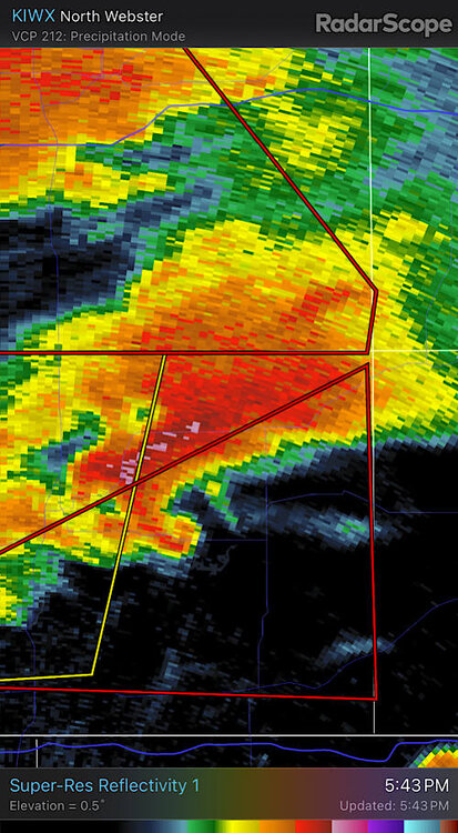
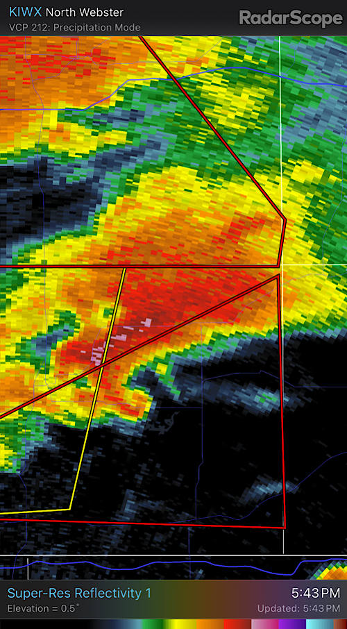
Classic hook.