Upstate Tiger
-
Posts
953 -
Joined
-
Last visited
Content Type
Profiles
Blogs
Forums
American Weather
Media Demo
Store
Gallery
Everything posted by Upstate Tiger
-
Yep. The 540 is in VA surprise. Just a bit slower and we're in business..
-
Euro better than GFS. 1057 high over the Great Basin LOL
-
Exactly!
-
We beat Kentucky, Duke, and UNC in the same year. Don’t tell me it’s impossible to get snow outside the mountains.
-
I see my annual American Wx dues were deducted out of my account today. If I do not see 6”-8” of snow IMBY by next weekend I am afraid I will be requesting a refund.
-
Glad I waited on the Euro.
-
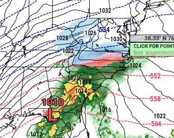
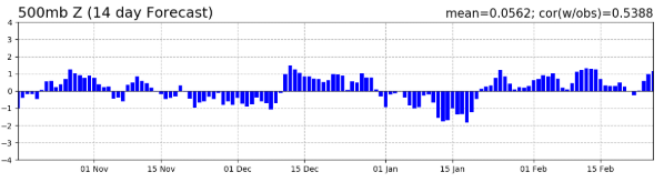
NAO forecast from this morning. You can see the dip for next week.
-

-
Next period to watch for NC is end of next week. Globals keep hinting at a storm further south.
-
Yep the next 2 weeks will feel wintry. Remains to be seen if there will be any snow or ice in the SE but we’re in for a cool period.
-
When the natives get restless and this place turns into Lord of the Flies, one needn’t look at the models.
-
Central Park is going to look a lot different in 10 days than it looks today. They have at least 3 pretty big events headed their way.
-
Really liked the 12z GFS. Interested in the Euros interpretation.
-
Presidents’ Day storm 1979 says hello! Warm leading up to storm. Warm by the end of the week after the storm.
-
Overnight Euro and 06z GFS would suggest a candlelight dinner maybe appropriate for Valentines Day.
-
Thanks for sharing! I love it when someone actually shares meteorology. Keep in mind, metereology and climatology are two different things...
-
How often do you have to cut it?
-
I can say with a fair amount of certainty that one day we will probably see another Miller A with widespread snow in the SE. I may not be around then, but it will be awesome.
-
Watching the second week of February. Cold is on the move from Canada and NAO looks to be moving toward negative territory.
-
Still looks to me like another round of really cold air pushing south from Canada into the US at the end of the 1st week of February. Looking forward to playing a round of golf after church Sunday for the first time in weeks. Hoping for sunny skies and low 50s. It will seem like summer.
-
GSP reached 59 one day this month. Will we reach 60? Puts this month in pretty rare company if we do not...
-
Yep. Who would have predicted 2 weeks ago a blizzard in Louisiana and all time record snow in Florida?
-
Good news for winter weather lovers is that arctic air remains in Canada and even rebuilds and expands in February. Won't take much to buckle the jet and get a CAD event. On the other hand, the NAO is headed into positive territory and the PNA is moving down toward neautral. At some point, one would guess Nina climatology would exert it's influence.
-
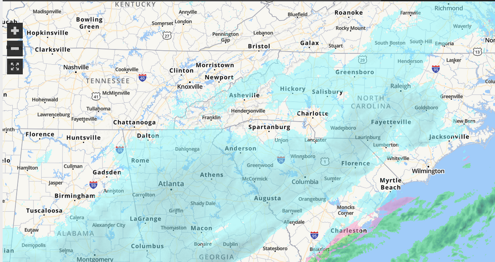
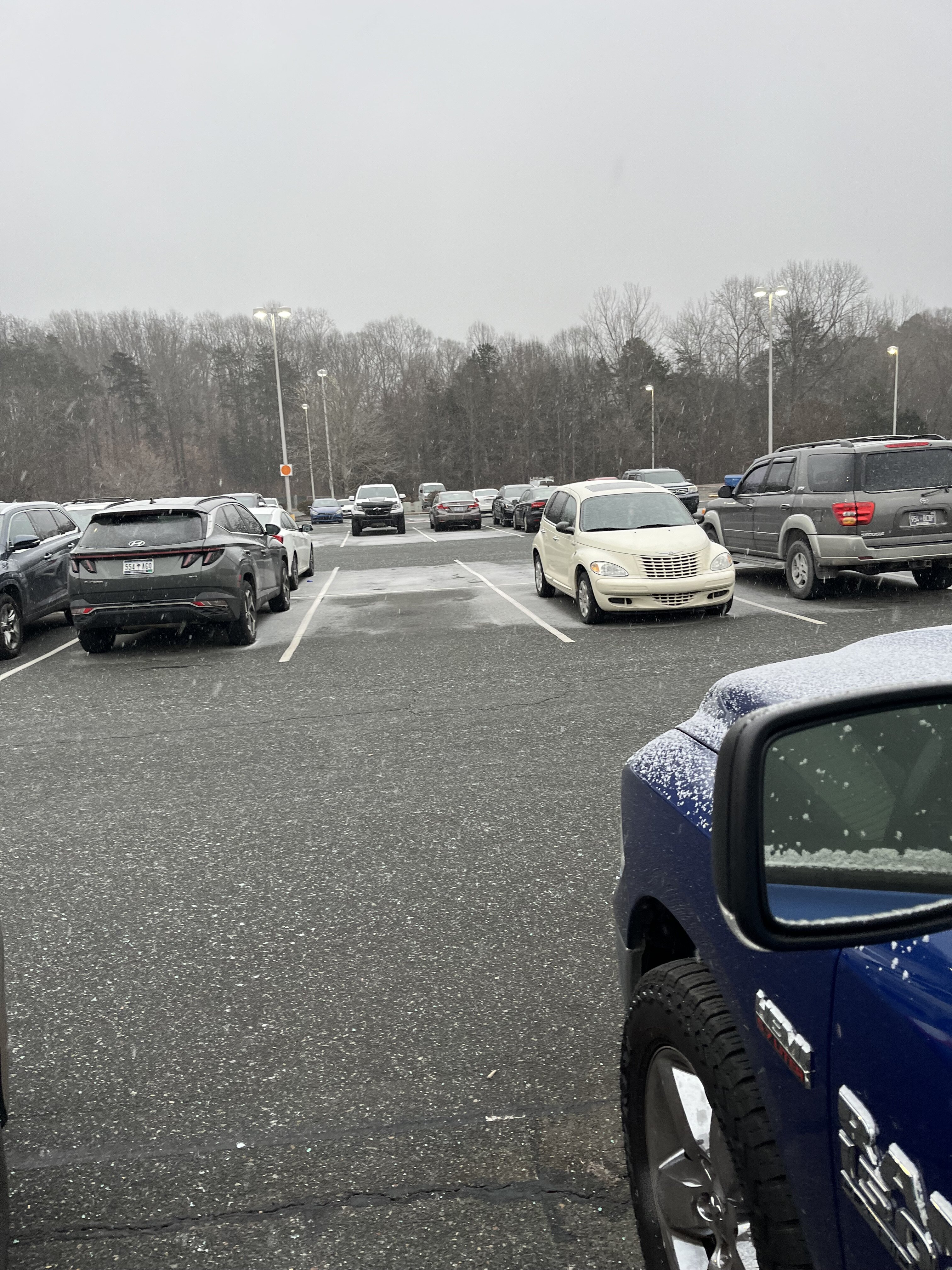
Leaving work in Gastonia and we already have a car topper and quickly sticking on roads. Brick you magnificent bastard.

-
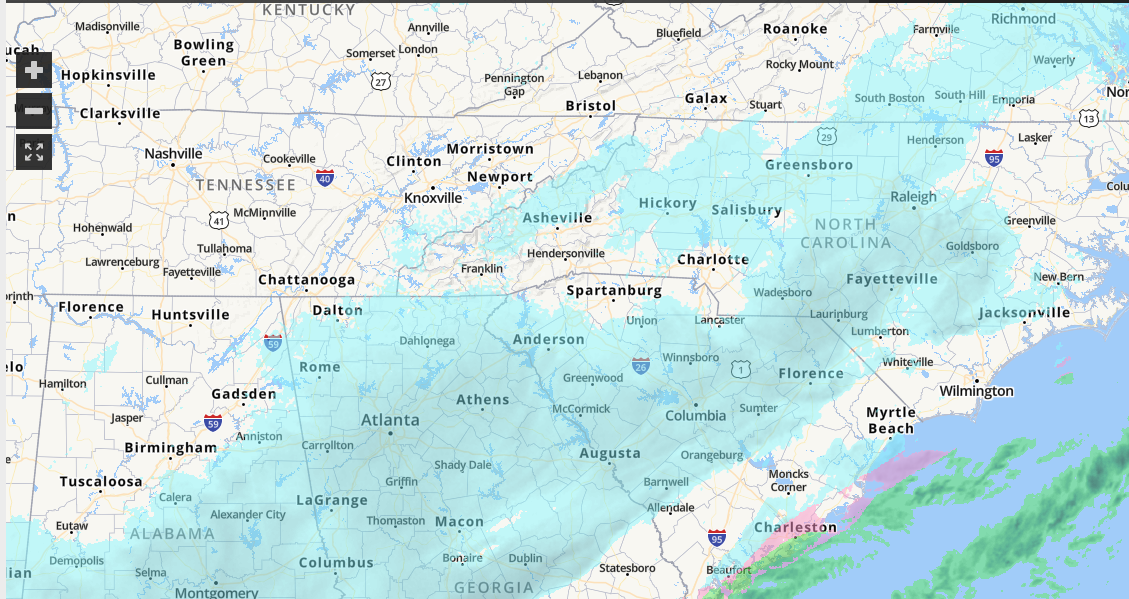
If someone just pulled up the radar and saw this with temps in the 20's across the region, he would be pretty impressed.