Met1985
-
Posts
16,564 -
Joined
-
Last visited
Content Type
Profiles
Blogs
Forums
American Weather
Media Demo
Store
Gallery
Everything posted by Met1985
-

2021-2022 Fall/Winter Mountains Thread
Met1985 replied to BlueRidgeFolklore's topic in Southeastern States
Yeah if the GFS and Euro can both show snow this far as a lead time we might be talking a 2 to 4 inch upslope event for the most favorable areas. The cold is definitely going to be there. -
2021-2022 Fall/Winter Mountains Thread
Met1985 replied to BlueRidgeFolklore's topic in Southeastern States
GFS back to showing us getting some snow the 13th and a much better chance the 15th with some very cold air for this time of the year. -
2021-2022 Fall/Winter Mountains Thread
Met1985 replied to BlueRidgeFolklore's topic in Southeastern States
Euro Still hammering away at snow chances this weekend. -
2021-2022 Fall/Winter Mountains Thread
Met1985 replied to BlueRidgeFolklore's topic in Southeastern States
Another cold morning with a low of 25 degrees. The GFS and EURO are at odds with chances of snow. The GFS has back way off for snow chances. -
2021-2022 Fall/Winter Mountains Thread
Met1985 replied to BlueRidgeFolklore's topic in Southeastern States
Yeah a lot to iron out still but that should usher in some very cold air for this time of the year. -
2021-2022 Fall/Winter Mountains Thread
Met1985 replied to BlueRidgeFolklore's topic in Southeastern States
Yeah definitely very cold this morning. We had a low of 21 here. Was very surprised that we almost hit the teens this morning. -
2021-2022 Fall/Winter Mountains Thread
Met1985 replied to BlueRidgeFolklore's topic in Southeastern States
Had a nice cold low this morning of 25 crisp degrees! Had a heavy frost and definitely had a winter feeling to it this morning. -
2021-2022 Fall/Winter Mountains Thread
Met1985 replied to BlueRidgeFolklore's topic in Southeastern States
Going to be a coold night. Already down to 30 degrees under clear skies. -
2021-2022 Fall/Winter Mountains Thread
Met1985 replied to BlueRidgeFolklore's topic in Southeastern States
Both the GFS and Euro are onto a significant cold blast coming through here around day 7 through 10 with our real first taste of snow along the border counties. -
2021-2022 Fall/Winter Mountains Thread
Met1985 replied to BlueRidgeFolklore's topic in Southeastern States
Yeah temps have dropped off quite a bit. -
2021-2022 Fall/Winter Mountains Thread
Met1985 replied to BlueRidgeFolklore's topic in Southeastern States
Smells like snow out here. -
2021-2022 Fall/Winter Mountains Thread
Met1985 replied to BlueRidgeFolklore's topic in Southeastern States
Already seeing a mixed back of precipitation on the radar currently. Temp is pretty steady around 39 degrees. -
2021-2022 Fall/Winter Mountains Thread
Met1985 replied to BlueRidgeFolklore's topic in Southeastern States
Had a low of 36 with a current temp of 42 degrees. This day is straight out of December. Looking forward to tonight. -
2021-2022 Fall/Winter Mountains Thread
Met1985 replied to BlueRidgeFolklore's topic in Southeastern States
Man I love this weather. Temps in the 40s overcast and cold for today. Chance of high elevation snow and the ensembles are looking really good for second half of November. At least in the day 10 through 15 day period. -
2021-2022 Fall/Winter Mountains Thread
Met1985 replied to BlueRidgeFolklore's topic in Southeastern States
I'm going to need you to jinx us all winter because you did that this whole summer lol. -
2021-2022 Fall/Winter Mountains Thread
Met1985 replied to BlueRidgeFolklore's topic in Southeastern States
Nice seeing you post again. -
2021-2022 Fall/Winter Mountains Thread
Met1985 replied to BlueRidgeFolklore's topic in Southeastern States
The Euro is really honking for snow around day 6 and 7 now. -
Fall 2021 Thread (September, October, November)
Met1985 replied to Carvers Gap's topic in Tennessee Valley
Oh no problem. Im in WNC in Haywood county. They saw snow up in Yancy county and on Mt. Mitchell this morning. -
Fall 2021 Thread (September, October, November)
Met1985 replied to Carvers Gap's topic in Tennessee Valley
We are seeing snow on this side above 5k. -
2021-2022 Fall/Winter Mountains Thread
Met1985 replied to BlueRidgeFolklore's topic in Southeastern States
Very nice. I saw were it had snowed a dusting up on Mt. Mitchell. -
2021-2022 Fall/Winter Mountains Thread
Met1985 replied to BlueRidgeFolklore's topic in Southeastern States
First flakes in the forecast for Thursday night. -
2021-2022 Fall/Winter Mountains Thread
Met1985 replied to BlueRidgeFolklore's topic in Southeastern States
They are getting snow on top of Beech ski mountain. First flakes of the season. -
2021-2022 Fall/Winter Mountains Thread
Met1985 replied to BlueRidgeFolklore's topic in Southeastern States
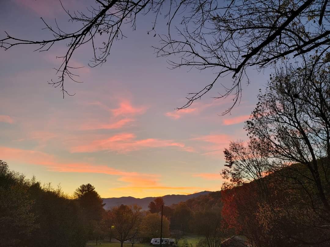
This was yesterday morning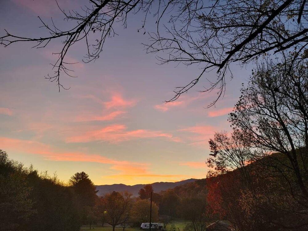
-
2021-2022 Fall/Winter Mountains Thread
Met1985 replied to BlueRidgeFolklore's topic in Southeastern States
Thank you good sir! Yes the weather in Gatlinburg was gorgeous. -
2021-2022 Fall/Winter Mountains Thread
Met1985 replied to BlueRidgeFolklore's topic in Southeastern States
First 20s of the season with a low of 28 degrees and heavy frost. Maggie ace I think you are right we are in peak here. Beautiful colors across the mountains.