Nelson
-
Posts
565 -
Joined
-
Last visited
Content Type
Profiles
Blogs
Forums
American Weather
Media Demo
Store
Gallery
Everything posted by Nelson
-
9.9" for mby to get us over 20" for the week.....
-
-
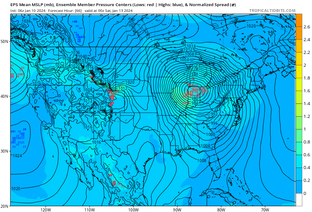
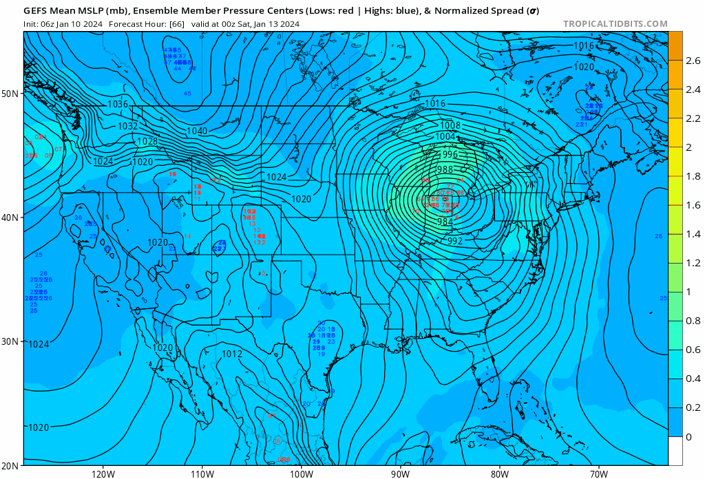
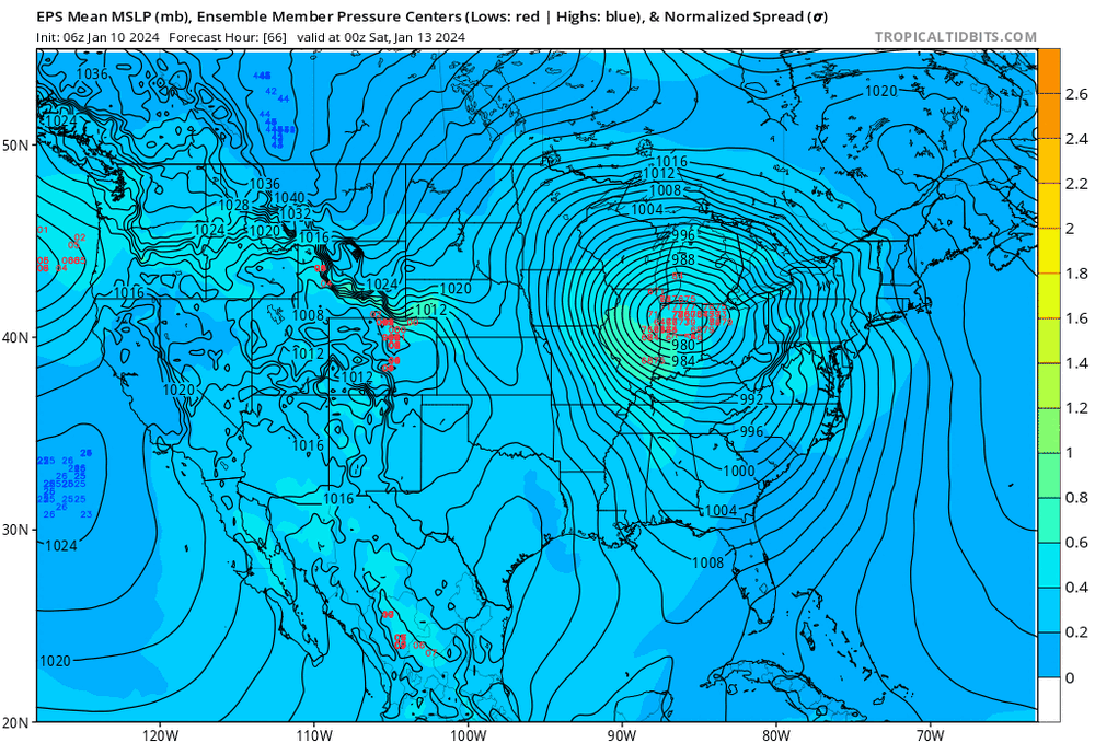
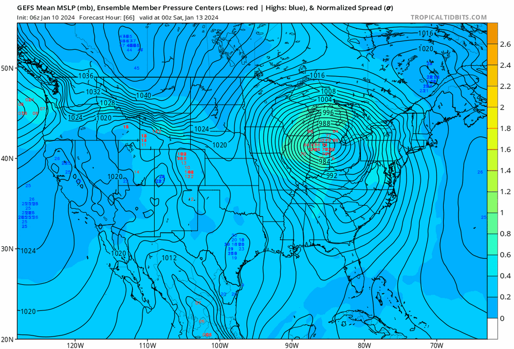
Obviously, lot of debating of finer details but at a higher level view, I think the GEFS and EPS ensemble means have been pretty consistent.
-

Winter 2023/24 Medium/Long Range Discussion
Nelson replied to Chicago Storm's topic in Lakes/Ohio Valley
**edit** just saw we pulled the trigger on a thread. I like it. Obviously would be tits if we got back to back 6+' storms (in my neck of the woods) but long ways to go yet on the weekend system. Lot of spread on the GFS ENS. Don't mind the EPS look at this point. Also, lots of talk about how the ECMWF has been shit as of late but does anyone have verification stats to back that up (I'm too lazy to look)? Seems like it was pretty consistent at range with the early week system vs the GFS. -
Winter 2023/24 Medium/Long Range Discussion
Nelson replied to Chicago Storm's topic in Lakes/Ohio Valley
Ride the ENS.... -
GEFS has been fairly consistent with the mean low track over the past few runs. As always, ENS are really the only thing to be seriously watching at this range.
-
Need this sh*t in January
-
The ignore feature is wonderful. Use it and save yourself the bullshit.
-
stay safe cyclone
-
That's the one thing that has struck me more than anything so far this summer - the low dewpoints. I can't remember a stretch where they have been, on average, as low as they've been.
-
Yeah, 60/54 here - feels like we are on the northern fringe here but will be fun to watch things unfold down south.
-
Eyeballing 6" here - right around what I was thinking. Some higher amounts to the east. Overall, nice little snowfall. Been the story of the winter her in South-Central Wisco.
-
I'll go with 5.5" for mby. .5" liquid seems to be about the model average and we should stick around 10:1 ratios. MKX talking potential dry air to overcome to start so we will see what that does to totals. Feels like general 4-6" in and around southern WI seems like a safe bet.
-
Crazy - mostly snow here with ice pellets here
-
Same here - with snow at times.
-
Switched over to mainly snow now... 29.5/25
-
Yeah, was just thinking that. Let's hope it stays sleet...
-
29F with moderate sleet here
-
Decent rates here. Radar looks nice...

-
Winter 2022/23 Medium/Long Range Discussion
Nelson replied to Chicago Storm's topic in Lakes/Ohio Valley
Change your password.... -
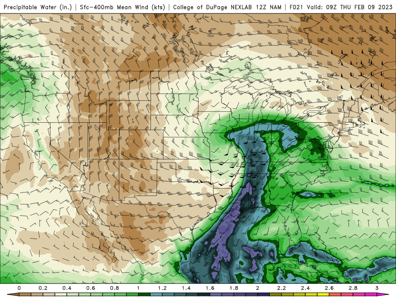
February 8-9 Should There Be a Thread For This Storm
Nelson replied to Hoosier's topic in Lakes/Ohio Valley
I would not be surprised to see some 8-9" totals -
February 8-9 Should There Be a Thread For This Storm
Nelson replied to Hoosier's topic in Lakes/Ohio Valley
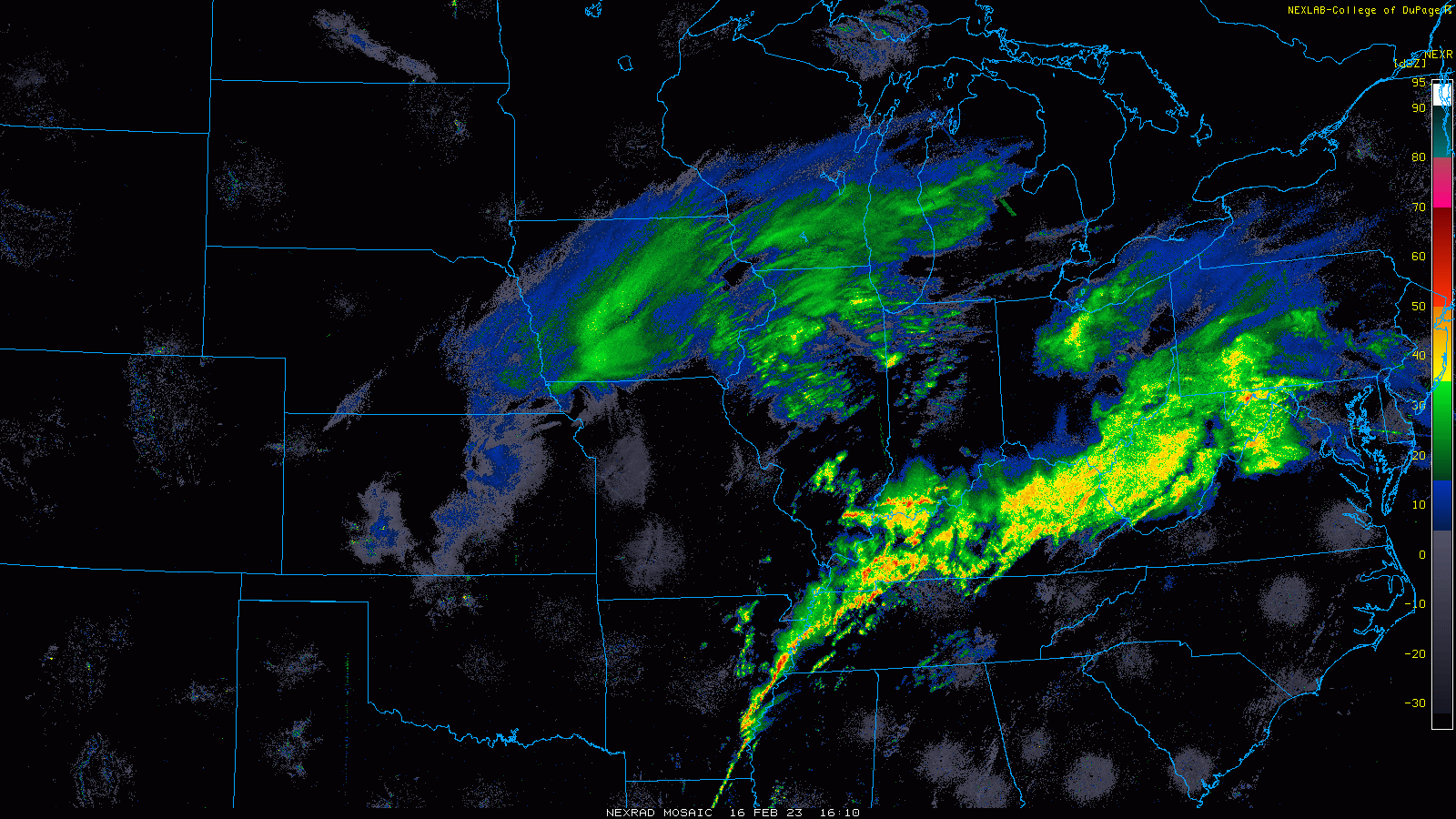
Just did a quick and dirty measurement and we are roughly around 6", maybe a little more. Snow is so wet/big flaked that there are highly variable measurements. ***still heavy snow -
February 8-9 Should There Be a Thread For This Storm
Nelson replied to Hoosier's topic in Lakes/Ohio Valley
1” /hr seems legit at the moment. Switched over just over an hour ago and we easily have an inch already. Paste job . -
February 8-9 Should There Be a Thread For This Storm
Nelson replied to Hoosier's topic in Lakes/Ohio Valley
Confirmed. . -
February 8-9 Should There Be a Thread For This Storm
Nelson replied to Hoosier's topic in Lakes/Ohio Valley
Liking 4-5" for the Madison area crew. Already been mentioned but too bad there isn't some colder air around. Moisture feed looks nice.