Kay
-
Posts
2,227 -
Joined
Content Type
Profiles
Blogs
Forums
American Weather
Media Demo
Store
Gallery
Everything posted by Kay
-
15 degrees at 11 a.m.
-

February 2026 Medium/ Long Range Discussion: 150K Salary Needed to Post
Kay replied to Weather Will's topic in Mid Atlantic
Haha. I get both points of view. Raging appetite for more! But also..can't be mega depressed right now because *waves in direction of glistening bulletproof snowpack* -
It was on land/the snowpack. Sorry if my post was confusing. However! I have seen a fox or two explore out on the river ice in the past as well. Rarely. It could be they were going after the smell of fish remains or something from eagles, for food (?) but this would usually be when there is some melting, even a little. This reminds me to watch out there though!
-
Can vouch for that northern western shore fast ice. Ob...a fox trotting across the glacier's surface as the sun sets. Very wintry!
-
The Jan 31 Potential: Stormtracker Failure or 'Tracker Trouncing
Kay replied to stormtracker's topic in Mid Atlantic
F it, I'll hang on to track a slight chance of a tiny pack refresher. I feel emotionally strong enough at this time. -
The Jan 31 Potential: Stormtracker Failure or 'Tracker Trouncing
Kay replied to stormtracker's topic in Mid Atlantic
I'm in the light blue and I'm ready to abscond with this. Run away. Elope. Tell the families later. -
The Jan 31 Potential: Stormtracker Failure or 'Tracker Trouncing
Kay replied to stormtracker's topic in Mid Atlantic
That's right. In part it's where we live. The land of the possible but not probable. Iykwim. Intermittent rewards. Tailor made for both addiction and torment. Lol -
If you have a chance - how are streets in Columbia doing?
-
February 2026 Medium/ Long Range Discussion: 150K Salary Needed to Post
Kay replied to Weather Will's topic in Mid Atlantic
Or buckle down. Always work for us lol. -
The Jan 31 Potential: Stormtracker Failure or 'Tracker Trouncing
Kay replied to stormtracker's topic in Mid Atlantic
In order to model good pbp manners for all the new and infrequent posters -
The Jan 31 Potential: Stormtracker Failure or 'Tracker Trouncing
Kay replied to stormtracker's topic in Mid Atlantic
All banter shall cease for euro...eh? -
The Jan 31 Potential: Stormtracker Failure or 'Tracker Trouncing
Kay replied to stormtracker's topic in Mid Atlantic
Sausage fest so very realistic -
Been wondering about this too, specifically whether models may have "misjudged" the snow/ice cover contribution (? I have no guess, question for mets)
-
Just gonna drop this here...and also ping @eyewall who's been posting some beauts. (glad you're safe!)
-
I had to explain the Georgetown joke to Nomz sorry for the banter but it's only going to keep bewildering the poor guy
-
One year we had a troll who reported rain in Georgetown during a snow event. It's now a running joke. (getting a wee bit tired imho but that's just me it gets the laughs.
-
Low of 14. Nearest mesonet station in Abingdon low of 12. Side note, it's wild how often I am pretty much exactly 2 degrees higher than that station. Have come to expect it.
-
Pleased to say I found it easily before reading these helpful posts but thanks!
-
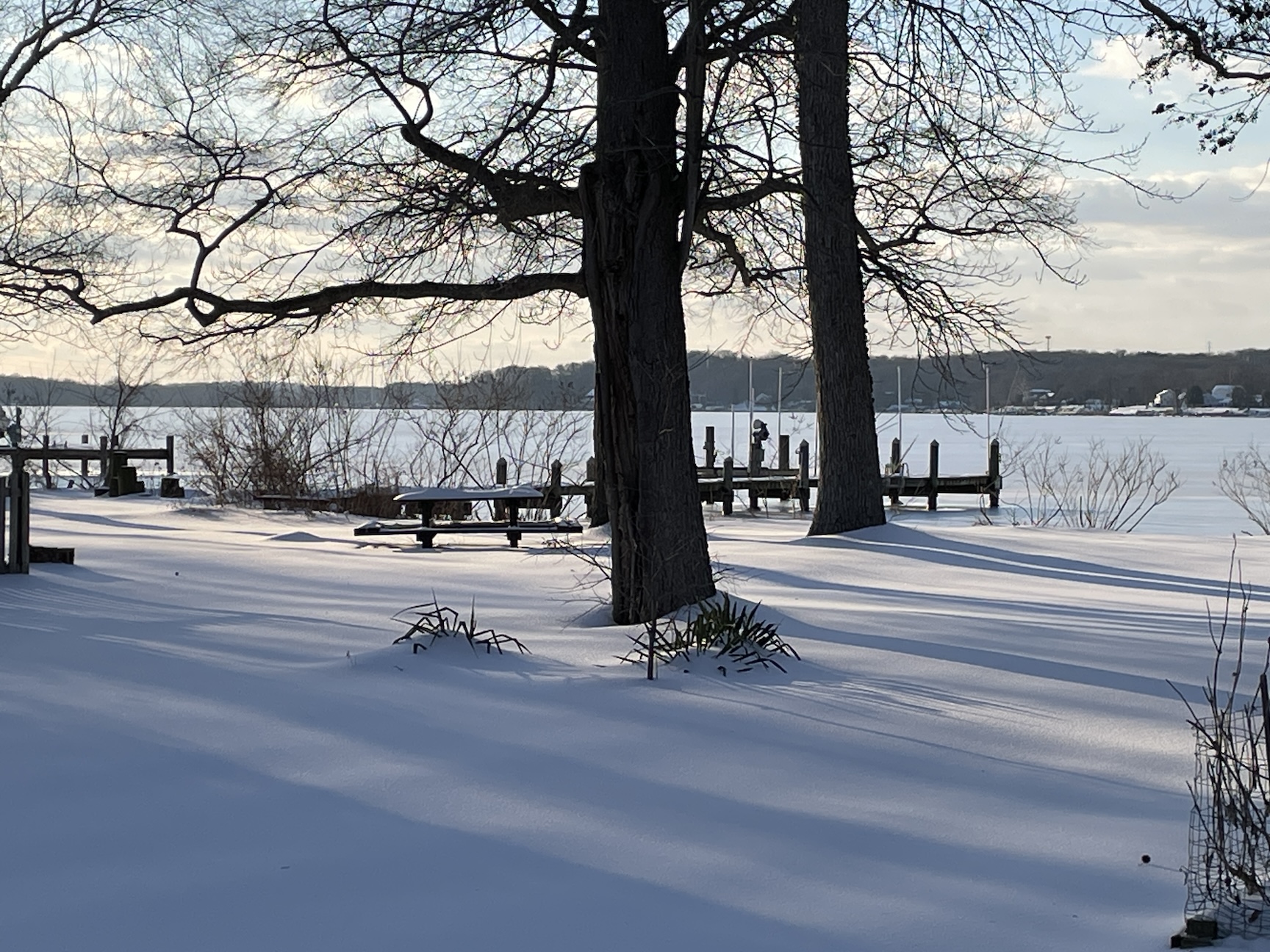
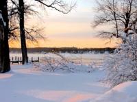
A place to share photos of the late January snowpack, of hopefully more snows to come, and of our mid-Atlantic winter scenery in general! Photographers and non-photographers welcome. Beautiful art shots and sooty parking lot piles, it's all good. Here is a shot of the Bush River, covered in ice and snow.

- 46 replies
-
- 18
-

-

-
I've never started one. Since 2009. Need to look at how it's done haha
-
We're going to have a snow pack for a while. Remember when we used to have winter photo threads? Maybe I dreamed it, too many lame winters. Where should we post pics of the Miracle Mirage aftermath, the normal obs thread? Can't be many from me, unless I clear some attachments eeesh. Would be nice to see more from around the sub tho...keep the snow cheer going.
-
Just finished driveway round two and done. Still using only a hammer and snow shovel lol. I was actually impressed at how handy the hammer was with busting up or slicing away/removing the ice crust. Lighter and easier for me than jabbing at it with a metal shovel. After my labors I tested out the snowpack. Broke through occasionally but was mostly able to walk on top! Instant being a kid again!! This is after a high of 26 and sun, it can only get better.
-
WE BROKE THE CURSE DUDE
-
Thanks, this is helpful! 10" seems more correct.