nwohweather
-
Posts
3,818 -
Joined
-
Last visited
Content Type
Profiles
Blogs
Forums
American Weather
Media Demo
Store
Gallery
Everything posted by nwohweather
-

2023 Short/Medium Range Severe Weather Discussion
nwohweather replied to Chicago Storm's topic in Lakes/Ohio Valley
The RIJ starting to show there -
2023 Short/Medium Range Severe Weather Discussion
nwohweather replied to Chicago Storm's topic in Lakes/Ohio Valley
Wow is this atmosphere unreal at the moment. You have CAPE approaching 6,000 j/kg toward the border with widespread STH values over 200 -
2023 Short/Medium Range Severe Weather Discussion
nwohweather replied to Chicago Storm's topic in Lakes/Ohio Valley
She’s a big one -
2023 Short/Medium Range Severe Weather Discussion
nwohweather replied to Chicago Storm's topic in Lakes/Ohio Valley
I don't love how this looks like a 9 PM - 1 AM event. Definitely some tornado chances looking at the soundings as we go into sunset -
2023 Short/Medium Range Severe Weather Discussion
nwohweather replied to Chicago Storm's topic in Lakes/Ohio Valley
Very sunny here in Toledo -
2023 Short/Medium Range Severe Weather Discussion
nwohweather replied to Chicago Storm's topic in Lakes/Ohio Valley
We'll see if the shear & instability can overlap well. Certainly no lack of energy here that's for sure -
2023 Short/Medium Range Severe Weather Discussion
nwohweather replied to Chicago Storm's topic in Lakes/Ohio Valley
Was all of that firing off outflow boundaries? I’ve never seen that in my life where storms over Cleveland built basically a conga line that reached all the way back to Indiana thru outflow. They look like lake effect snow bands -
2023 Short/Medium Range Severe Weather Discussion
nwohweather replied to Chicago Storm's topic in Lakes/Ohio Valley
What a wild event tonight. SRH and instability are through the roof. Dewpoints in the 80s!? -
Wild here. 84/76° is so uncomfortable. Looks like storms firing on outflow boundaries like a machine gun to me. Insane to see over Lake Erie right now
-
2023 Short/Medium Range Severe Weather Discussion
nwohweather replied to Chicago Storm's topic in Lakes/Ohio Valley
Awesome photos. A truly great look at tornadogenesis -
Great Lakes Hurricane in full force today
-
2023 Atlantic Hurricane season
nwohweather replied to Stormchaserchuck1's topic in Tropical Headquarters
As long as you have all that saharan dust out there, I don't care what any model shows -
2023 Atlantic Hurricane season
nwohweather replied to Stormchaserchuck1's topic in Tropical Headquarters
Another season of a quiet August -
Some serious wind and rain out of this line as rolls thru
-
Obscene amounts of lightning with this storm
-
Quasi stationary boundaries man. As good of a rain producer as those buckets at water parks
-
2023 Short/Medium Range Severe Weather Discussion
nwohweather replied to Chicago Storm's topic in Lakes/Ohio Valley
Or nitromethane if you’ve ever seen an NHRA race -
Haha if you bought a new chainsaw I guess it’s worth it
-
Everyone needs to calm down, downed trees in the yard aren’t fun anyways
-
I just think it needed about 2 more hours. It's a shame we couldn't get that overlap better timed with the ingredients
-
Ha, you act like they'll allow an EF5 rating anymore
-
Man the atmosphere is really recovering quickly. Ample shear & helicity to the east of current warnings in SE MI, lets just see if we can continue to build up. My house is currently at 75 degrees with a dewpoint of 75.
-
A lot of downed trees around Toledo, definitely delivered with widespread damaging winds. That line looks legit hitting the Lake Erie Islands right now, 70 mph is probable over there
-
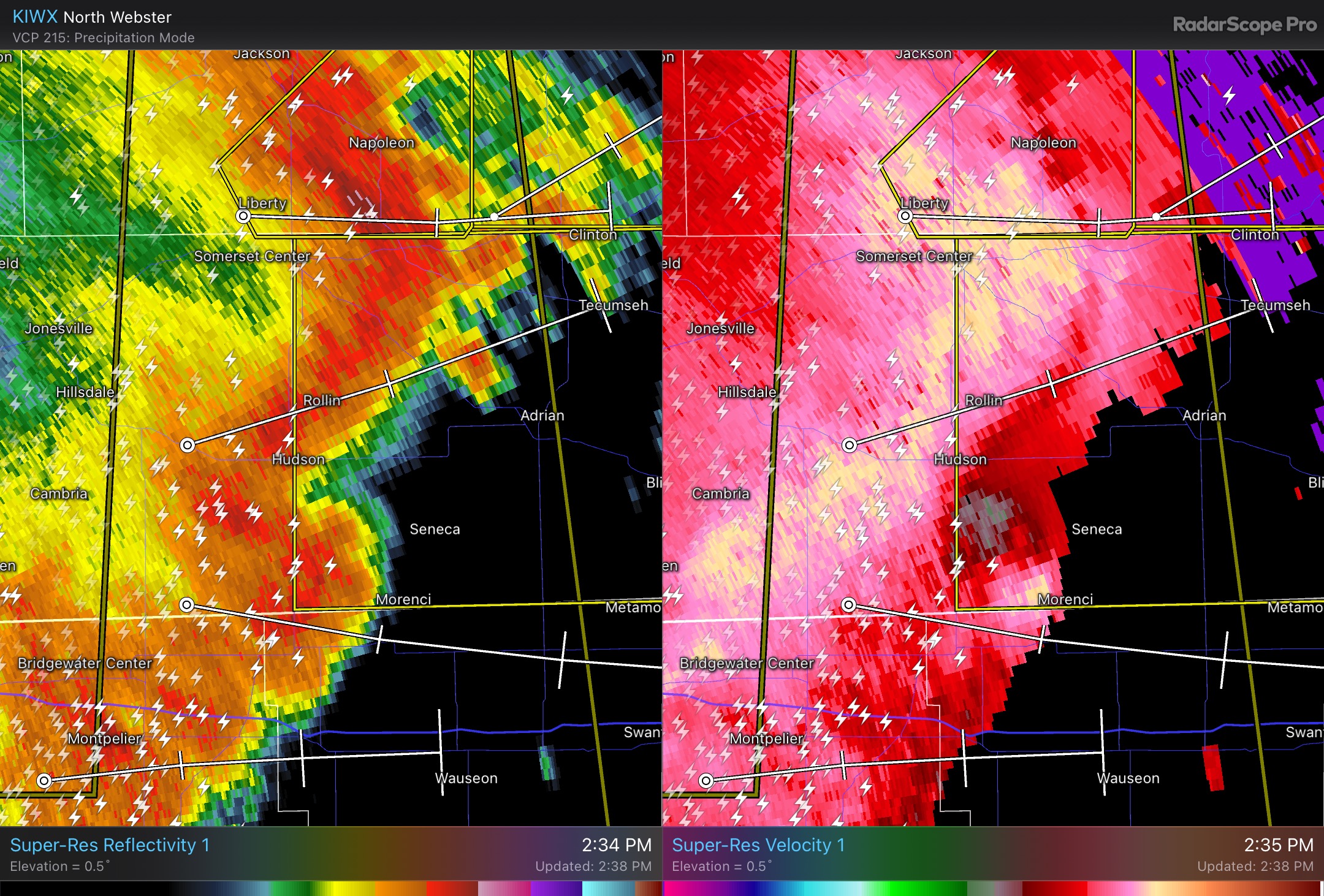
Definitely some spin up potential here

-
Nice line approaching at the moment. Will be interesting to see what transpires as the instability is quite a bit higher over SE MI/NW OH, but it's outrunning the better shear a bit