nwohweather
-
Posts
3,818 -
Joined
-
Last visited
Content Type
Profiles
Blogs
Forums
American Weather
Media Demo
Store
Gallery
Everything posted by nwohweather
-
Currently without power here SW of Toledo. My Kestrel showed gusts of 57 mph
-

March 2nd Moderate Risk ArkLaTex
nwohweather replied to Ed, snow and hurricane fan's topic in Central/Western States
The radar coverage is so rough -
Or just underestimating the power of this storm itself. 977 MB at Hour 36 is pretty bonkers for this part of the country
-
March 2nd Moderate Risk ArkLaTex
nwohweather replied to Ed, snow and hurricane fan's topic in Central/Western States
Definitely some steep lapse rates in play -
March 2nd Moderate Risk ArkLaTex
nwohweather replied to Ed, snow and hurricane fan's topic in Central/Western States
Once the warm front placement becomes clearer, I think we see a High risk tomorrow. With that kind of helicity in place there is serious risk for violent tornadoes and with a low LCL you could see some solid long trackers -
That’s why it’s a skilled profession and not called model watching
-
March 2nd Moderate Risk ArkLaTex
nwohweather replied to Ed, snow and hurricane fan's topic in Central/Western States
Great read. Also interesting to see violent tornadoes being mentioned a couple days out -
Still looking like an absolute big dog
-
Didn’t one of the Hi-Res models show this? I’d have to comb through but it showed a little blotch around Hillsdale Co that 100% verified
-
2023 Short/Medium Range Severe Weather Discussion
nwohweather replied to Chicago Storm's topic in Lakes/Ohio Valley
Awesome video! Impressive to actually see at real speed the tightening up of the rotation -
2023 Short/Medium Range Severe Weather Discussion
nwohweather replied to Chicago Storm's topic in Lakes/Ohio Valley
And there was a CC spike -
2023 Short/Medium Range Severe Weather Discussion
nwohweather replied to Chicago Storm's topic in Lakes/Ohio Valley
-
2023 Short/Medium Range Severe Weather Discussion
nwohweather replied to Chicago Storm's topic in Lakes/Ohio Valley
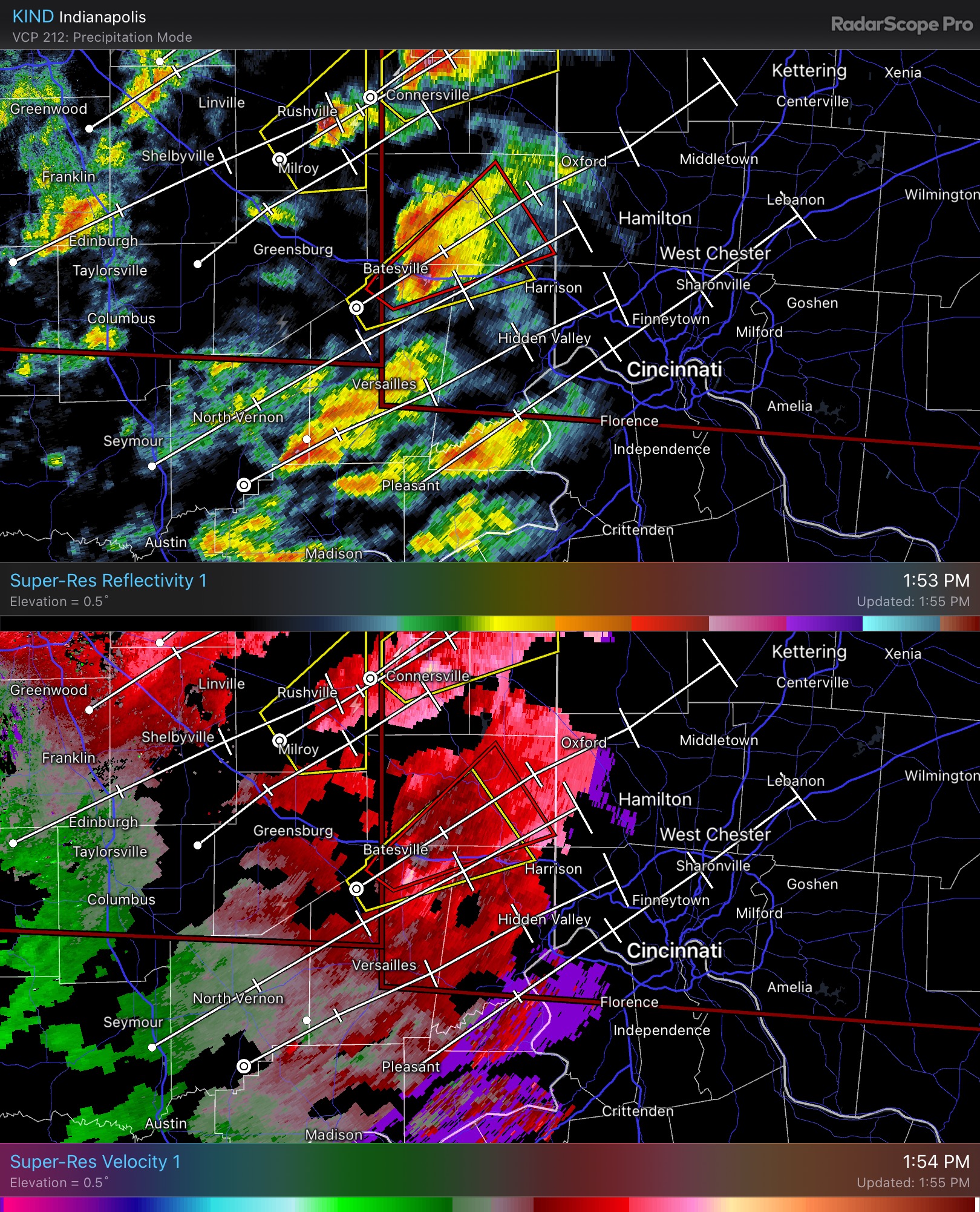
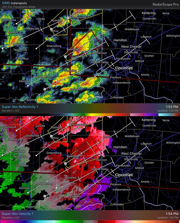
Looks like we may have a significant tornado on the ground west of Cincinnati -
The St Louis to Cleveland special right now on the Euro. I notice some solid winds on the backside of this storm as well, could be a paralyzing early March storm which was all the rage the first 10 years of this century
-
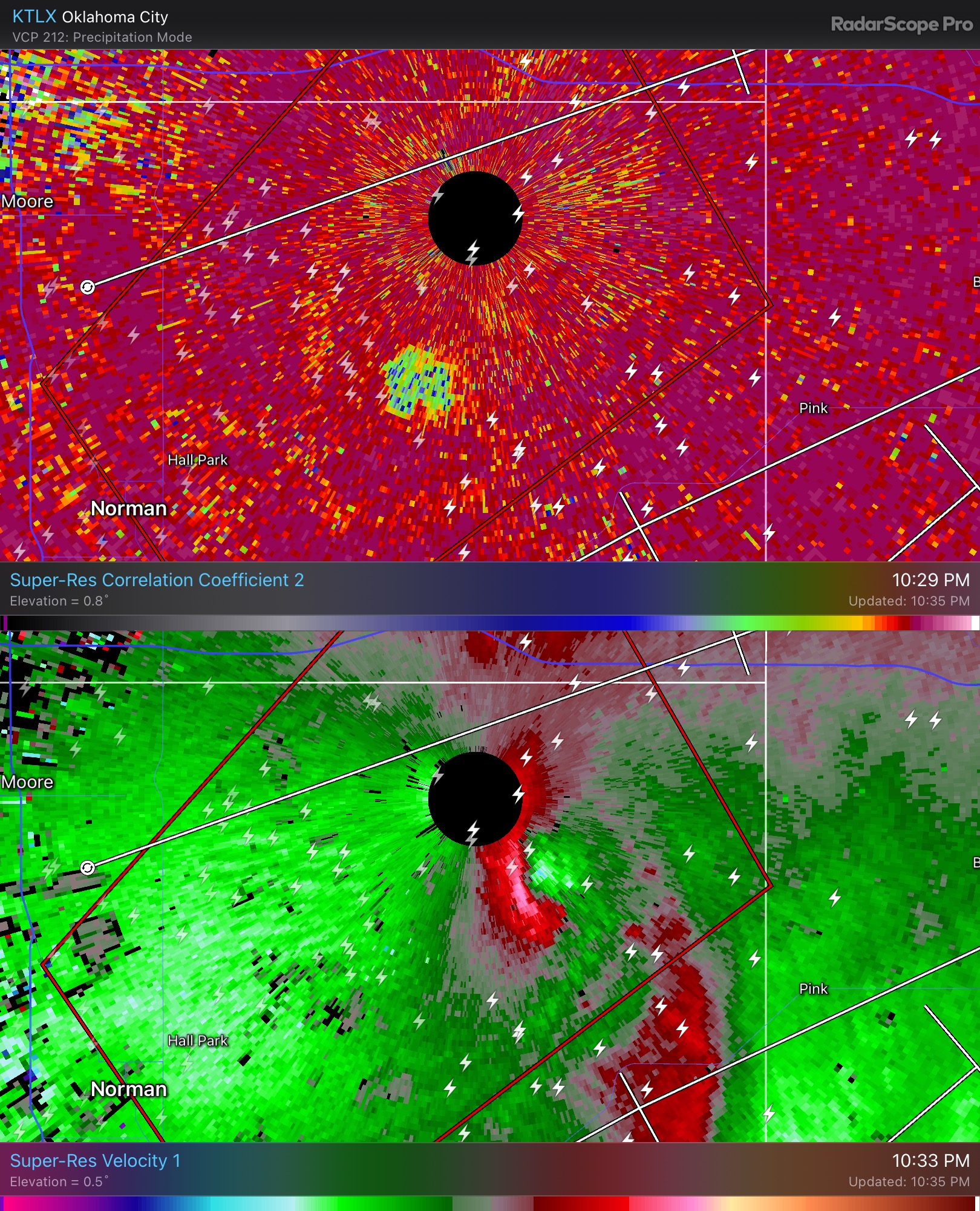
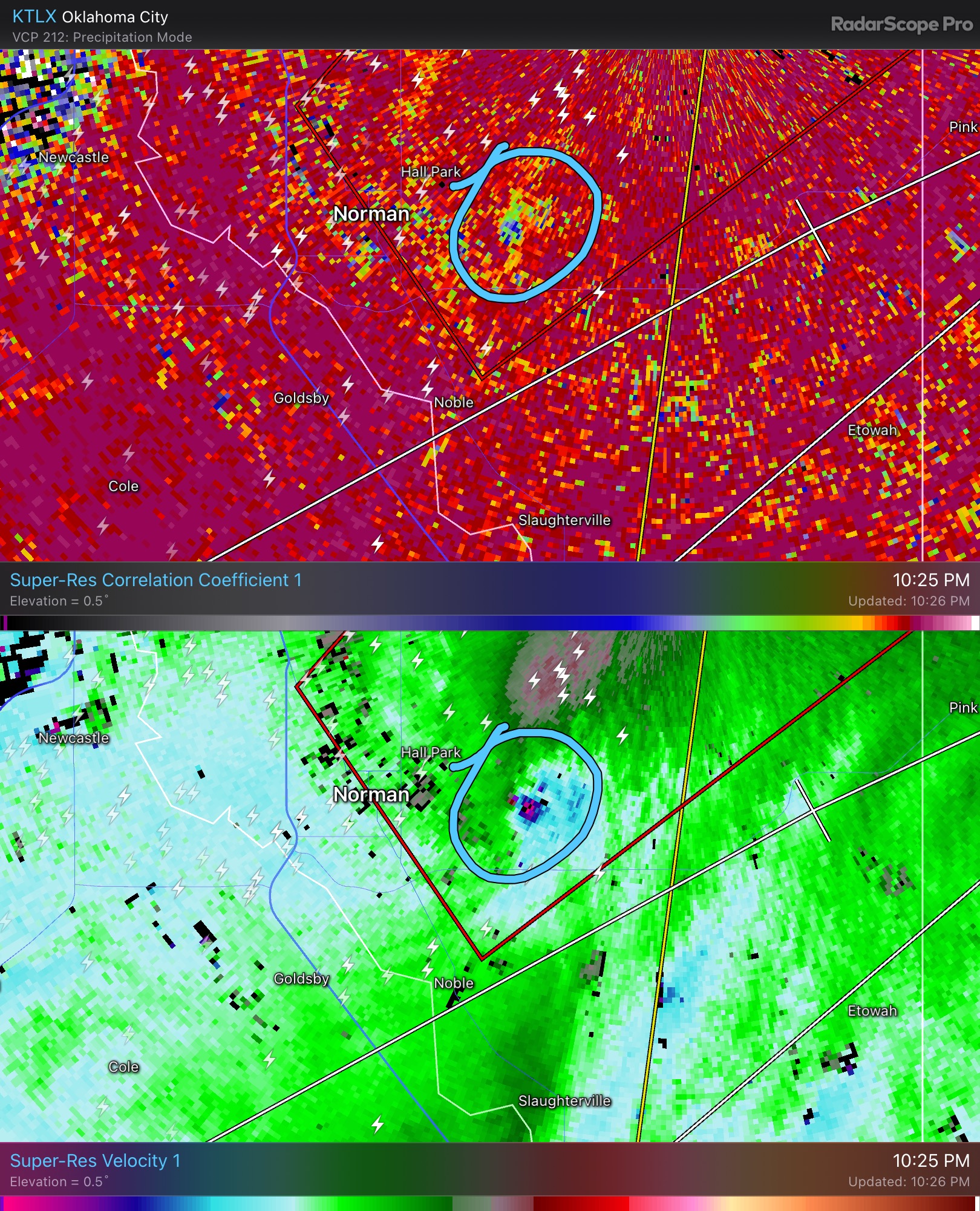
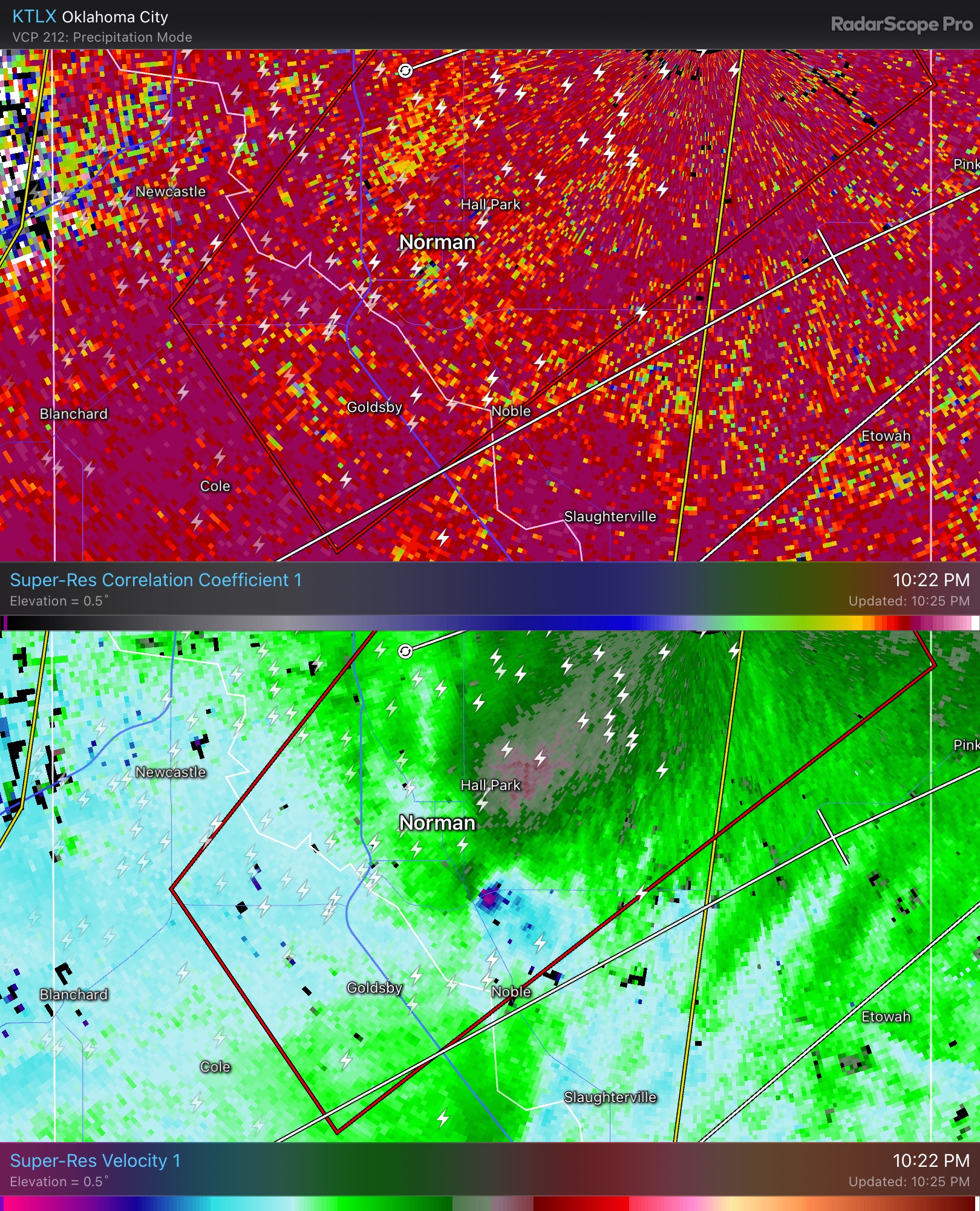
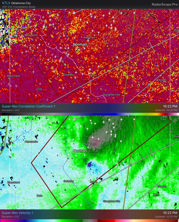
One of the wildest setups I’ve ever seen. Amazing that we were able to get that tornado around Norman
-
Might be a close miss

-
My office still does not have power and they said they are unsure when it will come back
-

-
Not great around Norman right now
-
OKC is about to get its clock cleaned. I will say I’m impressed with the gusts considering how much CIN there is. Also I notice the extreme SRH isn’t really overlapping the main line well
-
Wow they’re moving at 80 mph. Holy moly
-
Really could be a monumental day in the Plains today. Absurd dynamics at play and maybe some of the biggest polygons you’ve ever seen. The speed of the storms alone really sets the stage for a violent tornado, at 80 mph you could cover some serious ground in a short time. Hope any chasers stay safe
-
That’s what I thought, like I’m pretty sure an oil diffuser giving off steam would produce a tornado in that environment Really though there’s that potential for a violent tornado in Oklahoma tomorrow before everything goes linear
-
Wow, I couldn’t even imagine
-
Hows @HillsdaleMIWeatherdoing? Watching the news they said 90% of the county was without power which is not good in such a rural area