DopplerWx
-
Posts
3,398 -
Joined
-
Last visited
About DopplerWx

Recent Profile Visitors
3,768 profile views


-
precip looks a bit further north on the gfs out to 69
-
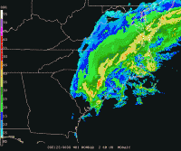
as the 12z nam runs, just look at the northward shift in precip for weds before our event in the last 24hrs.
-
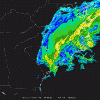
if the 00z euro had a bit more precip northward into nc i think we would have seen a 1-2" system, model just didn't have enough precip to spit out snow at the sfc level even though soundings looked near ideal for snow. would much rather have this issue than our usual fear of the warm nose screwing us. give me cold upper levels and ill worry about precip, especially in this pattern.
-
yep. sickening how it does the little jump above clt. at least i got 2 hours of really nice snowfall rates. hope to cash in on a big one later this winter.
-
Hrrr looks really good for late tonight with the back end. 3k nam showing it too. Hope it can help put down a legit 1-2”’of snow for those of us who got the shaft.
-
Hrrr still looking like a shot at some snow tonight Into tomorrow
-
Latest HRRR much better, nearly all snow for clt to rdu thru the end of the run
-
hrrr looking warmer out to hr18 vs the 12z run.
-
Yea initial rain then all snow until 5-6am or so in clt. 3k looks colder too
-
Brad PanovichVerified account @wxbrad 4m4 minutes ago More I shifted the snow a tad further south due to colder air & a longer duration of snow & sleet, but it still changes to ice Sunday pm. The ice threat keeps going up. #snOMG #cltwx #ncwx #scwx
-
same. moved from rdu to clt and they got 6" last year. even charleston, sc got 5"+. if i moved to Alaska they would likely go snowless and have sleetstorms.
-
soundings much improved for clt. i pray to god it is onto something.
-
we're toast. unless we get 4"+ the fv3 is dead to me.
-
happens every storm and then it trends away from us and snow crushes va and the mtns.
-
if we get frz rain rates will be heavy and temps marginal. these 1:1 frz rain maps likely won't even come close to verifying.