

frd
-
Posts
7,161 -
Joined
-
Last visited
Content Type
Profiles
Blogs
Forums
American Weather
Media Demo
Store
Gallery
Everything posted by frd
-
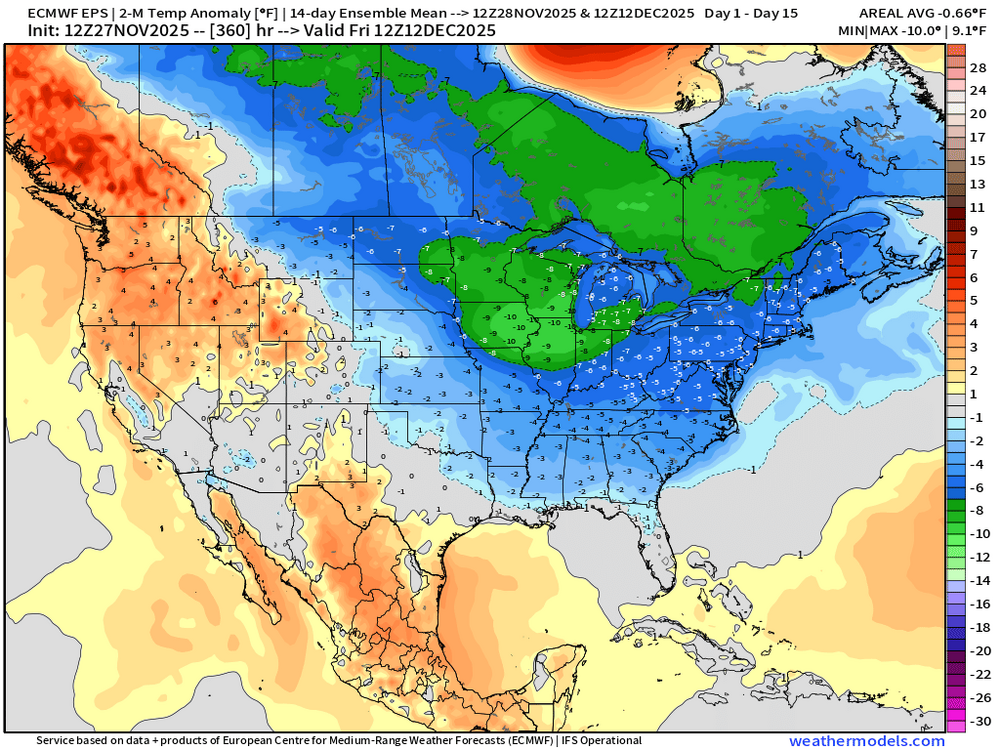
Active and cold = I can dream.
-
That looks consistent with yesterday's I believe, or the day before. But, consistency does not prove accuracy in this case. Although maybe the ensembles here are better than the AI model itself.
-
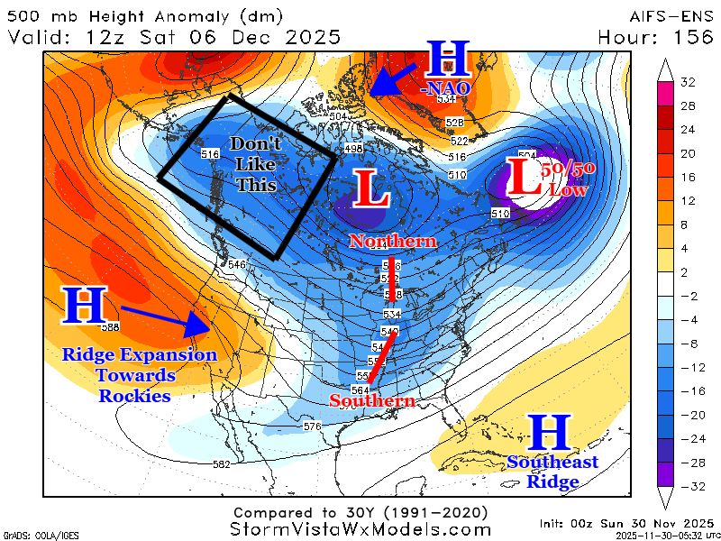
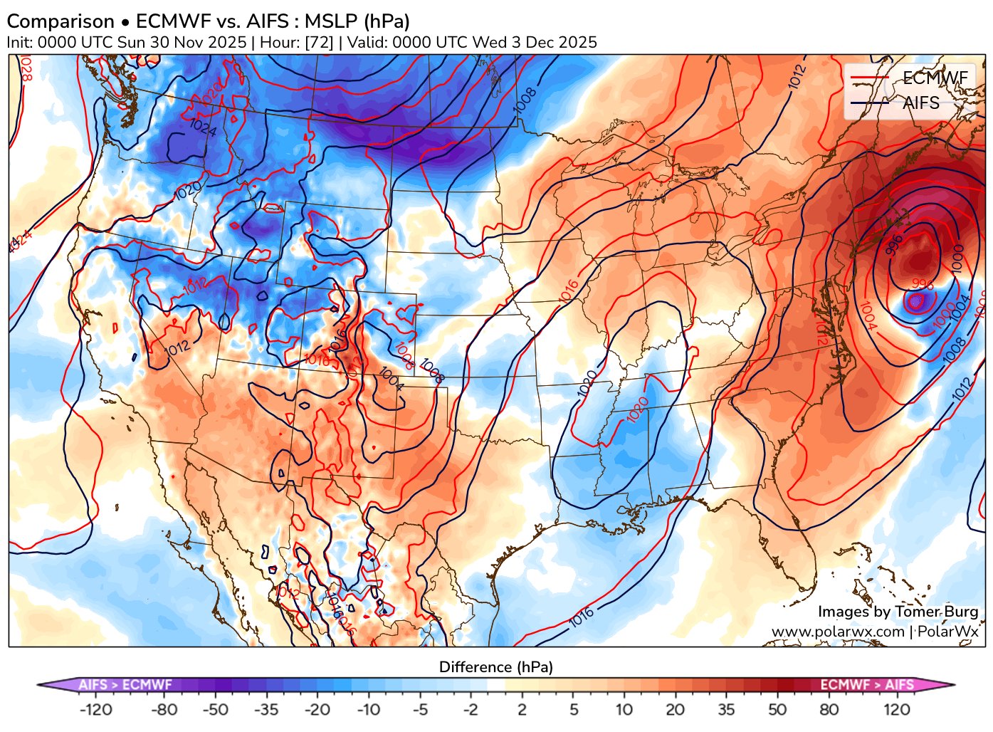
Interesting observation about the AIFS deterministic model by Tomer. ( for future reference ) Tomer Burg @burgwx 2h So far this case seems to be more of an AIFS Ensemble than an AIFS deterministic success (at least on the synoptic scale) - the AIFS quickly trended more amplified and now has a stronger and farther north cyclone than the deterministic ECMWF:

-
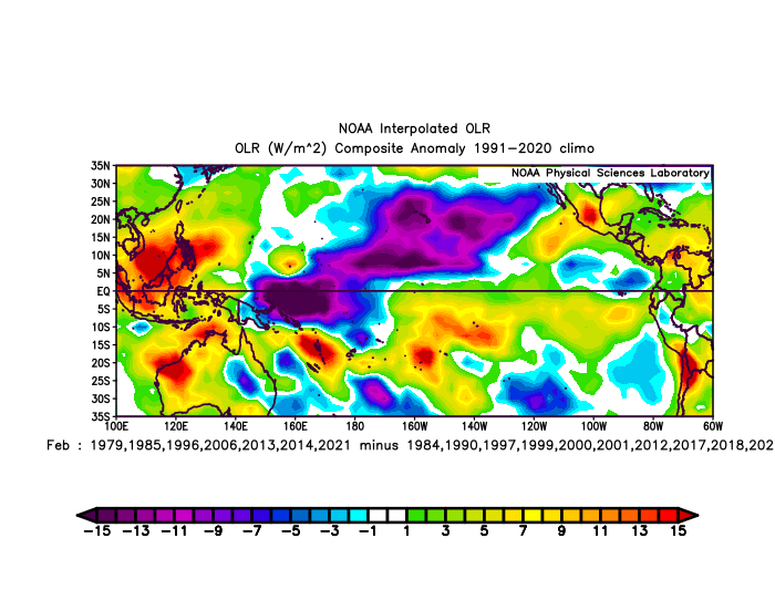
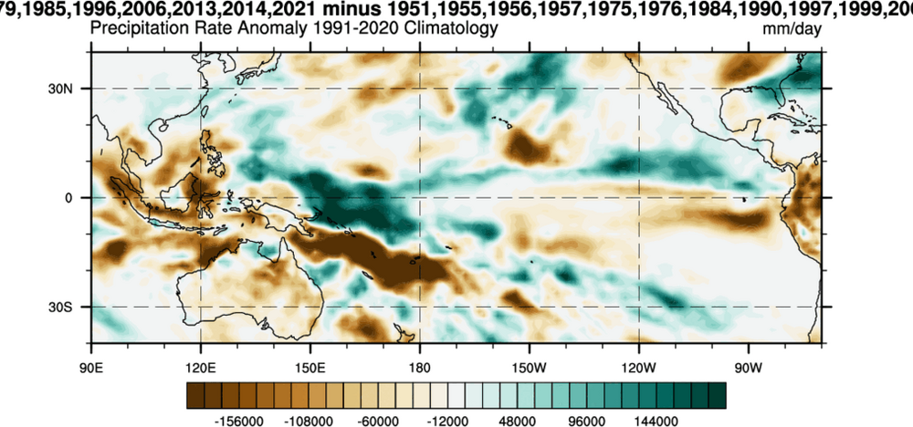
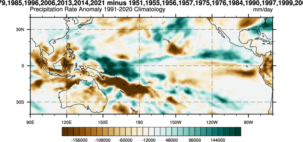
Eric Webb @webberweather 54m One key to this winter having a chance to break the -ENSO stereotype of a warm Feb in the E US is to nudge the IPWP eastward enough to focus convection just west of the Dateline in the Eq. Pacific Tropical Pacific OLR & Precip differences for cold vs warm -ENSO Febs in theE US:
-
I like this possibility. Mike Thomas @MikeTFox5 1h It's early! But definitely intrigued by next weekend. Compared to say, Tuesday, it is looking like a little better chance for the DC area. It's not perfect but again, it is a week out it doesn't need to be yet. Pattern wise definitely like that both -NAO and a 50/50 low are showing up in a lot of the modeling. Again, not perfect...the west could be a lot better and NAO could be more west based...but these are both features we are lacking with Tuesday so them showing up is a good start. Also of note is the Southern Oscillation Index, or SOI. One of my college professors loved the teleconnection that a sharp SOI dive was well correlated with East Coast storms. Well the SOI is forecast to take it's sharpest dive in at least 4 months around next weekend. So something interesting to keep an eye on!
-
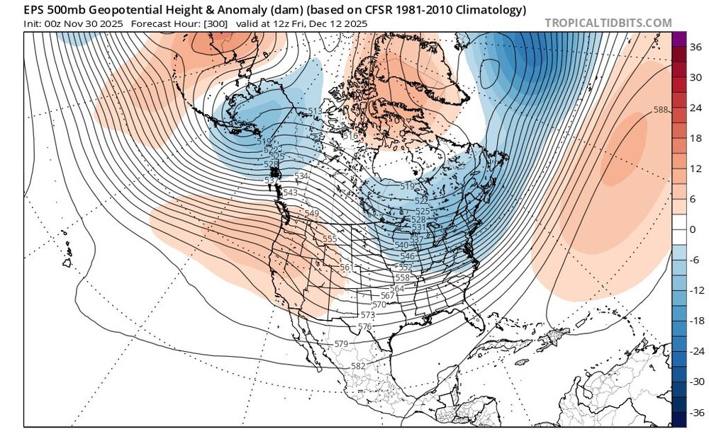
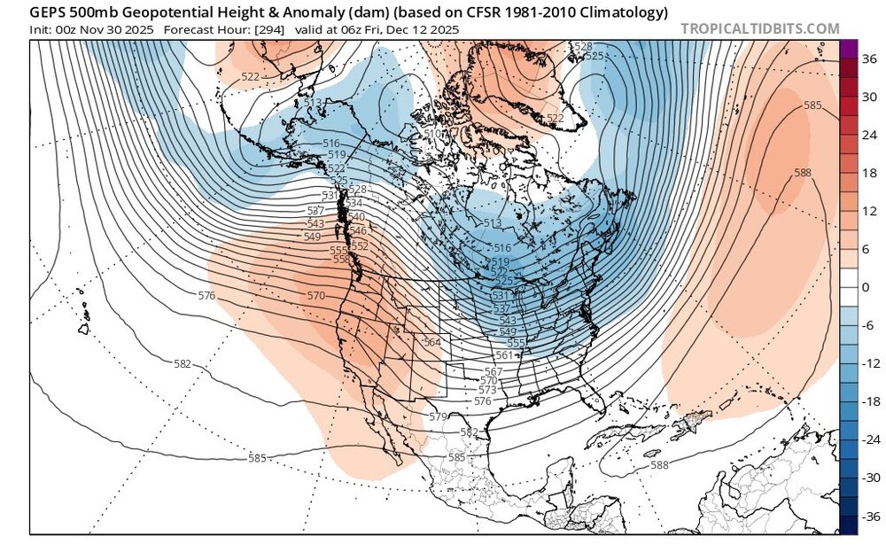
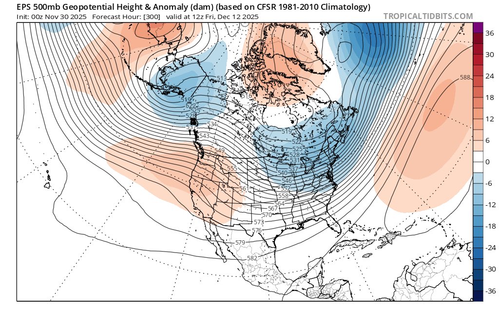
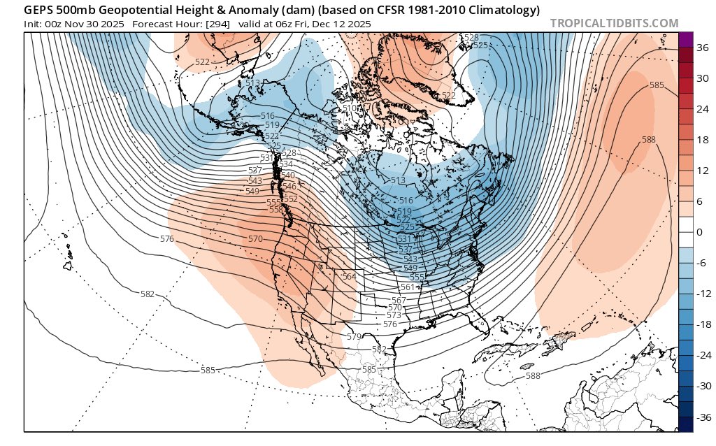
Close up on the 10 th. Wonder, and hoping, we get a better + PNA spike as we get closer to this time period.
-
Will not show the whacky GFS
-
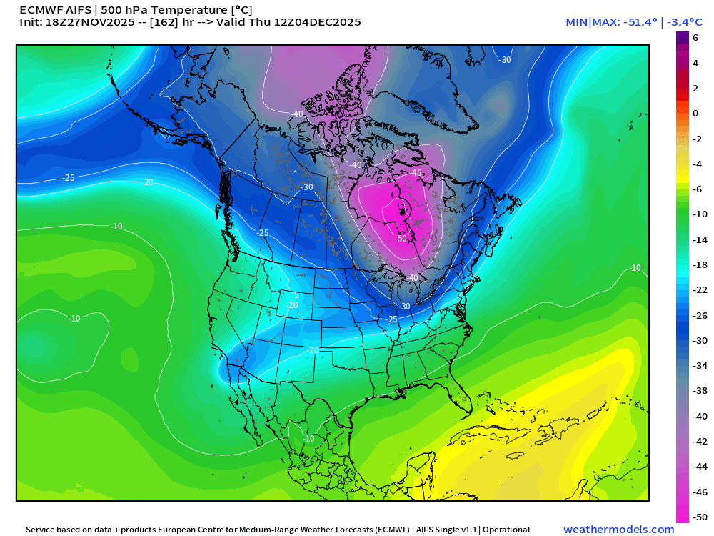
I see that in the modeling. Interesting I read the event was more of a reflective manner, and did not couple the SPV and the TPV. Of note is the current AO which despite Canada, and basically a large portion of North America cold, the AO has not dropped. Wonder if that changes going forward. I looked a couple days ago and believe long range modeling has the AO going negative.
.thumb.png.34e8ee1c06d472dab020d4714409ac23.png)
-
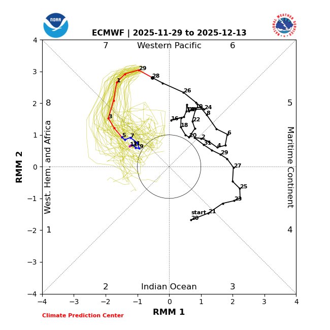
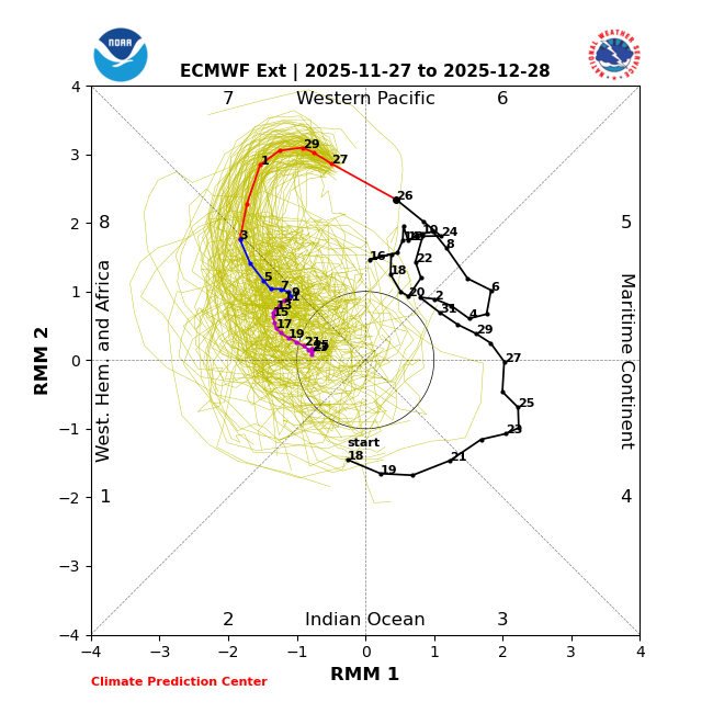
Here is the ext
-
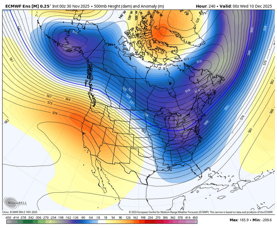
Looks so pretty. The weaker PV presently, and the MJO progression, along with increasing Atlantic blocking associated with the general background state actually support this cold and possibly snowy look in the East during December.
-
The 10 th does have real potential as you mentioned. Beyond that date things still look good for cold and snow potential.
.jpeg.e719856f38a1fedcdfadf48dc07324b3.jpeg)
-
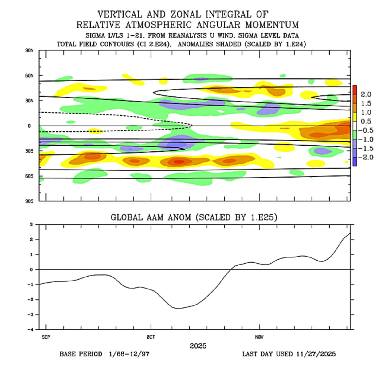
I would like some energy to arrive near mid December from our SW with cold air in place. Webb talks about a Nino like period possibly. Eric Webb @webberweather The ongoing MJO event in the West Pac has led to a *gigantic* build-up of westerly momentum (+U) in the tropical troposphere, w/ GLAAMa approaching +3 sigma; very El Niño-like. Eventually, some of this tropical +U will get injected into the mid-latitude storm track Eric Webb @webberweather 46m Very high +GLAAMa like this coupled with our La Nina base state is not exactly favorable for western troughing/-PNA & I expect this to remain generally the case thru late Dec or so, even tho the Euro weeklies are trying to argue otherwise.


-
So true !
-
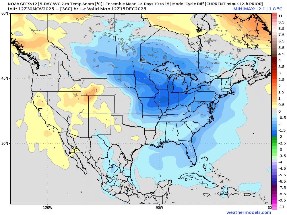
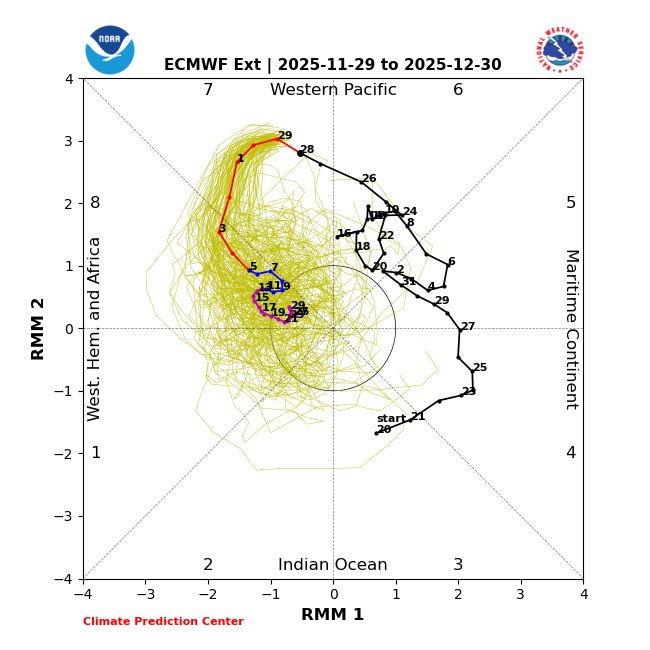
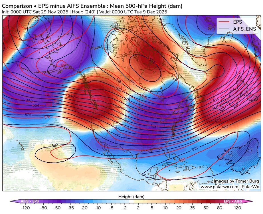
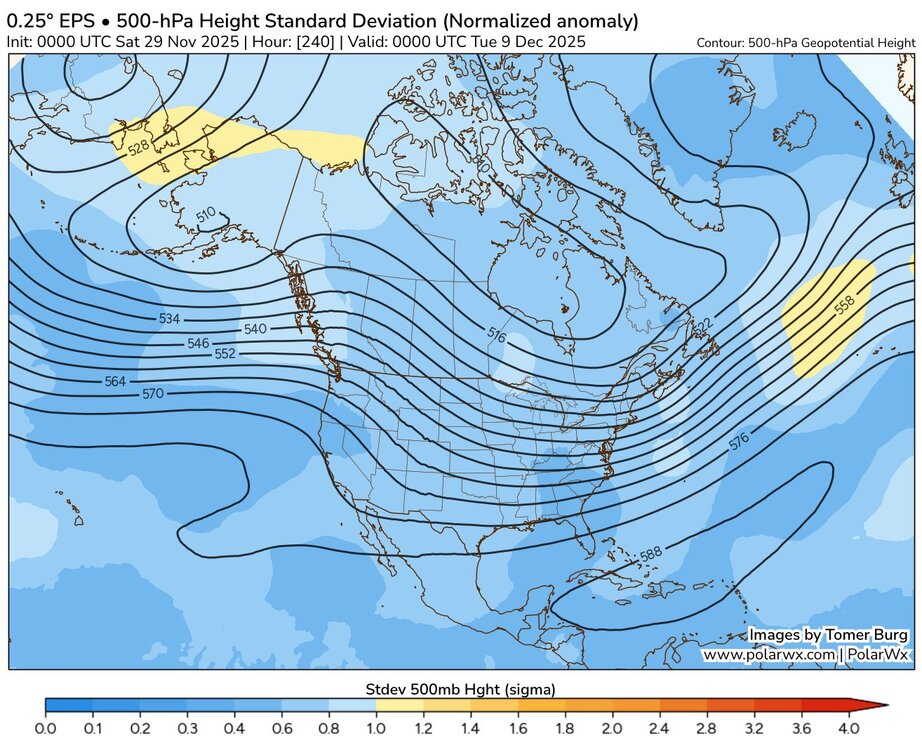
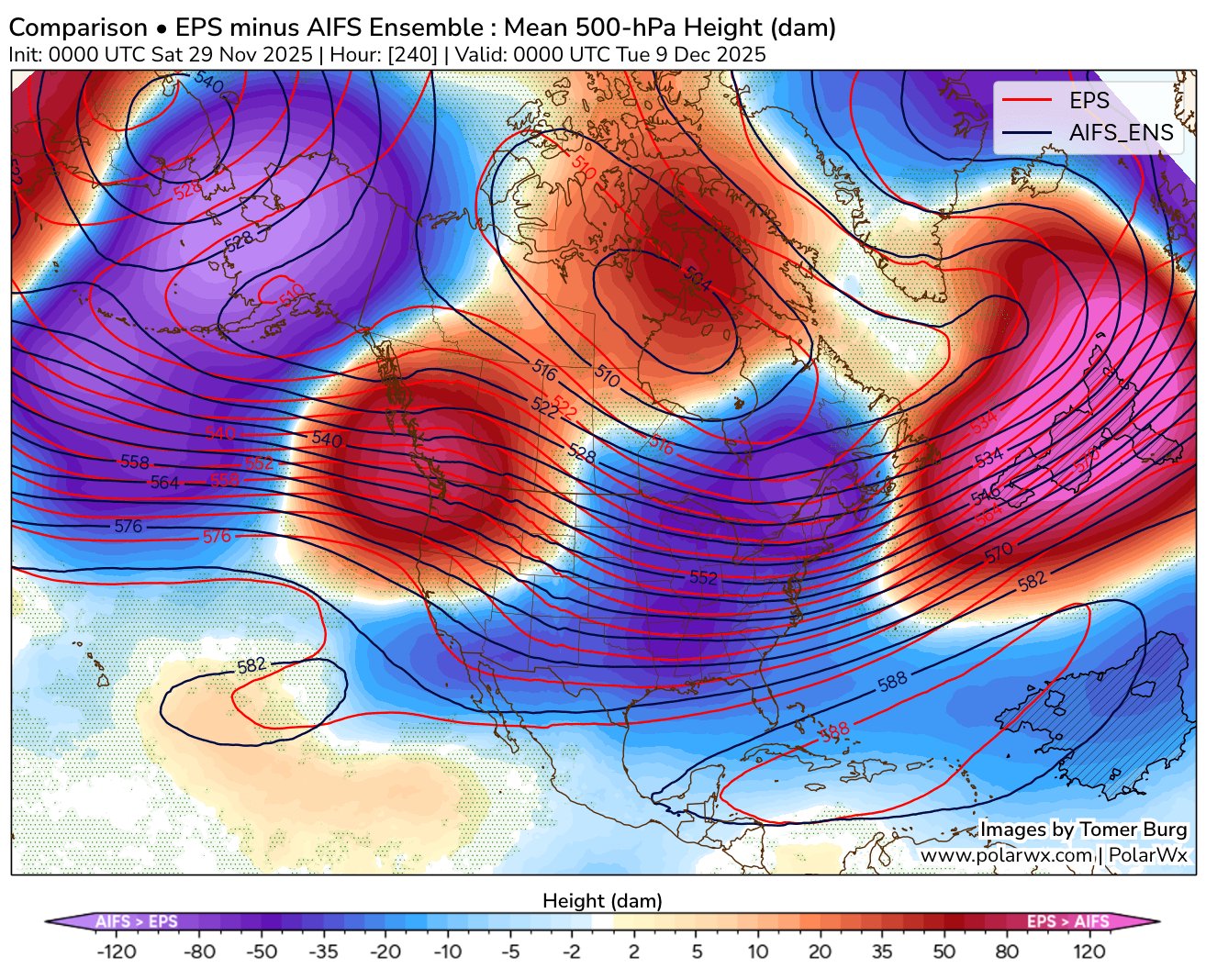
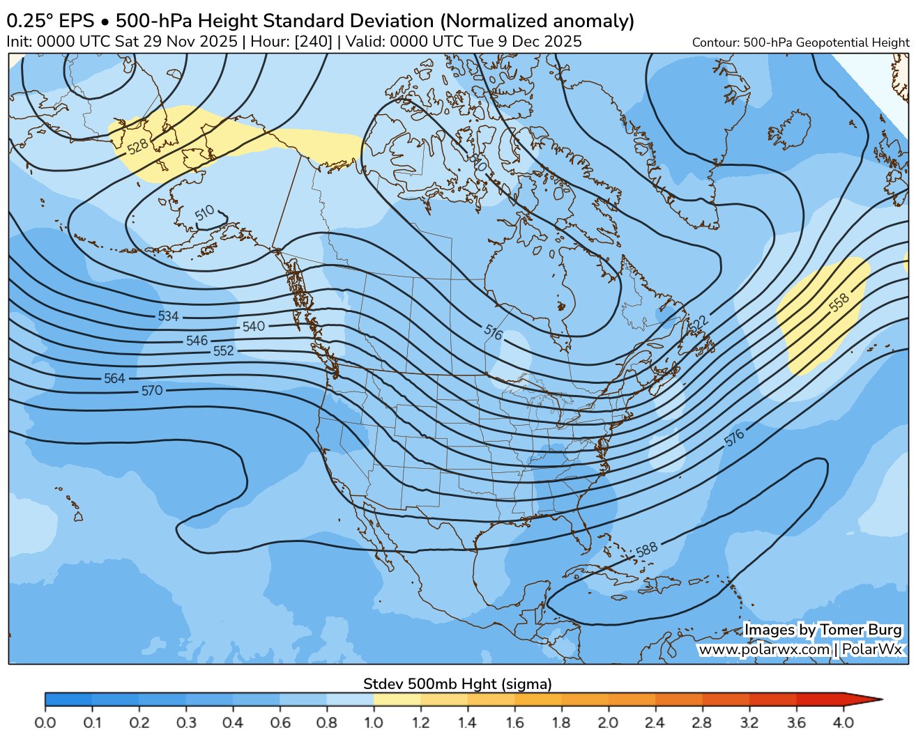
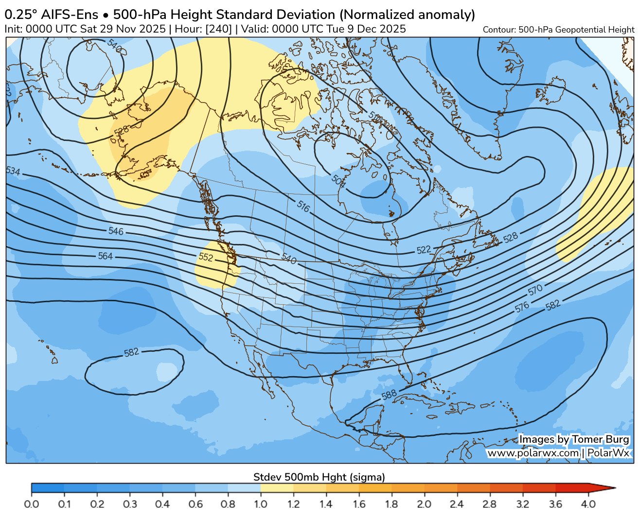
What are your thoughts here ? ( bolded part ) Tomer Burg @burgwx With the addition of the AIFS ensemble, I've also added plots comparing the EPS to the AIFS ensemble: https://polarwx.com/models/?model=comparison Some major differences emerge between them heading into the 2nd week of December, with the EPS colder than the AIFS in the eastern US: Differences between the EPS & AIFS ensembles are largest over Alaska, with the EPS showing a deep cutoff low over AK reinforcing western US ridging. The AIFS ensemble does not explicitly show such a strong cutoff low, but also has larger spread in 500mb heights than the EPS.

-
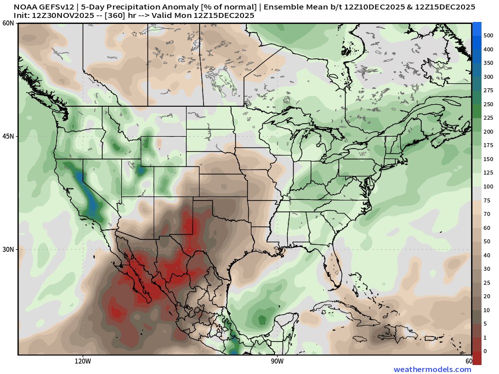
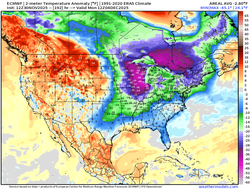
The ECMWF AI really cut back on the snow totals further South, and seems to have a cold bias. I thought I read here it is only useful with 72 hours of an event. Not really sure about that though. What have you noticed?
-
Paul Roundy @PaulRoundy1 The west Pacific warm pool is changing shape. Eventually it will allow for more convection near the Dateline, which can favor western N. America ridges. Paul Roundy @PaulRoundy1 38m If the western ridge is far enough west, it can favor a central N. American trough and eastern ridge. 1997 Feb-Mar had eastern US ridging in spite of central Pacific convection.
.png.ca6d6a1708312fcc53c4c4fe4100cb2f.png)
-
I like this slow movement.
-
I believe @GaWx had a detailed post about the benefits of a favorable phase(s) closer to the COD, versus high amplitude.
-
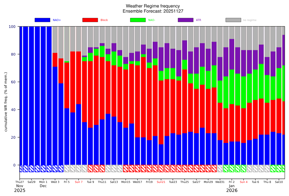
The AO remains positive, but we have intense cold in Canada and a weak PV. The MJO and the general progression could show potential Dec 15 th to Jan 5 th for the East Coast. >>>

.thumb.png.8a00fc81ee872e5fbdbb010cbdd0c0fc.png)
-
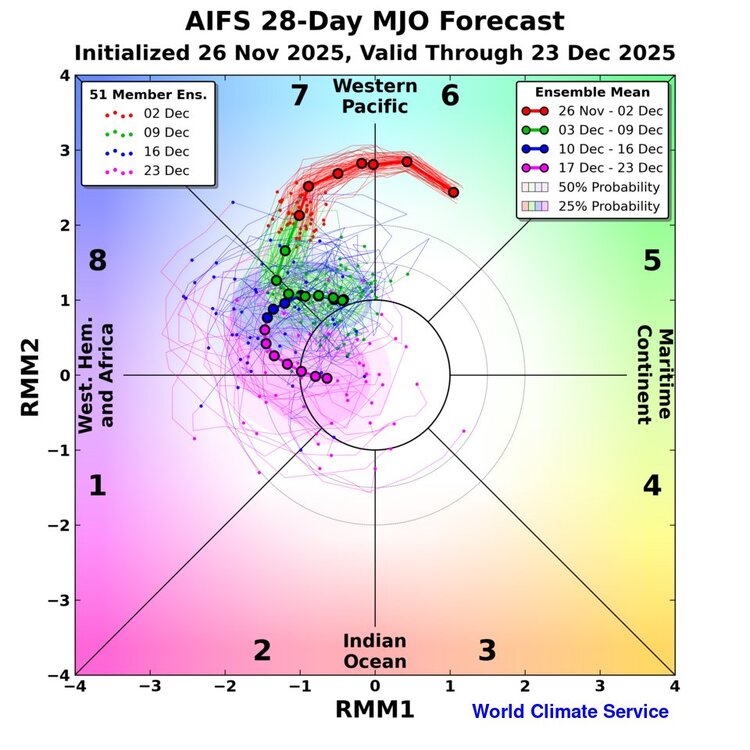
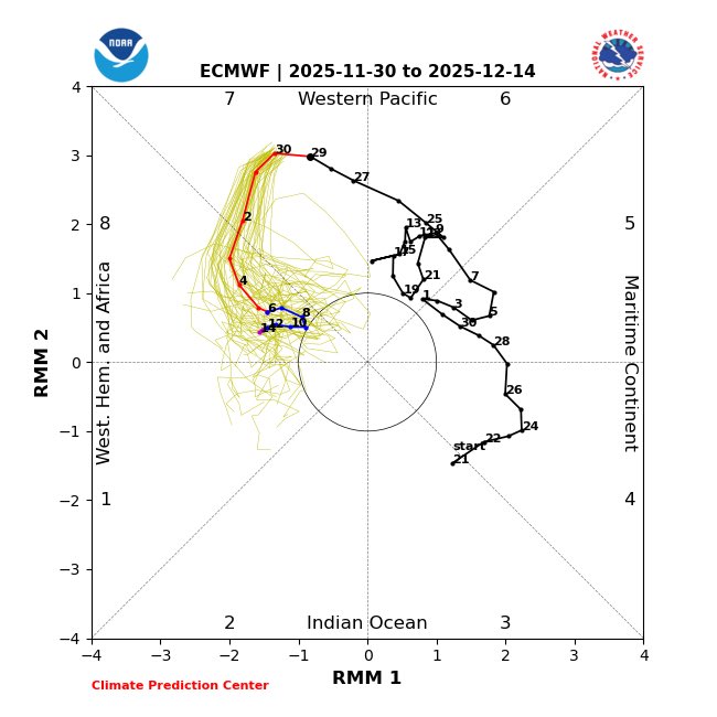
World Climate Service @WorldClimateSvc Quite excited about this: MJO forecast from the AIFS-ENS, including an in-house 28-day extension. Preliminary skill results are *very* interesting. Available soon to customers.
-
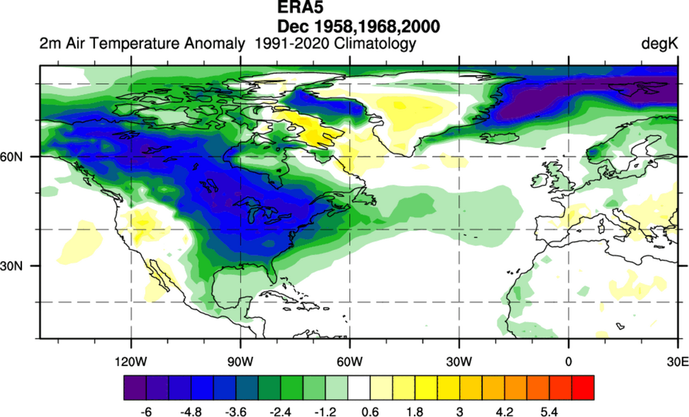
Interesting, past times when we had a warming.
-
Oh my, the SER is taking a vacation. Ensembles playing catch up as well.

-
That progression would at least tend to help us based on the opinion of many mets. I did not see Don's post. However, I read here it was using some of the forecast data from the ECMWF weeklies which I do not trust. They can be wrong, and the last two winters when bullish on cold and snow were terrible. So I feel them showing increased warmth can be incorrect as well. JMHO.


.png.5af30b1ed3915e1ee3b2489b13679234.png)


.png.bfbe2dde0b3b7d8d03b3301bfb0ee6ea.png)


