frd
-
Posts
7,193 -
Joined
-
Last visited
Content Type
Profiles
Blogs
Forums
American Weather
Media Demo
Store
Gallery
Everything posted by frd
-
I like this slow movement.
-
I believe @GaWx had a detailed post about the benefits of a favorable phase(s) closer to the COD, versus high amplitude.
-
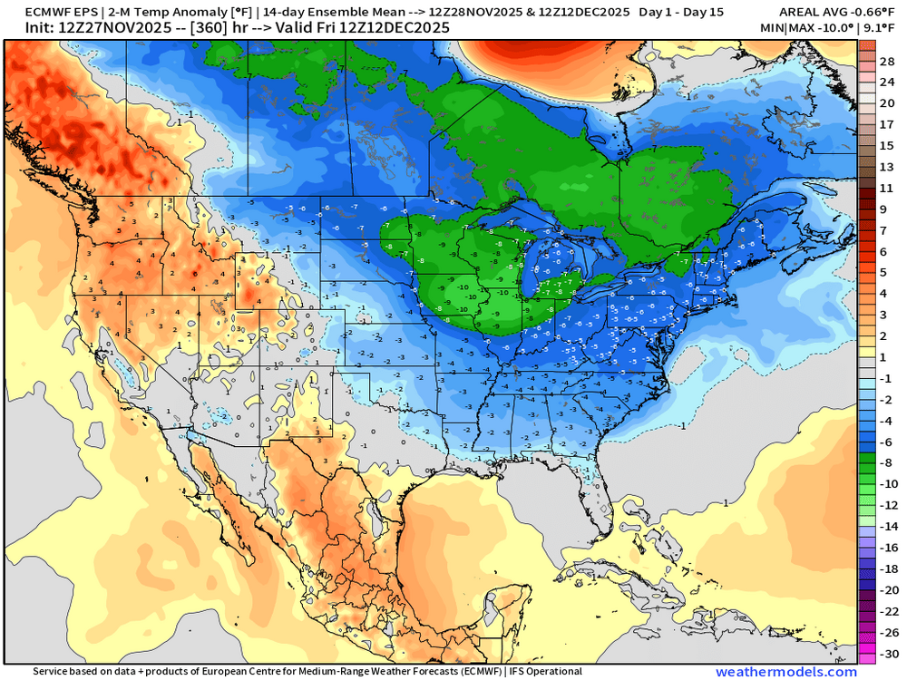
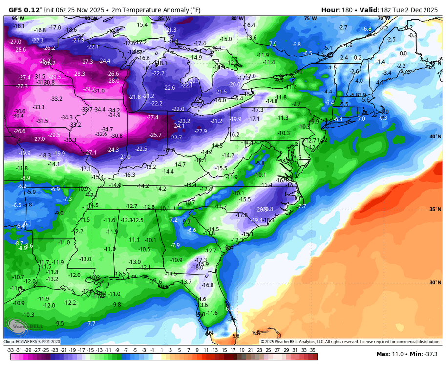
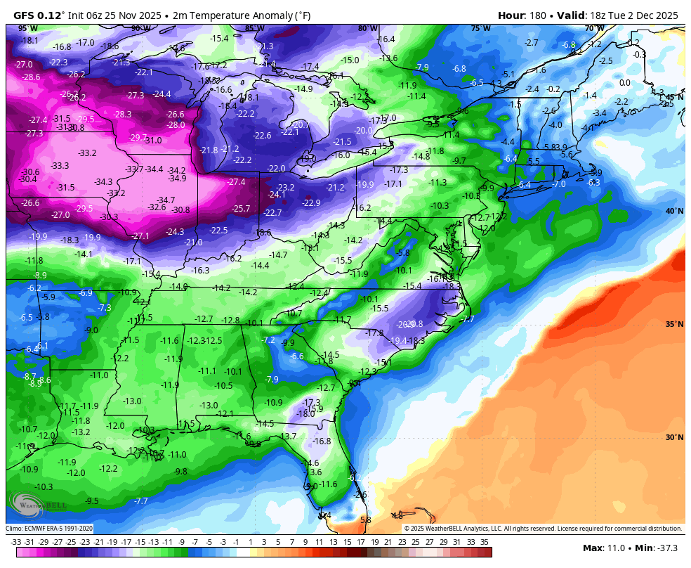
The AO remains positive, but we have intense cold in Canada and a weak PV. The MJO and the general progression could show potential Dec 15 th to Jan 5 th for the East Coast. >>>

.thumb.png.8a00fc81ee872e5fbdbb010cbdd0c0fc.png)
-
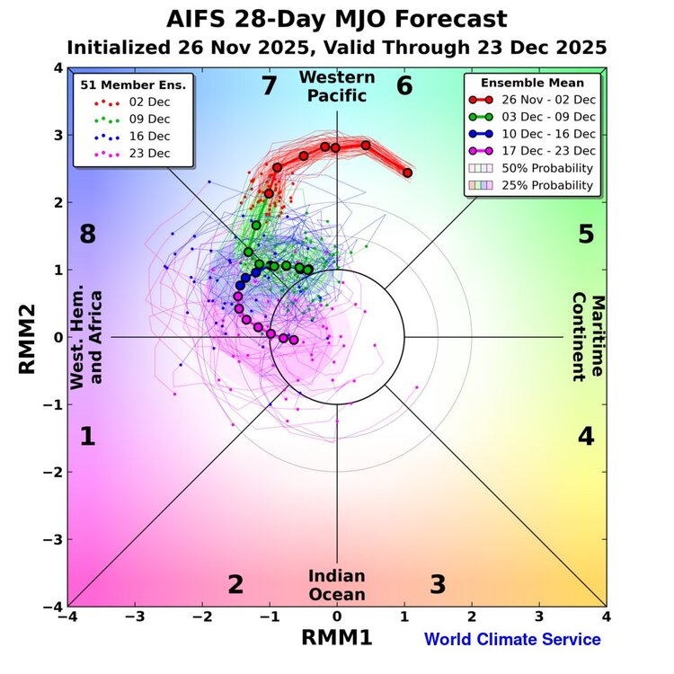
World Climate Service @WorldClimateSvc Quite excited about this: MJO forecast from the AIFS-ENS, including an in-house 28-day extension. Preliminary skill results are *very* interesting. Available soon to customers.
-
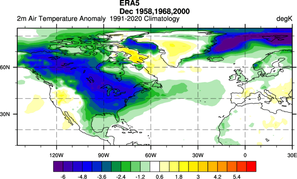
Interesting, past times when we had a warming.
-
Oh my, the SER is taking a vacation. Ensembles playing catch up as well.

-
That progression would at least tend to help us based on the opinion of many mets. I did not see Don's post. However, I read here it was using some of the forecast data from the ECMWF weeklies which I do not trust. They can be wrong, and the last two winters when bullish on cold and snow were terrible. So I feel them showing increased warmth can be incorrect as well. JMHO.
-
Looking better, and hopefully other data in the next week will point to the MJO getting into phase 8 at a lower amplitude, and then enter phase 1.
-
SER shifting SE. Modeling has certainly trended to colder outcomes in the East and the SE. .
-
Another day of clouds here. The forecast was for mostly sunny. But, so far 90 % of this day has been mostly cloudy. A theme the last 10 months.
-
Interesting AO forecast. Lots of spread, and not like the last two years. The strat warming( CW ) not influencing the AO, by a lack of coupling. As mentioned later in this post, in 1958 and 1968 they did couple but several weeks later. Giuseppe Petricca @gmrpetricca 47m Today's zonal GPH chart gives us a good example of uncoupled/limited coupling tropo-strato in the forecast. Strong stratospheric anomalies are present in the 10–50 hPa layer (and above - red rectangle), but below 100-200hPa, the situation is different, with limited vertical coupling (blue rectangle). While the stratosphere maintains a persistent positive anomaly pattern, at least until towards the end of the run, these signals do not propagate downward in a way that would typically influence lower-level circulation (for example, look at the orange/red anomalies back at the start of October, where they covered the entire column). In the troposphere, anomalies remain more variable and horizontally confined, indicating that the two atmospheric levels are acting more or less "on their own".
.thumb.png.1c110d27286b11ebeb987f586764802d.png)
.jpeg.a687b869237c0fc30c11406d0952d55d.jpeg)
-
From https://x.com/judah47/status/1992608265507946858 Seems very reasonable. Third week of December looks good.

-
>> For comparison. >>
-
If only the weeklies were correct for once in the super long range. Nice look mid to late December.
-
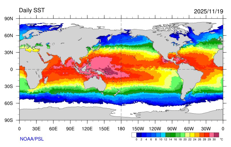
Eric Webb @webberweather The current global SSTa pattern is very favorable for the -EPO/+TNH pattern w/ the warmest water on the entire planet ~160E in the South Eq Pacific. The MJO is obviously giving it a huge boost here too. Eric Webb @webberweather · 16m I definitely underestimated how quickly this winter would dip into the ‘ol well of -EPO/+TNH we’ve seen so frequently the last 10-15 years. This pattern is only going to get stronger later in winter when the polar vortex intensifies& the warm pool starts zonally advecting east.
-
November 2025 general discussions and probable topic derailings ...
frd replied to Typhoon Tip's topic in New England
There have been winters that provided remarkable snow and ice events. Long duration cold, MECS, etc. nothing weird about that. -
November 2025 general discussions and probable topic derailings ...
frd replied to Typhoon Tip's topic in New England
Thats a bummer. Some feel the Mid Atlantic will do well because it is a Nina and its December, however I think we end the month below normal snowfall here, which by Dec. climo is not that much anyway, as far as temps its up and down. Basically nothing remarkable down here. Winters are not great anymore for cold and snowlovers in my hood. -
Looks encouraging, because some are worried about the SER and a rebounding PV in December. If you simply look at an East Coast Nina in December you would expect the look that you have posted in the 18z GFS.
-
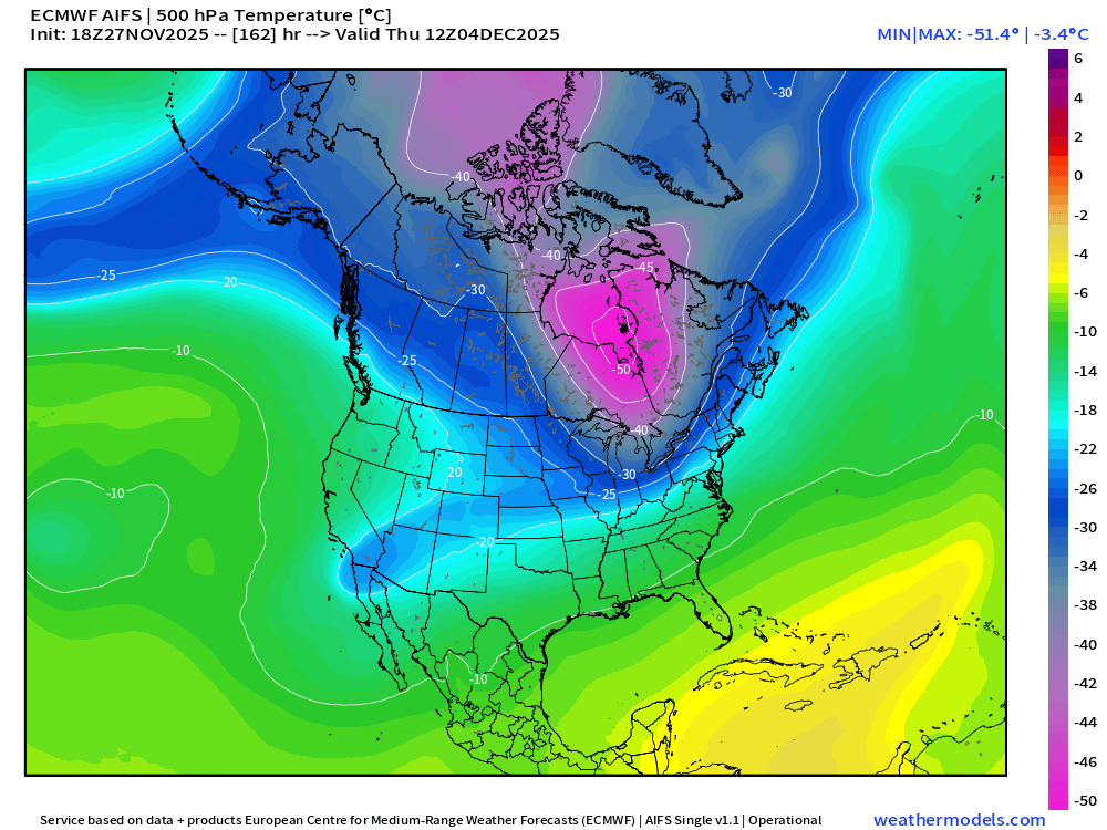
Fascinating the cold in the SW and the Baja. The deep troughs on the West Coast this year, and the last several, have been an issue leading to a SER. That 15 to 45 day map is interesting showing a cold anomaly from Alaska to the Baja.
-
I'm not even sure if it's wise to look at outcomes that far back.
-
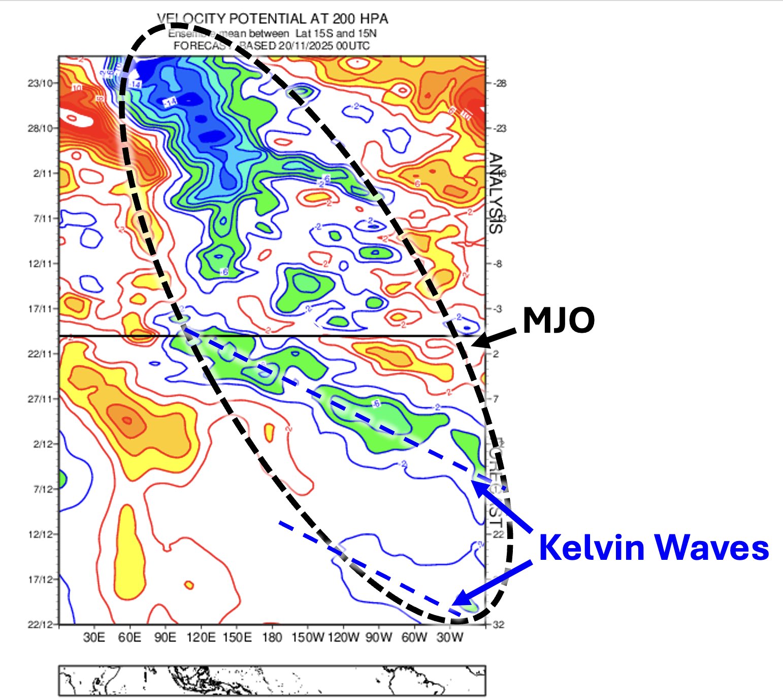
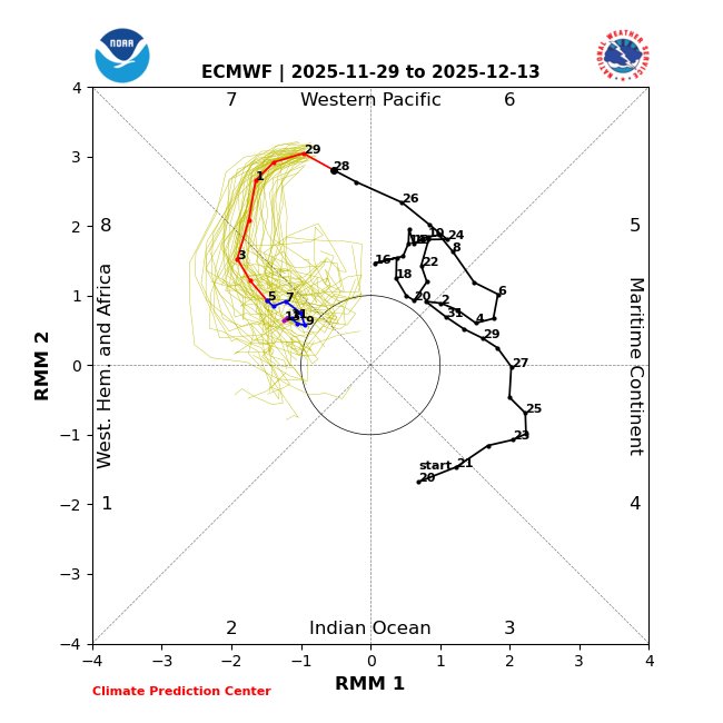
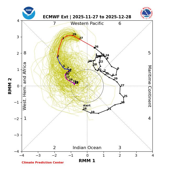
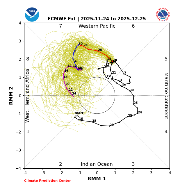
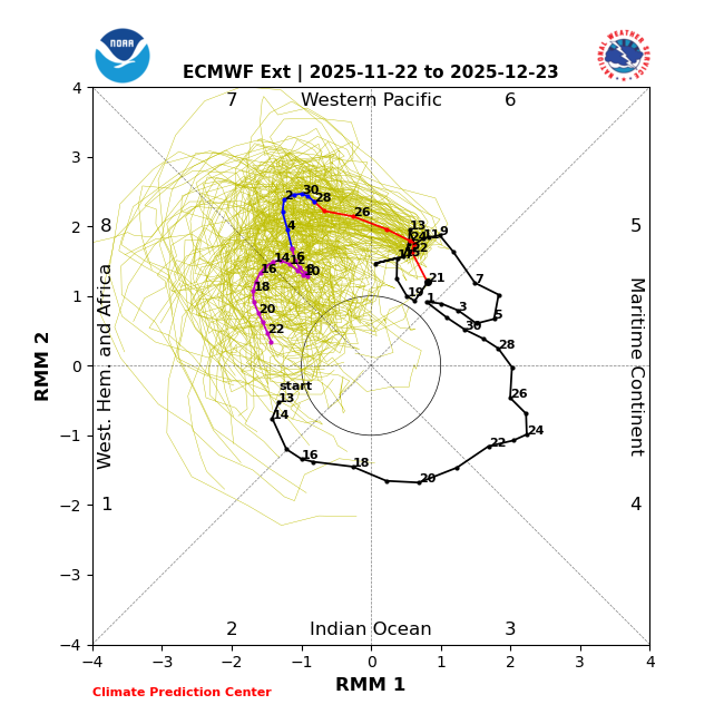
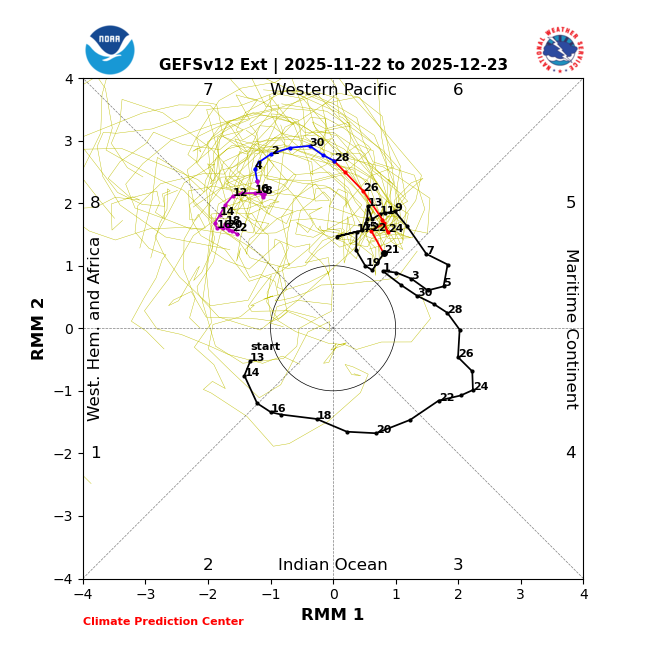
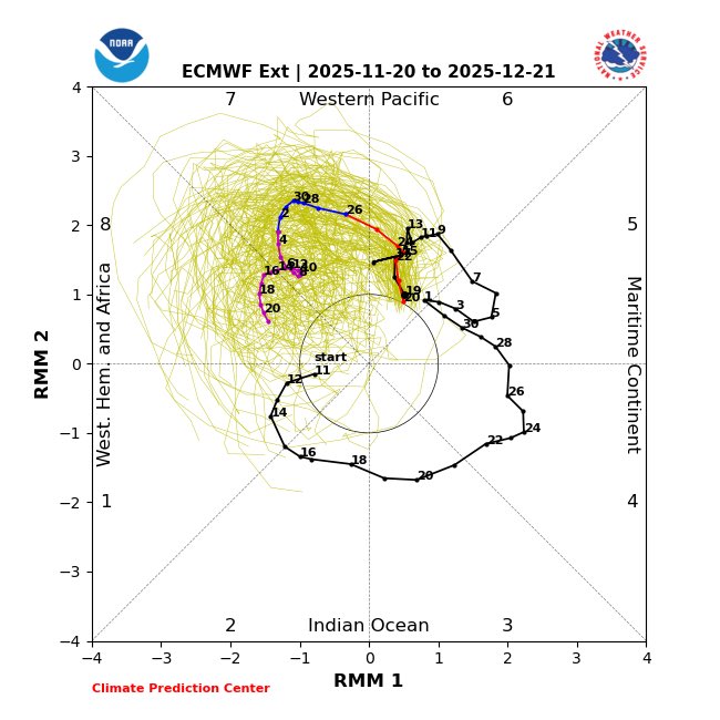
Eric Webb @webberweather It’s easy to spot Convectively Coupled Kelvin waves (blue dashed lines) propagating quickly thru the mjo envelope (black dashed line) the next few weeks on the forecast VP200a Hovmöller (left) This is largely why you’re seeing these loop-de-loops on the RMM phase plots (right)

-
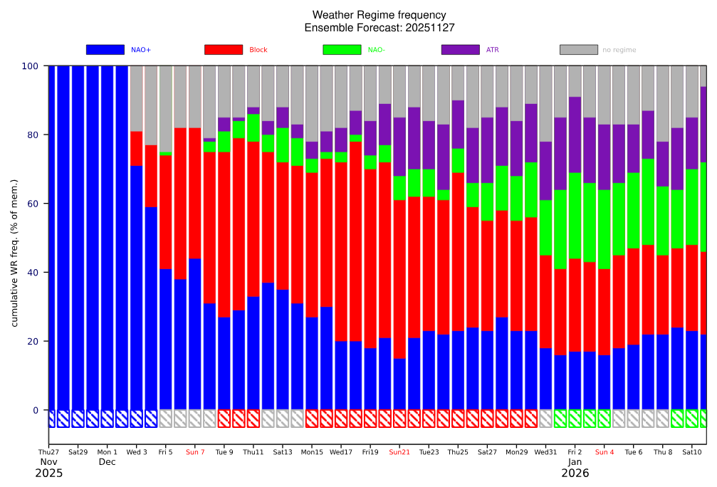
Snowcover and cold both become established in Canada by early December. This should help as the cold gradually pushes South with time.

.png.3ffd799d88614221771af18070a14ff0.png)
-
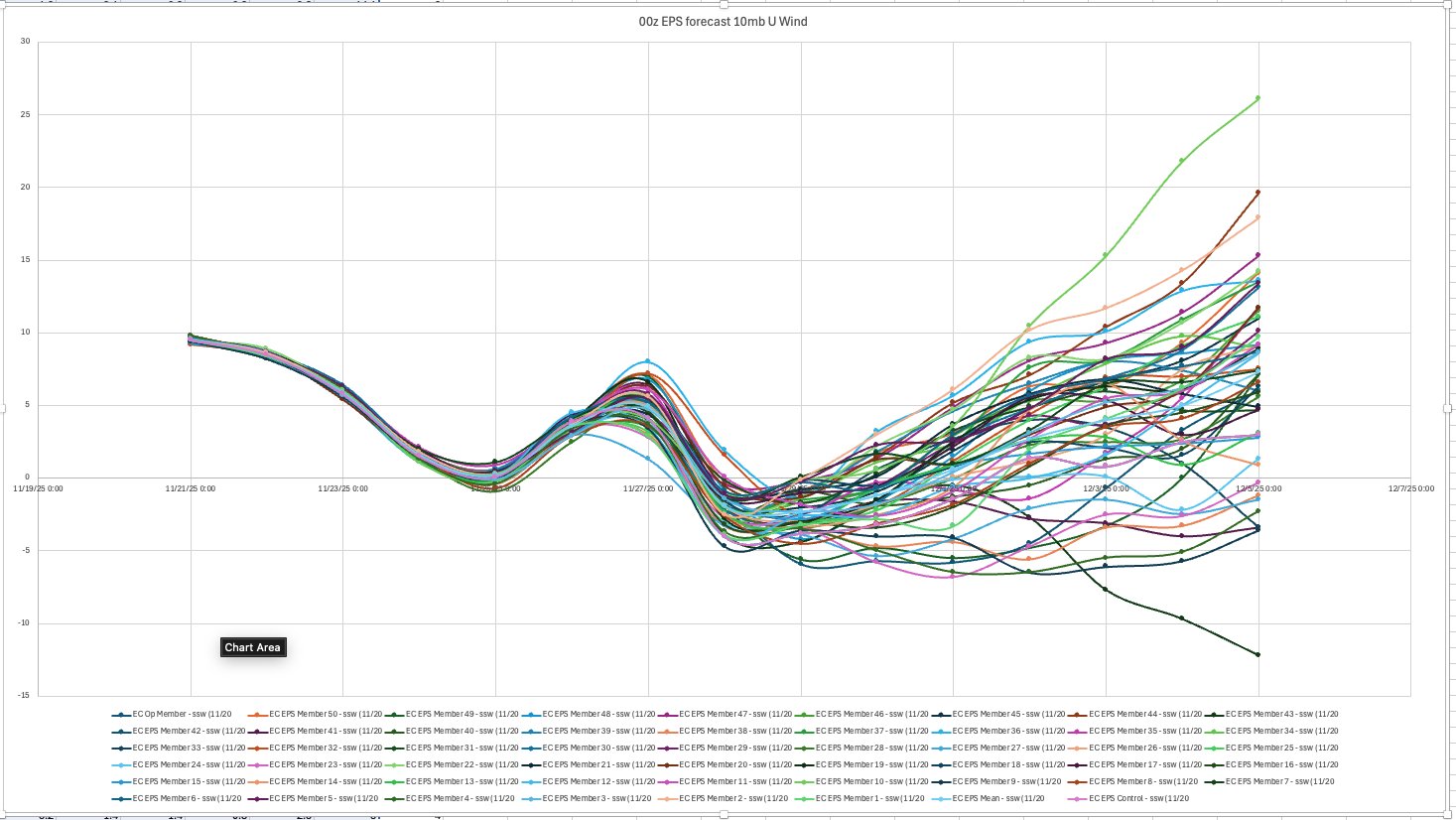
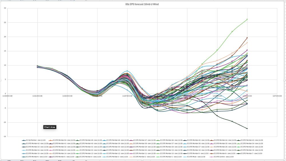
Allan Huffman @RaleighWx 22m Well for all you #SSWE people out there. Today's 00z EPS showed all members (100%) showing a 10mb U wind reversal over the north pole around 11/28 to 11/29. The implications, are enhanced blocking risk in December and the possibility that the SPV will be further receptive to weakening later in the Winter which could influence the mid/late Winter.
-
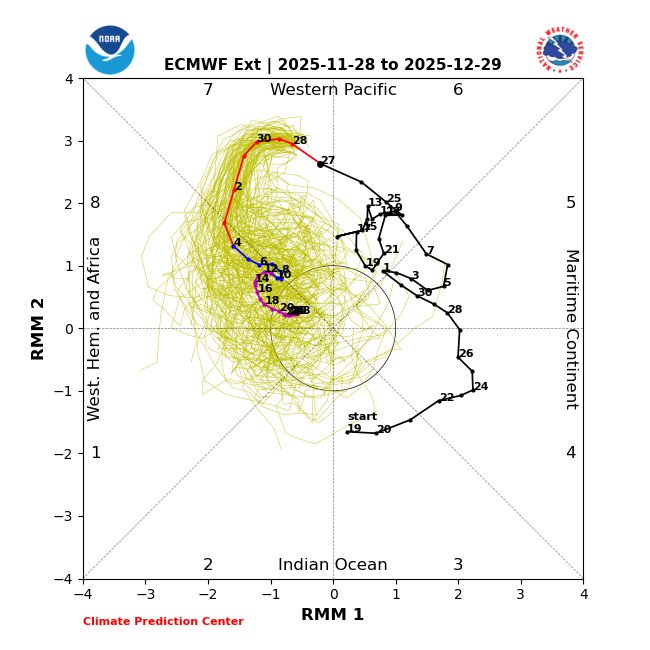
Warming events taking place at both the North Pole and the South Pole with assist the MJO in progressing into phase 8 in December.
-
Didn't Webb say the - NAO was going to lock in ?


.png.bfbe2dde0b3b7d8d03b3301bfb0ee6ea.png)


.png.19a02b398fe0a2f50f4e0b84e6084932.png)