Rjay
-
Posts
28,400 -
Joined
-
Last visited
Content Type
Profiles
Blogs
Forums
American Weather
Media Demo
Store
Gallery
Everything posted by Rjay
-
Thank you for being the voice of reason while I'm working.
-
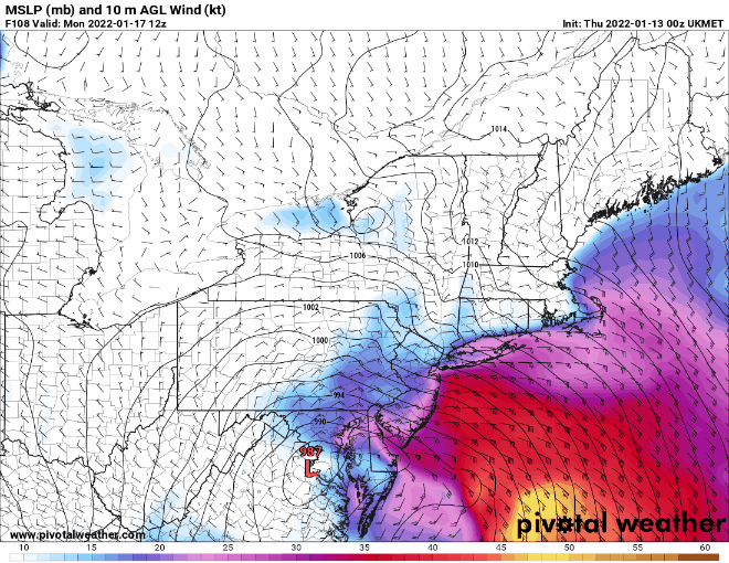
Yoda, just play around with this so you can see parameter you want. Good luck down there. https://www.pivotalweather.com/model.php?m=ukmet&p=sfcwind_mslp&rh=2022011212&fh=6&r=us_ma&dpdt=&mc=
-
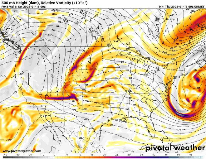
I disagree. I think although there were some positives, the trough goes negative quicker than the 18z run which negates those positives.
-
One of the unbannables
-
Doesn't disappear. Just goes in the banter thread.
-
Ummm dude. You have no idea.
-
How much for Philly?
-
Jfc
-
Give the interior a blizzard and me some severe wx. I do not want a slop fest.
-
They seem dead but our subforum has split into like 5 different forums over the years. It's really a shame.
-
If I could love a post it'd be this one
-
There will be some decent coastal flooding if you want to check that out.
-
The weenie maps show a foot for you but most of that is likely sleet. It's prob a few inches of snow followed by sleet and then rain as your temps rise into the upper 30s.
-
Be careful with the weenie maps unless you're on the north and west side of the low.
-
16 to 30 in 20 minutes at ISP