Rjay
-
Posts
28,400 -
Joined
-
Last visited
Content Type
Profiles
Blogs
Forums
American Weather
Media Demo
Store
Gallery
Everything posted by Rjay
-
In my intial post I talked about how we would need to thread the needle. This remains very true.
-
Nothing. But the bigger fear right now is still east. Everything is just so progressive.
-

-
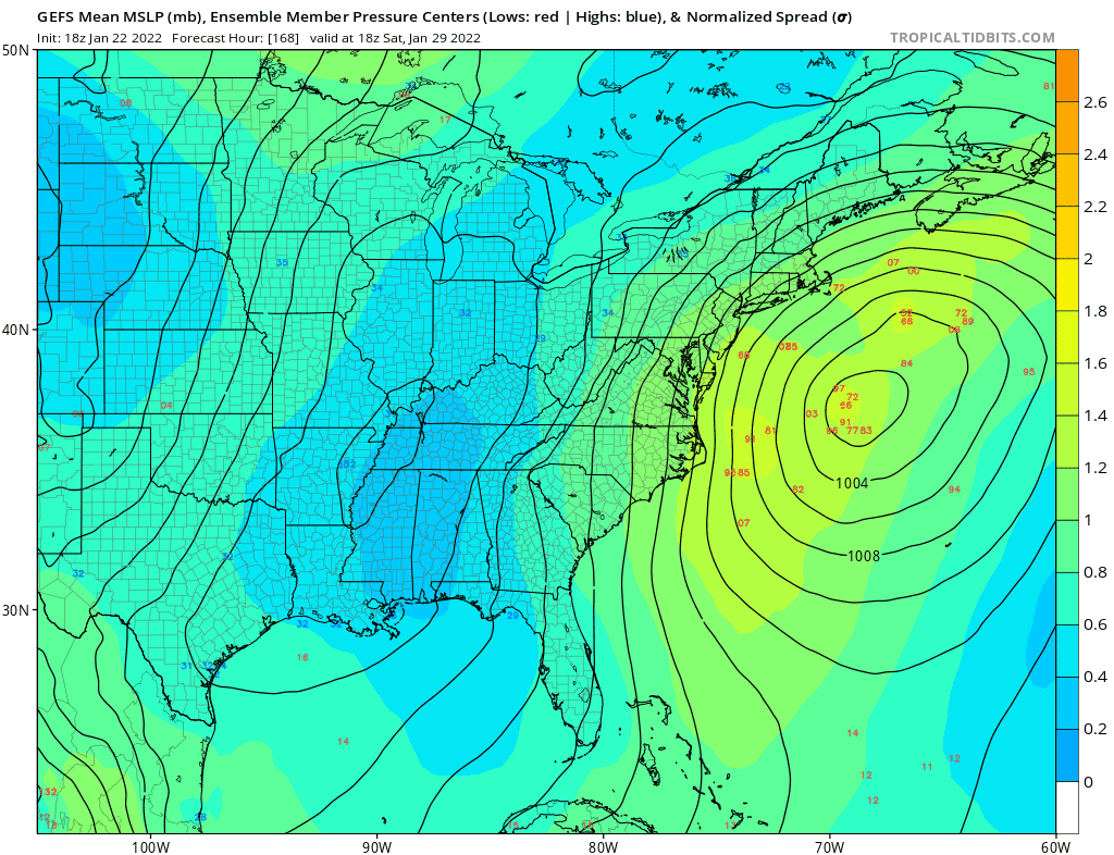
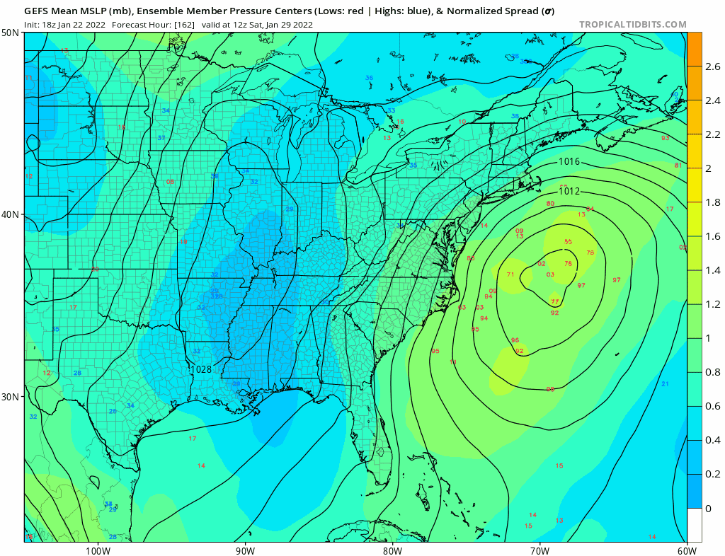
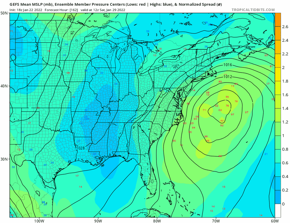
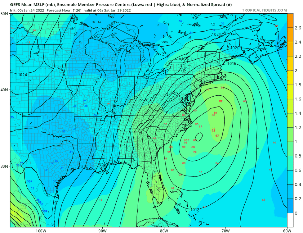
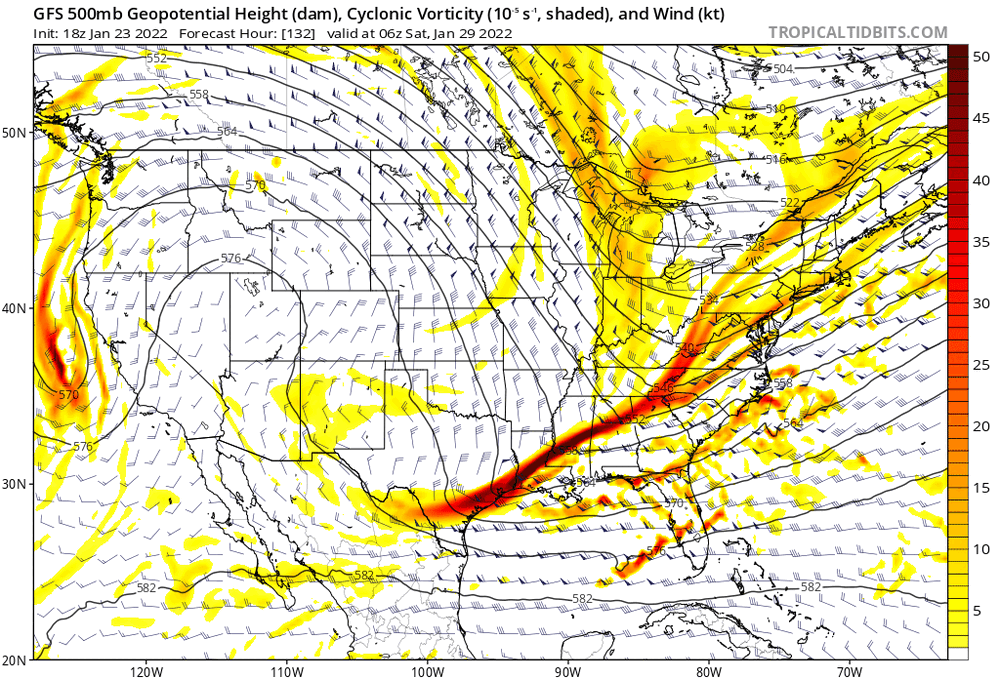
Last 6 runs of the gefs
-
-
.gif.753639597f1bc816f0dc71723ff8e398.gif)
-
-
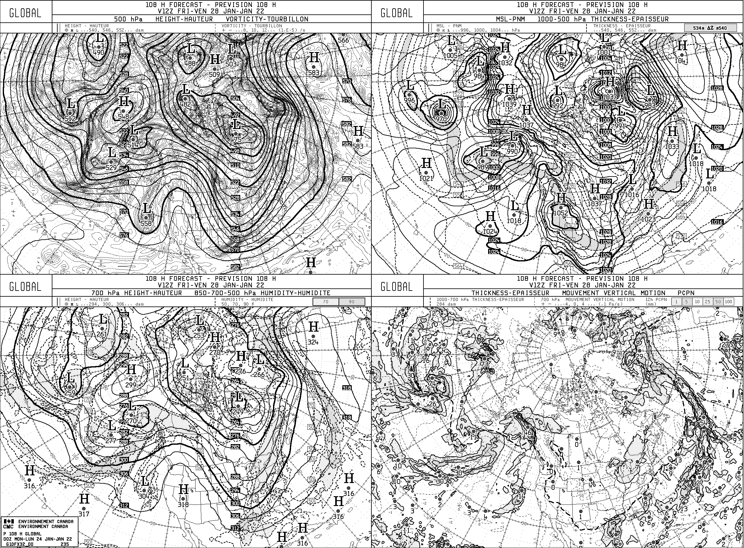
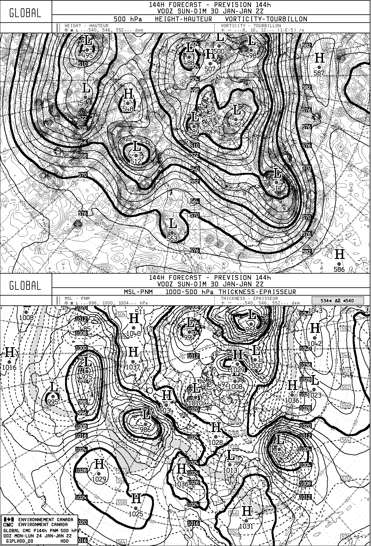
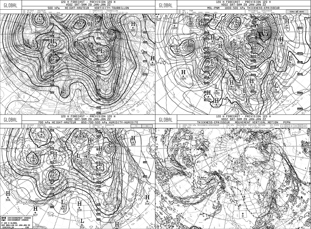
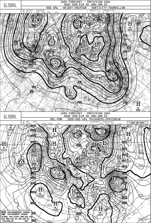
Enjoy the old school maps

-
@wdrag. Any thoughts?
-
We have a storm thread. I moved the posts to the proper thread.
-
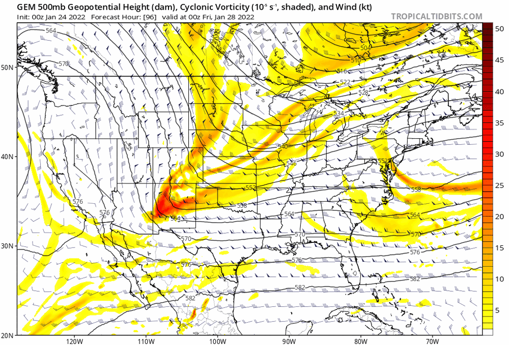
I would be surprised if the gefs weren't more amplified and didn't have a cluster west of the mean.
-
Strung out disaster vs this run.
-
Is that what you got out of that run? It was a massive improvement.
-
Upstate NY Banter and General Discussion..
Rjay replied to wolfie09's topic in Upstate New York/Pennsylvania
I can't believe what I just watched. -
Anything from way ots to a crusher. I'll take that at this range.
-
-
A storm system will develop over the southeast and move up the eastern seaboard between January 28th and 30th. As currently modeled this is a thread the needle type of event for our area. There's strong ensemble support for a major storm somewhere off of our coastline. This could work out for us but there's no real high lattitude blocking on the Atlantic side to slow things down and reinforce cold air into the area. Please feel free to discuss all that in here.
-
We really need to separate this threat from the January discussion thread. I don't want to see quality posts buried by model analysis of one possible storm.
-
But to me it's pretty indicative of how underdispersed the gefs are in general.
-
Pretty wild at this lead time.
-
I know you didnt. My post wasn't aimed at anything you said. I disagree. When there's high latitude blocking there's many more ways to get something to work out in our favor. Without blocking most events are thread the needle due to kicker, timing issues, etc.
-
The lack of high latitude blocking is going to make this hard to pull off.
-
33. Light snow
-
FRG is 39 and rain