Rjay
-
Posts
28,400 -
Joined
-
Last visited
Content Type
Profiles
Blogs
Forums
American Weather
Media Demo
Store
Gallery
Everything posted by Rjay
-
@donsutherland1. I tried messaging you about the issue but it says you can't receive PMs. I'm guessing your inbox is full.
-
Thanks again for tracking with us Walt.
-
You're right. There's definitely nothing wrong with being prepared. And you're right again. I'm saying 2" max .
-
I really don't think models show virga. I could be wrong but I remember reading that once. I do expect a virga fest up here though.
-
@wdrag. You're right about the gradient. It's almost always too high on the northern fringe.
-
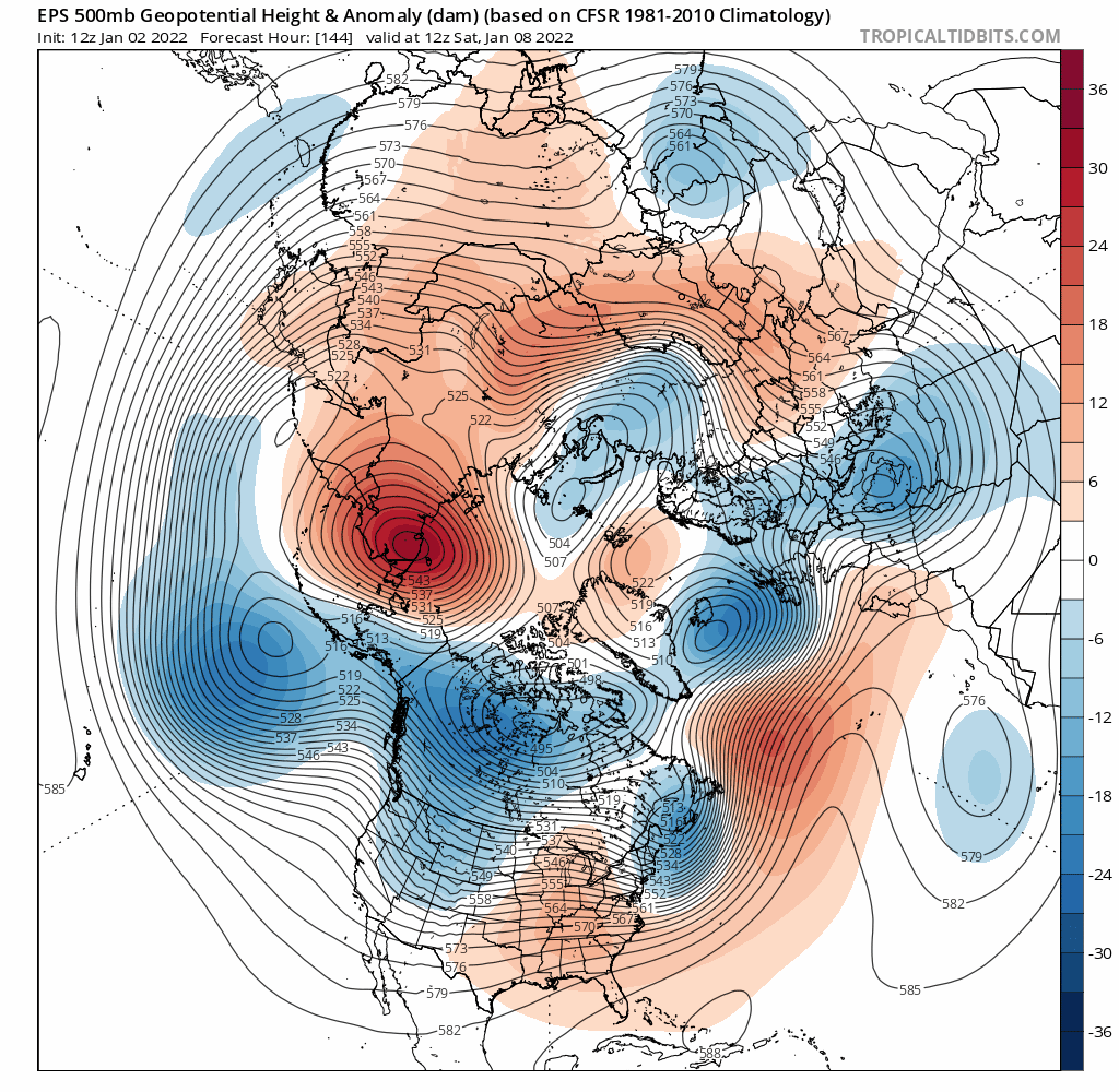
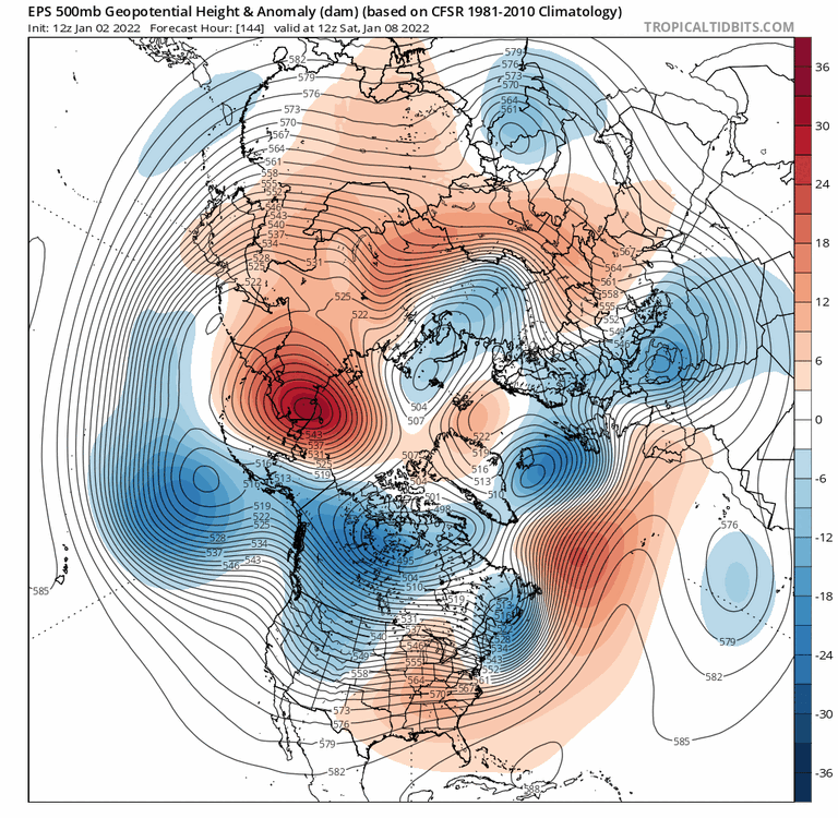
How useful is it to use the sref when it has a mean of 7" at LGA the night before an event that we all know will produce 2" max there? This ensemble is prone to wild swings.
-
They haven't been good in at least a decade
-
Never reliable
-
Days 10-15. Ok.
-
Pretty ugly after the late week threat
-
Watched the Jets for the first time in a long time bc I'm in the fantasy football championship game.
-
The Giants passed for 24 yards today
-
Lol
-
The old qb sneak on 4th and 2 hahaha
-
Antonio Brown rage quitting the NFL made my day.
-
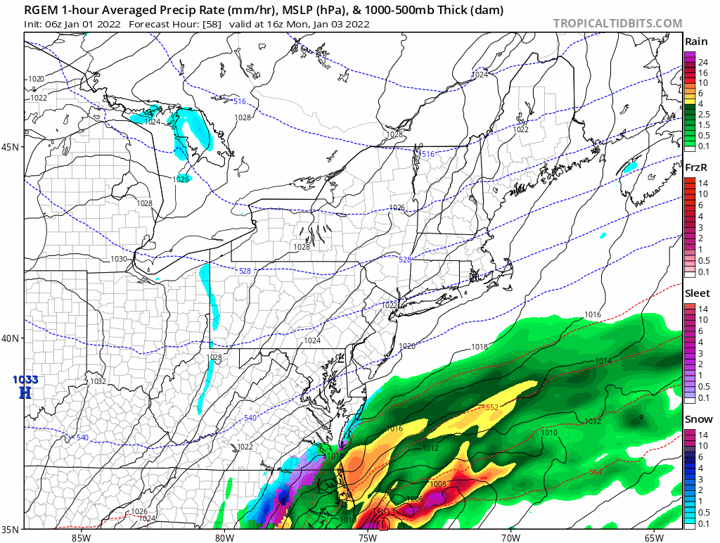
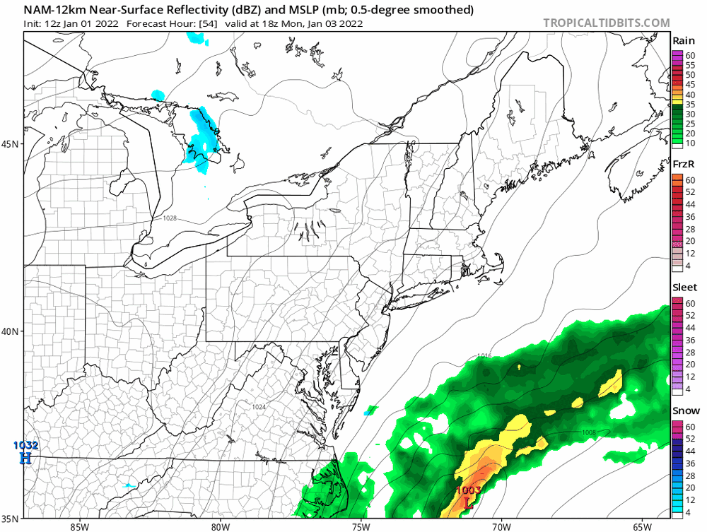
I think the href has the right idea although I can see the 1" line getting into EWR and NYC.
-
Yes. This will be fighting a lot of dry air on the northern edge.
-

-
-
Lol
-
Lol that's ridiculous
-
Of course it's going to rain but we had below normal temps every month and over 15 snow events iirc. It's as close as we can get around here.
-
It was as close to wall to wall as you can get around here in the modern era.
-
Another gray 50 degree day