WxUSAF
-
Posts
28,703 -
Joined
-
Last visited
Content Type
Profiles
Blogs
Forums
American Weather
Media Demo
Store
Gallery
Everything posted by WxUSAF
-

April 8th Eclipse- Last Easy One To See In My Lifetime
WxUSAF replied to Interstate's topic in Mid Atlantic
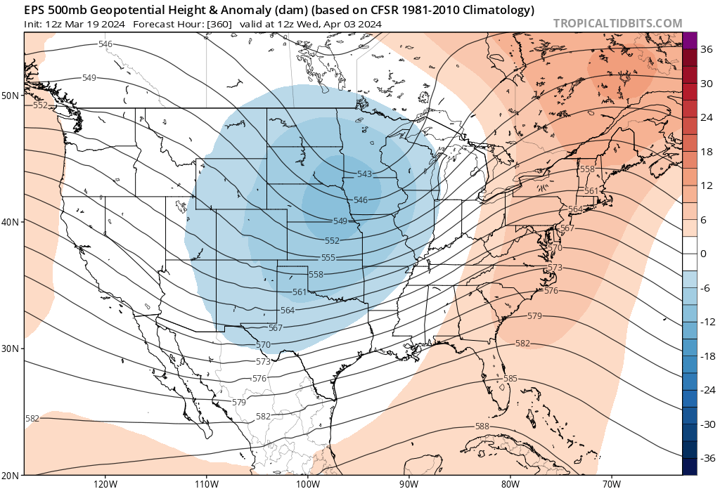
Ensembles trending wrong way for TX -
April 8th Eclipse- Last Easy One To See In My Lifetime
WxUSAF replied to Interstate's topic in Mid Atlantic
12z GEFS continues slower western trough trend, although not weaker. -
April 8th Eclipse- Last Easy One To See In My Lifetime
WxUSAF replied to Interstate's topic in Mid Atlantic
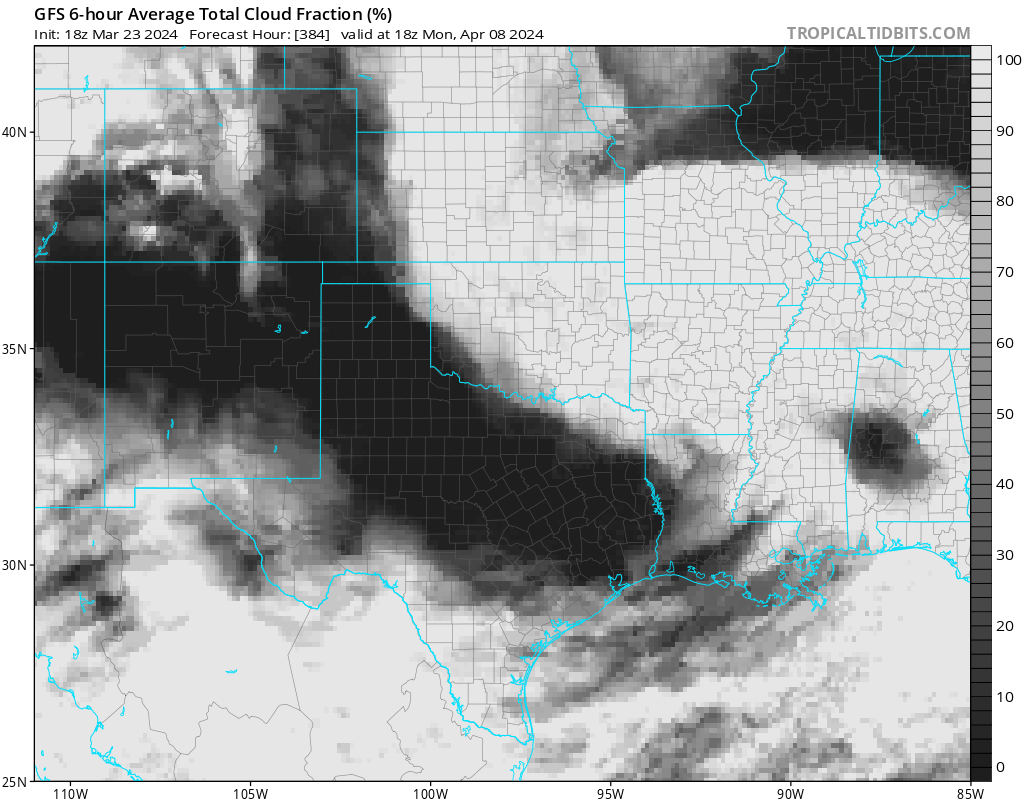
Somewhat positive start to the 12z suite with gfs and GGEM ops both again weakening and slowing the western trough. Keeps TX dry although verbatim there’s still clouds. -
April 8th Eclipse- Last Easy One To See In My Lifetime
WxUSAF replied to Interstate's topic in Mid Atlantic
^disaster Starting to get pretty worried. trend is for that western trough to be weaker and slower. I was hoping it would actually be faster and clear TX before Monday. But that doesn’t look like it’s happening. So I think I need to continue to root for weaker and slower and hope it doesn’t start pulling moisture into TX until Tuesday or after. -
What a washout of a week on tap starting late Sunday. 0z euro says 2-4” through the metro area.
-
That was dominant
-
April 8th Eclipse- Last Easy One To See In My Lifetime
WxUSAF replied to Interstate's topic in Mid Atlantic
We are doing more than just the eclipse but it would be a bummer -
April 8th Eclipse- Last Easy One To See In My Lifetime
WxUSAF replied to Interstate's topic in Mid Atlantic
10 days out and I’m starting to get worried for Texas… -
April 8th Eclipse- Last Easy One To See In My Lifetime
WxUSAF replied to Interstate's topic in Mid Atlantic
-
Rain looks east of progs?
-
Orioles opening day on the line
-
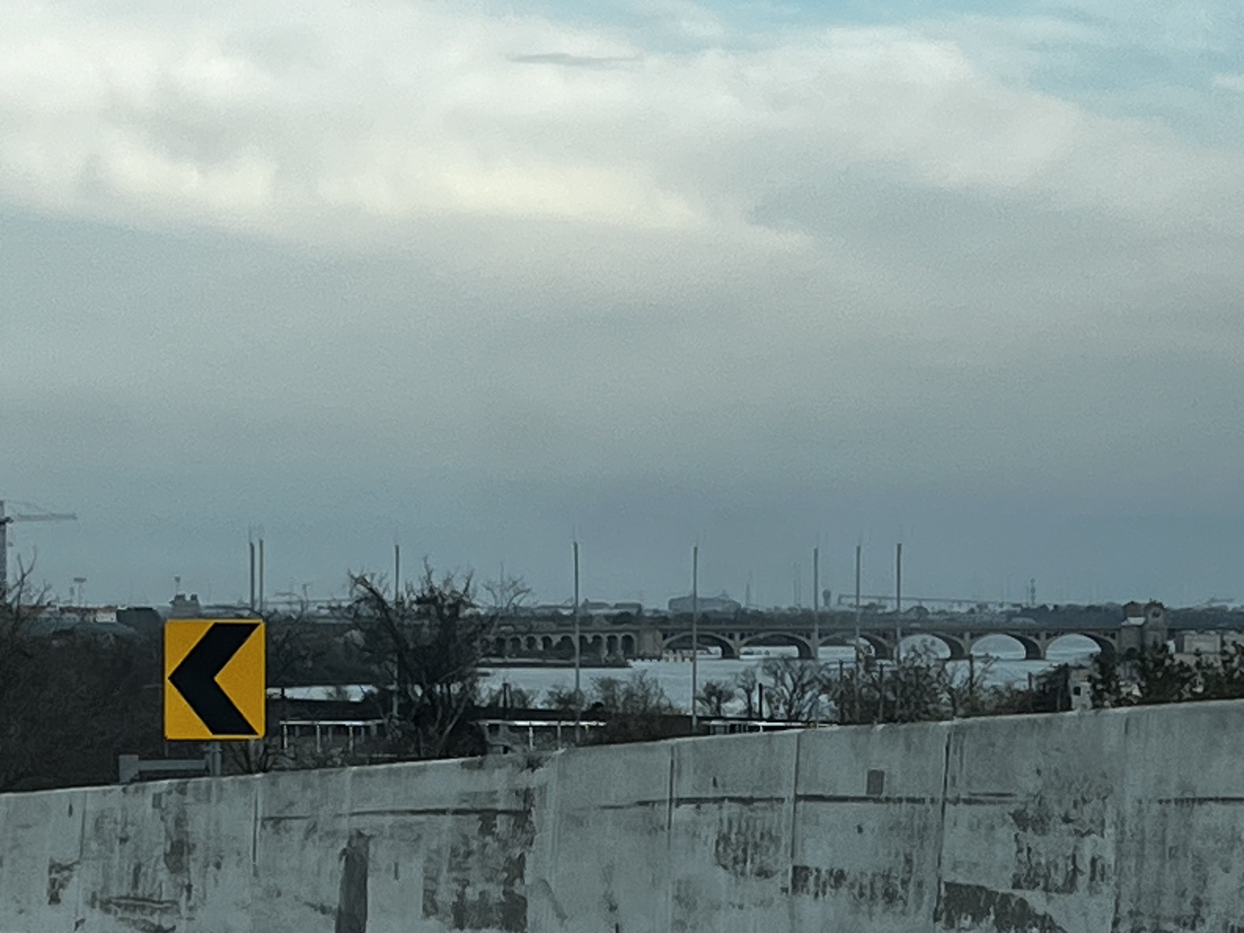
My view from Russell street ramp earlier

-
April 8th Eclipse- Last Easy One To See In My Lifetime
WxUSAF replied to Interstate's topic in Mid Atlantic
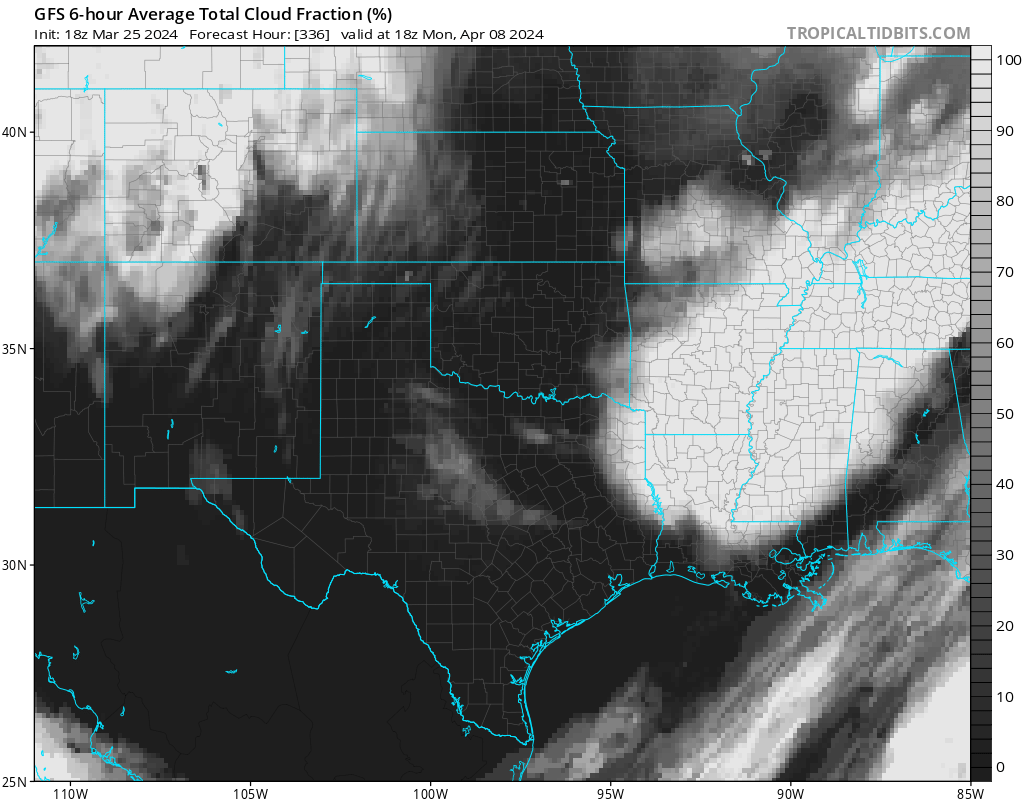
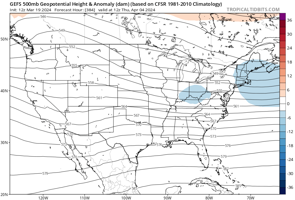
12z GEFS cloud cover is worst yet for TX totality path -
Think it’s lucky to have happened at the time of the day with the least possible traffic.
-
April 8th Eclipse- Last Easy One To See In My Lifetime
WxUSAF replied to Interstate's topic in Mid Atlantic
Yes please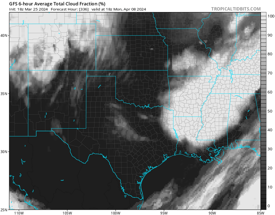
-
2024 Mid-Atlantic Garden, Lawn, and Other Green Stuff Thread
WxUSAF replied to mattie g's topic in Mid Atlantic
Violets are native at least! Host plants for some butterflies as well. -
Low of 25. Colder than I thought it’d be.
-
April 8th Eclipse- Last Easy One To See In My Lifetime
WxUSAF replied to Interstate's topic in Mid Atlantic
La la lock it up!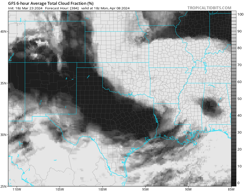
-
39 with driving rain. March!
-
He’s been banned repeatedly
-
BWI 28 DCA 32
-
Down to 25.9 just now per my PWS. Magnolia blossoms probably kaput.
-
Yesterday WTOP radio met called highs near 50 “well below normal” for this time of year
-
April 8th Eclipse- Last Easy One To See In My Lifetime
WxUSAF replied to Interstate's topic in Mid Atlantic
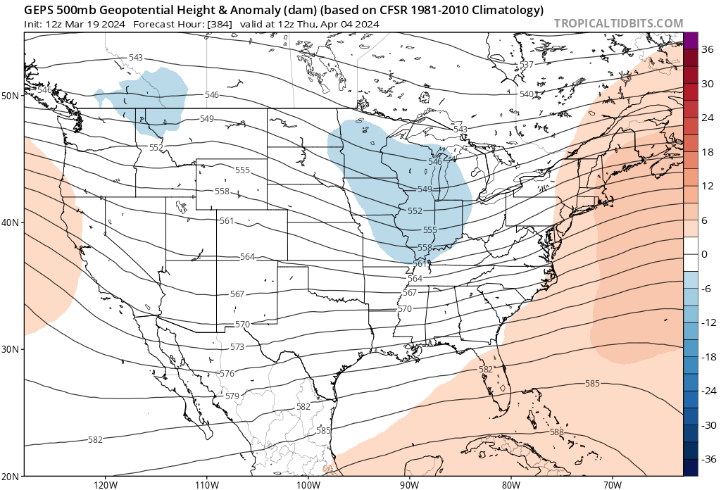
Eclipse weekend almost in ensemble range. All 3 systems suggest a trough in the middle of the country ahead of that and moving east. Hoping for a giant ridge over TX that weekend!


-
No contest #TheWorst