
Cfa
-
Posts
4,693 -
Joined
-
Last visited
Content Type
Profiles
Blogs
Forums
American Weather
Media Demo
Store
Gallery
Everything posted by Cfa
-
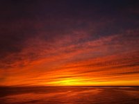
I often wish we had DC’s climate, or at least much less susceptible to BDCF’s. 82 here.
-
I have my 2902 connected to an Ecowitt GW1000 (GW1100 is the newer model) because my display had hardware/software issues and I didn’t feel like buying a new one. Ecowitt is owned by Fine Offset, the company that manufactures the 2902, so their stuff is fully compatible with the 2902. I don’t have access to AWN but it works for everything else (arguably more), and Ecowitt has something similar to AWN. The GW1000/GW1100 also supports accessories whereas my original 2902 display didn’t, lightning detectors, soil monitors, etc.
-
Blue sky CTG bolts associated with this Central Suffolk cell.
-
Not out here.
-
First rumbles of thunder for 2024. Light rain, heavy rain missing me to the west. I noticed the clouds starting to look pretty cumulonimbus about an hour ago and I thought I was wrong. It was just well into the 70’s and now this. Edit: Close lightning strike, sounded like an explosion, car alarms going off.
-
Just raw and miserable out here. Adventureland is open, I see people on rides, they’re nuts.
-
82. How can anyone hate this?
-
High of 77 here.
-
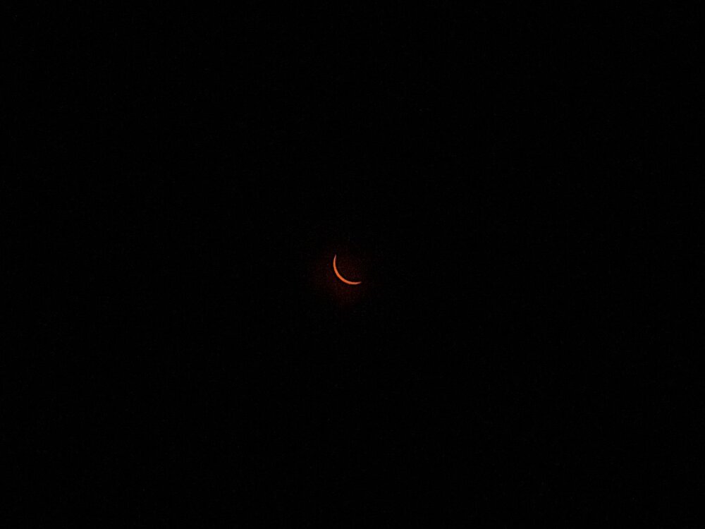
I saw posts last night from people still stuck in traffic in Vermont, when I had already gotten back to Long Island hours before, taking the scenic route, stopping multiple places along the way. I encountered zero traffic heading back down. Southbound I-89 in NH was Covid lockdown empty, which when coupled with the growing dimness from the eclipse became kind of eerie. Heading up I saw license plates from all over the east coast. None of them could’ve made it.
-
Taken with my phone in New Hampshire about 5 minutes after peak coverage. I came so close, this is going to annoy me for a while.
-
Getting quite dark here in NH. Dimmer than 2017 in LI.
-
I just bailed. I couldn’t take anymore near misses and stop and go traffic on I-91. My ETA slipped from before 2 PM to just after full totality. Going to Boston instead.
-
Contemplating taking the ferry and heading all the way up I-91 into the middle of nowhere tomorrow, but if it’s going to be cloudy I may stay put and enjoy my day off here in the 89% coverage zone.
-
Anyone else notice a gust of wind (pressure related?) with the arrival of the quake? I’ve heard this from multiple people in both NY and NJ. The glass door of the building I was in blew open and the roof made the loudest creakiest noise, like it wanted to collapse. I thought a helicopter or small plane struck the roof or something else nearby (I was near ISP). During the 2011 earthquake I lived in Queens, multiple stories in the air, my bed was bouncing and the building started swaying in a way that was uncomfortable. One wall developed cracks. Another quake in 2016, in the Rockaways, with an epicenter about 30-40 miles offshore. It was less than a 3.0 but I felt it and saw things moving. Much weaker than 2011 or today though.
-
Exactly 3 inches here, so many of these events since last year. I use to struggle to reach 2” in a calendar day.
-
0.72” here, rates fairly low so far.
-
75 again today, I didn’t expect that.
-
Topped out at 75 here, low was 35. Most forecasts had it reaching 66-68.
-
You’ll still get your 40’s at night. Currently 73, full sun, light breeze, feels dreamy.
-
Cherry blossoms opening up in deep Suffolk. High of 63 here.
-

Extended summer stormlover74 future snow hole banter thread 23
Cfa replied to BxEngine's topic in New York City Metro
https://www.cbsnews.com/colorado/news/colorado-ranchers-patrick-esch-ed-dean-jager-sentenced-rain-gauges-tampering-federal-crop-subsidies-nws-fcic/ KNYC’s thermometer next please. -
I saw this happening on the side of the road in Middle Island today and thought I was imagining things.
-
Extended summer stormlover74 future snow hole banter thread 23
Cfa replied to BxEngine's topic in New York City Metro
GTA: San Andreas’ soundtrack remains undefeated. -
High of 65 here, met spring feeling as it should.
-
It’s still crazy to me how we got Feb 2015 and Dec 2015 in the same year. Record cold in one winter month and the following winter month being so warm it’d rank among the warmest Novembers.


