

weatherwiz
-
Posts
81,342 -
Joined
-
Last visited
Content Type
Profiles
Blogs
Forums
American Weather
Media Demo
Store
Gallery
Everything posted by weatherwiz
-
Hopefully some day we'll get something like that again.
-
Thunderstorm triggering - and also keeping in mind we'd more than likely be looking at a pre-frontal trough triggering convection. Sunday we more than likely would see the actual cold front as the trigger which goes into Scott's point about Sunday's potential and towards the coast
-
Give me 25-30 higher
-
I am buying the NAM timing...the NAM is usually the model which is a bit too slow. Heights really fall too mid-to-late afternoon, even on the GFS. That too me signals leaning faster with timing (well one reason)
-
Timing is speeding up even more. May end up being a south and east of HFD day
-
AIT
-
it might be but this isn't
-
I'd watch for models to continue speeding up with the timing. There certainly could be a bit cutoff though within SNE where WOR is favored. Seeing the 18z NAM come in even quicker is something to watch...typically the NAM can be too slow.
-
I've been thinking the over the last 2-3 days the potential would be more western/central NY and PA and maybe SNE Sunday. However, looks like Saturday may end up being centra/eastern NY and PA into SNE. There are still timing differences but the NAM seems to be speeding up a bit. Good wind shear and solid height falls. Would like to see higher dewpoints and mid-level lapse rates but that's more pertinent if you're looking for outbreak type stuff. Just looking for thunder/lightning and a shelf cloud. Anything beyond is a bonus
-
Getting tingly about Saturday. Finally something to chase! What a boring week being off...nothing.
-
I’m super cautious as well, especially considering what we went through with the previous dog. Vet told us the same thing. Monitor over the next hour and if we notice her becoming in discomfort to bring her to the ER, otherwise we can wait until the 3:30 appointment. Also said to give her 25mg of Benadryl.
-
I wonder if a sting or the grass. The vet just texted back saying it may be hives too. We can bring her in for 3:30. What an expensive day…$2000 to get my AC fixed and I’m sure this will be a couple hundred bucks
-
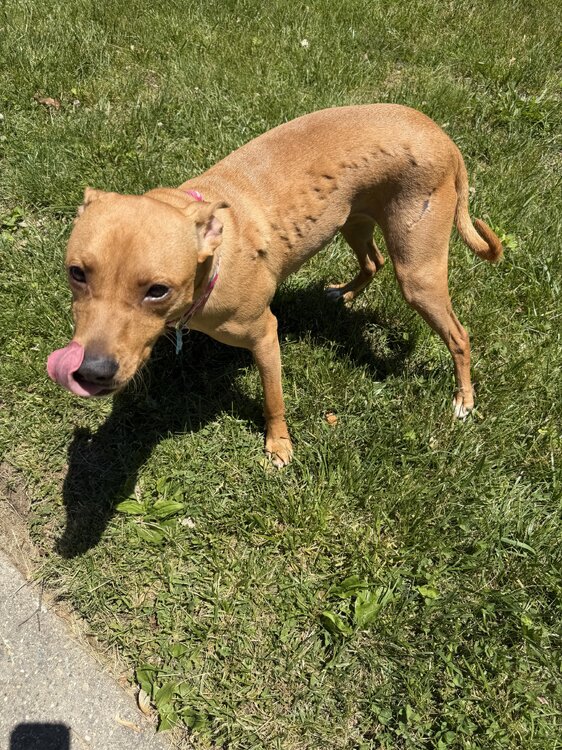
Yup. I rubbed my hands across and didn’t feel anything lumpy. A friend of mine said shedding but there’s no loose hair or hair coming off easily and it’s just that side.
-
I am wondering if it’s a grass allergy (though she’s been rolling around in the grass for the few weeks we’ve had her). She did eat a pup cone a few hours ago which is a peanut butter flavor. Was thinking bee sting but the skin doesn’t have any bumps. It’s just the fur
-
Texted the vet but a little worried. Never saw this. I was going to google it too but every time you google this stuff the return is usually some doom and gloom worst case scenario
-
Has anyone seen this happen with a dog before? Her fur is like bubbled up. She doesn’t seem in any pain or distress. Can’t feel anything on her skin
-
All the snow weenies care about are 10:1 and Kuchera
-
Signs were there for this I think. PVA streaming from the north and still pretty cold at 500
-
At least right now, nothing screams the developing EL Nino is a modoki, if anything it looks like we would be looking at a mixed or basin wide event given the strong anomalies in the (hostile) 1.2 region and Nino 4 region. Now, what would happen towards the end of the EL Nino event is a transition to a modoki EL Nino, which isn't uncommon for a weakening stronger EL Nino as region 1.2 tends to be the first to cool. In terms of impacts on the continental U.S. summer, Tip and I had some dialogue on this a few weeks back but I don't think there is much of a correlation and there are drivers. EL Nino's tend to not become fully established until late summer or even early Fall. An argument can be made that while the PAC is in the transitioning mode and this may have a quick and direct impact on the Hadley Cell but there atmospheric response can be quite often lagged to how the ocean is evolving and there are other factors to consider. Also, if we're just focusing on the impacts on summer to stronger EL Nino events, the sample size really isn't that great and at this point a strong event isn't even guaranteed. While the data may indicate that, we still need to get there first. IMO, I think some of the late winter/early spring responses within the Arctic and stratosphere held so much weight on the northern hemisphere pattern that we're still dealing with those impacts.
-
Weekend is going to be all about the warm front. I would not be surprised if guidance is a bit too hung up with the warm front and at least southern areas end up in the warm sector. But not a good sign when you see the sfc low weaken as it crosses the Great Lakes region. That's a good way to stall the warm front or transition it to a stationary front and we never truly warm sector and end up cool with clouds/showers. Uncertainty high for sure weekend and early next week...potential is there to get quite warm but need things to work out
-
Did anyone hear the boom? I did not
-
This is true
-
Just came back from Dunkin. Debated on pulling out the winter hat before I left.
-
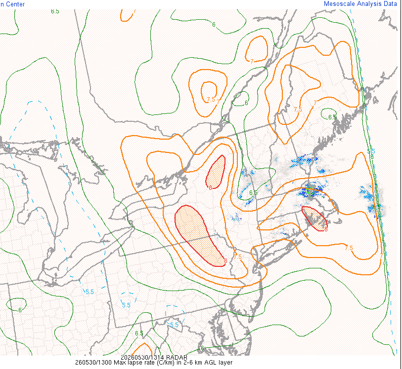
Quite breezy out there. Going to be an interesting over the next 3-5 hours out east when the LLJ maximizes with 2-6km lapse rates as steep as they are
-
llvl lapse rates may be steep enough to support gusts 35-40 mph inland. Also, the lack of rain farther inland and even potential for some cloud breaks may allow better than expected mixing (evident by the steep llvl lapse rates)


