Ralph Wiggum
-
Posts
17,383 -
Joined
-
Last visited
About Ralph Wiggum

- Birthday 08/06/1974
Recent Profile Visitors


-

E PA/NJ/DE Spring 2026 Obs/Discussion
Ralph Wiggum replied to PhiEaglesfan712's topic in Philadelphia Region
Buckle up:
-
E PA/NJ/DE Spring 2026 Obs/Discussion
Ralph Wiggum replied to PhiEaglesfan712's topic in Philadelphia Region
So aside from the subforum merger, what's our next trackable event? Severe? Floods? Heatwave? -
E PA/NJ/DE Spring 2026 Obs/Discussion
Ralph Wiggum replied to PhiEaglesfan712's topic in Philadelphia Region
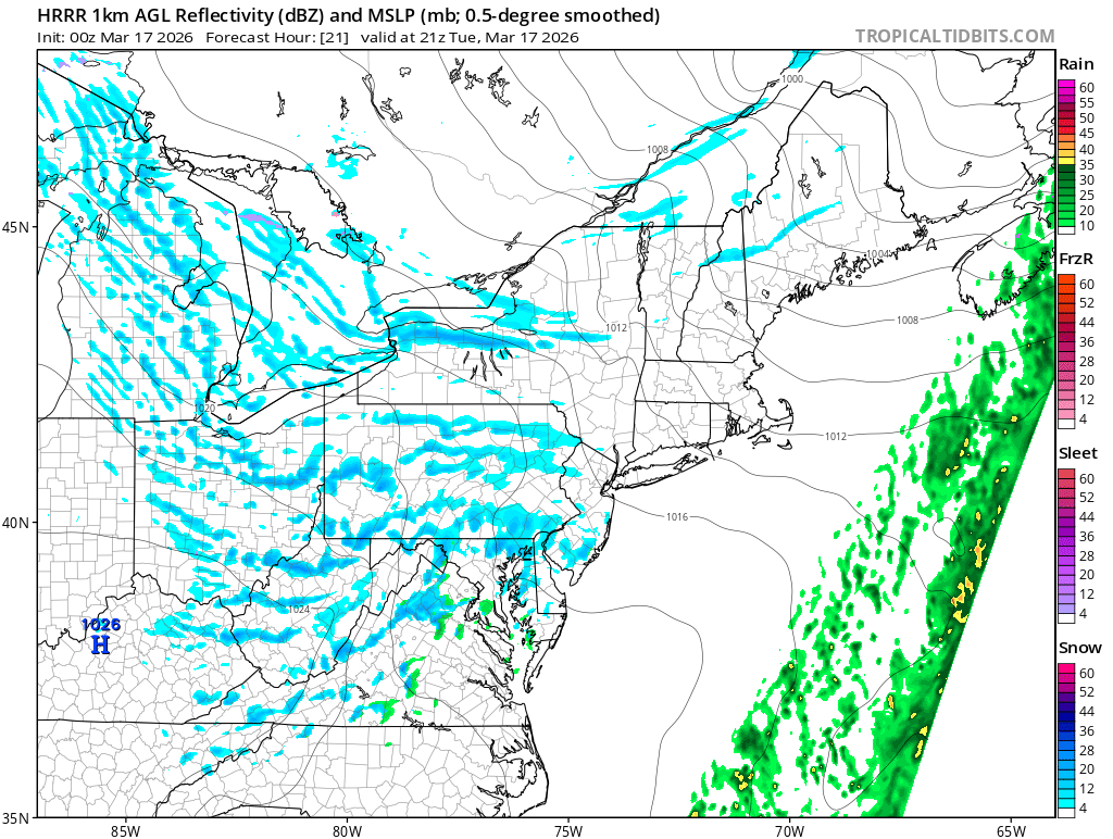
Hrrr looks squally tomorrow afternoon
-
E PA/NJ/DE Spring 2026 Obs/Discussion
Ralph Wiggum replied to PhiEaglesfan712's topic in Philadelphia Region
Was there severe weather anywhere in the state? This was being billed as the largest most severe threat in many years. -
E PA/NJ/DE Spring 2026 Obs/Discussion
Ralph Wiggum replied to PhiEaglesfan712's topic in Philadelphia Region
I have friends and in SE Bucks and Delco family blowing up my phone asking about these tornadoes and dire severe warnings with schools letting out early. Apparently the local news is breaking in to TV shows about it. Oh brother.... -
Flyers have a solid goalie in Vladar. Tho every time they get a G with promise, they trade them away. We'll see what happens here. Zegras is a spark. A few other younger guys with some promise too.
-
Flyers really piss me off. That is all.
-
Welcome aboard! This is the only place to post, dont let anyone tell you otherwise. We are a close group, no a-holes in group. We are a "less is more" place with fewer folks but high quality. You will fit in perfectly. What part of the area you moving to? Stay away from Pats and Ginos btw. Again, welcome!
-
E PA/NJ/DE Spring 2026 Obs/Discussion
Ralph Wiggum replied to PhiEaglesfan712's topic in Philadelphia Region
Love this!!!! -
E PA/NJ/DE Spring 2026 Obs/Discussion
Ralph Wiggum replied to PhiEaglesfan712's topic in Philadelphia Region
High of 37 coming tuesday, high of 39 wednesday. It just snowed 2 days ago. Am I missing something? Sustained cold isnt really a thing this tme of year but a day of 2 BN here and there works. -
E PA/NJ/DE Spring 2026 Obs/Discussion
Ralph Wiggum replied to PhiEaglesfan712's topic in Philadelphia Region
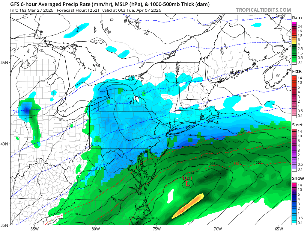
Hey, some of us are too busy over analyzing the fantasy snowstorm on the long range gfs. Right where we want it: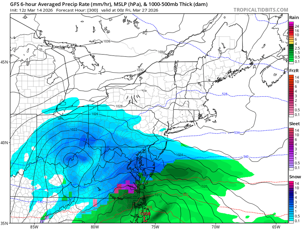
-
E PA/NJ/DE Spring 2026 Obs/Discussion
Ralph Wiggum replied to PhiEaglesfan712's topic in Philadelphia Region
Ditto on the power loss for a brief time today -
E PA/NJ/DE Spring 2026 Obs/Discussion
Ralph Wiggum replied to PhiEaglesfan712's topic in Philadelphia Region
This winter has been persistent no matter what happens between now and Tax Day. One to remember. Here's a 360hr norlun for fun:
-
E PA/NJ/DE Spring 2026 Obs/Discussion
Ralph Wiggum replied to PhiEaglesfan712's topic in Philadelphia Region
Right, sun angle and stuff -
E PA/NJ/DE Spring 2026 Obs/Discussion
Ralph Wiggum replied to PhiEaglesfan712's topic in Philadelphia Region
Heavy snow. Mulch and car tops caving. 35F