CT Rain
-
Posts
26,272 -
Joined
-
Last visited
Content Type
Profiles
Blogs
Forums
American Weather
Media Demo
Store
Gallery
Everything posted by CT Rain
-
You have low clouds in Moosup today?
-
Without a doubt in the winter you'd lock in 1-2 feet EOR.
-
meh The extent of my investment in this is "wow, looks rainy next week"
-
lol you're ridiculous
-
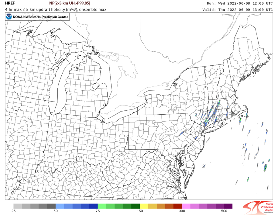
Pretty classic pattern for a summer deluge. Depending on the orientation/location of the ULL there could be a severe threat too.
-
Stein had a nice run.
-

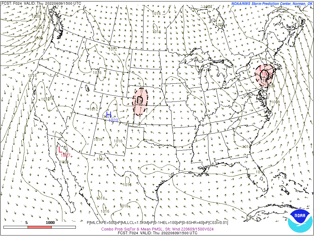
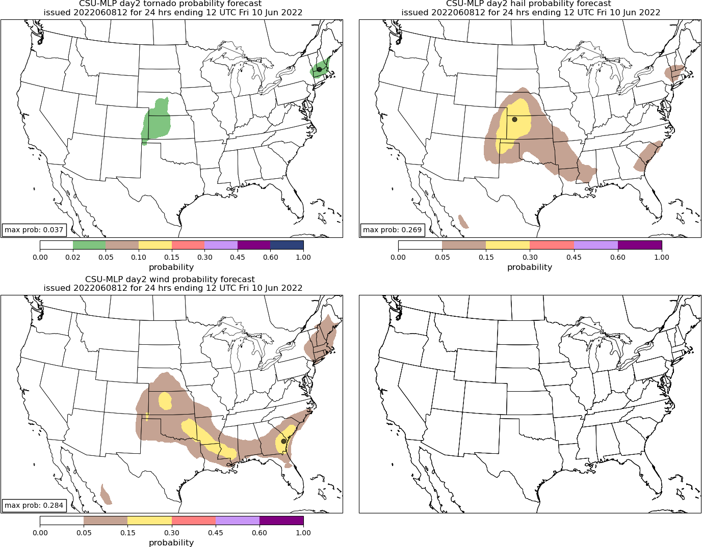
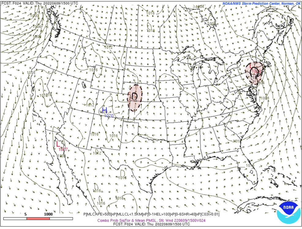
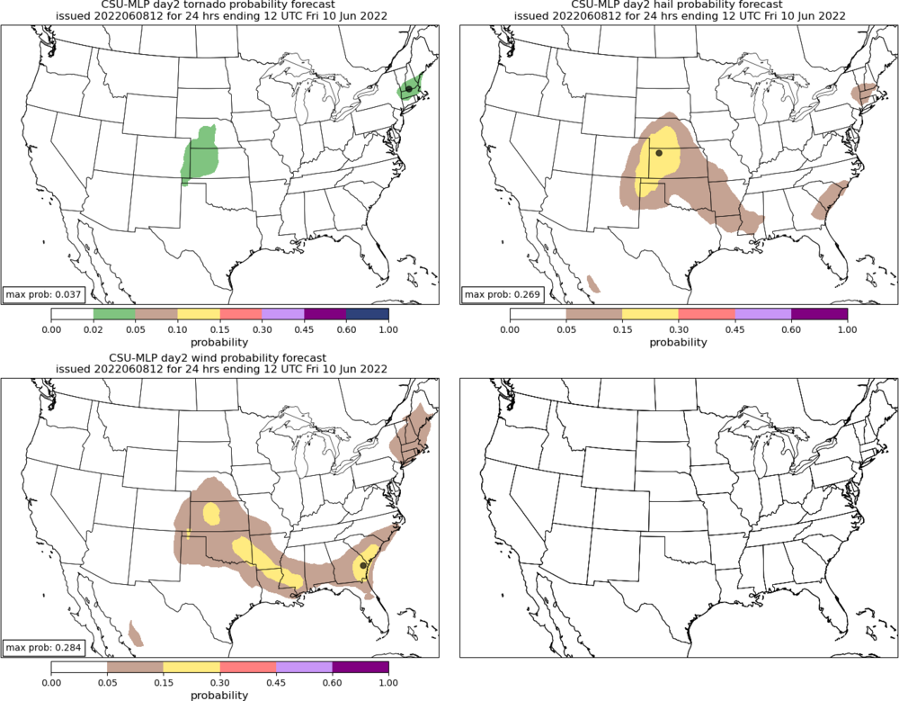
Severe Weather Threat Week...so many threats!!!
CT Rain replied to weatherwiz's topic in New England
That day was the worst -
Tomorrow's severe threat looks decent. Plenty of low level/deep layer shear. Wouldn't be surprised to see a spinner or two in New England.
-
Wiz... I'm very disappointed you haven't posted about the NAM for Tuesday PM!
-
Can I share that on air with credit to you?
-
Really D10-D15 that's chilly/wet on the GFS.
-
The GFS looks worse
-
Watch the warm front tomorrow morning.
-
lol drunk.
-
May have to watch for some storms Friday night on the leading edge of the EML with that convectively induced vort.
-
Looks pretty good to me WOR. I think there's definitely a tornado threat W CT and Hudson Valley as wind fields increase later this afternoon and surface winds remain backed a bit.
-
There could definitely be a dud day or two next week if one of those shortwaves tracks underneath us.
-
-
Yeah I have partly/mostly cloudy and low 50s. Not great.
-
What a nightmare that is.
-
Saturday, March 26, 2022 Convective Grauple/Small Hail/gusty Showers
CT Rain replied to weatherwiz's topic in New England
Decent look for Saturday. Some hail/graupel plus a change to snow in the hills. GFS has TTs spiking to 64 around here which is about as high as you'll see... and the instability doesn't just peak for an hour and abate... it's there for a few hours. -
Saturday, March 26, 2022 Convective Grauple/Small Hail/gusty Showers
CT Rain replied to weatherwiz's topic in New England
Yeah... TTs spike above 60 for a time. Definitely has a squall look for the higher elevations. -
March 2022 Obs/Disc: In Like a Lamb, Out Like a Butterfly
CT Rain replied to 40/70 Benchmark's topic in New England
I had 10" of extremely heavy wet snow in Guilford at 250' ASL. Lots a tree and some big branches. Was quite a storm! -
March 2022 Obs/Disc: In Like a Lamb, Out Like a Butterfly
CT Rain replied to 40/70 Benchmark's topic in New England
Boxing Day was the worst. The firehose storm was annoying. -
March 2022 Obs/Disc: In Like a Lamb, Out Like a Butterfly
CT Rain replied to 40/70 Benchmark's topic in New England
I'm not sure I've ever been angry about not getting 5" of snow on March 23rd.