CT Rain
-
Posts
26,272 -
Joined
-
Last visited
Content Type
Profiles
Blogs
Forums
American Weather
Media Demo
Store
Gallery
Everything posted by CT Rain
-
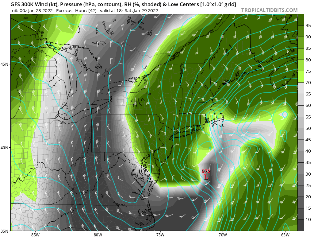
 One reason to be bullish back to the west into CT and LI... even the GFS with its wonky depiction has a great look to the west. In fact it introduces dry slot issues for Boston. Check out the 300K isentropic surface at 18z. I also attached an area averaged sounding for SE Mass.
.thumb.png.05305f4c1f640fc71907f63aaa874156.png)
-
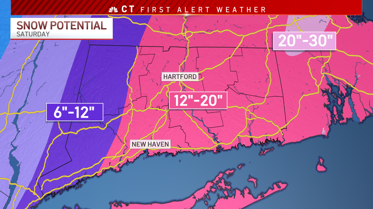
The GFS is about 1" of liquid for HFD/HVN. Given the fact it's busy bumping west and catching up with everything else you have to give the nod to the Euro. Given somewhat better than 10:1 ratios even a straight GFS/Euro compromise would get you 12-20.
-
Big QPF jump on the GFS ensembles from 18z to 00z. Sort of time to toss them since they've been trash.
-
I was actually getting ready to go pick up dinner with Scott and Legro texted me lol
-
Yeah I'm happy with our numbers right now. Obviously big error bars here but we'll see.
-
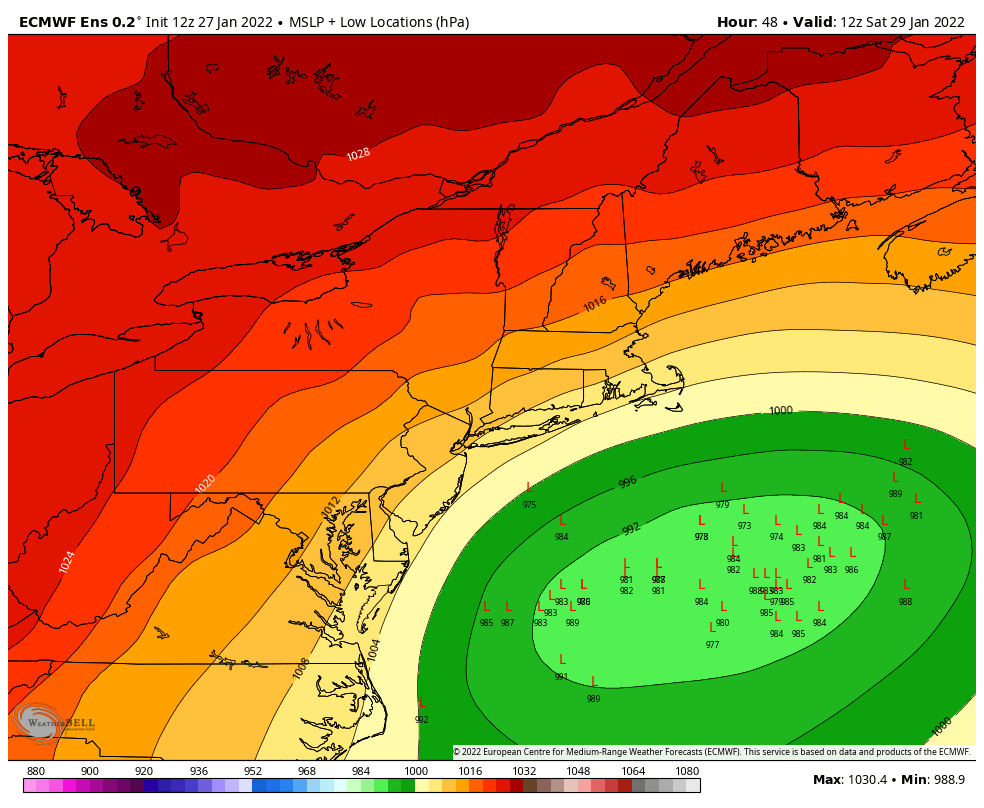
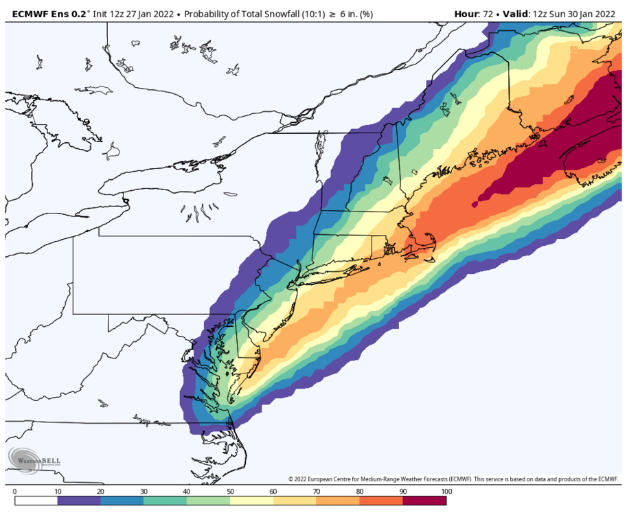
Exactly. There's something weird going on. The fact that 30% of the Euro Ens members don't even give Boston 6" shows that this setup is really freaking challenging.
-
I don't think a lot of people realize how unusually sensitive this forecast is to fairly small changes in the evolution. The fact that all of the mesoscale models are way out there and the EPS distribution has grown quite a bit from 0z to 12z is a pretty big red flag. I'd hedge toward a bigger solution but man there's a lot that's pretty weird about this one.
-
The 18z NAM 3km is a disaster. Way east.
-
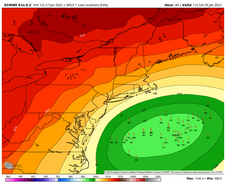
The weird thing is we have seen the spread increase in the EPS fairly dramatically from 00z to 6z to 12z. And it's no just the dual low thing... there are some real eastern outliers that are struggling to get precip even to Boston. Doubt they're right but a few red flags to consider.
-
As mentioned the spread in the 12z EPS has only grown larger from 06z and 00z. Not really what you like to see this close to an event. What surprised me was how many members have really ugly solutions. For example, 30% of members have <6" of snow for Boston. That's not an insignificant amount and it has increased from 00z.
-
Looks like more along track spread more than anything else.
-
700 low track is a bit east for my liking here. BUT that 500mb low track is juicy for us. So a decent look for some deform snow even far west.
-
Seems like the goal posts are narrowing now. I think getting >12" here is starting to get pretty tough. We're seeing a tick east with the hugged solutions and a tick west with the OTS ones. I like 6-12" for HVN/HFD to the RI border for now.
-
GFS is better. Definitely west some.
-
Even the confluence to the north over Canada looks better.
-
Appreciate it! Been a weird storm to communicate but feel like we can still provide context/value that you can’t get on an app.
-
Thanks yeah. I didn’t want to show the same stuff I’ve been showing. Figured it was a different way to express the uncertainty which is definitely higher than normal.
-
I showed the NWS 10th/90th percentile forecasts. First time I've ever done that lol
-
Yes but this is definitely more uncertain than most. The 10th/90th percentile NWS forecasts tell the story well with 0" to 18" in Hartford.
.png.477ac47fba37e210433bf5aacaca9b11.png)