CT Rain
-
Posts
26,272 -
Joined
-
Last visited
Content Type
Profiles
Blogs
Forums
American Weather
Media Demo
Store
Gallery
Everything posted by CT Rain
-
Fake Cold.
-
Looks like the plug has been pulled on tonight's flurries lol
-
And it's also not your typical fire hose LLJ/warm advection push backing in. Seems like it's some low level frontogenesis and some upper level support getting it done.
-
Hopefully the pope weighs in soon on this storm.
-
Develops into a hybrid kind of system over the Gulf Stream with a bit of a warm core.
-
Very Winter '22/'23. Lock it in.
-
At least it snows in Vermont!
-
Wow the Euro is really close to an epic solution. Going to be fun to track.
-
Any thoughts on how Sunday will be? Was thinking about either Mount Snow or Okemo?
-
Temps are pretty borderline south of the Pike. Not too excited.
-
EPS looks a little bit better for the Monday deal.
-
Stowe was really good this morning. Snow was super soft and not terribly heavy and slushy. Fun to ski on with a total March vibe (sun was out quite a bit this morning). That said, they need snow badly. Not sure how much more of a beating they can take. Went in to drink by 1.
-
Blah. How bad will it be tomorrow? haha
-
Heading to Stowe for Saturday and Sunday. Every New Year's ski trip I take is a disaster
-
 Looks like 43.0" at the Airport. https://nwschat.weather.gov/p.php?pid=202212251442-KBUF-NOUS41-PNSBUF
 -
Yeah the BDL record is on April 27th, 1962 (94 to 41) The 2 day temperature swing is 1/27-1/28/1994. (53 to -10)
-
BDR is down to 11F which makes their diurnal temperature range 46F. The record is 48F. Central Park tied their record of 48F this evening. Wild.
-
Can't wait for a thread about 50s and rain.
-
How'd the resorts make out?
-
It verified. JFK gusted to 50 knots.
-
Obs aren't impressive around Philly now which should be doing a bit better based on the model soundings near the cold front.
-
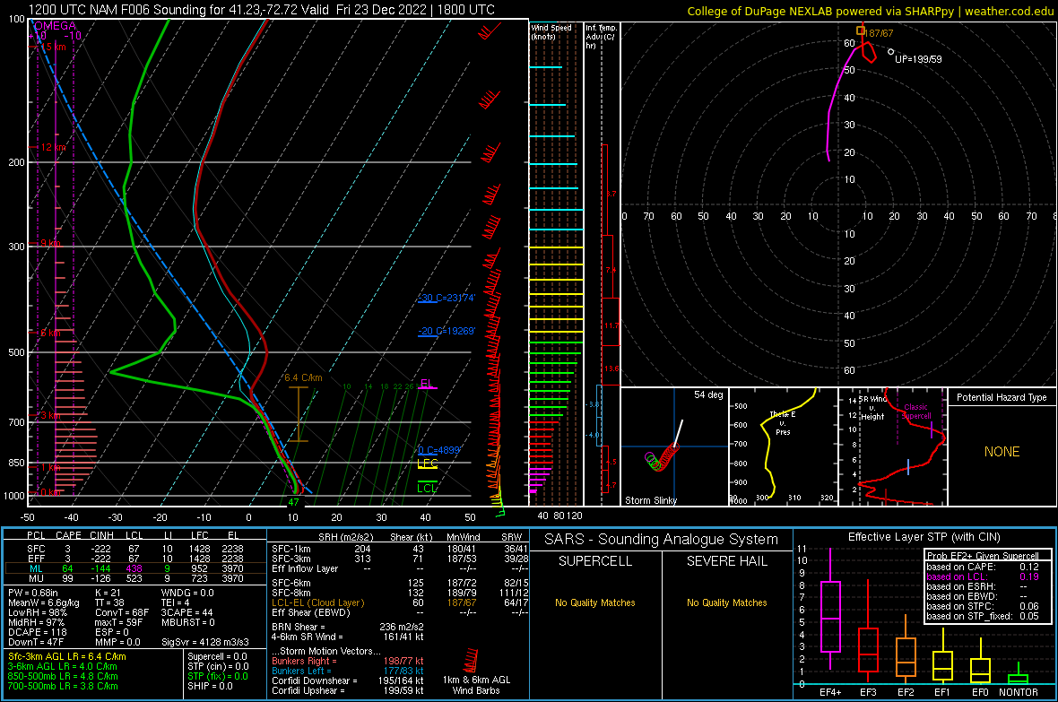
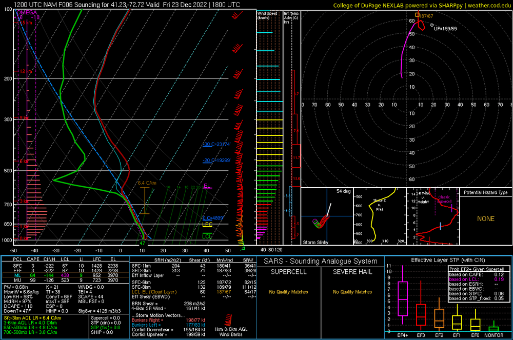
The cold fropa could be very nasty. Sounding is for New Haven.
.png.e454be751d11b8a1438d23267f4a27c3.png)
-
50 knots MHT and 55 knots HIE
-
HFD gusted to 50 knots at 554a.
-
Yeah it’s roaring here in West Hartford.