Dunkman
-
Posts
2,115 -
Joined
-
Last visited
Content Type
Profiles
Blogs
Forums
American Weather
Media Demo
Store
Gallery
Everything posted by Dunkman
-
Looks like you have the last band of heavy wind over you right now. Should get better soon I think?

-
It's mixing down very efficiently. Radar has us with 60mph winds at like 5k feet and we're getting gusts in rain bands pretty close to that. Watch out whoever ends up under that band. I would not be surprised to see those 80mph gusts verify.
-
That SVR warning for the nasty looking band east of MT. Airy mentions 80 mph gusts. Do not want.
-
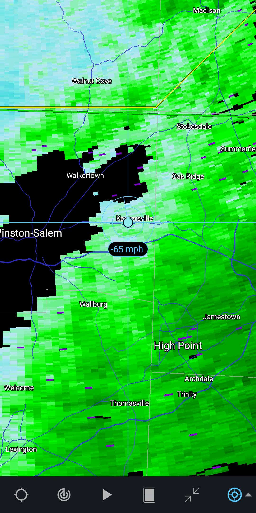
It's really picking up in the Triad now. We've had a couple gusts around 40mph in the last 15 minutes.
-
It's a little odd with Zeta because although there's some warming of cloud tops on the south side it's nothing like you usually see when the south side of a storm falls apart.
-
Certainly doesn't look like there's a whole lot on the south side on radar now.
-
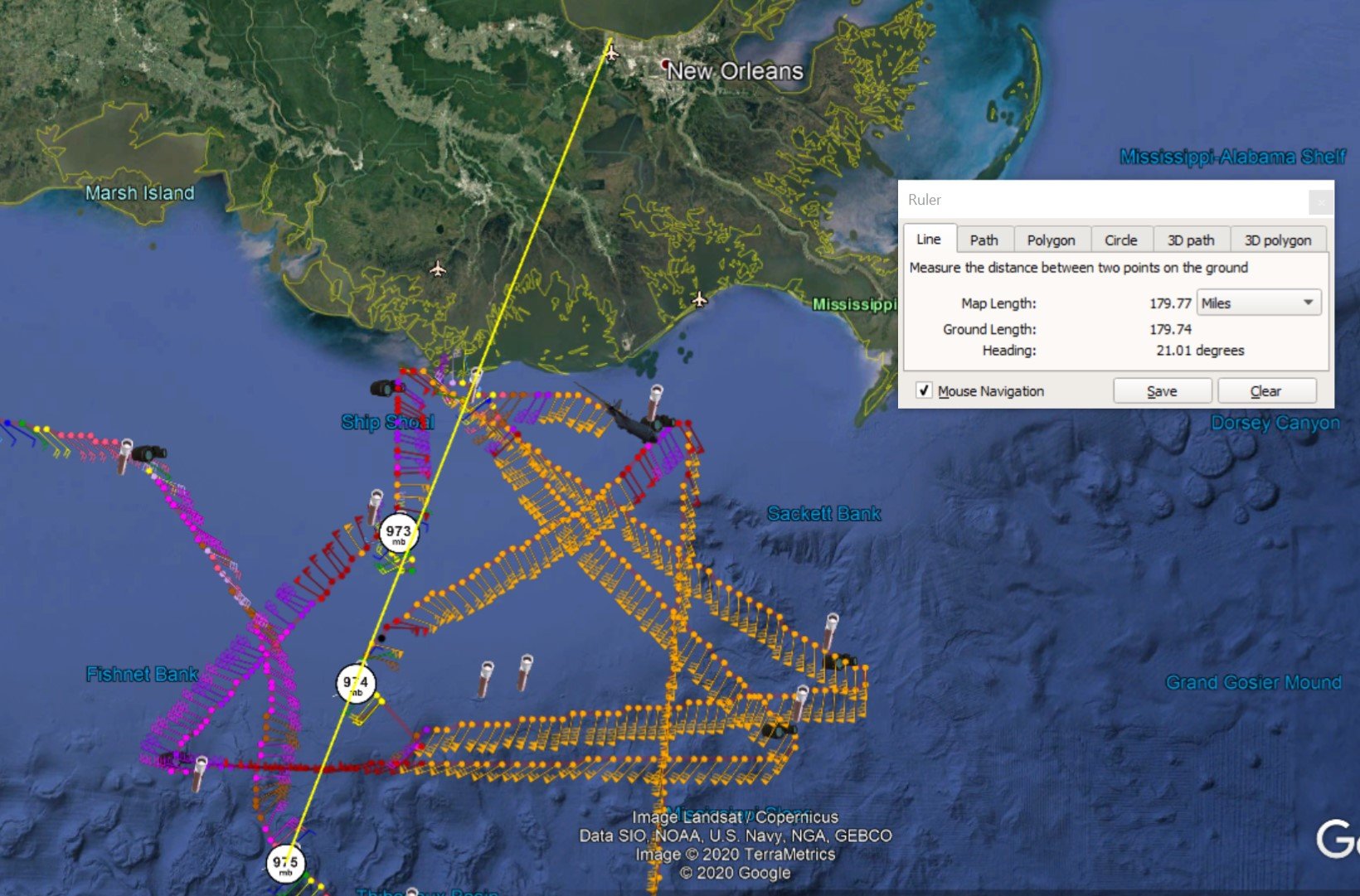
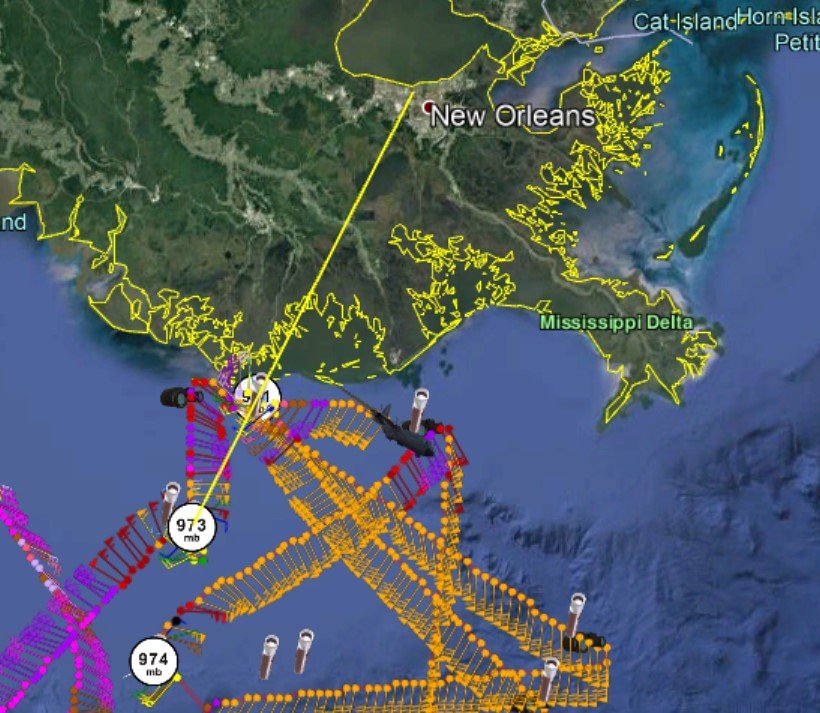
So unless there's a change of motion I don't see how NO misses it entirely. If you take either the short term more easterly motion or a more longer term look it still goes over the city.

-
Looks like a bit of a wobble back to the east from the last couple dropsondes.
-
Yeah the NC mountains are under a TS warning. That's a first I think.
-
At GSO they received 2.0" with 0.26" QPF which ended up being right in line with the Kuchera estimate of 7-8:1 for the area in the HRRR.
-
Still some light snow falling here in the Triad but I'd guess accumulations are over. Measured 1.5" on the back deck which is certainly more than I expected this morning. Nice to have something to track and see some snow fall.
-
Officially 0.7" at GSO as of 4:24. Glad to have the streak gone!
-
So is it really actually going to snow in southern Wake this time? Are we sure? Oh and nice SN here in High Point, sticking to the deck and some in the grass.
-
I just can't believe that it's a lack of moisture that's going to do us in. What a slap in the face after suffering through the wettest start of the year ever.
-
You know if it ends up too warm and we get a lot of white rain I can live with that. It's what you'd expect from this pattern. If the precip fizzles out after every storm for months has over performed that's going to be really annoying.
-
I mean of course a good Euro would bring me back but after what I've seen so far today I'm out. The NAM and the GFS with no ensemble support against the world isn't really where I want to be 2 days out. Definitely the most exciting and important suite of model runs this winter for NC, it's a shame it's mostly flopped.
-
I'm pretty excited about getting NAMed at least once this year. It's a big step forward!
-
Fun fact about February 1990, it was right in the middle of the longest snow drought on record here in the Triad. They may be onto something with this Arctic Oscillation thingy.
-
I'm happy to see the 60s will be back for the start of Fab Feb!
-
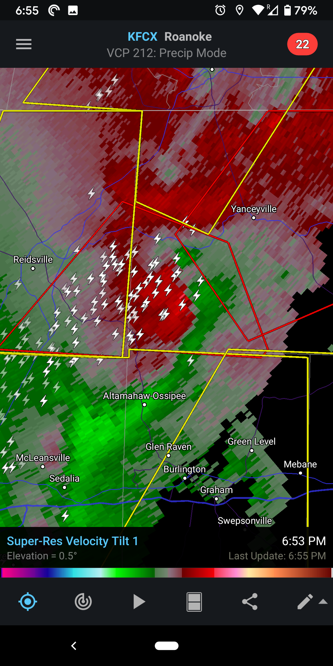
That warned storm north of Greensboro has really gotten it's act together

-
Tornado warning in Guilford County. That part of the line went over my house less than 10 minutes before it was warned. Pretty wild few minutes.
-
Yeah the graphic they have for the watch is all wrong here's the text: The tornado watch area is approximately along and 85 statute miles east and west of a line from 20 miles west southwest of Columbia SC to 30 miles northeast of Greensboro NC. For a complete depiction of the watch see the associated watch outline update (WOUS64 KWNS WOU8).
-
How long do you think it'll be before we keep reliving Sandy in painstaking detail every time there's a hurricane? I'm setting the o/u at 2050.
-
With every post I've seen saying a model is going west the last 2 days it should be hitting Texas by now.
-
Yeah and honestly it seems like the NHC was maybe a little late with the hurricane watches. I really think the wind radii expanding out relatively rapidly is a pretty big concern. I know they didn't go with the actual reading but I can't say I ever remember a dropsonde measuring 200+ at the surface before. Anyone else?