Dunkman
-
Posts
2,115 -
Joined
-
Last visited
Content Type
Profiles
Blogs
Forums
American Weather
Media Demo
Store
Gallery
Everything posted by Dunkman
-
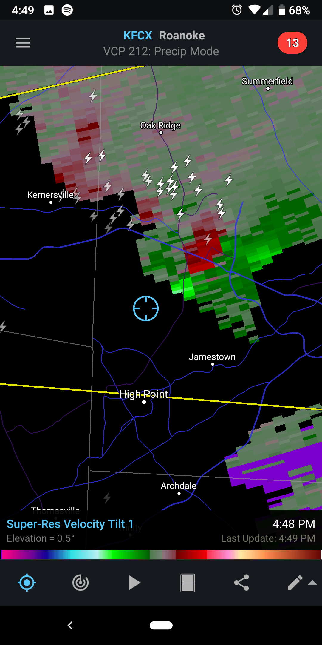
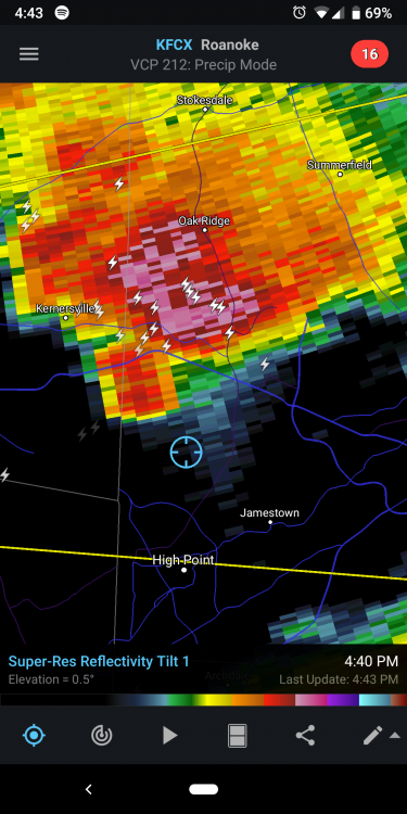
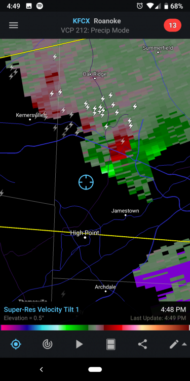
Odd timing on that the storm is much weaker than it was 20-30 minutes ago. Another warning now for the storm near Concord.
-
For sure. The hail marker is up to 2.25" for that storm as well. That storm is like 75 dBZ just WNW of Greensboro. I'd imagine there will be a lot of storm reports rolling in soon.
-
Yeah I have a pretty good view from here. It's definitely rotating.
-
Storm that just moved through Winston probably needs a TOR soon
-
Nice little notch on that storm
-
Nothing even remotely interesting materialized here in the center of the Triad but hey look it's more rain...
-
This only being warm enough to rain for the 12 hours it's actually precipitating thing is some bs
-
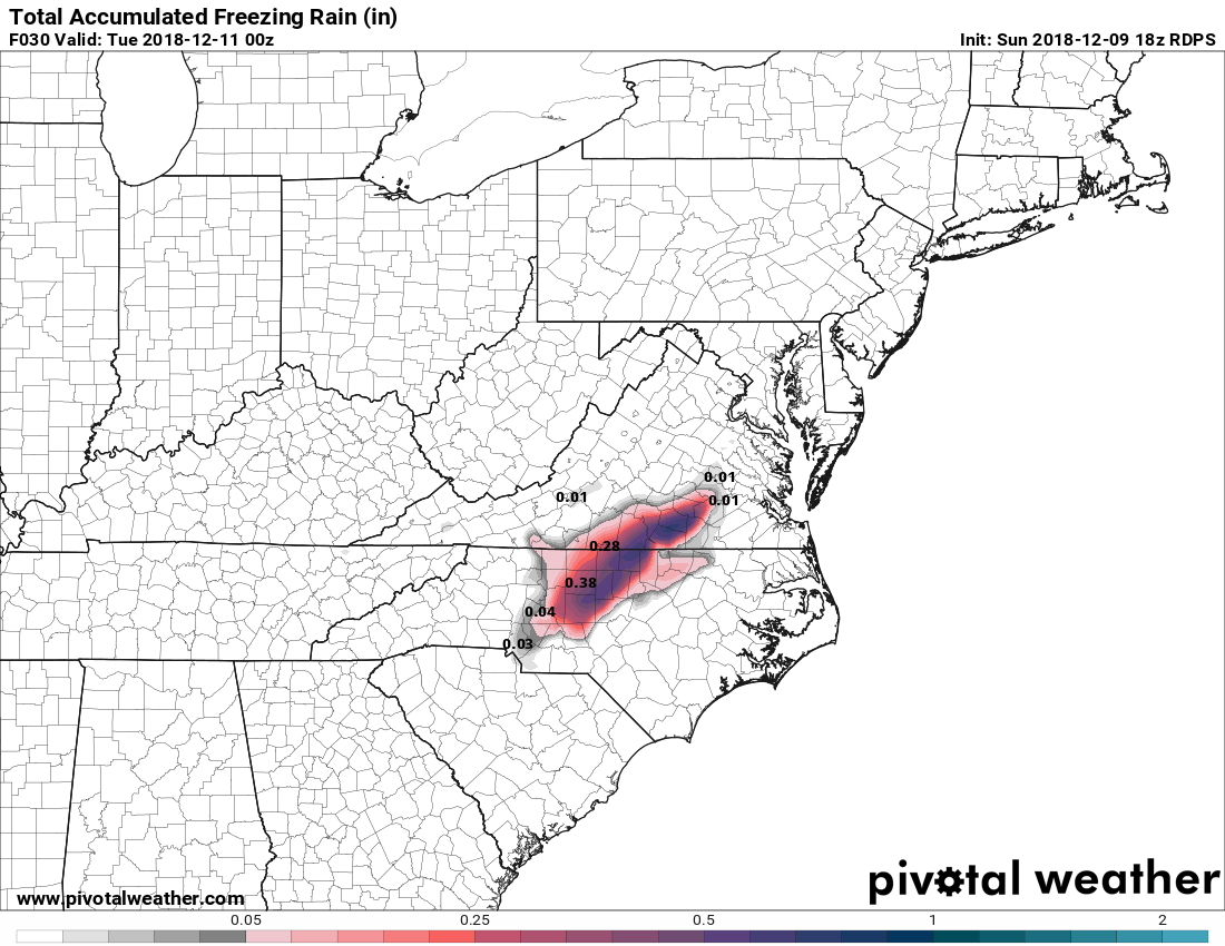
It's all zr right now I don't think you're missing out
-
Lol thanks. I need to sleep probably.
-
Sure

-
There's actually a pretty substantial stripe of ZR on the RGEM from the Triad and points ENE.
-
-
There were some people on the edges of the transition zones in which the NAM seemed to give the most accurate forecast but as a whole it was pretty bad for this event compared to the other guidance.
-
Probably location dependent but in general temps are supposed to get better as the night goes on and into the morning hours.
-
Just want to say I'm glad we can go back to treating the NAM like crap. This new world in which it was a trustworthy and respectable model was not a place I was comfortable living.
-
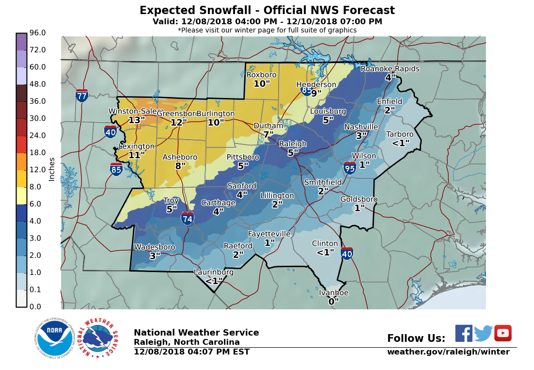
My point and click has me at 9-16 now. I'd take 9 in a heartbeat and be thrilled about it, they sure are optimistic at RAH tonight.
-
Our WSW doesn't even start until 1am. Isn't that what's supposed to happen?
-
It's fine that's just the column cooling down. Has nothing to do with the warm nose that may/will push in later.
-
Thanks, yeah I hope so. Takes a perfect setup for us to stay snow when the QPF approaches an inch or more and this is not that. I'll be happy to take our usual this early in the season.
-
Here's the number guesses instead of ranges. I haven't had a foot at my house since I bought it in 2006. Not expecting it this time either but it's nice to see.
-
We'll see what ends up happening but I was wondering if the second round may start showing back up on some models. It's the kind of thing I recall showing up very late in the modeling more than once in the past.
-
I remember a few years ago we had a basically all sleet storm. It was kind of amazing in its own way. We had something absurd like 5" of sleet but the really crazy thing was the foot deep sleet drift on my back deck where it had rolled down the roof and piled up. I don't remember how long exactly but it took forever for it to melt. Feels like it may be time for another one of those. Also instead of snow cream we tried to make snow icees from the sleet. Do not recommend. Maybe get some fruit flavored syrup instead of vanilla/sugar/milk or something.
-
Oh we're all going to be in here for this one I think!
-
I have a feeling everyone who isn't in the mountains or Virginia is gonna end up here before we're done. As for us in the triad, I really don't like being a few miles from disaster on both the NAM and RGEM.
-
Absolutely. As you know I'm sure, it can always sleet here. We've had mostly IP storms when the models never even hinted at mixing until in the short range.