
Superstorm93
-
Posts
8,256 -
Joined
-
Last visited
Content Type
Profiles
Blogs
Forums
American Weather
Media Demo
Store
Gallery
Everything posted by Superstorm93
-
Check out those new towers...
-
Recon is finally departing. Looks like we'll have a fix in a few hours.
-
Convection really exploding in the northern portion of the circulation. Banding has improved considerably as well.
-
They may be overestimating the amount of shear coming from Gamma. It's really hard to see this not blowing up.
-
The GFS sounding though...
-
Delta is really starting to get that "look" to it this morning. Will be interesting to see if it can take advantage of the favorable conditions ahead..
-
Looks like the GFS wants to bring down another TUTT ahead of the system behind 97L and shear/land interaction eventually kill the system off. Pretty notable changes with regards to TCG in general, but we're still a long ways out from knowing is this has a shot at surviving past the islands. 97L should have a pretty decent environment in the Western Caribbean later this week, but we'll see it if it can slow down to take advantage of it.
-

Central/Western Medium-Long Range Discussion
Superstorm93 replied to andyhb's topic in Central/Western States
Very nice pattern in the LR Could be a start to another active end to the month. -
Central/Western Medium-Long Range Discussion
Superstorm93 replied to andyhb's topic in Central/Western States
-
Central/Western Medium-Long Range Discussion
Superstorm93 replied to andyhb's topic in Central/Western States
-
Central/Western Medium-Long Range Discussion
Superstorm93 replied to andyhb's topic in Central/Western States
All Day 7 risks so far... http://tweetimgs.pmarshwx.com/pmarshwx/20160421/20160421022044.png -
Central/Western Medium-Long Range Discussion
Superstorm93 replied to andyhb's topic in Central/Western States
Looks like we're going to be busy again soon.. -
Central/Western Medium-Long Range Discussion
Superstorm93 replied to andyhb's topic in Central/Western States
Maybe some more action next week. -
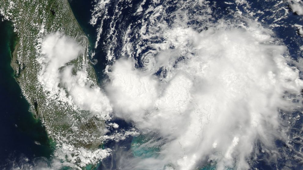 Our first storm of the season has come to life off the SE coast. Stay with us to get the latest information as it moves up the coast line.
 -
Historic Tornado Outbreak April 27, 2011
Superstorm93 replied to CUmet's topic in Weather Forecasting and Discussion
Honestly, I don't think they knew any better. Some of the folks in the videos barely knew they were looking at a tornado. -
Historic Tornado Outbreak April 27, 2011
Superstorm93 replied to CUmet's topic in Weather Forecasting and Discussion
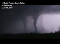
One of my favorites of all time... Who says that tornadoes can't cross large hills? The structure is simply incredible. -
Historic Tornado Outbreak April 27, 2011
Superstorm93 replied to CUmet's topic in Weather Forecasting and Discussion
Imagine how much worse this could have been if the northern MDT risk had actually verified? All in all, good job by the SPC. -
Historic Tornado Outbreak April 27, 2011
Superstorm93 replied to CUmet's topic in Weather Forecasting and Discussion
Video just put up a few days ago by James Spann. -
Historic Tornado Outbreak April 27, 2011
Superstorm93 replied to CUmet's topic in Weather Forecasting and Discussion
The morning derecho that preceded the outbreak was pretty insane as well. Many people forget about that aspect of the outbreak, but there were some here that though that all the left over convection would damper the potential outbreak. -
Historic Tornado Outbreak April 27, 2011
Superstorm93 replied to CUmet's topic in Weather Forecasting and Discussion
To think that the Moore/Bridge Creek Tornado was a confirmed 318mph (possibly stronger) beast and did not leave any evidence of ground scouring like the Philadelphia tornado did, is just scary... The appearance of the tornadoes of that day will ALWAYS stick with me for the rest of my life. The insane amount of motion in each one just showed how ridiculous the atmosphere was that day. I have seen dinky little horizontal vorts on EF3+ tornadoes before, but the vorts on these tornadoes MUST have been able to do some sort of damage with how fast they were rolling and how close to the surface they actually were. Does anyone know if the NWS surverys found anything about this? -
Historic Tornado Outbreak April 27, 2011
Superstorm93 replied to CUmet's topic in Weather Forecasting and Discussion
I remember watching this thread from the day it was started until many days after the outbreak had actually ended. Amazing info and events are in here. Somehow, this needs to be saved for good along with the Joplin thread. -
Devastating tornado strikes Joplin, Missouri
Superstorm93 replied to Hoosier's topic in Weather Forecasting and Discussion
Excellent pictures. Thanks for the updates! -
Devastating tornado strikes Joplin, Missouri
Superstorm93 replied to Hoosier's topic in Weather Forecasting and Discussion
That's horrible. Here's the LSR from a few minutes after it happened: -
Devastating tornado strikes Joplin, Missouri
Superstorm93 replied to Hoosier's topic in Weather Forecasting and Discussion
This is pretty awesome. . -
Historic Tornado Outbreak April 27, 2011
Superstorm93 replied to CUmet's topic in Weather Forecasting and Discussion
Crazy...
