Tatamy
-
Posts
2,570 -
Joined
-
Last visited
Content Type
Profiles
Blogs
Forums
American Weather
Media Demo
Store
Gallery
Everything posted by Tatamy
-
Those echoes over SE PA actually have the look of an inverted trough.
-
Montauk looks like white rain.
-
2” new this morning. Weekend total 6.2”. We have tapered down to very light snow/flurries.
-
GFS had 1-2” for my much of my area on some of the recent runs overnight. Had 4-6”. So much for the GFS.
-
RAP has done good with this event here so far.
-
Now up to 4” OTG. Roads are terrible here.
-
I can concur with that. I just measured 2.5” in the center of the city. Visibility has been about 3/8 mile for two hours now.
-
Watch the models. It’s not moving much to the east currently. What has my attention is how heavily it is snowing just west of me. My visibility has dropped to 1/2 mile with moderate snow.
-
Snowing hard to the west of Allentown as seen on traffic cams along I78. Visibility’s there look to be 1/4 mile.
-
Light snow 27/22 Visibility 3 miles
-
GEFS is juicier.
-
I would like to know where the 03z RAP went to party at.
-
Good luck!
-
Many of the posters on here live near the coast. The event for tomorrow will primarily affect interior areas. The one for Sunday if it happens will be a coastal event.
-
The NWS is focused on the threat for Saturday with the advisories that have just been issued. Model support for the Saturday event is greater than the potential one for Sunday.
-
Mt. Holly has just issued a WWA for their part of northern and western NJ and NE PA for 2-4” of snow.
-
Check out the other mesoscale models for tomorrow- it’s not the only one.
-
12z NAM is going all in for interior areas.
-
Surface Temps are problematic


-
44” for me by the end of the month? I will go for the under on 6” for the balance of the month.
-
I think they meant snow.
-
I don’t doubt it. Visibility’s on I84 in NE PA were in the half mile range when I checked a few minutes ago.
-
The echos over eastern PA are snow showers and squalls. The echos moving along I84 look quite intense with visibility’s of 1/2 mile or less. The brief snow shower we just had dropped visibility below 1/2 mile. Temperature dropped from 41 to 36 as it passed. If you are N&W of the city look out for these.
-
Strongly agree. The model has been a consistent outlier with its fantasy snowstorms and blizzards. What’s worse is that people are misappropriating it to social media to drum up hits on their pages and sites.
-
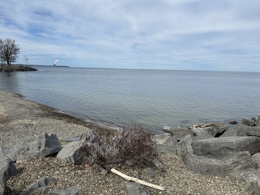
I took the photo below in April 2024. This from a park in upstate NY called Mexico Point State Park. It’s on the shore of Lake Ontario right in the heart of the snow belt country. It looks and feels like the shore of LI Sound. A town called Pulaski just a few miles away recorded 4 feet of snow in two days with a lake effect event in the past two weeks. If you want to see KU style snow events each year this is where you need to be.