

Tatamy
-
Posts
2,032 -
Joined
-
Last visited
Content Type
Profiles
Blogs
Forums
American Weather
Media Demo
Store
Gallery
Posts posted by Tatamy
-
-
10 minutes ago, mikem81 said:
Not sure hw relevant, but the RAP just moved about 100 miles north at 21Z

Actually the change from the preceding run is about 20-25 miles.
-
 1
1
-
-
12 minutes ago, NEG NAO said:
radars will look great here tomorrow and a lot of that in our area will be virga at the start.........
A lot of us will be smoking cirrus…
-
1
-
-
Mt. Holly issues WSW for much of DE and southernmost NJ including Atlantic and Cape May counties for up to 4-6” of snow.
-
2 minutes ago, MJO812 said:
Gefs also bumped north
The mean brings 9” to Cape May.
-
On the 18z GEFS two members bring significant snows as far north as NYC while an additional one reaches LI
-
10 minutes ago, Stormlover74 said:
Wow gfs gets a few inches up this way now and blasts areas further south
.thumb.png.8fcab1ca94cbb26a9c771f11cf2e9788.png)
Road trip to Cape May tomorrow night?
-
1
-
-
FWIW the 12z GEFS had 5 members with good to big hits to the north and west of I95 and 2 members with hits from the city S and E. Another member covered the whole area. I backed out the output from what I believe will be a non event Sunday night for this forum. This is from the Dupage website which shows outputs from 20 members.
-
 1
1
-
-
3 minutes ago, MJO812 said:
Gfs less amped for next weekends storm

GFS goes from a cutter at 0z to an inland runner at 6z to a DT special at 12z for the end of week potential event. These types of outputs reinforce the argument about how far out these OP runs should go.
-
2
-
-
14 minutes ago, bluewave said:
A perfect Nov to Apr -NAO /-EPO pattern with a ridge near California. Maybe Walt can comment on what the long range forecasts looked like. I really got interested in longer range forecasting after reading Walt’s great AFD’s out of the Boston NWS office in the late 90s. Probably the greatest long range AFDs in NWS history.

I enjoyed reading his short term AFDs back in those days especially when a Coastal storm was in the offing. It was required reading for me first thing in the morning to read those AM Taunton AFDs.
-
1
-
1
-
-
1 hour ago, UnitedWx said:
That's cool...especially because it was this same event as an 8 year old in Granby CT that cemented my interest in weather. (Also the Windsor Locks tornado a year later). We already had an awesome pack in '78. I remember we had gone to the bus stop Monday morning and the bus was late. A friends mom came by and told us school was cancelled. We didn't really understand because it was only flurrying but found out why soon enough! Late morning my dad came home from work and we all had to help my neighbor get his truck unstuck, it was blocking our driveway. We ended up being out of school til the following Monday. To this day I swear that the official measurements for this storm are way on the low side. I was only a kid, however both my dad and grandfather said they measured about 28 inches in both Granby and Simsbury...and my Grandfather was NOT someone who would not exaggerate. I would love to see something like this again! By far the closest we've come in this area was the 2013 blizzard. More snow, but less drifting here. If it hadn't happened on a weekend I believe the impact would have been different. It took me two long days to completely snowplow my route, and at the time I only had like 15 driveways.
I experienced this storm on LI. 30” fell where I was on the north shore of the island. What I remember about it was the number of hours that the visibility was consistently 1/4 mile or less. They had to use payloaders through the duration of the storm to clear the streets . I did not see something like that until 2016 when we had the same amount where I live in eastern PA. Visibility wise that one was not as spectacular however it did the job.
-
1
-
-
7 minutes ago, 40/70 Benchmark said:
I didn't realize that one was unexpected. Wasn't paying enough attention in the crib, I guess.
Did it back in?
Yes it did.
-
1
-
-
16 minutes ago, 40/70 Benchmark said:
This is what I was getting at...that is the absolute worst nightmare of a season....it wasn't even warm. It was actually cold, and on paper, you would have been happy with that season....but it just invented ways to not snow around here.
Imagine having a season so called that LI sound freezes over, adorned in snowfall futility records....
Give me 2011-2012 over that. lol
Those were lean years back in the 70s and 80s however you did get an unexpected snowstorm on 12/6/81 that dumped 16-24” from Boston to Providence.
-
1
-
-
29 minutes ago, 40/70 Benchmark said:
I know.
I was around for that one (PD1). I was living on the north shore of LI at the time. We did get snow for that- 7” worth with more in NYC and Jersey. The kicker for that one was a large part of LI Sound was frozen over. Like east facing coastal areas in NE we would get a bump in accumulations with storms that have a low level flow from the E and NE. With the frozen coastal waters our totals were cut in addition to what resulted from the synoptic setup.
-
16 hours ago, TauntonBlizzard2013 said:
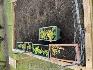
@dendrite @dryslotand other gardeners.
My wife and I are making a small area of raised beds in our backyard. Each bed will be 4x6…. I’m making them out of 40 2x4x10… I have a set of plans.
Anyway, what are some good vegetables that I can just plant seeds in the spring and go? We don’t have the space or time to start stuff indoors and transplant.
Also, is it easier just to buy tomato plants and cucumber plants than starting from seed?
Are potato’s a viable option?
You don’t have to wait until spring in order to obtain produce from your garden. I have lettuce and parsley growing in mine right now. They are quite hardy and will withstand cold temperatures. I have been down to 17 with calm winds and our plants are fine.
-
1
-
-
For those following this event on the models there have been large differences in the placement of the expected snow accumulations. In any case at this time there is steady snow falling in places primarily to the south and west of Harrisburg and State College. Radar shows the area of heavier precip in that area. The echoes to the north and east of there are primarily virga. What is interesting right now is moderate to heavy snow coming down in a burst in some places to the SW of Harrisburg along I81. In particular I just saw a visibility of about 1/4 mile near Chambersburg.
-
1
-
-
Light Snow/Graupel mix here. 0.5” new. 28*
-
0.12” overnight. No ice here however all surfaces are wet. 32*
-
1 hour ago, wdrag said:
No sure if anyone is seeing mping reports to our southwest PHL area to near DC with spotty freezing drizzle, ice pellets and snow? Not sure about the snow but an interesting night for ice is coming I think for nw NJ.
Light drizzle here with 33.
-
1
-
-
24 minutes ago, LoboLeader1 said:
26 here this AM
Two days in a row with temps in the teens. 18 yesterday and 19 this morning.
-
2
-
-
36 minutes ago, SnoSki14 said:
Highly unusual and convoluted pattern that will wreck havoc on the models. Models still attempting the phase shortwaves for 22nd which will have implications for future events.
Strong -PNA coupled with strong Atlantic blocking. Everything is destructively interfering with one another.
Now if this were mid-late Feb or March we would be sitting pretty given wavelength changes but as it stands it's one big mess.
Strongly agree. GFS in particular is flopping around like a big fish thrown out of the water.
-
Cold front is through here. Wind gust to 43 mph during the past hour. High temperature of 64. Now down to 50.
-
Getting some mood flakes out here with those echoes crossing eastern PA and western NJ.
-
2
-
-
4 minutes ago, MJO812 said:
I can't believe I have been tracking this storm non stop since last week.
Ant - you are too dedicated to this process (I have been tracking it nonstop as well all the while it has been circling the drain so to speak on the models). We will get our chances this winter however this is not it.
-
4
-
 1
1
-
-
1 hour ago, jm1220 said:
Nada to zilch inches. Possible amounts up to zippo.
Those echoes across eastern PA are all Virga at this time. I checked traffic cams in the area and nothing is reaching the ground. One report of snow from the Reading area on mPING. Amounts to zippo look good…
-
1
-
.png.630f4b88e9ef261542dcbd3f06a4bac2.png)
january 3rd potential coastal grazer
in New York City Metro
Posted
I wish you folks along the south shore and Brooklyn and SI good luck with this one. I think that while 1-2” is possible there I think a car topper is most likely. I think folks on the Jersey shore south of Long Branch and east of Islip on the island stand the best chance of seeing 1-3” with higher amounts further down the Jersey shore.