powderfreak
-
Posts
83,820 -
Joined
-
Last visited
Content Type
Profiles
Blogs
Forums
American Weather
Media Demo
Store
Gallery
Everything posted by powderfreak
-
 82/77 Constant thunder. Feels like the Dominican Republic.
 -
Good, actionable info. A lot of anecdotal comments going around without nuance… obviously everyone’s mileage will vary.
-
Yeah I bet the neighborhood is bustling at -25F. I love the cold and spend most time outside on the mountain in it, but it’s a fools errand to say more folks are outside in extreme cold than extreme heat. Plenty of folks out up here.
-
You get a roll, and you get a roll… 90/70

-
It’s really the south wind that does BTV in. There’s like a localized nocturnal jet that can even strengthen overnight on the VT side of the Lake. You’ll see most stations calm (like Plattsburgh on the NY side of the Champlain Valley), while BTV is steady 15mph gusting 25 in like tropical breezes. And the temp will be like 86F at midnight lol.
-
Feel like BTV is usually a candidate for that too in these heaters.
-
I agree. The disconnect between expectations, actual official verification, and forecast are off by quite a bit. But I’ll always wonder how much the general public cares.
-
Can I play devil's advocate for a minute? To "society," what is the actual impact difference between 100F vs. 104F? I'm not a fan of media, social media hype, etc. But maybe I'm jaded and just expect some level of hyperbole to occur in any content we consume (social media, streaming, TV, even radio), whether I agree or not. I certainly agree that it's way overblown, annoyingly so. I take solace in the fact that it might alert the public to a very hot period. Anyone without A/C doesn't care if it's 100F or 104F for an official high. It's an urban area, it's really hot regardless of the actual value. I think hyping low wind-chills can be a bit overblown too, but at the end of the day, the public knows it will be uncomfortable for a few days. I always wonder what would happen if they downplayed everything.
-
Hey I knocked the heated steering wheel, until my recent rig has it. I won’t lie, having an odd satisfaction leaving for the mountain and work at 4:45am and it’s -15F… but that steering wheel feels nice and warm lol. My wife always jokes I’ll go wander around Mount Mansfield in the brutal cold measuring snow and skiing, and then like a heated steering wheel. I do want the AC seats though, ha.
-
81/48 Gah it’s so nice outside. Drinking in these dews before the swamp arrives.
-
Only if they are low-carb will they get that warm.
-
At the end of the day, that’s all people remember. That was really hot. It’s kind of like arguing -10F, -15F, -20F etc. it’s all rather unpleasant for the public.
-
The best I’ve had was telling someone over the phone their password needed to contain a special character and they did “specialcharacter1” …
-
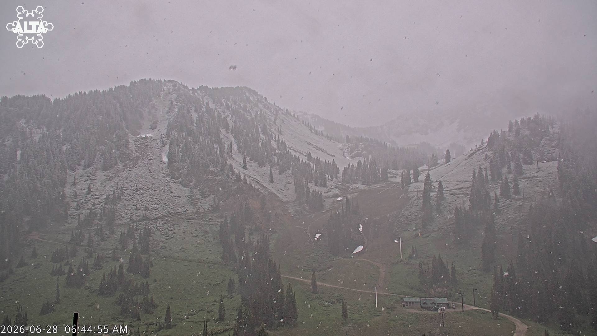
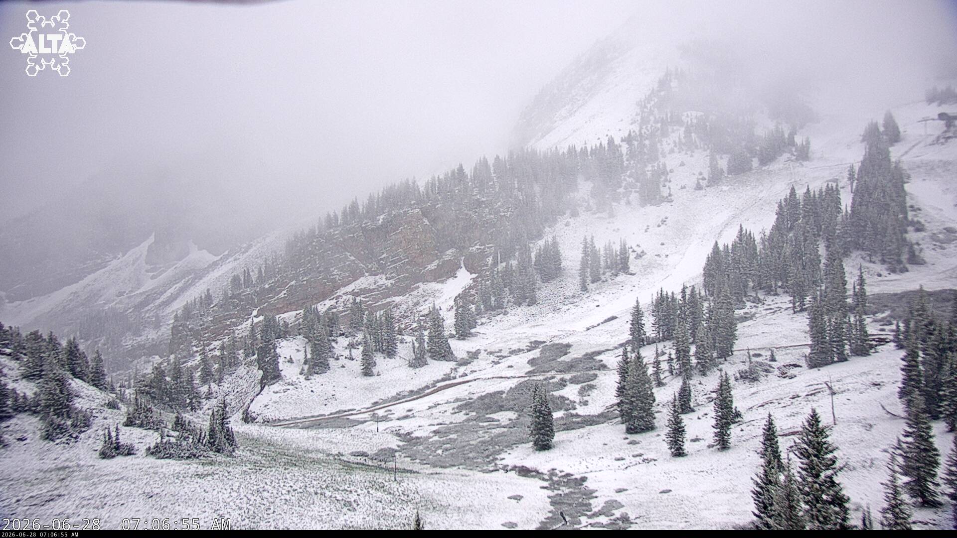
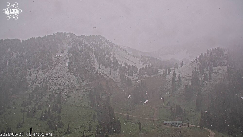
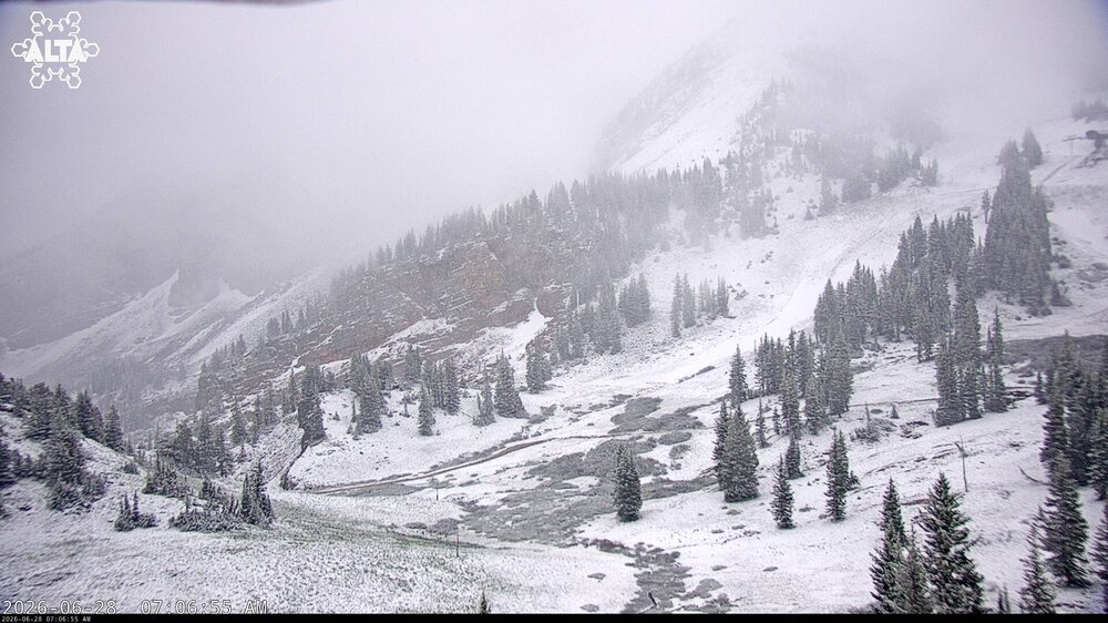
For @vortex95... snowing this morning at Alta and the neighboring Wasatch peaks around Salt Lake City.
-
Oh that trough means business. I understand completely what Vortex means by bias. If MWN was going to see freezing temps with highs in the 60s in New England, it would be talked about. It’s just really hard to get the public to give two shits about anything high elevation in the Rockies… maybe some passing footage of snow on the tail end of a newscast while credits role.
-
I honestly think if MSM polled the public they would say it snows year round in the northern Rockies peaks.
-
When it snows above 2,000ft even in New England (anytime of year), no one really cares lol. Above 8,000ft in the Bitterroot Mtns isn’t going to move the public interest needle much.
-
Ha, 11 members and 9K guests.
-
Webbed hands of Stein have reached the server room.
-
This thing is full struggle bus today.
-
Joe Bastardi got rich off that with snowstorms and winter weather fans in the late 1990s and 2000s.
-
58F, the mountain valleys always have the biggest ranges. Hottest then the coolest.
-
Nice 1.20” for event? That’ll soak.
-
Absolutely, sorry if that came off as having a “winner” or “loser”. It’s a discussion board, so it was a little funny that after 6 paragraphs about the overuse of “heat dome”, that Tip writes a one liner about a massive heat dome in the long range. Hopefully we can see a little of the humor in that sequence of posts.
-
0.19” today. Enough to wet the ground.