
SLPressure
-
Posts
566 -
Joined
-
Last visited
Content Type
Profiles
Blogs
Forums
American Weather
Media Demo
Store
Gallery
Everything posted by SLPressure
-
36 now after low of 34.1. Proximity of the river evident.
-
2026 Mid-Atlantic Severe Storm General Discussion
SLPressure replied to Kmlwx's topic in Mid Atlantic
Lots of noise, not much wind. .80 rain in 1 hr. Nice downpours, overwhelmed the gutters. Temp dropped 15 degrees. National Harbor. -
Loved his insight. RIP.
-
eight this morning
-
TT maps look like 8-10 for dc.
-
Thank you! Much appreciated.
-
Looking for a little help in deciding to hold an astronomy program this evening, 8-10pm. Any guesses on cloud cover during this period? Southern Fairfax county.
-
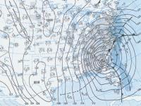
The return of the elusive Nor'easter. Drought buster or bust?
SLPressure replied to dailylurker's topic in Mid Atlantic
A significant change in the model guidance from yesterday is the lack of rapid phasing of the two mid-level cutoffs. Most guidance now show a gradual phasing of the two vort centers, a process that plays out over a two to three day period. As a result, there could now be two surface lows that develop in tandem along the broad frontal/baroclinic zone that stretches from the Carolinas to well off the southern New England coast. This is important for our area as it will displace the strongest winds to east of the Delmarva and also has led to a big decrease in overall rain totals for the area. As a result, we likely see an initial surge of wind and rain moving into the area Sunday morning as the baroclinic zone takes hold across the Mid-Atlantic. The strongest winds are going to occur Sunday morning, gusting around 25-35 mph and up to 35-40 mph along the immediate Western Shore of the Chesapeake. Lesser, but still breezy at times, west of the Blue Ridge with gusts around 20-25 mph. A steady rain overspread the area early Sunday morning and persists through Sunday night. For those west of the Blue Ridge it likely will be a steady drizzle to light rain, with more light to moderate east of the Blue Ridge. Rainfall totals are around half to three quarters of an inch, with 1.00-1.50" along/east of I-95. The wind forecast is lower than what we had yesterday, so probably will not reach Wind Advisory criteria along the Western Shore on Sunday. Cannot rule out some sporadic gusts around 45-50 mph, but the threat for frequent gusts to that level are much lower. Temps struggle to reach the low to mid 60s Sunday. -
Thank you!
-
I have to lead an outdoor program this evening in the Mt. Vernon are of Fairfax county. With the waffling of the precipitation potential, what are thoughts on odds of steady, moderate, rain between 6 and 9 pm?
-
I know we used to have a storm mode sometime in the past. Wasn't there also a model mode? No banter during the running of the models, or something to that effect. Parsing through 10 pages to find real information is getting old.
-
6.8" National Harbor
-
Yeah, can't always go with the verbatim translation of any model output. Or with the current temperature. Or with anything to do with the weather. It will definitely humble anyone. But I am loving that I was wrong!
-
DCA still at 34. Modeled at 29. Doesn't bode well for the temperature forecast today. NAM 3k 10:1 4-8, Positive snow depth change 2-3.
-
On TT, there is the option to look at "positive snow depth change". What exactly does that mean? It shows 7 north to 8 south at 45h, yet 10-1 has 8 north to 12 south. Which is more accurate?
-
I know it has been previous mentioned, snowing for 24 hours and the hourly rate is relatively light. How will daytime temperatures above 32 degrees affect the accumulation as depicted on the modeled maps?
-
Ugly for us south and east of DC. Ugh.
-
NFL model forum. Awesome!
-
January Medium/Long Range: A snowy January ahead?
SLPressure replied to mappy's topic in Mid Atlantic
LOL. I took the bait. My bad. -
SN+ at the moment. Covering everything all over again. Awesomely beautiful!
-
Just started snowing again in National Harbor. 6" on the ground so far.
-
Thank you!
-
Oof?
-
What is the lead time for NHC, re: posting watches and warnings? And do they only post along coastlines? Maybe a dumb question, but just curious. Visiting family in Orlando at the moment. And when was the last time Orlando was under a hurricane warning?
-
The Weekend Rule? Saturday 2/17 - The Icon Storm
SLPressure replied to DDweatherman's topic in Mid Atlantic
39/22 National Harbor


