

CaryWx
-
Posts
2,832 -
Joined
-
Last visited
Content Type
Profiles
Blogs
Forums
American Weather
Media Demo
Store
Gallery
Everything posted by CaryWx
-

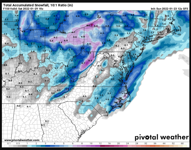
Potential 1/28-1/30 2022 winter storm
CaryWx replied to Prismshine Productions's topic in Southeastern States
I agree. Do not understand the more dampened out moisture field with the overall set up. -
actually a little further sw?
-
I can't tell if the 84hr synoptics on the NAM are favorable for Carolina snows or not. Can you elaborate a bit?
-
probabilistic is the operative word I'm guessing. Some maps are safer bets than others.
-
Not a bad place to be at this range.
-
Wasn't this storm on the gfs just a couple days ago
-
Not sure I have the emotional meteorology mettle to bounce up and down for a third week here
-
January 20-22 “bring the mojo” winter storm threat
CaryWx replied to lilj4425's topic in Southeastern States
-
January 20-22 “bring the mojo” winter storm threat
CaryWx replied to lilj4425's topic in Southeastern States
-
In the bullseye this far out? I dunno
-
This is about as board wide a hit as we're gonna get. Kudos to those of you putting up with us RDU & extended area folks. We can be insufferable.
- 727 replies
-
- 12
-

-

-
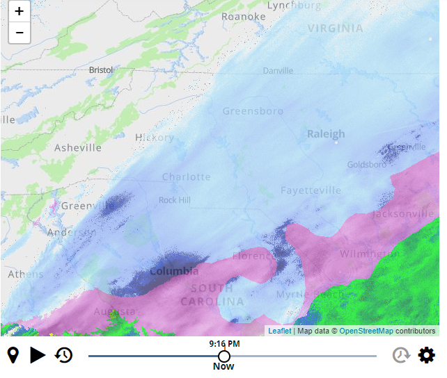
It's ripping some heavy powder in Cary right now
-
You're going to get rocked
-
I've only have tiny grit like snow coming down. But there's nothing minor at all about this event and a solid 24 F. Temps is going nowhere but down. edit: Powder is almost blinding too and will only increase
-
I meant twitterverse
-
Any mets on social media chiming in about lower rates in the Triangle or honking be patient.
-
Thing is will these heavier rates nw of Columbia hit or miss the Triangle to the east.
-
What's your location?
-
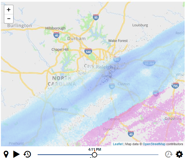
This. Plus the heavy stuff is progged for 10pm-2am
-
I think it's projected to end in the Triangle by 3am. Still that's a good 7hrs of moderate+ snows
-
I would have to say returns look heavier for those in Garner attm
-
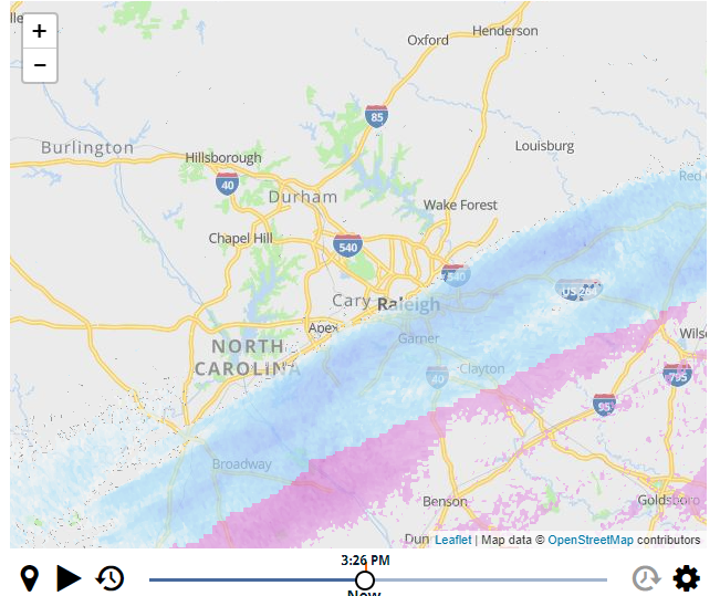
Another snapshot of icontrol radar for Raleigh area. Curtesy WRAL
-
Very light flurries here in southeast Cary 4:05pm. 5mins behind schedule.
-
I know WRAL's icontrol is not all that but this is why I am not seeing flurries yet nor some others in Raleigh.
-
Ok, I will check again and squint hard...
