

michsnowfreak
-
Posts
18,382 -
Joined
-
Last visited
Content Type
Profiles
Blogs
Forums
American Weather
Media Demo
Store
Gallery
Everything posted by michsnowfreak
-
One memory I'll never forget was Jan 31, 2002. After 9.5" of snow followed by heavy freezing rain knocked out everyone's power (storm total precip around 3"), seeing the white landscape and crystal-draped trees against the night sky with zero light pollution.
-
2013-2015 were easily my favorite back to back winters as well though, and lake effect was at a minimum with frozen lakes. 2013-14 defied the odds almost in its combination of persistent cold, snow & snowpack, easily earning the title of most severe winter on record. 2014-15 wasn't particularly snowy but it had the brutal cold and more deep snowpack. I'd rank 2007-08 & 2008-09 as 2nd for favorite back to back winters.
-
The December 2001 lake effect event was definitely how that winter climbed so high onto Buffalos snowy list, but there were still some good synoptic winter storms. A massive winter storm hit much of the country from Jan 29-Feb 2 with a crippling combo of ice and snow. And there were other storms in Feb/Mar as well. Definitely not a winter I'd like to repeat overall but it had some fun times.
-
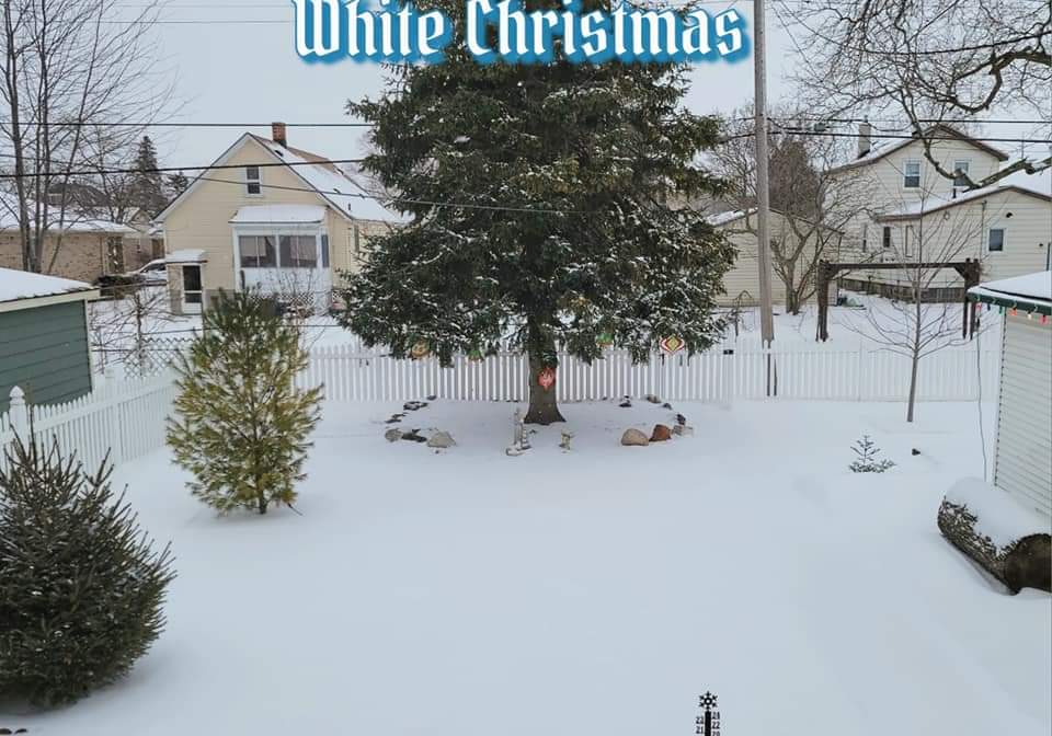
The December 2022 cold snap was a few days of arctic cold, blowing snow and howling winds centered right around Christmas. The blizzard that was initially forecast was extremely underwhelming in terms of snowfall amounts, about 2 inches of sugary sand fell here but it was essentially a ground blizzard all day causing lots of drifts. Wind chills were around -30° here. A much calmer snowfall blanked a fresh 2.5" over the drifty snow on Christmas morning for a postcard Christmas scene. But no one really got buried. I think that was the storm that originally had a thread a ways out for a massive east coast blizzard.
-
I have had a feeling for a while that December may be one of the best months of the winter this year, at least here. Its been a while since December was THE month of the winter, and its also common to happen in Ninas. Doesnt always happen that way of course (1998-99, a terrible Dec and excellent Jan). One thing about a Nina is that most of them feature one unusually snowy month.
-
Definitely not a favorite winter of mine, but wasnt terrible by any means here. Dec 2022 had the huge arctic blast at Christmas time. And March was snowy.
-
Thank you. But my apologies, I meant what does "minus" mean? They are still an analog just not as good of one? I used to think minus meant you wouldnt want to include it in a dataset lol.
-
Even in 01-02 we had some good storms. 11-12 was definitely the dud, but still had multiple snowfalls. Ninas in general are favorable here. They dont all work out great, but youd want a Nina over Nino any day in this area.
-
What are the minus analogs?
-
There was ONE unique thing about 2022-23, one thing I couldnt recall any other time, and that was the surplus of....snowmen! Back to back PACKING wet snowfalls on Jan 22nd (3.4") and Jan 25th (6.5") led to snowmen everywhere, which froze in place for the next few weeks. Usually you see a handful of snow forts or snowmen peppered in suburbia, but the unusual amount of wet snow in mid-winter (followed by colder temps) was making them show up everywhere. It was a nice scene for sure. March had a good snow blitz too. Detroit ended up with 37.1", so while a below avg season, nothing striking about it at all...and in fact, quite a large amount of precip was wasted on unusual 5-6:1 ratio snow, so had temps been a few degrees colder during a few snowfalls, it would have easily been an avg snow season. The blinding thundersnowstorm of March 3rd saw 6.2" on 1.11" precip.
-
1931-32 remains the warmest winter on record in many locations of the midwest and Ohio Valley. At Detroit it remains #2, behind 1881-82. So while 2023-24 was the warmest modern day winter, it ranks 4th overall, behind 1881-82, 1931-32, & 1889-90. The climate was colder in the 1800s but there were some wild warm winters thrown in. Then 1931-32 was kind of like the welcome to a three decade surge peppered in with many mild winters (tho none could come close to 31-32).
-
Great analysis. Do you see either of those coming into play? We had some good storms in 01-02 & 22-23, but definitely not fun winters overall.
-
Haha thank you for your confidence, but we all know how the weather works, no guarantees. The composite maps from CPC are actually too good right now, they would imply a storm track just to our east loading us up with lots of snow as the warmth stays east and the cold to our north and northwest is ample. But a composite map rarely will pan out. What I like about this winter- A very strong early model signal for AN precip, and combine that with Nina climo and increasingly wetter/snowier winters the past several decades, I expect "average precip" to be the low bar. We also tend to have more wiggle room for an average snow season regardless of temps. After our mega snow blitz from 2007-15, we have been fairly average-ish in the snow department. The only standout winters since 2016 were 2017-18 (snowy at 61.0") and 2023-24 (low snow at 23.5"). Last winter was the first significantly below average snow season since 2011-12, and that low season was sandwiched in by heavy snow winters before and after. ENSO and all other factors aside, its very common for us to have a snowy winter after a sub-25" winter. What I dont like about this winter- Definitely like more than I dont like, but one thing that always worries me is the usual Nina rollercoaster. They can be some of the most up and down winters we see, so I really dont expect a great snowpack season. In the unlikely event timing is always bad, we could waste a lot of storms on rain and bad tracks to our west, surviving mostly on wraparound, lake effect, and clippers. And of course the pacific worries of the past many years come to mind. We actually get treated to some good dynamic wet snowstorms/thundersnows in those patterns usually, but I can kiss a lot of snowcover goodbye. Bottom line- If the anamalous cold to the north and warm to the south pans out, I fully expect some great winter storms somewhere in the midwest & Great Lakes, along with some arctic outbreaks flirting with record cold and some torches flirting with record warmth at some point during the season.
-
Thanks! Excellent read. Its really interesting to me, maybe just not enough sample size, but the composites locally of a weak or strong La Nina yield above avg snow, while a moderate yields below avg (not terribly so, but still its far different than the very straightforward climo of Ninos with weak (good), moderate (ok), strong (bad)).
-
Does anyone have a breakdown list of what ninas were central based, east based, etc?
-
It's my understanding that MJO phases are difficult to predict far in advance.
-
This will interesting to see because as you said, it is often the case as shown in enso analogs (mild nina Falls) but this summer has been a very unexpectedly pleasant summer in the midwest surrounded by the heat to the west, south, and east.
-
Weather/seasons go in cycles though, even when the trend is warmer any month can be colder depending on the pattern. During the past 6 Falls at Detroit, only 1 of 6 Septembers and 2 of 6 Octobers were colder than average, but 4 of 6 Novembers were colder than avg. So based on that November has the best bet to go cold. But a mild November wouldn't surprise me, as often in Ninas a mild November gives way to a cold December.
-
Me too. Great Lakes repeatedly are showing up in the AN precip category and not as warm as further east, which is usually a recipe for good snows.
-
Fall is in the air today!
- 231 replies
-
- 4
-

-
- absolute trainwreck?
- abandon all hope?
- (and 1 more)
-
Definitely like that outlook lol
-
Another thing I'm liking in the Great Lakes is that unlike last winter, there looks to be a lot of cold in Canada.
-
High on 7/31 was 91F. was hoping it wouldnt hit 90 because its quite rare to see no 90s in July. July finished -0.3F but the high temp was -1.0F. High temps have been undewhelming the last 2 summers, outside of this June, but no complaints here!
-
You wont hear me complain about another 2002-03. 69" here. Unusually huge difference between Detroit (61") and Chicago (29"). I'd have no problem ordering a cold clipper express and some thick lake ice while the east has fun, but obviously that type of pattern looks unlikely this coming Winter. The last 2 winters were frustrating, but not nearly as much as they were for parts of the east. It was the perfect example of how warm winters produce some real dynamic snow systems up here. 3 or 4 widespread thundersnow systems the last two years among other things. But the deep winter element was missing outside of a week here or there. I'm liking the looks for this winter snow-wise so far statewide, but many things can and will change before the first flakes fly.
-
After the last few years of enso threads, it's apparent that the east tends to prefer Nino and the midwest/Lakes prefer Nina. But I would think that for those further south, say from NYC south, winter is much less dependent on sustainability and more on a possible huge storm or two. So just as a strong nino didn't produce as you expected doesn't necessarily mean all hope is lost with a nina either.

