michsnowfreak
-
Posts
18,453 -
Joined
-
Last visited
Content Type
Profiles
Blogs
Forums
American Weather
Media Demo
Store
Gallery
Everything posted by michsnowfreak
-
I'd rather have a snowy Nina March ala 2008
-
I like the cold. Now....the -30 wind chills while I was out shoveling Dec 23? No. I thought it would be fun but it was legit hard to breathe. But moderate cold I love and find invigorating. Took a winter walk yesterday. Snow wise the past 5 seasons have not sucked here, except 2018-19. They haven't been great, but haven't sucked. Maybe other parts of the subforum, but im sick of hearing that average to above average snow seasons "suck". The frustration of this snow season, especially to mid Jan, is what a sucky snow season is. Not not getting wall to wall snow 2017-18: 62.5" above 2018-19: 31.9" below 2019-20: 43.8" avg 2020-21: 47.0" slightly above 2021-22: 47.9" slightly above
-
Today was a rare clear day, went for a walk in the park through the crunchy snow to get some fresh brisk Winter air.
-
I think most still give a nod to 13-14, but then they revert to the 70s lol in the next breath lol. I wonder how it was in the 70s. Like, did people say "it doesn't snow like it did in the 50s" even tho the 50s were way warmer and way less snowy.
-
Oh, for sure last Winter was FAR better. I'm not a skier, but a friend of mine went to just the other day and said he had fun. I don't think there's any disagreement that this is just plain and simple not a good Winter overall. The trolling posts (even though by mostly one person) do get old though. Especially when last Winter was a good Winter for the cold lovers, and we are a few years removed from our snowiest decade on record.
-
Each winter is different so hard to say what grades would have been with an "average" February, but each of the last 2 winters finished slightly above average snowfall thanks in large part to Feb. I was a fan of the cold last winter, not just the snowy Feb. And in 2021, depth got to 15" in Feb. Even if the last half of this month gets active and snowy, looks like we won't be adding to the 20+ inch Feb club that had become the norm. Maybe March will be interesting. Just as we've been due for a dull February, we're due for a rockin March. I don't care as much about tracking, just give me results.
-
@Powerball special. Detroit skycover: Dec skycover- 9.2/10 Jan skycover- 9.2/10 55 cloudy days 6 partly cloudy days 1 clear day
-
As mentioned, Detroit tied for 6th warmest...but the snow ranked 60th snowiest out of 143 years.
-
DTW is measured just outside airport grounds in a location more suitable for snow measurement. I heard a lot of airports were doing this. Really, isn't that the best case scenario. You want accuracy.
-
Skiing and snowboarding hills are doing just fine in Southern Michigan as well. Yeah they make plenty of additional snow, but that's needed for a deep firm base. Really, Cromartie trolling us getting over the top. He doesn't even post about weather or snowstorms that are going on in his location, just talks about torching. Yes, winter is disappearing because we had a mild January. Can't remember the last time we had a cold Winter where the Great Lakes had above average ice cover. Wow. I looked, we haven't had a cold Winter with above average ice cover since...LAST WINTER!
-
For Detroit. With a mean temp of 33.5°, Jan 2023 will tie with 1890 & 1990 for 6th warmest jan on record. Technically, 2023 was a fraction colder than each of those, but rounded to a tenth of a degree it ties. It was 3.2° colder than the warmest Jan on record. Total snowfall of 11.7", while a few inches below the current Jan normal, is incredibly an inch ABOVE the longterm avg. Season to date snowfall is 19.2". Last Jan was 27th coldest on record, over 13° colder than this Jan.
-
I did not realize that Winter was just February 7-13. Funny it sure looks and feels like midwinter as we close out January. I'm glad you're back though. Was worried since you did not say a word when Milwaukee got an 8" snowstorm. Figured you forgot your password or something. After all that's what we're here for, right? To discuss weather
-

Winter 2022/23 Medium/Long Range Discussion
michsnowfreak replied to Chicago Storm's topic in Lakes/Ohio Valley
We literally had a cold January and February last year. There's a difference between weather & climate. -
So odd to see clear skies lol
-
Winter 2022/23 Medium/Long Range Discussion
michsnowfreak replied to Chicago Storm's topic in Lakes/Ohio Valley
You've been quiet lately -
We're only halfway done. But so far it's definitely not as bad as 2011-12 here. Plenty of time for improvement or unimprovement lol. The wintriest spells have been mid November, the week of Christmas, and late January. We have had snow on the ground continuously since the morning of Jan 22 with no melt in immediate sight. We are at 19.2" so far....2011-12 was my all time low (since I started in 1995-96) of 25.5".
-
Interesting graphic. Side note, I see your phone does the same annoying thing mine does when making a post lol. Crazy enough, with the half inch of snow today, Detroit actually is in an exact tie with last season to date. Both 2021-22 & 2022-23 were at 19.2" thru Jan 30th. Avg to Date is 24.2". Last season finished at 47.1", which is a 2.1" above avg but about 6" above the longterm avg.
-
You are in the Indiana suburbs of Chicago right? I did not realize it has been that bad. Whats your season to date? Going beavis is justified. In fact that's what it should be used for, not knit picking little things during snowier times.
-
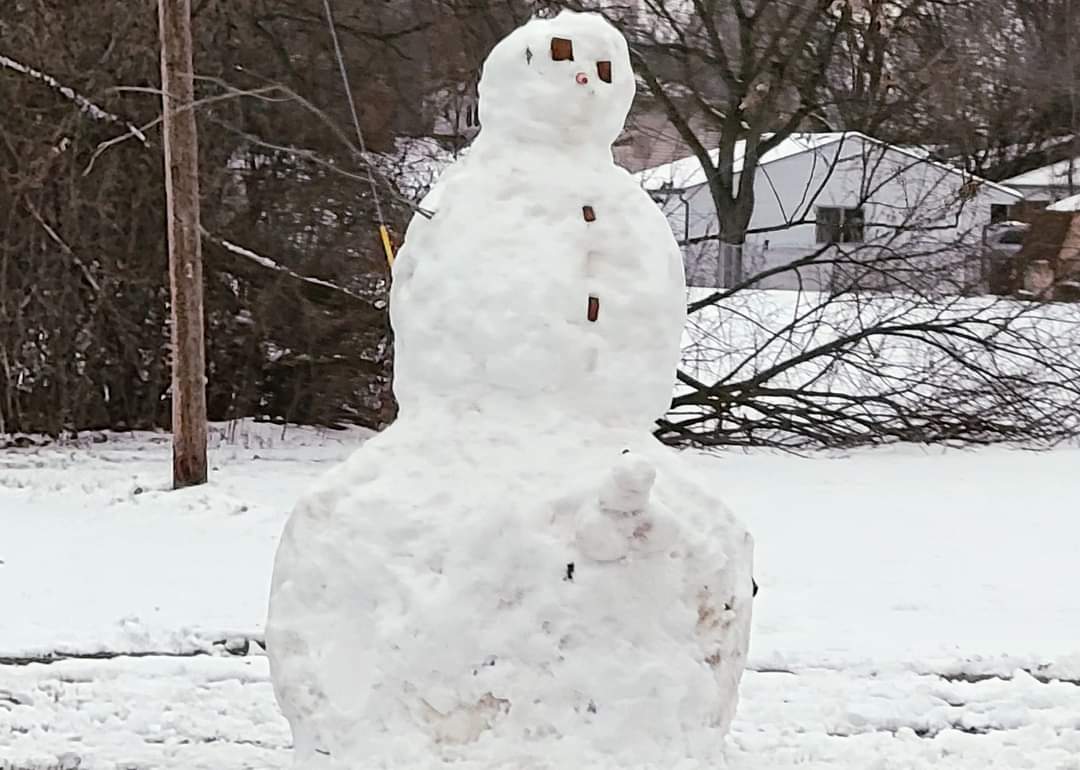
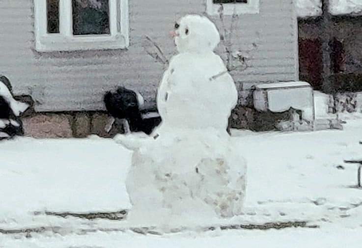
Picked up 0.5" of snow this morning, which brings my January total to 11.6" and the season to date 19.6". Made up quite a bit of ground the last 8 days. DTW will finish January with 11.7" of snow bringing their season to date 19.2". I do think it's cool how so many people made snowmen during the packing snow last week. Every day I stumble across new ones.
-
When I drove by this huge snowman, along a main road, this afternoon, I literally lol'd and had to turn around for a pic. Wish I got a better one.

-
Remembering 1/5/2014, "The Polar Vortex"
michsnowfreak replied to Chinook's topic in Lakes/Ohio Valley
I'm like a grandparent talking about their grandkids when it comes to the Winter of 2013-14. I just can't get enough of it. The polar vortex storm was awesome and the temperature drop behind it was something I've never seen. Digging out in -50゚ wind chills was quite an experience. And to think that that was only the beginning of a historic winter! The sunset pic was taken right after the polar vortex storm ended. The rest of the pics are from February.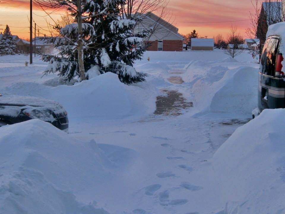
-
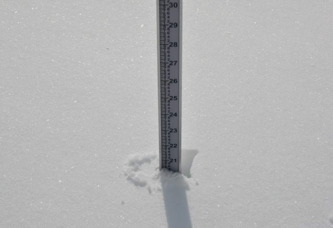
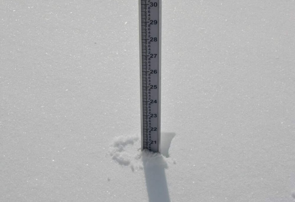
Snow depth here is now between 4 and 5". Extremely dense. With the cad coming might be a nice time to take a brisk winter walk at a metro park.
-
I didn't realize snow was that close lol. Forgot to ask, what did you get the 25th?
-
Just got a little light freezing rain here. Temp only got up to 32 so never got warm. Looks like Toledo hit 40°
-
It's definitely been an "A" Winter in Minneapolis. Here, right as we enter the midway point of Winter, I have to say my grade has bumped up to a "C-" November had a surprise heavy burst of snow on the 12th where it puked the biggest flakes I've ever seen, and then the Arctic front on the 19th dropped a few inches with below 0 windchills. The December 23rd storm with temperatures near 0 and wind chills of -30 creating blizzard conditions may have fallen short of initial accumulation potential but it was pretty sweet to see 2 days before Christmas. Then waking up Christmas morning to a fresh and unexpected 2" blanket of new snowfall which covered the old drifty snow and made for an absolutely courier and Ives Christmas scene January was the definition of dumpster fire until last week. All of a sudden we're over 11" on the month thanks to 3.7" & 6.2" storms this past week, both caked to everything, the latter of which was a good storm, and we have snowpack in place for the cold