

michsnowfreak
-
Posts
18,382 -
Joined
-
Last visited
Content Type
Profiles
Blogs
Forums
American Weather
Media Demo
Store
Gallery
Everything posted by michsnowfreak
-

Winter 2022/23 Medium/Long Range Discussion
michsnowfreak replied to Chicago Storm's topic in Lakes/Ohio Valley
It looks mild the next 2 weeks but I'm sure nothing that will make the trees bud. Then looking like a cold March. -
Winter 2022/23 Short/Medium Range Discussion
michsnowfreak replied to Chicago Storm's topic in Lakes/Ohio Valley
If I'm wrong I'm wrong but honestly I'm really feeling a good March for this region. It's been so long. We have not had what I would consider a real snowy March here since 2008. In the 15 years since we've had multiple snowy months of every other month from November through April. This year has definitely bucked certain trends of recent years, so why not go all out. Up to this year, it was getting almost comical that we could predict snow for SE MI... Nov- 250% of average Dec- 20% of average Jan- 80% of average Feb- 250% of average Mar- 20% of average Apr- 200% of average -
Winter 2022/23 Short/Medium Range Discussion
michsnowfreak replied to Chicago Storm's topic in Lakes/Ohio Valley
The last 3 years April has outsnowed March. Let's reverse that trend this year as well. 2020: Mar 1.8", Apr 4.7", May 0.7" 2021: Mar T, Apr 4.5" 2022: Mar 3.7", Apr 4.4" -
Winter 2022/23 Short/Medium Range Discussion
michsnowfreak replied to Chicago Storm's topic in Lakes/Ohio Valley
The average Feb snowfall for the last 15 years at Detroit has been 18.2". Literally double the 20th century average. That includes 9 of the 15 years being 20+ and several in the 25-32" range. Looks like this Feb is finally proving things can go wrong. Look out March, the lions will roar. -
In the milder winters I really get out to enjoy the good periods when they are present. Obviously I do the same in the cold snowy winters but there's more leeway and room for laziness then. Ive spent more time outdoors the past couple weeks than I do in summer lol, getting the most out of Winter fun while we've had a good solid snowblanket. Same thing around Christmas. It was a beautiful white Christmas but it was more than just a scenic touch to add to the holiday, I spent time outdoors that week as well, even during the brutal wind chills. I'm really feeling late February into March for this sub forum but regardless of what happens then I am totally with you. I will get immense pleasure out of a palm killing spring deep freeze.
-
There were some incredible swings in the 19th century here from Winter to Winter. This 5 year stretch was insane: 1877-78 very mild 1878-79 bitter cold 1879-80 warm 1880-81 bitter cold 1881-82 record warm
-
Hit 42 today. After a solid 2 week stretch, snow getting patchy but still more snow than grass.
-
Winter 2022/23 Medium/Long Range Discussion
michsnowfreak replied to Chicago Storm's topic in Lakes/Ohio Valley
In my opinion 2017-18 is a highly underrated Winter here. It came after the record smashing snowy stretch from 2005 to 2015, and since 17-18, it's been pretty average snow-wise as a whole (and we know that average is unacceptable for many a snow weenie lol). Ended up with a season total of 62.5" here and at DTW the 61.0" ranks as the 15th snowiest winter. However Detroit's northern suburbs cashed in far better, with 87.3" at the White Lake DTX NWS office and some unofficial reports nearing 100" in the micro climate snow belt of northern Oakland County. Pics below are from 2-9-18.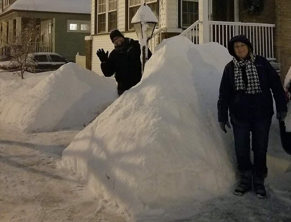
-
Winter 2022/23 Medium/Long Range Discussion
michsnowfreak replied to Chicago Storm's topic in Lakes/Ohio Valley
Feb 2018 was the only warmer than avg month of that cold season, and it was only due to the torch the last 10 days of the month. It was actually a snowy month here. And yes, that April ice storm was something. -
Went to a local ice festival today and there were some cool ice sculptures there. @beavis1729 my throne is made of ice.
- 344 replies
-
- 12
-

-

-
Winter 2022/23 Short/Medium Range Discussion
michsnowfreak replied to Chicago Storm's topic in Lakes/Ohio Valley
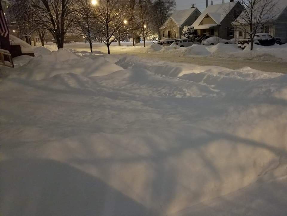
You are indeed correct. Tomorrow will mark the 14th day in a row with 1"+ on the ground, and it will be the 23rd day this season so far. Been a sucky winter but could be worse. Snow depth is taken at 7am. On January 22nd, snow started just after that time. By 9am it was 1" So essentially the day was white but it will still go into the books as 0 depth. Having a set observation time for depth is a good thing though because it all averages out in the long run. December 29th, our 7th and final day and the Christmas snow cover stretch had 1" on the ground at 7 AM but it was down to patches by late morning and gone by evening. Pre 1950 the obs depth was 7pm. -
Looks like one heck of an extreme from 1857 to 1858.
-
Winter 2022/23 Short/Medium Range Discussion
michsnowfreak replied to Chicago Storm's topic in Lakes/Ohio Valley
A spring snow can be incredibly scenic while it's going on and shortly thereafter, but you want to forget about snow cover by that point. We've had a 2-5" type snowfall 3 years running now in late April (Apr 17, 2020, Apr 20, 2021, Apr 18, 2022). Makes for incredible photo ops but is mostly gone in a day or two. It's been nice the past few weeks to have a solid snowpack but the coming week looks like crap. Quite optimistic for later February into March tho. -
Winter 2022/23 Short/Medium Range Discussion
michsnowfreak replied to Chicago Storm's topic in Lakes/Ohio Valley
I totally understand as we always say, different strokes were different folks. Not sure if you're counting 2017-18 or not, but that was a good snowy winter. Since then it's been much more "average" overall but February 21 was definitely a good month to see deep snow and we did have an 11" snow storm. But again regarding beavis I would bet my last dollar that if you offered him a Winter with 80" of snow including 2 storms over a foot but constant thaws/torches leaving more bare ground than snow...or a Winter with 35" of snow, constant cold and no bare ground the entire Winter he would take the latter in a heartbeat. It's been a pretty cold week but we are gonna warm up this week. I got some tears while walking in the park yesterday due to the cold. But that's after being out for prolonged period. Just stepping in-and-out even the bitterest cold doesn't bother me at all. -
Went for a walk in a park before sunset and I have to admit I thought of @beavis1729 several times. With the biting cold air and snow crunching underfoot, It's the perfect Winter day (obviously meaning for a day that's not actually seeing snow fall lol). I love when everything's frozen.
-
Winter 2022/23 Short/Medium Range Discussion
michsnowfreak replied to Chicago Storm's topic in Lakes/Ohio Valley
You are NOTHING like beavis. For one thing you spend winters in Florida and don't like cold. Cold and snowcover are far more important to him than snowstorms, he is very similar to me. Oh and by the even tho theres been more than 2" of snow on the ground for 2 weeks, 2"+ depth plus some cold (i forget what) is the threshold for some sort of beavis winter day stat he concocted. So today is definitely a beavis approved day here. -
Winter 2022/23 Medium/Long Range Discussion
michsnowfreak replied to Chicago Storm's topic in Lakes/Ohio Valley
I know it's controversial but I've heard the BSR looks good for a wintry and active late February into March for our region. -
Winter 2022/23 Short/Medium Range Discussion
michsnowfreak replied to Chicago Storm's topic in Lakes/Ohio Valley
Very well said. I feel like I love snow as much or more than beavis. I just don't understand the expectations and the constant complaining. I took a beautiful Winter walk the other day and plan to take another one today. Maybe get out and enjoy Winter while it's here instead of worrying that a melt is around the corner. And yes, outside of Minneapolis I think everybody has complained about this Winter. Nobody's acting like it's good. We've done better here compared to a lot of others on the subforum but I have voiced over and over that it's not a great winter. I've also said on multiple occasions that this is the perfect winter for beavis to actually complain. But Beavis has been complaining about the same thing for years even when there's been good times. Chicago had 2 feet of snow on the ground just 2 years ago yet if you listened to him youd think they were snowless. I almost fell over when he even had a few complaints about 2014. Sometimes the mainstream media likes to make Chicago sound like Fargo, which is a little ridiculous. But likewise it seems as though beavis makes Chicago sound like Saint Louis which is equally ridiculous. I only hope the next time Chicago gets hit he actually goes out and enjoys Winter instead of staring at his computer to find the next torch and live in fear of it. Side note, the Christmas snowstorm was one of the most impactful 2 to 3" snowfalls I've ever seen here in terms of actual conditions. Kind of like the opposite of when you get a 6 or 7" snowfall in the Spring that only creates a layer of slush on the roads. -
Shades of 2014 here
-
Winter 2022/23 Medium/Long Range Discussion
michsnowfreak replied to Chicago Storm's topic in Lakes/Ohio Valley
I used mine 3 times so far. Dec 23, Jan 22, Jan 25. Shoveled for the rest. The blower kept clogging on Jan 25 the snow was so dense/wet. Hoping for a good powder to play in. -
Obviously this is an unusual extreme for them, but the nearly completely snowless winter up-and-down I 95 on the East Coast is a magnified example of their feast or famine climate.
-
Wind chill advisory in effect tonight
-
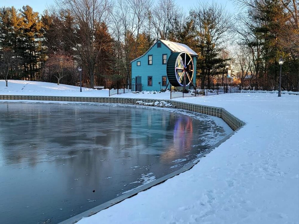
And mind you, being "satisfied" does not make something a good or great Winter. There have been definite good times the past several winters but the last great winter was 2017-18, and before that was 2014-15 and of course the grand poobah of all 2013-14. The last truly sucky Winter was 2011-12, but there have been subpar Winter since (2015-16, 2018-19). A lot of the other ones fit into the category of "satisfied", not good, not bad. Pic below from February 2021.
-
Xmacis, the best site out there for climate data
-
I'd rather have a snowy Nina March ala 2008


