michsnowfreak
-
Posts
18,382 -
Joined
-
Last visited
Content Type
Profiles
Blogs
Forums
American Weather
Media Demo
Store
Gallery
Everything posted by michsnowfreak
-
Detroit has only had 0.5" which also would be 2nd least snowy Feb if it holds. It's absolutely the other shoe dropping after an incredible run. 9 of the top 14 snowiest Febs have come since 2008 (records date to 1880)! The month does seem a little wintrier than that since the first week was blanketed in snow and we had the big ice storm.
-
I've heard about that!
-
With this wind it would have been a disaster if Ice was still on the trees
-
 I can't upload videos from Facebook here, but I took several videos. This is a screenshot of one where the sky is lighting up blue green from transformers blowing in the distance. The left side is the normal view, the right side is while the transformer is blowing
 -
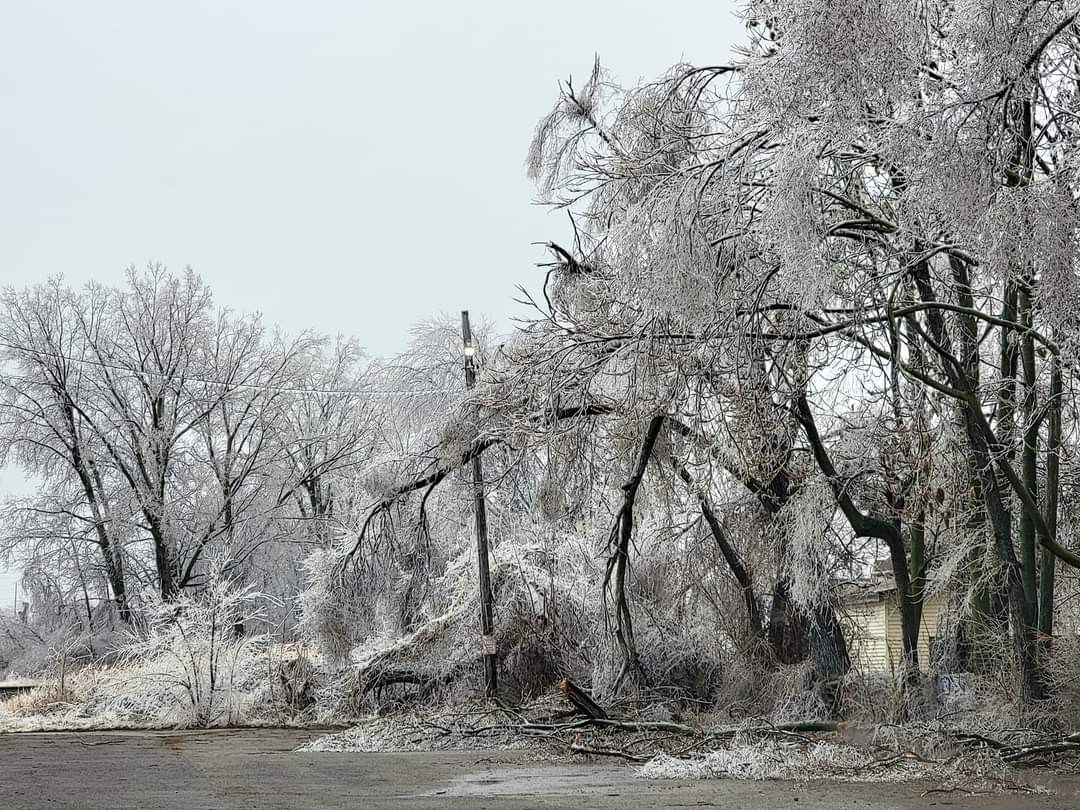
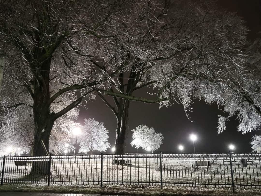
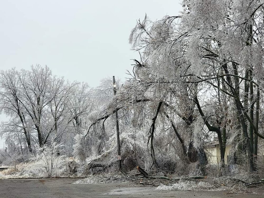
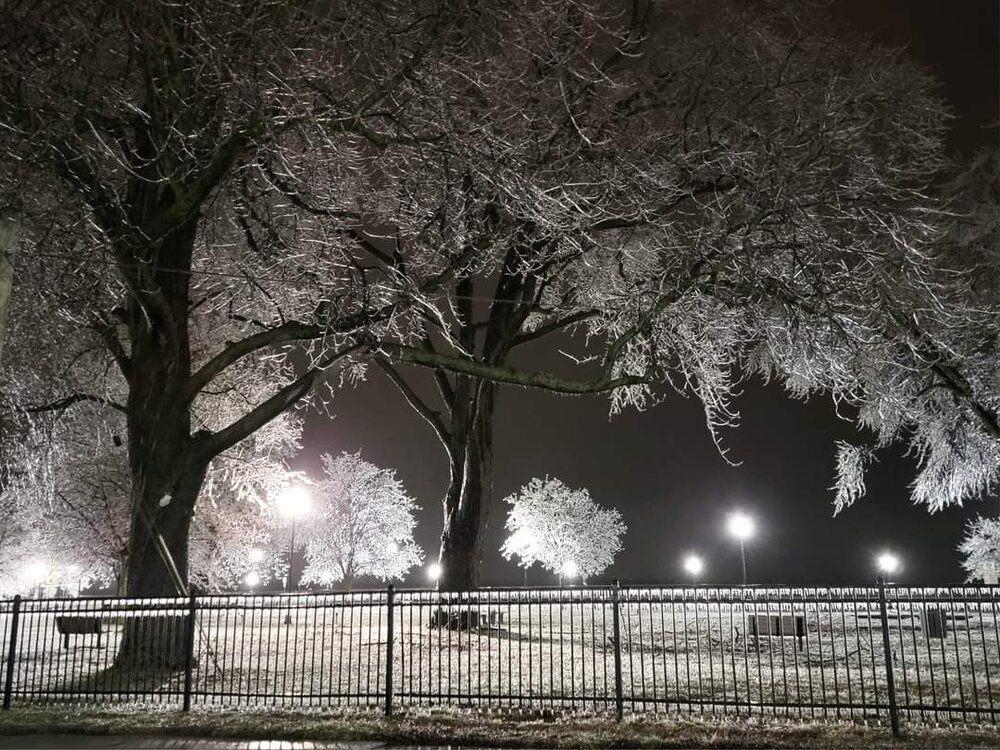
It was closer to a half inch or a little more here but the hardest hit area was around Ann Arbor. As crappy as this Winter has been, this was our third "picture postcard" event in the past month (Jan 22 & Jan 25 snowstorms). The beauty of ice is incredible but I'll take snow all day everyday. When you hear the cracking of ice laden tree limbs all around you; it's a different feel than being outside in a snowstorm or thunderstorm. There seems to be more ice storm signals on the extended GFS which of course means anybody is game.
-
The southern 3 rows of counties in Michigan had a bad ice storm yesterday. Worst ice storm in 50 years in Detroit. The beauty is incredible but the destruction sucks. I lucked out with my trees, others didnt.
-
While we've certainly had some ice storms since then, the news is calling this the worst widespread ice storm in Southeast Michigan in 50 years. The ice has now melted but there's still tons of clean up to do.
-
It was so beautiful I wished the ice wouldnt melt off the trees as it is, but I know better. Last thing we need is more destruction from this storm. Whats crazy is, as crappy as the winter has been overall, this is the 3rd storm in the last month that has provided absolute postcard scenery (Jan 22 snow, Jan 25 snowstorm, Feb 22 ice storm).
-
It's almost comical how you can bank on any graph showing warming/less snow/etc starting in the 1970s. But even in doing that, this graph is absolutely wrong in Michigan. Ran the numbers for Detroit, Flint, and Grand Rapids and all had somewhat of an INCREASE. I'd imagine they used Coop data. Missing data that comes with many coop stations would really help bring down the curve.
-
This was the worst ice storm here since 2002. Walking around this morning and hearing tree limbs crashing to the ground was crazy. Lots of tree limbs and lines down. But SO beautiful. A part of me wishes the ice would stay on the trees for tomorrow when it's cold and sunny, but another part of me realizes that would make things even worse with the wind.
- 776 replies
-
- 20
-

-

-
Quite an Ice Storm in southeast MI. Power flickering, more than half of Wyandotte is without power but I have it so far. Tree branches falling and transformers blowing. I can't think of anything more love/hate for a weather enthusiast than an ice storm. The inconvenience is huge but the beauty is incredible. The last pic is a transformer blowing in the distance. I videoed and screenshot it. You can see blue/green frequently lighting up the night sky.
- 776 replies
-
- 11
-
-
I never realized they had a webcam. I would much rather be up there but the ice storm is pretty cool. After being up North a few days ago though I can't tell you how desperately they need that snow brown ground in st ignace/mackinaw.
-
Lots of power outages, trees down, and transformers blown in Wyandotte but so far all is good here.
-
We just had thunder ice too. My white pine is really sagging, hope its ok.
-
Icy day in SE MI
-
Winter 2022/23 Medium/Long Range Discussion
michsnowfreak replied to Chicago Storm's topic in Lakes/Ohio Valley
I just posted this in the March discussion thread but it's worth repeating. They're getting excited in new england for multiple threats. And southern ne has had a far worse Winter than us. Every subforum has your crowd of "it's been a bad Winter so it's not going to snow in March" and some of them are gonna be dead wrong. -
They're getting excited in new england for multiple threats. And southern ne has had a far worse Winter than us. Every subforum has your crowd of "it's been a bad Winter so it's not going to snow in March" and some of them are gonna be dead wrong.
-
March 2014 & 2015 were fun because of the deep snow. But yes overall exciting wise? It's been a while
-
Let's do a snowy march! February broke the stretch of getting buried so maybe March can break the stretch of being zzzz
-
Had a trace of snow and sleet at the onset otherwise it's been all freezing rain here
-
I didn't know you went up north
-
Yes. It's the only one I can recall
-
Hey you said winter headline lol. Jokes aside there's probably been more than you think of with some sort of headline. I think Jan 1999 was a statewide storm. But obviously many storms that do well for us don't do much for the rest of the state (most recent example Jan 25th) and most storms that do well elsewhere screw us.
-
Technically lol Dec 22, 2022
-
The April 2018 ice storm here had lots of ice accretion on trees and grass but minimal pavement. And I do want to stand corrected we also had a February 2019 ice storm but I was up North during it. So that would be the last real ice storm here.