michsnowfreak
-
Posts
18,382 -
Joined
-
Last visited
Content Type
Profiles
Blogs
Forums
American Weather
Media Demo
Store
Gallery
Everything posted by michsnowfreak
-
What a way to run a morch
-
DTX calling for 11-13:1 ratios.
-
2000 was a very cool and wet summer. Almost no heat.
-
I didn't bother either. It clogged enough Jan 25. It didn't have a prayer Mar 3 haha
-
I'm liking ratios to not be slush with this one. Chances are increasing that Detroit could see its 3rd 6" snowstorm of the winter. Go figure lol
-
Dallas would be TORTURE for me. Absolute TORTURE
-
Feb 1 2015
-
I can walk down to the river (9 blocks away) and see Canada on a clear day hehe.
-
We've done a lot better in Detroit than Chicago. Not good, but a lot better. But I'm different than most. I'd rather be on the cold side of the warm sector and have snow into May. And actually it has been snowing into late April and May in recent years lol.
-
I certainly would not call it likely at this time, but there's an outside chance Detroit could have its 3rd 6" snowfall of the season.
-
It is indeed far different. But Duluth is having a banner season and Chicago a bad one. Some places 45N had awfully bare stretches in mid winter. Just not a good Winter relative to climo except isolated parts of the UP and of course Minnesota.
-
Looks like some heavy snow moved through 1-2am overnight. Woke up to a fresh 1.4". March so far is 7.1", season to date 28.7". DTW also got 1.4", so 7.8" in March and 29.0" season to date.
-
I personally wouldn't call it the best stretch. I'd probably call the last week of Jan to first week of Feb the best stretch, followed by Christmas week. But both the Feb 22 ice storm and Mar 3 snowstorm were very fun storms.
-
I can confirm. It was like marshmallows falling from the sky. It was a true mixed bag from rain to snow and sleet to rain back to snow back to rain lol. Picked up a very slushy 0.2" both here & DTW. The old snow cover is reduced to patches in the shade and of course lots of plow piles
-
Exactly. Every event there are so many factors that play in to what kind of snow ratios you will see and model output perfecting this is a long way away. Knowing your climate certainly helps, but even that is only a part of the puzzle. In some cold events we see the flip side of this scenario, and we get a lot more snow than is forecast because it's so fluffy. Using all the above factors you mentioned, and especially important is giving a forecast range of amounts, it's all you guys can do and hope for the best lol. Unfortunately in the day when there are so many social media hypesters you guys will always take the flack.
-
They're fun to look at but those snow algorithms are taken too seriously by most, myself included. You always hear "___ model overdid amounts" etc but really we should be looking at the qpf.
-
What a cardio workout it was. Sucks to miss the best snows to my nw but can't complain because it was expected amd the snowband was relatively narrow to begin with. This was a very spring like winter storm. Made its own cold air, blew in and roared with ferocity, now the next day is sunny, calm, and very melty/drippy.
-
Your area jackpotted
-
Ratios were an issue (as feared) more than qpf for the immediate south burbs. It was like when you pour water in sand to make a sand castle.
-
Not sure if you got any rain/sleet, but it absolutely compacted here after pouring rain/sleet. 3.5 wet snow + rain/sleet + 2.0 wet snow = depth 4.2 of absolute concrete. DTW finished with 6.2", liquid total 1.11". Morning depth 5". With 6.2" at DTW, they have leap frogged me on season total, sitting at 27.4". My 5.5" puts me at 27.1". Love this lol: WEATHER CONDITIONS THE FOLLOWING WEATHER WAS RECORDED YESTERDAY. THUNDERSTORM LIGHT RAIN HEAVY SNOW SNOW LIGHT SNOW FOG FOG W/VISIBILITY <= 1/4 MILE HAZE BLOWING SNOW
-
Going with 5.5" here on approx 1.15" liquid. Measured before & after the 75 minute sleet/rain deluge. Depth is about an inch lower. It's like shoveling sleet. Never saw a more dense blanket of snow. Season to date now 27.1".
-
Not sure if they reopened but I heard DTW airport temporarily shut down and had incoming flights diverted to Chicago.
-
This is our 3rd potent Winter storm since January 25th. And to be honest, while snow fell short, the Arctic blizzard conditions were something to see December 22nd as well. I was recently telling a wx friend from ny about the winter of 2001-02 and how as warm as it was there were a couple real good winter storms. It seems that the real mild Winters heighten our chance for some potent storms. That said, I'll still always take a cold/snowcover winter first.
-
Lost some Balsam limbs. These poor trees lol. 3rd winter storm since Jan 25 that they've taken a beating.
-
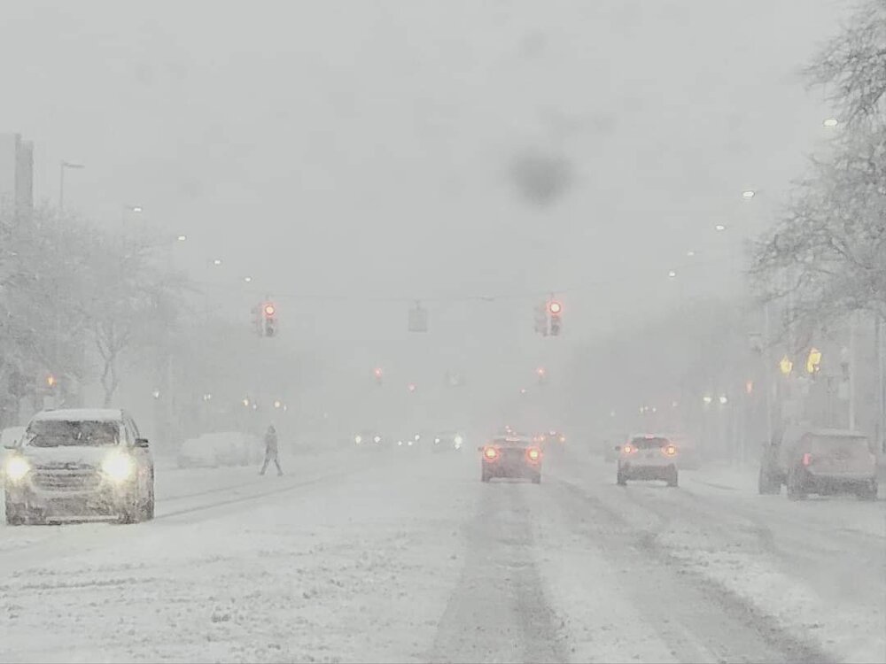
Wild storm. Blizzard conditions, then it poured sleet and rain for over an hour, multiple lightning strikes and rumbles of thunder and now back to snow. Over an hour straight of nonstop pinging is frustrating but can't say it wasn't expected here. Was at 3.7" Before it switched to heavy sleet and rain. Snow is so heavy its crazy. Shoveling will be a cardio workout.