-
Posts
6,649 -
Joined
-
Last visited
Content Type
Profiles
Blogs
Forums
American Weather
Media Demo
Store
Gallery
Everything posted by Terpeast
-

Appreciating Each Other/Poster Compliments
Terpeast replied to SnowenOutThere's topic in Mid Atlantic
Wow, I didn't know that. From his writing I assumed he was in college or just past that. @bncho You've got a bright future, kid. Keep it up, whatever you're doing. -
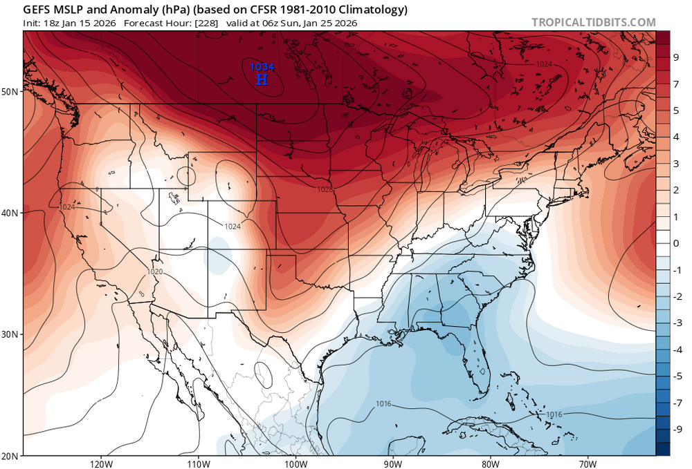
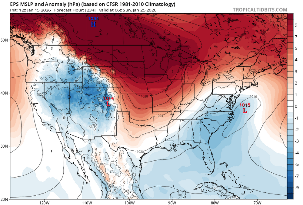
gfs and euro still worlds apart for Sunday. We need those recon flights yesterday haha
-
Fringed
-
No there isn’t. I was looking at 12z
-
Some maps I look at are for commercial use and can’t share publicly
-
El nino during a solar min? Not trying to speak for Chuck…
-
EPS has a mean of 6-8” for the dmv, at least double that of gefs
-
Not sure which storm you were talking about specifically, but there was one coastal storm in feb 2023 that dropped 1.3” qpf imby and more in other places. Temps were 37-40. I’ve wondered if we copied and pasted that storm onto the 60s-80s winters, it would have been 13”+ I’ll add that after last winter and this December, I feel a lot better about future winter prospects compared to how I felt through 22-23 and 23-24. Those two winters were just plain ugly temp wise, but we’ve been getting colder temps so that hasn’t been the issue as much as dryness and the lack of STJ moisture.
-
-
What would make a difference is whether that pacific trough breaks through. If it stops short in the GOA, it'll keep the +PNA ridge going. If it breaks through into western canada, the +PNA will break down and we go warmer (speaking generally across CONUS, east may be slowest to warm even in that scenario).
-
This one is yours. The Ralph Wiggum Storm. Question is, are you gonna deliver?
-
I'm just as annoyed as the next guy at the pull back in trends, but in this case I don't think the GL low is to blame. If it were an arctic high, I think it would be even more suppressive/OTS.
-
Probably best to stick with a personal rule of not getting invested until 3 days before the event - just like the old days. We've seen models, especially the GFS and its ensembles, show something good at 5 days and we think it's "in range" only to have them pull back at 4 days. I also think that maybe the balloon launch cancellations out west are having an effect on the models at the 4-5 day range.
-
Brutal hobby
-
Good news, PNA is finally trending up in the 11-15 day! 6-10 will be moderately negative but not extremely so.
-
Looks like euro was a step back for Sunday, but maybe some snow showers Fri-Sat
-
Aren’t we looking at hr 100-ish?
-
We're still 12-24 hours past the critical 4 day window for this system, so I wouldn't be surprised to see it trend even further at 18z and 00z. Sometimes we even see it trend (either way) inside 48 hours!
-
Taking notes... GFS, ICON, and CMC all three trended closer to the coast for the Sunday system.
-
Looks like the Sunday event is our next best shot at light snow in DC metro (ok maybe some snow showers tonight if lucky). Then a cutter-ish/SWFE event Jan 22-24 where we rain or mix, and things should get interesting after that. Who knows, something might sneak up on us within a couple days in that entire time frame. ngl it's been a boring winter so far - at least we didn't torch for that long. My highest high was 60 this January, and it looks like I won't reach that again for the rest of the month.
-
Sneaky trend for us. Let’s keep that going!
-
Blocking would do it. Or a preceding strong storm that becomes a 50/50 low, ideally both. One other thing I forgot to mention is the reason we don’t want troughing in the NW US is that it promotes a parade of GL lows, which has been a bane for us. That’s a characteristic of -PNA. We don’t get GL lows in a +PNA, instead we get cold highs.
-
Love how it skips the exact panels we want to see. (At least on TT)
-
The map you just posted isn’t actually a “traditionally” neg PNA, but a transient gradient pattern where the index “computes” negative for a few days. More like a bootleg -PNA. However, I would feel better if we didn’t have troughing in the pac NW. We’d want ridging there to maintain the cold supply as the storm approaches here (even as a cut off low or energy undercutting the +pna ridge). I do like the atlantic side, we have a PV pressing down south towards us with confluence. The biggest failure risk is that the western trough gets stronger, the TPV retreats north or NW, and the eastern ridge pumps, and the storm cuts. So far we haven’t been trending in that direction, though. The other end of the spectrum is where the PNA is so positive (with -EPO) that it suppresses the storm south. Right now that is the most unlikely scenario for that window. In short, with -EPO and a strong TPV in SE canada, we’d root for a neutral PNA if not slightly positive. In this case, too much -PNA, cutter. Too much +PNA, suppression. But generally, we get our best snows snowstorms when the PNA is positive. btw this is why we like El Ninos. STJ undercuts the +PNA, which delivers the cold while we get gulf moisture from a STJ wave. Way simpler than trying to thread the needle during a Nina.
-
Normally a negative PNA would dump the cold west of us causing storms to cut, pumping the SER. In this case, hopefully its more transient but atm we may have temp/mixing issues as storms attempt to cut while cold air presses it south. We can hope it continues to trend in our favor as @Chris78 just showed a few posts above. A mildly negative or neutral PNA shouldn’t hurt in our case.


