Terpeast
-
Posts
6,687 -
Joined
-
Last visited
Content Type
Profiles
Blogs
Forums
American Weather
Media Demo
Store
Gallery
Everything posted by Terpeast
-
That one may yield better results for you. Hopefully it'll have a CCB that throws some of that back to us west.
-
Small tip on interpreting 850 anoms - our climo minimum is -4C, so even if it's "anomalously warm" by 3 C, it's still -1 May not be worth much since it's an AI model and I don't trust thermals (yet), and there are other levels where the warm nose could be strongest (probably 750-800 mb). Mesos will help us figure that out as we get closer in.
-
Gfs and euro came into much better agreement on both track and mix line. The only difference is gfs flips us back to snow and keeps it going for another few-several hours, while euro dry slots us after a brief bout of sleet. Dry slot may actually turn out to be freezing drizzle/snizzle.
-
Was so tired last night that I couldn’t even make it to the 0z gfs run. When I woke up, I saw the “hot” flag on this thread so I knew this would be really good… or really bad. Looks like we’re in good shape!
-
The shaded colors illustrate it well. I think its an offset and they cancel each other out
-
So about the same strength and a tick further back. If nam is ingesting the new data, this hasn’t really changed anything imo. All comes down to the NE wave now
-
I’m also starting to think that the new data from the southern piece may not even change things all that much. Everything comes down to what’s going on over Canada. Hope they ingest data from up there.
-
Less phasing, more confluence (TPV up top that wasn’t shown in 12z)
-
Hopefully they’re just narrowing things down and meet in the middle or even closer to Euro’s side, then we’re fine. Unfortunately it’s a bit of a forum divider in terms of mixing.
-
Yeah west Loudoun stays all snow this run verbatim. I flip for a bit, but not before 14” (again, verbatim)
-
This is after 12 hours of snow, 6-9 hours heavy.
-
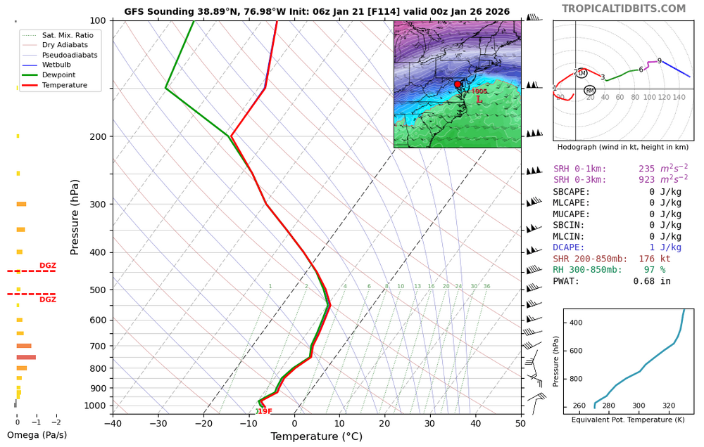
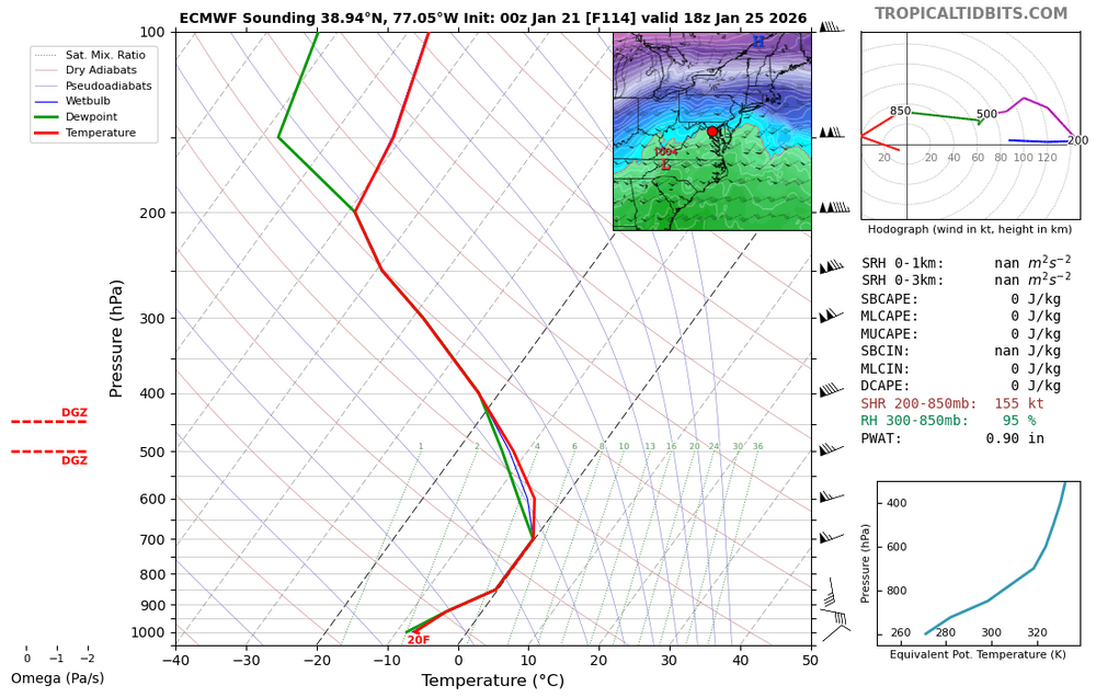
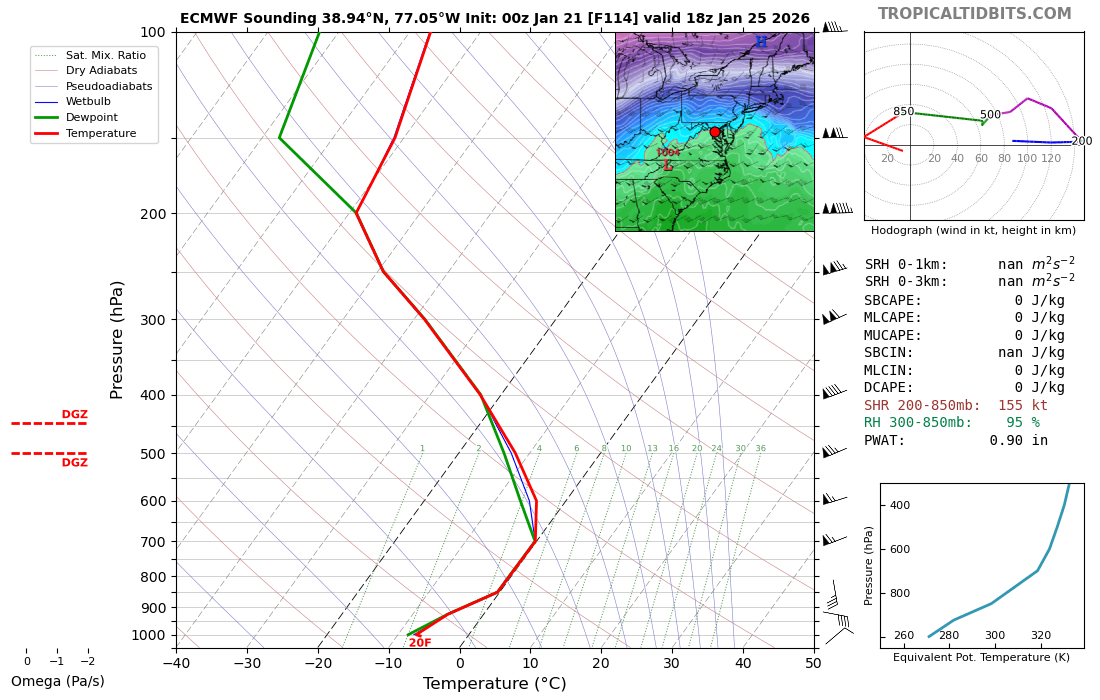
700mb temps - 0 line briefly touches DC on one panel then collapses south.
-
When looking at the 00z runs tonight, pay attention to the difference in both waves out west between 0 hr in the new run vs 6 hr forecast in the previous run. That might give us clues IF there are any differences that stand out.
-
Dangerous to buy into the NAM trend, but it was within its range (60hr) when it spaced the NS and SS waves apart and strengthened confluence. We'll see if other models do the same and backtrack its NW trend.
-
My mom just asked me how much I think we're getting. I gave her a conservative estimate, 6-12" with some sleet. She lives closer to dc proper than I do, so for my own backyard I'd bump that up a couple inches.
-
Well, that's kind of extreme. I'd disagree with him in that Chicago is getting the goods while we mix/ice. Certainly won't rule out some sleet here, but I'd put the snow max along the spine of the Apps through central/northern MD.
-
That being said, I don't think the CMC is right in driving that strong low into the OHV with an arctic airmass in place like that.
-
Model reshuffling in progress. At least CMC gives us 10" before topping off as sleet. If that's the "worst" case scenario, well...
-
You're right. There are more overamped EPS scenarios, but the goal posts are still pretty wide.
-
Still shows the majority of solutions with the max across our south of us. Overamped scenarios are still in the minority.
-
Key words: "especially the northern stream energy which is currently strung out across much of western Canada into the arctic"
-
If I'm at 20.6" I'll tolerate a bit of ice. Whatever falls will become a glacier for at least two weeks maybe three.
-
This is 1960s cold.
-
Whatever it takes to get 20"+!
-
700 mb temps is the level we want to watch for any sleet. BL temps, as depicted right now, are very cold so freezing rain will be minimal. Warmest panel on GFS: Warmest panel on Euro: Warmest panel on CMC - no sounding, but looks like 0-1 degrees C on the sounding over DCA.