Terpeast
-
Posts
6,687 -
Joined
-
Last visited
Content Type
Profiles
Blogs
Forums
American Weather
Media Demo
Store
Gallery
Everything posted by Terpeast
-
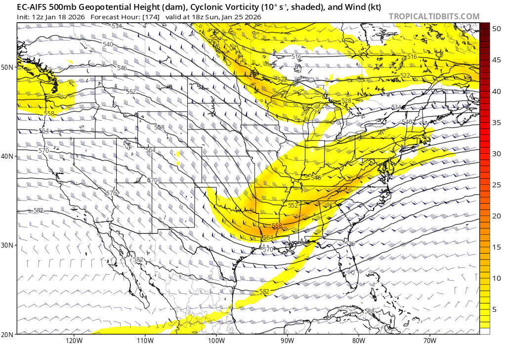
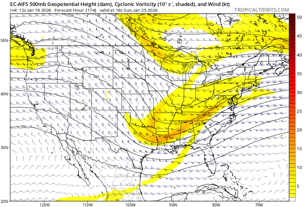
Just checked - AIFS op has been beating all other op models based on 6-10 day verification scores at 500mb over the past 3 months. Let that sink in. Today’s 12z run:
-
You can see a secondary swath across the deep south, so its clear that there are a few suppressed members. But still are in the minority. The op just happens to be one of them this run. Would not be surprised to see a very different 18z op run.
-
Not sure about the ops, but AIFS ensembles have been doing an excellent job at 500mb.
-
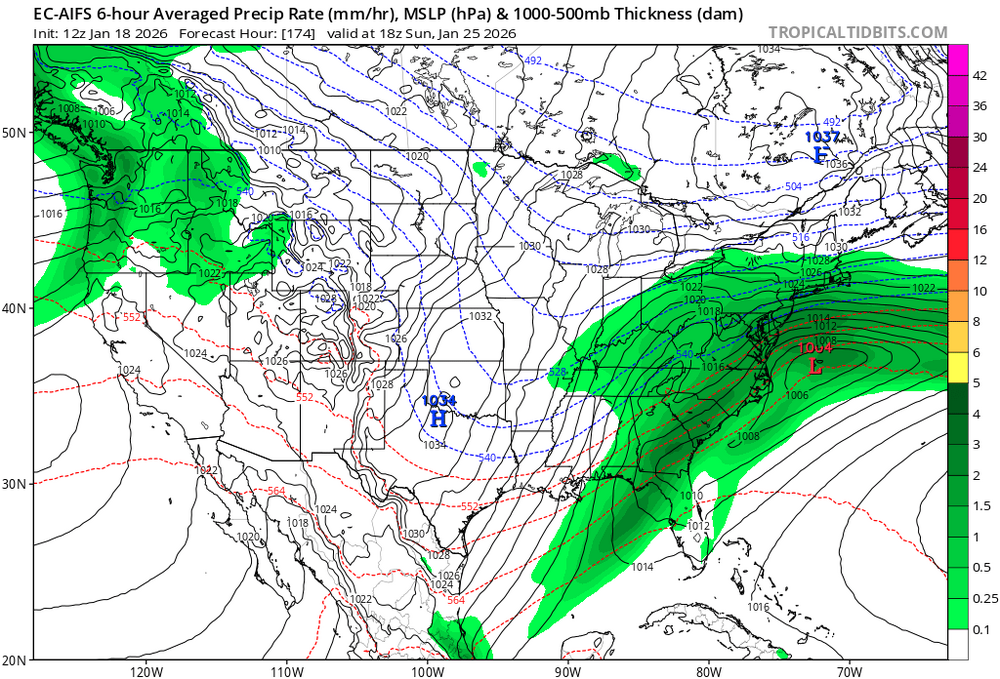
If the weeklies are correct, we’ll be mostly shielded from the canada torch and then winter ends on Feb 23 (unless march does something crazy)
-
Just looked at all ensembles this morning. Nothing really changed. Jan 22 never had support. Jan 25-28 window is what they are keying on. I think the warmer rainy cutter scenario is the least likely. Snow/ice storm most likely, with the likelihood of a suppressed system somewhere in between closer to the lower end.
-
Big fat zero here
-
I noticed gfs is trending that wave faster. Agree we need it to slow down a bit
-
Nothing really. Just the usual
-
Got a point there. This mornings WWAs came a little late for northern MD
-
I guess they just disregarded or didn’t even check the latest models that went warmer and cut back on snow accums. Or maybe they didn’t think the new runs were correct.
-
True, but that means we’re banking on rates to get this to work out for most.
-
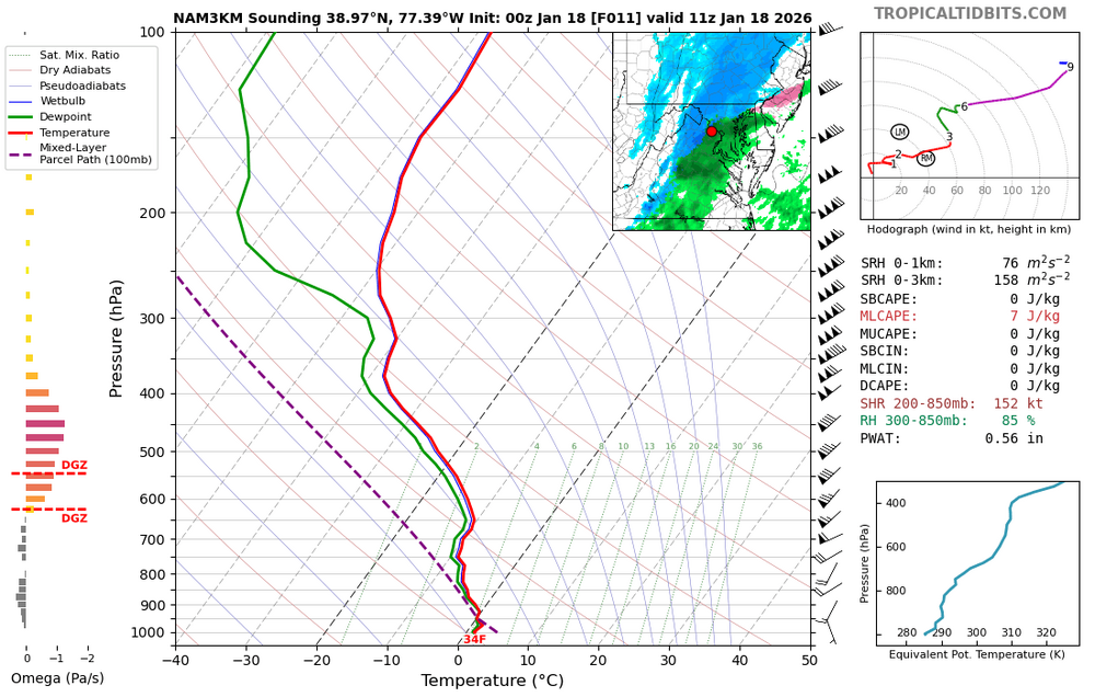
0z nam a little better for mby, but temps stay at 33-34 during the heaviest precip. Sounding is (wet) snow, but will have a tough time accumulating towards advisory criteria.
-
30/27 currently, mostly clear but not that dry
-
Many of us have become extremely attuned to the possibility of a rug like so many before, that if an ens run loses an inch from 10 days out, they go off the cliff like lemmings
-
Yeah, I’m def gonna read their AFD to get a feel for what they’re thinking. It’s also sunday, not like its during a rush hour commute.
-
Wow, that’s bullish. I don’t know if I would have issued a WWA
-
At least this will be more than I got this morning
-
Lean on ensembles after D5 folks…
-
Agree with this map, but a little worried about temps just above the sfc. Prob forecasts give mby 40% chance of reaching 1”
-
New map

-
love how the ens mean hooks the 1.5+ back into the DMV. Could be another potential overperformer
-
Yeah, details are up in the air, but both show a ss wave coming up into cold air nearby. That’s something we haven’t seen much of in these parts around here lately.
-
Yep, I’d lean more on the mesos and even radar as its more of a nowcast situation
-
Gfs ice storm and euro slider, lets split the difference
-
Same