Terpeast
-
Posts
6,687 -
Joined
-
Last visited
Content Type
Profiles
Blogs
Forums
American Weather
Media Demo
Store
Gallery
Everything posted by Terpeast
-
Step in the right direction by gfs. And the cmc, that’s something else!
-
Once we get to 84-96 hours, I’m sure we’ll see a reshuffling of models. No idea which way it’ll go.
-
Still new and untested model like AI-GFS and its ensembles. But it has potential
-
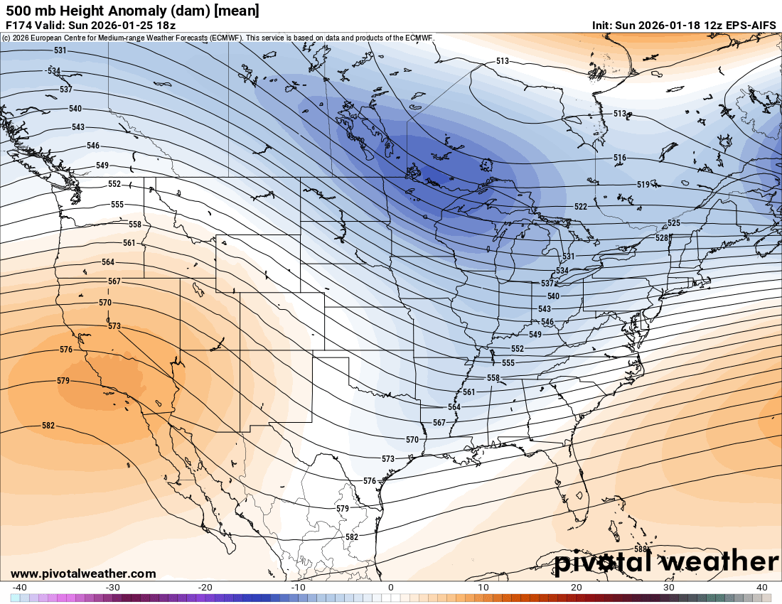
Also notice the PV is more east on gfs than euro, aifs, aigfs
-
The MSL pressure field actually shifted north in the TVA on 6z vs 0z eps. Mostly noise, but the shift was noticeable.
-
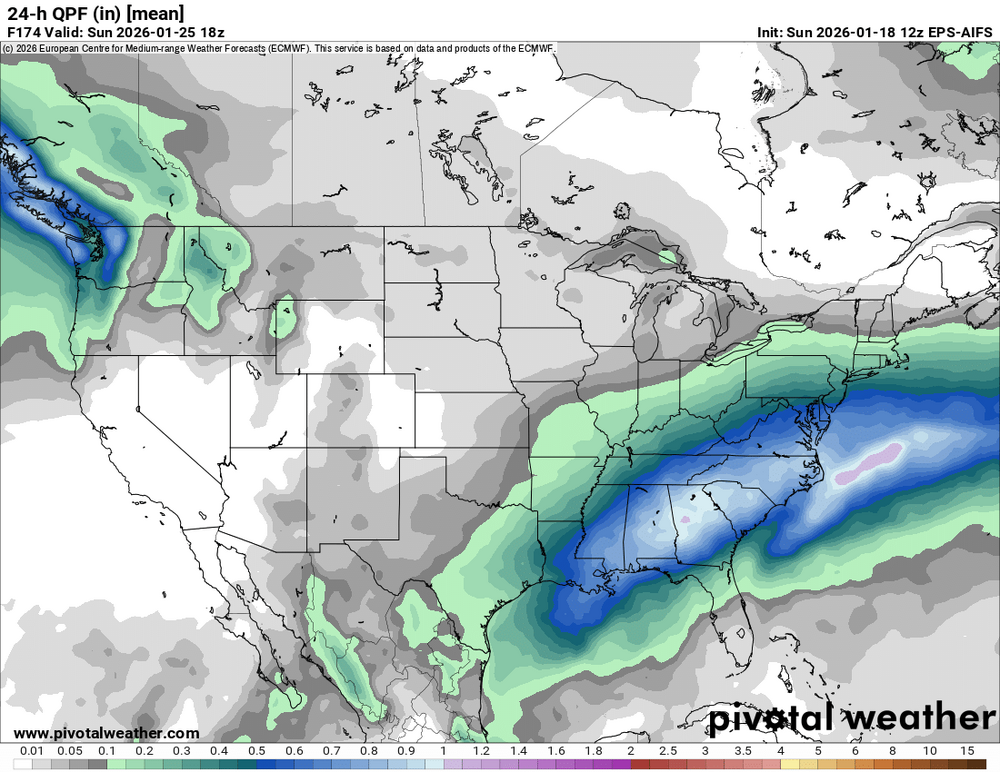
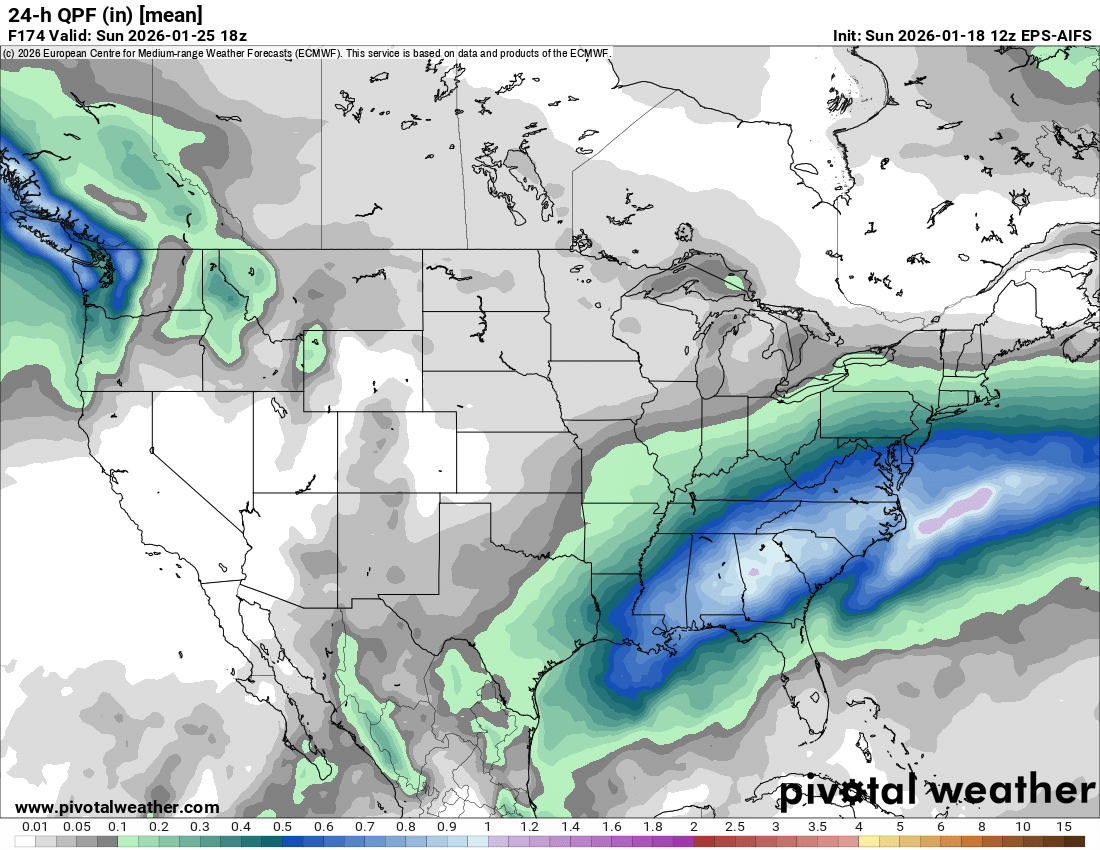
Just woke up. I’ll summarize… models basically held. We’re on the northern part of the precip shield, which could help our ratios and h700 fgen forcing. Cold high is starting to weaken (was probably overdone). And I’ll address this: in this specific case, move that pna ridge a few hundred miles east, and we’ll suppress this thing all the way to the gulf. The EPO is so strong that we need a little SE ridging to give us a good overrunning event. It’s not the same thing as a bomb cyclone HECS, but overrunning with lots of cold can produce a lot of snow if strong enough.
-
Going to sleep now, y’all take the euro. I think we’re starting to see models diverging as they usually do between 5-7 days out, and then they’ll re-converge closer to a final solution at around 4 days, which takes us to Wed-Thur.
-
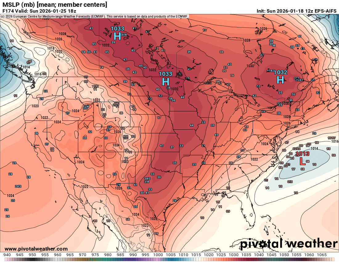
Rare to have >1050 highs. Even 1040 highs aren’t all that common
-
Think I’ll take the under on 1055 on that high
-
Kinda a new development… even more suppressed, then a nrn stream wave pops down and tries to give us some cold smoke. Definitely different from the last two runs. We don’t have the final solution yet.
-
12/19/09 was a relatively high ratio storm, no mixing no dry slots. 12-14:1 thereabouts.
-
This echos my thoughts, same page. Increased chance of suppression based on recent runs bút still not the most likely outcome. Just can’t discount the idea right now
-
Yeah iirc it was stubbornly SE of the rest of all guidance and we were willing it to come NW. In vain of course.
-
And moisture angling wsw-ene instead of due east (or even SE!)
-
Yeah, and what’s more, op gfs has been ranking near the bottom for verification scores
-
Still thinking gfs/gefs may be overdoing the cold dome, its a known bias a week out. Not every day we get 1050 highs rolling in south from canada
-
Actually shifted south on both surface and 500mb. I fear we can no longer discount the suppressed scenario if EPS does the same.
-
I’d pay attention to how the ensembles trend, whether they shift more south or stay where they are.
-
This
-
Fwiw AI GFS doubles down on its 12z look. (It’s a relatively new and untested AI model unlike AIFS)
-
Back edge approaching. All i got was a few flurries and sleet. This storm sucks here. Congrats to those to the S and E
-
50 member breakdown: 33 dmv hits, 16 suppressed, 1 incomprehensible so that favors 2/3 odds of a non suppressed hit, and even some suppressed solutions still get us with at least a few inches
-
Flurries. Microscopic flakes
-
Based on radar i may get a shot at some flurries
-
Here’s AIFS ensembles (which has been cleaning up in verification). MSLP mean is slightly south of the op aifs low position, by maybe 50 miles. But better clustering to the NW of the mean position