tavwtby
-
Posts
2,814 -
Joined
-
Last visited
Content Type
Profiles
Blogs
Forums
American Weather
Media Demo
Store
Gallery
Everything posted by tavwtby
-
yeah looks like a wild few hours here, wind whippin too, changed over quick, but has waffled the last half hour, solid snow now though
-
pretty quick changeover here
-
we flake...
-
We ping...
-
yessir.. sitting at 34/33 and drizzle currently, I have a feeling I may be just a bit east for the real good stuff, think that'll be more norfolk west
-
202 special?
-
ALY still thinkin 4-6 here, we'll see, I'm sticking with 2.5"...
-
rivals everest!
-
weird is, it's been showing like a sub 940 low for a few days now, no? it's like the third time I've seen something crazy like this
-
I am once again surrounded by advisories, with just a hazard outlook...
-
ALY does that too, but not all the time... earlier it had 2.3" for around here, now a range is spit out
-
HRRR trying to flip to SN by like midday here, would be better if this were an overnight type deal, daytime snow in march, especially with antecedent airmass being scoured away is not a good snowmaker imho, unless it absolutely rips, will be windy though especially if that upper jet streak mixes down
-
considering this winters event totals for this area, one would expect 4.5-5", seems to be a popular amount this season... that said I'm not expecting any more than a couple slushy inches, I think a lot of precipitation is wasted before cold push, be happy to bust high, but I think max 2.5" here.
-
this is looking a little more interesting here, it feels great outside now, honestly, unless it's a major snowfall, I really don't want it, just prolongs the mud, but hey we stat pad...
-

March 2022 Obs/Disc: In Like a Lamb, Out Like a Butterfly
tavwtby replied to 40/70 Benchmark's topic in New England
yeah the rate of the snowmelt yesterday was impressive, kids built a snowman at 10, was a snowball by 3 -
well we did have this period pegged for a potential wintry scenario... not exactly how I envisioned it, and still not buying anything but the wind and some cold rain but have a feeling this will surprise
-
yup...on a different note, I was trying to talk my dad out of doing the snow this morning, telling him it'll mostly be gone by sunset, he stubbornly continues, threw a shear pin and wasted a gallon of precious gas...and everything else melted, ha
-
have a feeling this may surprise some folks... I said that about yesterday too, but stuck to my 1-3 and busted high, always nice to bust high...
-
april wasn't too bad last year, for april anyway, but that stretch from mid may to just about July was awful and like rain every other day it seemed, summer wasn't that great either, if you like HHH weather, I for one would sell that crap, but my wife likes it... anyway, I'm a little over 5" from breaking over 18-19, and about 10" from 06-07, as it stands now, fourth worst winter since 1932 when the station near me began recording, awful, but not the worst.
-
jesus, seriously??? 934!!
-
yeah you're right with me there, thanks
-
seems the 2-5 region wide was a legit call
-
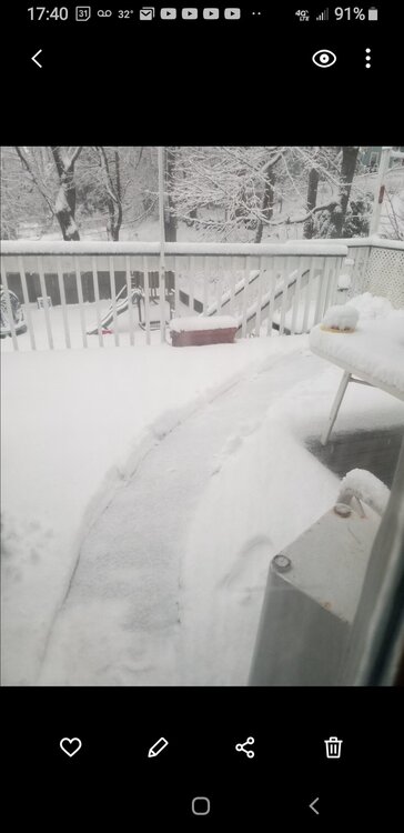
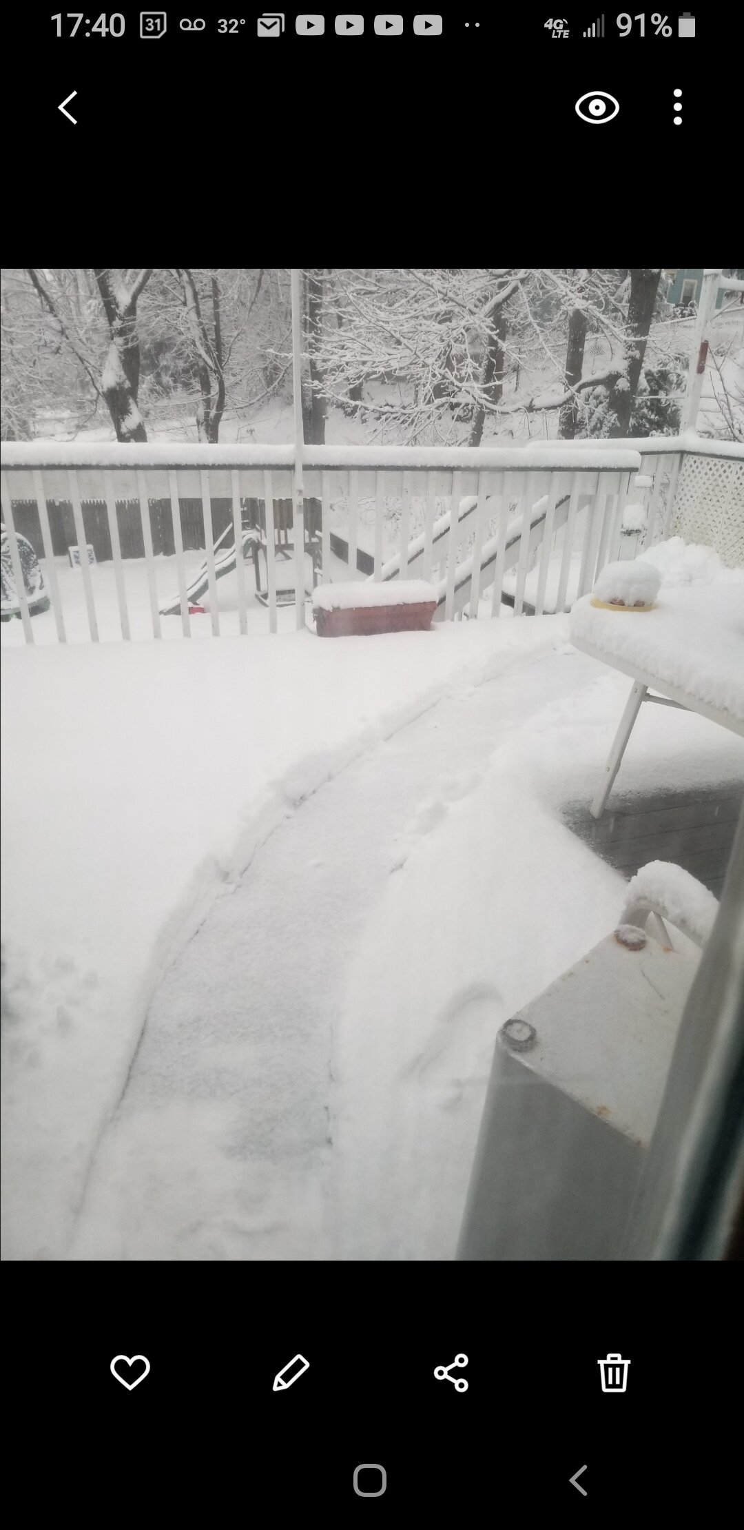
this gonna look real purdy in the morning, until it all goes away.still lightly snowing believe it or not, stuck to absolutely everything even the fence wire had like a half inch on it
-
ovah...5 on the nose almost got to 35 on the season, still about half of climo but whatever, bring on spring... unless Saturday tries to pull something, but doesn't look likely
-
almost an inch fell since I did this, pretty impressive, went and did the walk and chicken run, them birds don't even come out when it snows it's funny, I usually tarp over the coop and run so they have some clear area but didn't last night so they hunkered down today