Baum
-
Posts
4,521 -
Joined
-
Last visited
Content Type
Profiles
Blogs
Forums
American Weather
Media Demo
Store
Gallery
Everything posted by Baum
-
^ snow events on glorified cold fronts have never been money in these parts.
-
^ spot on.
-
GFS out to lunch.
-
^ yet. Has to get in NAM range for that.
-
I'm now pumped to see "a few flurries" added to my forecasts to add some variance to the day in, day out refrain of "Mostly Cloudy with a high in the low 30"s"
-
when does the 18Z GFS roll out?
-
nah.
-
It's a start.^
-
I want part l
-
Much appreciated! Ride it.
-
Z z z
-
Alek and Cary are right. We're screwed.
-
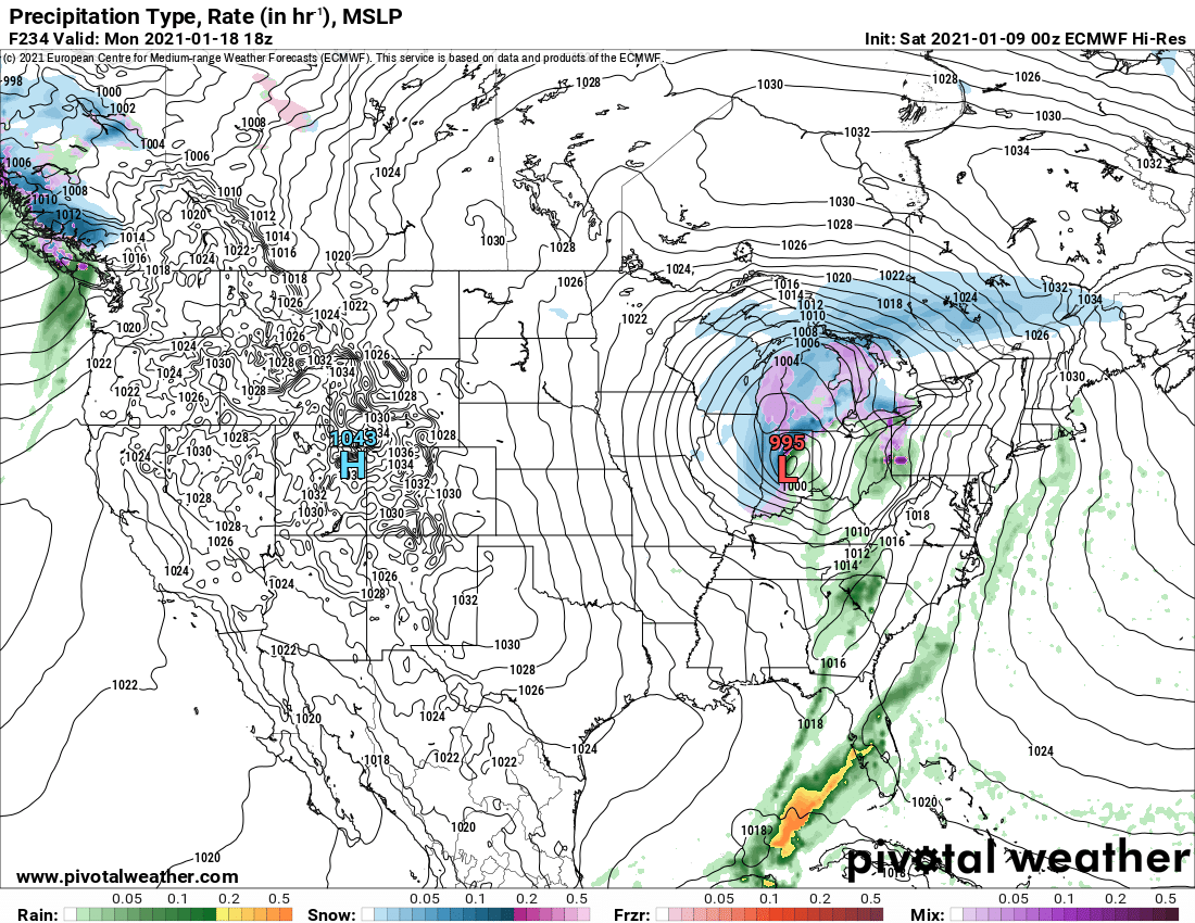
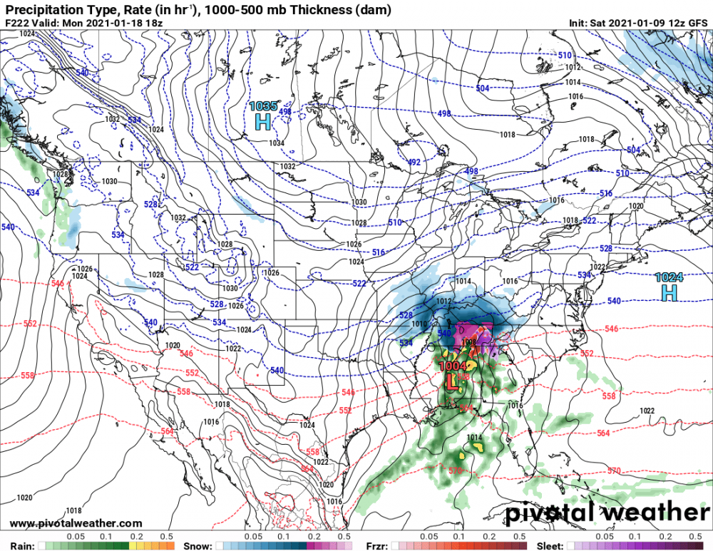
MLK Day....can someone draw a 982 over Indianapolis. Temps in Indy should be 52 degrees. Meanwhile in Chicago 24 degrees with Heavy Snow and blowing snow with 36 mph winds from the northeast. Minneapolis Sunny and -16 at 3pm. Draw it. Thanks in advance.
-
Honestly, I have no clue what the guy is or who he is came across the article and thought it might add to the thread. I'm not even sure if it espouses any direct opinion on the topic one way or the other but it does seem you might be quick to shut down any type of dialogue that doesn't meet your standards or fit your viewpoints. Quick add on here as I went back to make sure the article was not simply a fictional account as noted above. While it is true the author is a fiction writer he has also done non-fiction work. I have included an excerpt that alludes as such: "I hadn’t interviewed scientists about SARS-2 or read their research papers. But I did know something about pathogens and laboratory accidents; I published a book last year, Baseless, that talks about some of them. The book is named after a Pentagon program, Project Baseless, whose goal, as of 1951, was to achieve “an Air Force–wide combat capability in biological and chemical warfare at the earliest possible date.” Just wanted to make sure I was posting relevant material here.
-
If you haven't come across it before, here is some light reading for those so enticed: https://nymag.com/intelligencer/amp/article/coronavirus-lab-escape-theory.html?__twitter_impression=true&s=04&fbclid=IwAR0uLrwtliS8Tg6d2vFG1aGk01Ee_WRdkiyxIa3rbBLjNUCW5uP1_zlgjp8
-
Time for MLK day and Valenties Day, Presidents Day, and St. Paddys day.
-
biggest office, Quad Cities, counters: WITH THE EXCEPTION OF WET WEATHER IN THE PACIFIC NORTHWEST, THE PATTERN ACROSS THE CONTIGUOUS U.S. IS UNUSUALLY QUIET FOR THIS TIME OF YEAR. THERE ARE NO ARCTIC AIR INTRUSIONS OR SIGNIFICANT STORM SYSTEMS ON THE IMMEDIATE HORIZON.
-
my hoar frost event was a bust this AM.
-
Winter doldrums early. Part of the climo. Will just make us enjoy the good stretch when it comes. And these stretches can sometimes breed a surprise or two event....especially in January.
-
It's come to this. Do we post the hoar frost event in a thread by itself or in the short term winter thread?
-
today was your day. And the last 6 days has been epic.
-
^ I'll take optimism everyday.
-
^ too soon. Rubber Band Watch in effect for back half of the month. Enjoy the down time.
-
buckle up.