Powerball
-
Posts
14,471 -
Joined
-
Last visited
Content Type
Profiles
Blogs
Forums
American Weather
Media Demo
Store
Gallery
Everything posted by Powerball
-
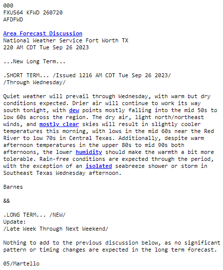
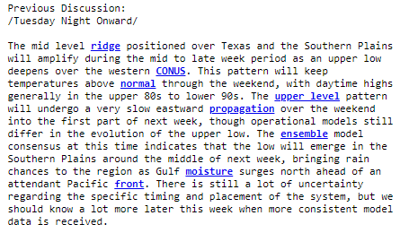
One of the shortest and sweetest AFDs I've ever seen. And the previous discussion for reference:
-
.gif.85857603b61ac18d0fb7fd11ce9ef19b.gif)
-

Texas/Oklahoma 2023 Obs and Discussion
Powerball replied to Ed, snow and hurricane fan's topic in Central/Western States
Welp, the 80s that were in the forecast went POOF. But we seem to be finally done with the 100s, lol... -
Texas/Oklahoma 2023 Obs and Discussion
Powerball replied to Ed, snow and hurricane fan's topic in Central/Western States
Ending uo getting no more rain more other than the 30s seconds of fat raindrops from earlier yesterday afternoon. -
Texas/Oklahoma 2023 Obs and Discussion
Powerball replied to Ed, snow and hurricane fan's topic in Central/Western States
It's finally my turn. Ton of CTG lightning. -
Texas/Oklahoma 2023 Obs and Discussion
Powerball replied to Ed, snow and hurricane fan's topic in Central/Western States
In the mean time, DFW made it to 101*F for the 2nd day in a row, another record... -
Texas/Oklahoma 2023 Obs and Discussion
Powerball replied to Ed, snow and hurricane fan's topic in Central/Western States
For what little it's worth. Radar/satellite look quite underwhelming thus far... -
Texas/Oklahoma 2023 Obs and Discussion
Powerball replied to Ed, snow and hurricane fan's topic in Central/Western States
Just got a bunch of fat raindrops for about 30 seconds. Was enough to dampen the ground and make a few puddles. Fortunately, most of this weak sauce crap percolating seems to missing the airport, so another 100*F high should still be on the table. -
Texas/Oklahoma 2023 Obs and Discussion
Powerball replied to Ed, snow and hurricane fan's topic in Central/Western States
Dallas = New LA... https://www.keranews.org/energy-environment/2023-09-22/new-tool-says-dallas-fort-worth-ranks-third-in-the-world-for-transportation-related-greenhouse-gas-emissions -
Texas/Oklahoma 2023 Obs and Discussion
Powerball replied to Ed, snow and hurricane fan's topic in Central/Western States
There's a good chance DFW will hit 100*F again today. After today, we'll be 1 day short of tying 1998 for the 3rd most 100*F+ days in a year, and surpass 2000 for the most 100*F+ days in September. EDIT: Depending on the evolution of convection throughout the day, today may be the latest 80*F+ low ever observed in the season as well. -
Texas/Oklahoma 2023 Obs and Discussion
Powerball replied to Ed, snow and hurricane fan's topic in Central/Western States
And not to be neglected, new Record Maximum Lows of 79*F were also set at DFW yesterday and today. -
Texas/Oklahoma 2023 Obs and Discussion
Powerball replied to Ed, snow and hurricane fan's topic in Central/Western States
This is also th 9th latest occurence on record for DFW. -
Texas/Oklahoma 2023 Obs and Discussion
Powerball replied to Ed, snow and hurricane fan's topic in Central/Western States
-
Texas/Oklahoma 2023 Obs and Discussion
Powerball replied to Ed, snow and hurricane fan's topic in Central/Western States
lol... -
Texas/Oklahoma 2023 Obs and Discussion
Powerball replied to Ed, snow and hurricane fan's topic in Central/Western States
DFW has made it to 99*F as of 3pm, tying the daily record high back in 2005. -
Texas/Oklahoma 2023 Obs and Discussion
Powerball replied to Ed, snow and hurricane fan's topic in Central/Western States
Oh, and the current record high for today at DFW is 99*F (set in 2005) -
Texas/Oklahoma 2023 Obs and Discussion
Powerball replied to Ed, snow and hurricane fan's topic in Central/Western States
FWD has bumped highs to 99F and 98F today and tomorrow, and is even talking about a Heat Advisory (although I don't see it has been issued officially yet). FWIW, will need 1 more 100*F+ day to tie (with 2000) for the most ever in September. DFW is currently tied for 2nd place with 6 days. EDIT: Heat Advisory just dropped for majority of the CWA (eastern edge of counties excluded) through 7pm Sunday... -
I see Hoosier's back. Grand Reopening and Grand Reclosing?
-
Summer 2023 Medium/Long Range Discussion
Powerball replied to Chicago Storm's topic in Lakes/Ohio Valley
And even for the western parts of the subforum, on balance it wasn't a hot Summer. A lot of similarities to 2009 pattern-wise, with most of the heat centered over LA, TX, New Mexico and Arizona. -
michsnowfreak came out of hiberbation with guns ablazing...
-
Texas/Oklahoma 2023 Obs and Discussion
Powerball replied to Ed, snow and hurricane fan's topic in Central/Western States
That lasted for about 5 days... -
Texas/Oklahoma 2023 Obs and Discussion
Powerball replied to Ed, snow and hurricane fan's topic in Central/Western States
Today should be the last 90*F high at DFW for a while... -
Texas/Oklahoma 2023 Obs and Discussion
Powerball replied to Ed, snow and hurricane fan's topic in Central/Western States
And amazingly, DFW achieved an intra-hour high of 110*F. The 3rd this year and the latest it ever happened -
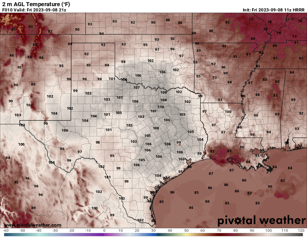
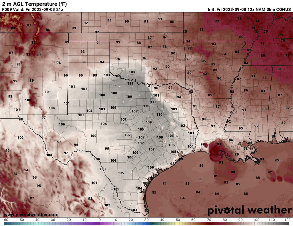
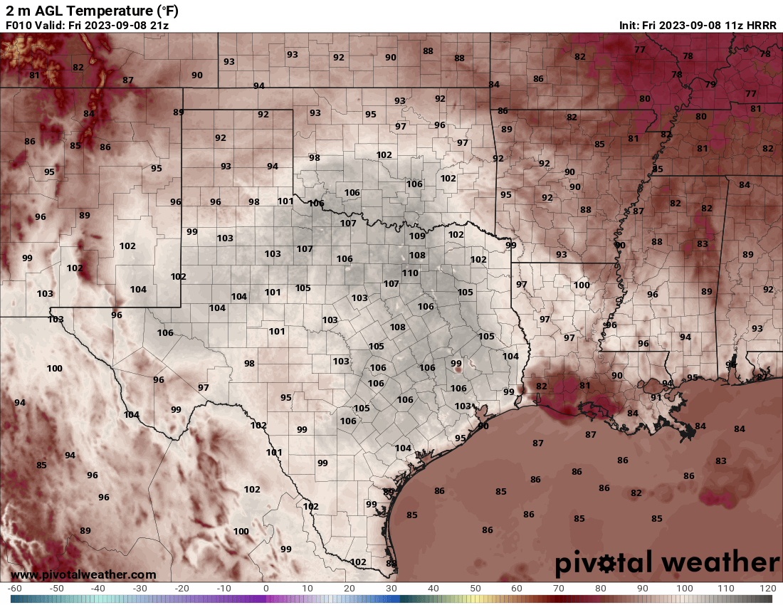
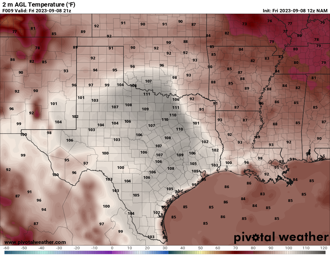
Texas/Oklahoma 2023 Obs and Discussion
Powerball replied to Ed, snow and hurricane fan's topic in Central/Western States
-
Texas/Oklahoma 2023 Obs and Discussion
Powerball replied to Ed, snow and hurricane fan's topic in Central/Western States
Ooof!!!