Powerball
-
Posts
14,463 -
Joined
-
Last visited
Content Type
Profiles
Blogs
Forums
American Weather
Media Demo
Store
Gallery
Everything posted by Powerball
-
Looks like the smoke's going to stick around for Detroit much of the day on Friday as well...
-
I'm guessing there will be a lag with the live maps updating (they're still not working).
-
Gotta love how the satellite's out of commission indefinitely the one day it's needed especially bad, lol...
-
Fun times in Detroit. Strong to severe cap busters on top of wildfire smoke...
-
The HRRR *has* backed off on the visibility restrictions for the southern half of MI, so there's that...
-
Really surprised at how well the dewpoints held up despite the NW flow and deep subsidence.
-
Yes to downsloping.
-
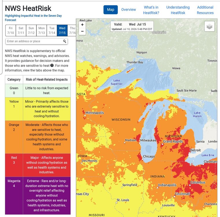
On the plus side, that might be enough to hold temps down on Thursday...
-
Oof...
-
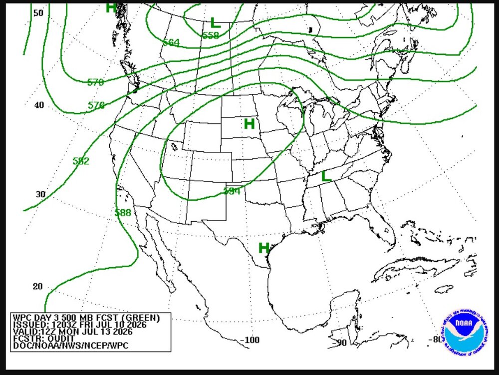
That might also explain why the models have backed off on what was nascent potential for cap busters along the front Wednesday...
-
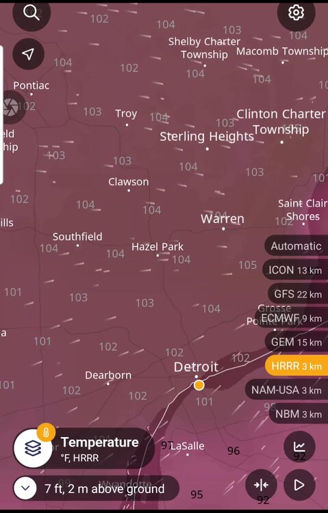
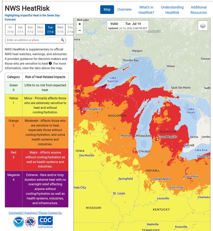
100*F+ seems fairly likely for Detroit tomorrow. About as perfect as a setup as you can get...
-
Funny thing is, while humidity will be lower, there's likely a better shot at 100s with this round compared to the last one, with the peak currently projected to be Tuesday/Wednesday. Duration is a lot more questionable though (especially with NE extent).


-
The bolded is certainly impressive, and surprising.
-
There were also several reports I've seen of a full-blown dust storm preceeding the rain....
-
https://x.com/i/status/2073156007291699252
-
95*F still did manage to happen after all at the last possible moment (5pm obs). So that's 3 total for Detroit this heatwave..
-
There's also a SPC Enhanced Risk area now for Southern MI, all the way from Lake Michigan to Detroit, for daamging winds. Funny enough, there are areas in the Enhanced Risk now that weren't even in the Slight Risk earlier. SPC mesoanalysis does indicate the atmosphere's finally recovering across Metro Detroit from this morning's outflow bubble as well...
-
That is (unironically) a very good analogy, lol...
-
So multiple things can be true, and your post is also misleading on several points... 1. Yes, Detroit did see its most consecutive number of 95*F+ temps (2) in this stretch since 2011. Yes, it's currently 92*F and the heating cycle for today is technically not over, but as dewpoints begin to pool upward for the remainder of the day after mixing down to the mid/upper 60s ahead of the MCV over Lake Michigan, DTW will likely fall short of 95*F today. 2. Coverage-wise, it is/was certainly the most expansive heatwave since 2012. *HOWEVER* 2. Your claim that it's the warmest stretch since 2011 is debatable at best. Definitely true in terms of overnight lows, but terms of duration for 90*F+ highs (6 days) and warmest daytme high (99*F), that distinction goes to 6/27 - 7/2 in 2012. 3. Relative to the aggressive highs in the model outputs, the forecast highs in the NWS grids as well as the duration of this heatwave that was originally projected (which was at least through the weekend versus ending today), this event was a bust. There's no getting around that.
-
Flash Flood situation setting up for parts of Chicagoland...
-
Eh, I just double checked and the cap on the 18z DVN sounding was weak at best. It was really an issue of nebulous forcing if anything. The convergence from the outflow boundary simply wasn't enough to overcome the weak cap for widespread development. It could have easily gone the other way had surface convergence ended up a bit stronger. Now, the 80% probability given for a watch was way too presumptuous (a MD for isolated coverage, which did happen, would have been better), I'll grant that. But the potential was there and their discussion did a good job delving into the backgroud environment that existed. The thing too is, there will be more conditional / low-predictability opportunities like this all throughout the weekend. Above all though, this MD was nowhere near as bad as the Broyles one a while back.
-
To be fair, there was one severe cell that did go up. I'm pretty sure it hinged upon surface convergence along the outflow / differential heating boundary from the early day MCS in Northern WI / MI being sufficient enough for widespread initiation, and it was close as several other cells did attempt to go up. But hey, it happens. And it just shows how sensitive the potential is in such a moisture-laden / high instability / weakly capped environment.
-
They apparently got slammed with severe t'storms too afterwards...
-
https://x.com/i/status/2072348771464155192
-
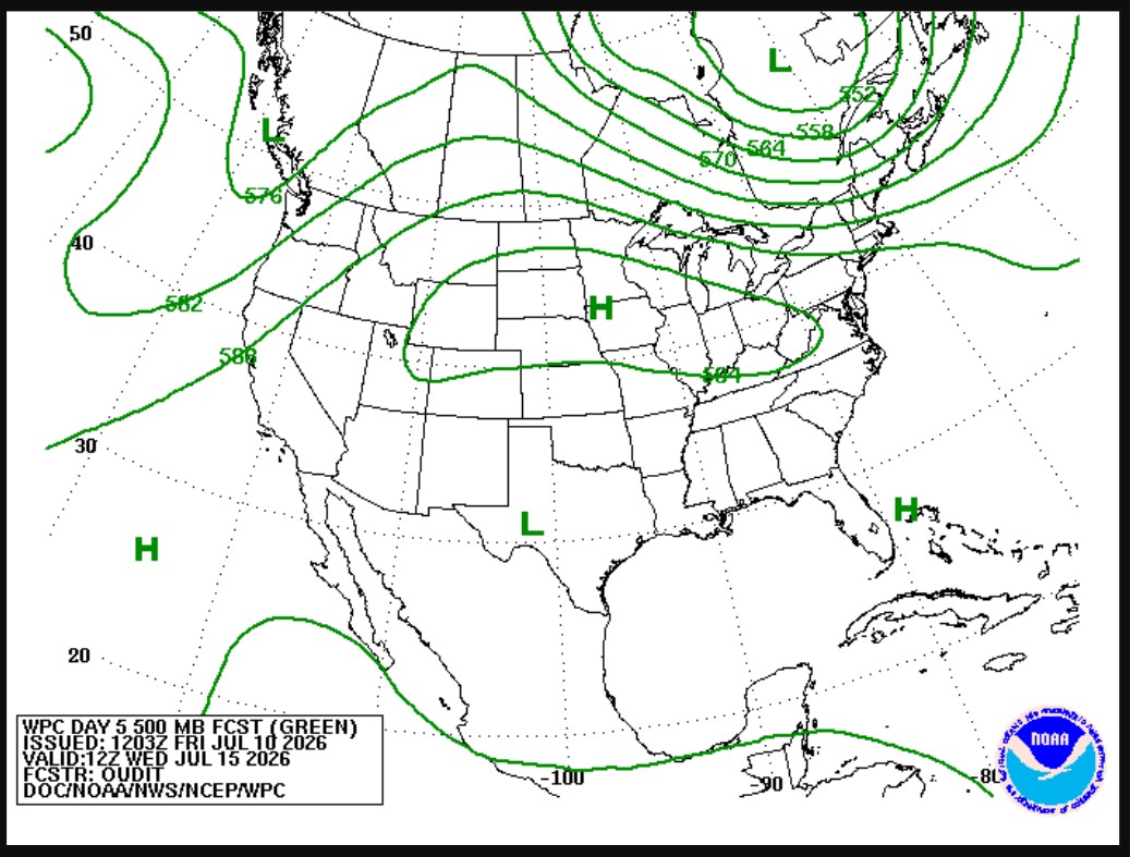
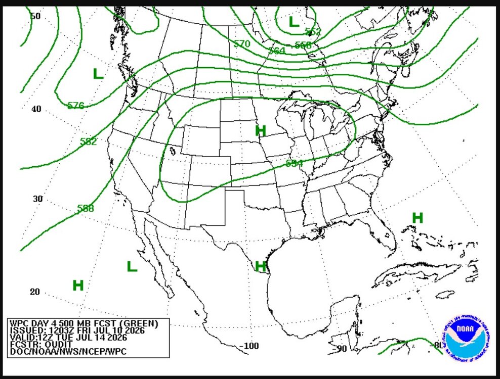
Classic ROF setup the next few days for northern parts of the subs, certainly an upside to the center of the ridge ending up flatter and further SE than originally expected...