

Maggie Valley Steve
-
Posts
979 -
Joined
-
Last visited
Content Type
Profiles
Blogs
Forums
American Weather
Media Demo
Store
Gallery
Everything posted by Maggie Valley Steve
-

2025-2026 Fall/Winter Mountain Thread
Maggie Valley Steve replied to Buckethead's topic in Southeastern States
Temperature is down to 30. Wind is picking up and the ground is wet. No snow here so far. -
2025-2026 Fall/Winter Mountain Thread
Maggie Valley Steve replied to Buckethead's topic in Southeastern States
I managed to hit 49 today. Tomorrow should be a bit warmer making my warmest day so far this December! Snow returns Saturday night into Sunday as the Arctic front arrives with very gusty winds and windchill real feel temperatures in the -10 to -15 range and actual low temperature of 8 degrees Monday morning. The coldest I've had was back on November 11th with a 7 reading when the last Polar Vortex lobe hit our Region. -
2025-2026 Fall/Winter Mountain Thread
Maggie Valley Steve replied to Buckethead's topic in Southeastern States
I apparently had a bit of very light snow overnight. I suppose it's officially a trace, but I'm still surprised this far south. -
2025-2026 Fall/Winter Mountain Thread
Maggie Valley Steve replied to Buckethead's topic in Southeastern States
Looking like we actually have a true clipper system heading our way overnight. I expect Buckethead will report an inch or two overnight. Perhaps flurries here in Haywood County overnight. The fast flow continues into the coming weekend! -
2025-2026 Fall/Winter Mountain Thread
Maggie Valley Steve replied to Buckethead's topic in Southeastern States
I managed a trace of snow. Haywood County schools are on a 2 hour delay today. -
2025-2026 Fall/Winter Mountain Thread
Maggie Valley Steve replied to Buckethead's topic in Southeastern States
I'm getting sleet mixed with rain currently. -
2025-2026 Fall/Winter Mountain Thread
Maggie Valley Steve replied to Buckethead's topic in Southeastern States
Currently 30. I had a trace. Keep adding to those seasonal totals! -
2025-2026 Fall/Winter Mountain Thread
Maggie Valley Steve replied to Buckethead's topic in Southeastern States
Finally getting snow in the Valley from the squalls. Nothing showing up on radar, but it's snowing. -
2025-2026 Fall/Winter Mountain Thread
Maggie Valley Steve replied to Buckethead's topic in Southeastern States
I drove up to Soco Gap (4300 ft) at the Haywood/Jackson County line at the Parkway. Snow squalls are dropping enough snow to cover 19 at times above 3800 ft, but our DOT is standing by with salt and plows.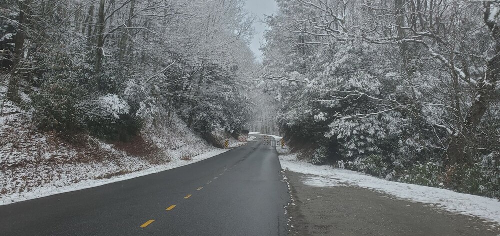
-
2025-2026 Fall/Winter Mountain Thread
Maggie Valley Steve replied to Buckethead's topic in Southeastern States
Temperature is dropping and winds out the NW are increasing currently. Cataloochee has light snow falling as well. I can see off my front porch snow showers are moving in from the Cataloochee Mountains, so in an hour or so, we could see light snow in the Valley. -
2025-2026 Fall/Winter Mountain Thread
Maggie Valley Steve replied to Buckethead's topic in Southeastern States
Should get a break the next couple of hours as the cold front arrives and upslope snow begins. Temperature has risen to 35 now and the fog is only a couple of hundred feet above the Valley floor. -
2025-2026 Fall/Winter Mountain Thread
Maggie Valley Steve replied to Buckethead's topic in Southeastern States
Just woke up and walked the dogs. 34 with a rain/snow mix. Cataloochee is snowing and 31. Edit to add: I have all light snow now -
2025-2026 Fall/Winter Mountain Thread
Maggie Valley Steve replied to Buckethead's topic in Southeastern States
Like last evening, temperature is falling quickly but I do have a bit of breeze this evening. My high was 49 today and have dropped to 38 under clear skies. Hunter in his afternoon post on X stated that this is a two part system. The first coming early tomorrow morning and lasting to around 10 AM. The second part of this system should arrive after 3 PM and he believes this one will drop 2 to 3 inches across the Smokies and Balsams. He stated it should wrap up before daybreak Tuesday morning. -
2025-2026 Fall/Winter Mountain Thread
Maggie Valley Steve replied to Buckethead's topic in Southeastern States
The 12Z GFS solution is coming in with a nice hit..thumb.png.f5a7ed74dd26bbc7821c5a72f1d6d0fd.png)
-
2025-2026 Fall/Winter Mountain Thread
Maggie Valley Steve replied to Buckethead's topic in Southeastern States
The 12Z 3km NAM suggests 2 to 3 inches here in the Valley. Even Asheville gets snow! That models continues to suggest a good 24+ hours of light snow in Haywood County. Is it enough for GSP to expand the WWA this afternoon?.thumb.png.d0bc842baddcec925f3b2b79aa125dfc.png)
-
2025-2026 Fall/Winter Mountain Thread
Maggie Valley Steve replied to Buckethead's topic in Southeastern States
No freezing fog at the house this morning. It's currently 25 which is my low. Snow makers are busy up at Cataloochee and Tube World here in town. I'm not expecting much from the system coming in overnight into tomorrow. Late this week we are likely to get the coldest air of the season as lobes of Arctic air heads our way. It's too soon to know if we will have precipitation arriving with the Arctic front. -
2025-2026 Fall/Winter Mountain Thread
Maggie Valley Steve replied to Buckethead's topic in Southeastern States
Currently 30 with frost. -
2025-2026 Fall/Winter Mountain Thread
Maggie Valley Steve replied to Buckethead's topic in Southeastern States
Anyway, skies have cleared and the temperature has dropped 5F the past hour. Currently 37 at 5 o'clock. -
2025-2026 Fall/Winter Mountain Thread
Maggie Valley Steve replied to Buckethead's topic in Southeastern States
Maggie Valleys average is 8 to 10 inches a year. I've surpassed for the last 6 years and already well on the way to surpass the average again this winter. We need a big synoptic storm Region wide to calm the Mountain envy! -
2025-2026 Fall/Winter Mountain Thread
Maggie Valley Steve replied to Buckethead's topic in Southeastern States
That's simply not true. I've averaged over 8 inches every year for the last 6 years and have even seen a couple of years over 25 inches. I bet Buckethead has been above average as well. -
2025-2026 Fall/Winter Mountain Thread
Maggie Valley Steve replied to Buckethead's topic in Southeastern States
The 12Z GFS remains aggressive for a nice little event Sunday night/Monday/early Tuesday..thumb.png.cde71be4ba36dbae733bf48b5a53b8e5.png)
-
2025-2026 Fall/Winter Mountain Thread
Maggie Valley Steve replied to Buckethead's topic in Southeastern States
Woke up to a low of 34 here in the Valley at 3200ft. Looks like Cataloochee dropped to 33 with light rain. Warm nose saved us for this event. Keeping an eye on Sunday afternoon into Monday for another shot of wintry weather. I see DC has snow this morning. Good for them. -
2025-2026 Fall/Winter Mountain Thread
Maggie Valley Steve replied to Buckethead's topic in Southeastern States
38 and light rain currently. -
2025-2026 Fall/Winter Mountain Thread
Maggie Valley Steve replied to Buckethead's topic in Southeastern States
Stuck at 41 after a low of 26. Wet bulb is 28 with a DP of 19. Radars from Morristown and Nashville are juicy! -
We Mountain folks are pulling for you guys! Don't give up, it's December 3rd and we aren't even into prime time climo wise for the Region!


.png.d2823165dddbb7e42894683ae76f38a9.png)
.png.57d5d0d4bd09f77675e6350377c02840.png)
.png.b51b71007800fbd025524d151ccca91f.png)