Bob Chill
-
Posts
36,386 -
Joined
Content Type
Profiles
Blogs
Forums
American Weather
Media Demo
Store
Gallery
Everything posted by Bob Chill
-
From a "real feel lol" perspective it most likely will. Should get good mixing/turbulence once the sun does its thing. Yesterday was a good reminder about southerly flow+saturated column. Winds near the surface have to fight to touch it. I've personally never witnessed a significant southerly wind event anywhere west of the bay. Every prediction underperforms. Westerlies have it easy. They get tumbled and pushed to the surface. Maybe you can witness some beautiful devastation in your yard today. I'm rootin for ya brother
-

Jan Medium/Long Range Disco 2: Total Obliteration is Coming
Bob Chill replied to Jebman's topic in Mid Atlantic
You and I have have different perspectives on this for geographic reasons lol... but I really don't like vertical tracks. Off the coast or not, they are awful on the nerves leading in and our geography/latitude typically fights my yard. These storms can pop of course but there's a long history of scrapes and whiffs in my memory banks. ONE of these days... oh boy I tell ya... and it's going to be awesome if it happens while I'm still alive... a BIG FAT stripe of snow from Nashville TN to just south of Cape May will happen again... some day.... lol -
Jan Medium/Long Range Disco 2: Total Obliteration is Coming
Bob Chill replied to Jebman's topic in Mid Atlantic
Analogs are loading up for the d8-11 period. Recent notable dates are Jan 03, 04, and 96. 2003 was wintry but not much precip. Jan 2004 was an inch away from epic. Jan 96 showing up as well but opposite enso so theres that. Nearly all analogs center during periods of winter wx. Majority light/mixy but some impressive dates either way. -
Jan Medium/Long Range Disco 2: Total Obliteration is Coming
Bob Chill replied to Jebman's topic in Mid Atlantic
I'm pretty optimistic about at least 1 decent event this month. I don't like seeing so many runs with mix lines west of 95 tho. It's been a strong personality trait this winter. Sometimes those are hard to shake. We'll see -
Jan Medium/Long Range Disco 2: Total Obliteration is Coming
Bob Chill replied to Jebman's topic in Mid Atlantic
CFS monthly looks just as sweet. All 3 global ens are moving in this direction late in their runs right now and it makes sense (at least to me lol) Get the -AO/NAO/EPO combo and we won't have many temp problems. Get those features linked and stable and we can probably stumble drunk into a nice storm. Might be the only way cuz we bout tried errything else man.... sheesh... lol -
Jan Medium/Long Range Disco 2: Total Obliteration is Coming
Bob Chill replied to Jebman's topic in Mid Atlantic
I'm having doubts of any kind of relax now. Been expecting ens to rebuild or not unbuild the general blocking theme as leads shorten. Happening kind of quick. That's very encouraging. Nobody in here wants to deal with a 1 week wait just to get cold close enough to snow again. This is acceptable for Feb too -
Jan Medium/Long Range Disco 2: Total Obliteration is Coming
Bob Chill replied to Jebman's topic in Mid Atlantic
Considering the personality of this winter, the last thing on my mind is models locking in suppressed at long leads. Lol. Sure, it could happen any winter for many reasons. This winter doesn't want to carve east with any kind of efficiency. Everything has been "loosening up" in the mid range so far. I won't bet against that until I lose the hand. -
Jan Medium/Long Range Disco: Winter is coming
Bob Chill replied to stormtracker's topic in Mid Atlantic
They're good for looking at the northern hemisphere and how things could evolve. When I look at the weeklies above it makes a lot sense to me. Epo ridge still there but higher heights/pressure squeezing back into the NAO region. So the idea of blocking flexing after the TPV does the do-si-do around the pole and heads south again. Adds some confidence to my thoughts earlier about how we move thru the month. What the weeklies aren't good for is snowfall/storms or anything specific. I only use them to know whether to close my blinds or not. Right now they remain open. -
Jan Medium/Long Range Disco: Winter is coming
Bob Chill replied to stormtracker's topic in Mid Atlantic
My guess is the "breakdown" is nothing more than a reshuffle. The closed ridge floating towards Siberia is a bit of a thorn because you can't connect that to the AO/NAO space. Earth won't allow it. Lolol. Maybe it rolls over the top and ends up beefing up a -AO. Maybe it just dissolves and heights build around the pole just cuz. I'm not nearly smart enough to know the how's but I've watched this stuff long enuff to know that this blocking event most likely isn't super anomalous and temporary. It feels more like a setup for multiple reiterations of the same general idea. That said, falling completely apart is on the table so if leads shorten and the blocking idea vanishes it's a big net negative to the future of our winter. Analogs look very active. Lots of mixed events in there but the analogs are screaming precip with a colder profile. Some of the analogs show that it marked the beginning of a very active period like Jan 1982 listed below. Mixy but plenty wintry. Late Jan 82 into early Feb was active too. What the analogs and ens haven't been showing is big dog potential. So seeing active mixy periods with limited big storm potential is a pretty fair take for right now. Something big can pop for sure given the activity but nothing really points towards a big storm yet. If it does, you know I'm all in. But only once my personal algorithm tells me to get excited lol -
Jan Medium/Long Range Disco: Winter is coming
Bob Chill replied to stormtracker's topic in Mid Atlantic
My first instinct right now is to hedge on the block not really decaying but wobbling and pulsing. I think you probably agree. For people who aren't used to using ensembles, they may think "decay" means "gone". It could happen that way but my take in lr ens is simply spread smoothing the mean to a point where features get washed. My gut guess is the AO/NAO block will remain intact and as we move forward in time the ens means will show that as leads shorten on the current decayed look. In a best case scenario, this will continue for 4-6 weeks. At least for a couple. Not a week and done. That would be anomalous based on history of previous strong blocking events. Eta: I'm not talking about the specific west based nao block as much as the ao/nao domain space in general. NAO domain is quite volatile but not the AO. Time will tell but history is behind us at least -
Yea, not too exciting with this setup. Like MN said above, anything southerly rarely mixes down west of the bay. Especially when its a saturated airmass. I never even get good northeasterlies during a big snow storm. Same kind of thing. It's hard to get those winds back down to the surface once deflected. The bay on the other hand, it loves southerlies. Lol. The channeling affect of the land (especially with southeasterlies) accelerate the wind. GFS is most certainly seeing that. What it doesn't see is ground truth of how wet southerlies work in the piedmont lol. Westerlies (especially NW) are a different beast. The can mix real well with the dry air, uneven heating, and topography. Westerlies tumble down like waves. High winds come in pulses. That when piedmonters can watch beautiful devastation from the comfort of our homes.
-
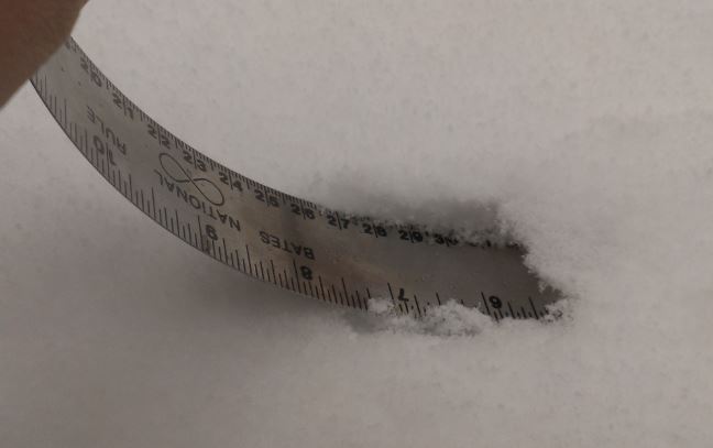
OK western crew, times are tuff and imma let u in on a Iittle secret... You'd be surprised how little snow you need to report 6"+. I thought I would get that much but not this time. Don't let me down
-
Jan Medium/Long Range Disco: Winter is coming
Bob Chill replied to stormtracker's topic in Mid Atlantic
Setup for front end possibilities after this weekend looks much better on both the gfs and cmc ops. Better spacing and heights in the wake of the weekend system -
CMC is backing down on the amp thru 78. Colder run likely at least for one model... with an ugly previous solution. Lol
-
Always feels like I need a neck brace when I leave this place lol. It's Tuesday. It can shift north and south and strong and weak multiple times still. Ops will still be divided in some way today. We can wrangle, bicker, and ring or just watch and wait. It's a choice. Lol. Considering the track and origin of the shortwave, my hunch is it ends up stronger than whatever the 72 hours progs are showing Thursday AM. Is that good or bad? Only Thursday knows. Lol. About the best time of year you can ask for with a marginal aka seasonable airmass. It's not going to be cold smoke in either of my yards I don't think. I'm prob going to CT wed-early sat AM. I can stay the weekend if it ends up a northern storm. Idk what to think yet. Little things mean a lot and there are a lot of little things that need to happen before really knowing what to expect. I don't expect a big memorable storm in my yard. 3-4" would do it for me to be satisfied for a while. Clean ground/grass cover with the blanket look and not bumpy shallow potatoes. Is that really too much to ask? ...don't answer
-
Jan Medium/Long Range Disco: Winter is coming
Bob Chill replied to stormtracker's topic in Mid Atlantic
EPS is basically just as sweet but I like the PAC on the GEPS better. The entire d10-15 period looks amazing from a pattern evolution perspective. I mentioned this in the last couple days that the PAC was primed to get right and this panel shows it perfectly. Split flow, all 3 streams meeting somewhere in the middle of the conus, potential shortwaves aimed at us from the pole, pac nw, and some pineapple connection. The magnitude of the west based block showing up at long leads is jaw dropping at this point. Lovin this man. -
Jan Medium/Long Range Disco: Winter is coming
Bob Chill replied to stormtracker's topic in Mid Atlantic
6z Gefs has pretty much dropped the trouble to our west. Only 1 member driving a low into Ohio. The rest are money. This is a beautiful panel really. Could be the op wagging the ens but either way, track is locking in for now. If 12z and 0z tonight don't wiggle much then it's pretty safe to assume there will be few if any big shifts going forward with storm track. Significant ground truth shifts will occur every 6 hours tho hahahaha lol. Imma just hug the snowiest from here on out. Never fails... to punch my dreams right in the face -
Jan Medium/Long Range Disco: Winter is coming
Bob Chill replied to stormtracker's topic in Mid Atlantic
Generally speaking, that usually only happens with progressive flow and northern stream systems. Slower moving southern stream systems with any kind of block are modeled pretty well by 96-120 hrs. Doesn't mean a 20 mile shift can't destroy hopes and dreams tho lol -
Jan Medium/Long Range Disco: Winter is coming
Bob Chill replied to stormtracker's topic in Mid Atlantic
Not having the mids get lambasted with a primary to our west driving to or north of our latitude is a huge relief. Even the improved airmass on guidance can't offset that. Need deep cold. Seems like now we are just watching wobbles with a favorable but a bit too close track to our SE. Not a bad place to be right now. I know what you're rooting for and I'm good with that because if you get hit flush, my property in VA will as well. I'd prefer to be down there for a good storm but opposite direction usually lol -
Jan Medium/Long Range Disco: Winter is coming
Bob Chill replied to stormtracker's topic in Mid Atlantic
We've seen this stuff in past morph into a weaker solution with a front end thump/dryslot. Ops often back down on strength with big cutters a week out. Get a modest wedge with snow on the ground and I can easily see it be a mixed event with decent accums (2-5"). We've had many in the past buy they aren't too memorable because of dryslot drizzledrip and slush when it shuts off. Either way it looks like a juicy storm cutting west is in the works no matter what. We'll see how it goes -
Jan Medium/Long Range Disco: Winter is coming
Bob Chill replied to stormtracker's topic in Mid Atlantic
We'll run circles defining the hybrids. We've done it many times lol. Any storm that jumps is called a Miller b because it looks like one but me and you dont see it that way. Barolclinic transfers from a low approaching from the deep south is not a Miller b in my book. They usually have big juicy WAA in front. A defining difference from a NS Miller B that never gets going until it's gaining latitude. Just my take and separates the 2 in my brain with how I view the possibilities. -
Jan Medium/Long Range Disco: Winter is coming
Bob Chill replied to stormtracker's topic in Mid Atlantic
CMC is simply amped. It wasn't the elephant OH transfer solution. If the euro shows the same heights (or better) at hrs 60-72 like the gfs/icon did, we can start not worrying about the most heartbreaking type of outcome. Didn't take much at all to knock that solution down today. Very subtle shift. Same with temps. I think too many people jumped the gun on a few wobbles warm past few days. I didn't like seeing it either but long range tracking shouldn't laser in so quickly. Being reactionary to ops beyond d4 can greatly reduce personal verification scores. -
Jan Medium/Long Range Disco: Winter is coming
Bob Chill replied to stormtracker's topic in Mid Atlantic
Gfs already looks like confluence/cold should be improved behind the 4th wave. Maybe something mucks it up but the short range trend looks good to me. -
Jan Medium/Long Range Disco: Winter is coming
Bob Chill replied to stormtracker's topic in Mid Atlantic
It was an improved run and you could see it by d4. I don't pay much mind to the ICON but the run was sweet. All we should care about is keeping the primary as far south of OH as possible for now. ICON had that door closed early -
Jan Medium/Long Range Disco: Winter is coming
Bob Chill replied to stormtracker's topic in Mid Atlantic
Icon cleaned up some of the disjointed upper level energy with the track across the deep south. Kept dirty air away and also kept the primary track away from the danger zone. What a beaut Clark!